
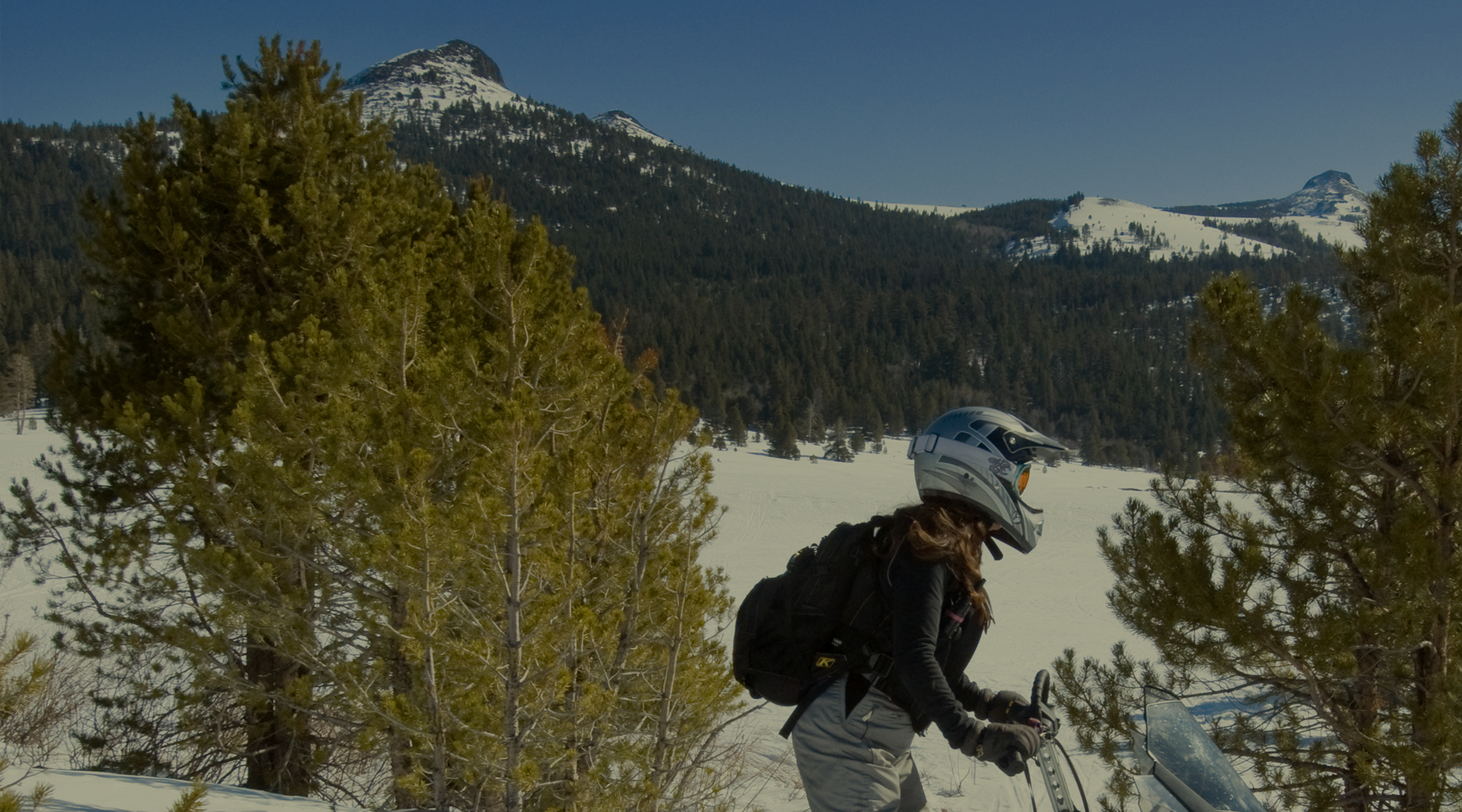
California’s Joint Strategy for Sustainable Outdoor Recreation & Wildfire Resilience
California’s Joint Strategy for Sustainable Outdoor Recreation & Wildfire Resilience
This Joint Strategy, developed by the Task Force Sustainable & Accessible Recreation Key Working Group, provides a roadmap for improved access to sustainable outdoor recreation, with a focus on areas where wildfires are impacting those opportunities throughout California.
RESOURCES
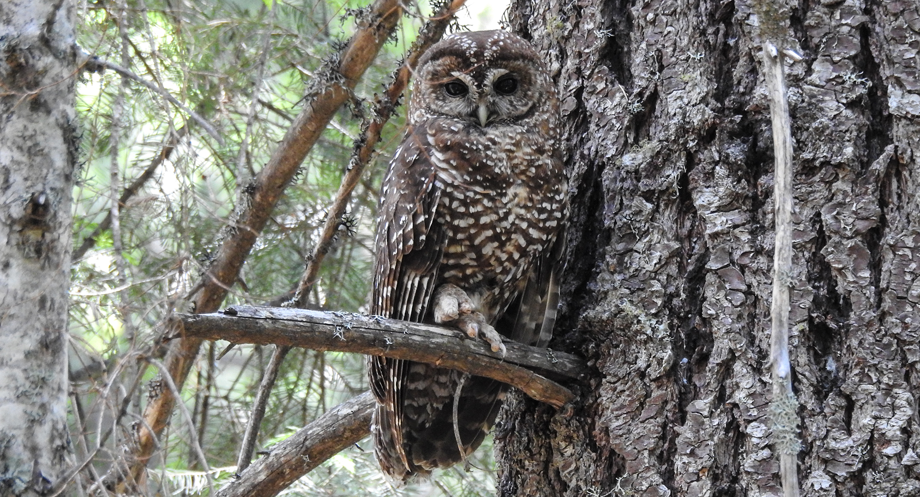
Public Comment Sought on Proposal to List California Spotted Owl
Photo Courtesy of Anastasia Stanish
Public Comment Sought on Proposal to List California Spotted Owl
The U.S. Fish and Wildlife Service (USFWS) is proposing to list two distinct population of the California Spotted Owl under the Endangered Species Act: the Coastal-Southern California DPS as endangered and the Sierra Nevada DPS as threatened. As part of this proposed listing, USFWS is including a 4(d) rule for the Sierra Nevada DPS that exempts the prohibition of take under the ESA for forest fuels management activities that reduce the risk of large-scale high-severity wildfire. USFWS is seeking public comment on the proposed rule through April 24.
USDA Invests More than $48.6 Million to Manage Risks, Combat Climate Change
USDA Invests More than $48.6 Million to Manage Risks, Combat Climate Change
USDA will invest more than $48.6 million this year through the Joint Chief’s Landscape Restoration Partnership for 14 projects that mitigate wildfire risk, improve water quality, restore forest ecosystems, and ultimately contribute to USDA’s efforts to combat climate change. Under the Joint Chiefs’ Partnership, the USDA Forest Service (USFS) and Natural Resources Conservation Service (NRCS) co-invest in areas where public forests and grasslands intersect with privately-owned lands. An award of $3.3 million was awarded to a phase three project focused on fire resilience in Trinity County. The project will address high-risk cross-boundary threats by strategically treating forests on both private and national forestlands, and it will address new threats created by 2020 and 2021 wildfires.
Forest Stewardship and Post-fire Forest Resilience Projects 2022 Annual Report
Forest Stewardship and Post-fire Forest Resilience Projects 2022 Annual Report
Launched in 2019 in response to a recommendation by Governor Brown’s Forest Management Task Force the UC ANR Forest Stewardship Education Initiative established the Forest Stewardship and Post-Fire Resilience Programs. These programs involve forest landowners in managing and protecting their forests through the development of a forest management plan. Since 2020, 368 people have completed one of the 19 workshop series offered across the state. The 2022 Annual Report summarizes the impact of the programs.
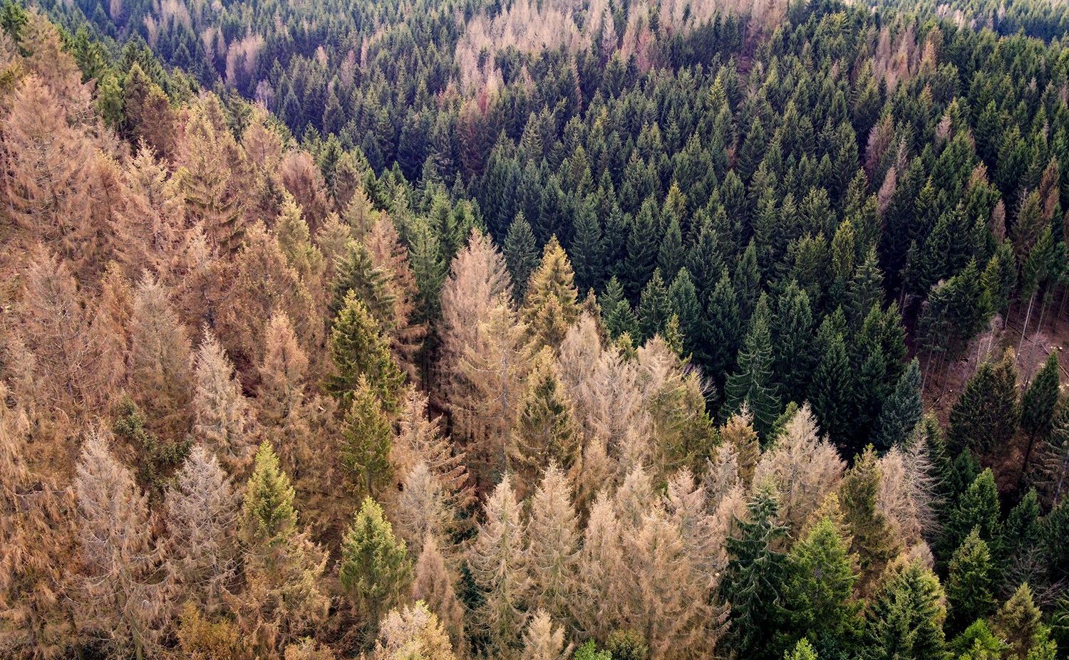
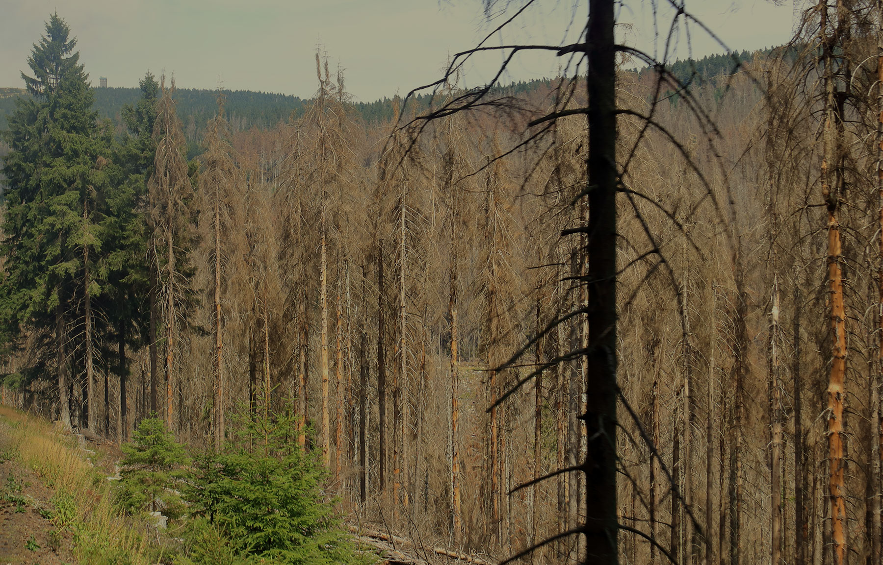
Survey Detects 36 Million Dead Trees in California
Survey Detects 36 Million Dead Trees in California
On February 7, the U.S. Forest Service published the 2022 Aerial Detection Survey report providing an annual estimate of tree mortality. The survey revealed about 36.3 million trees across 2.6 million acres of federal, state and private land died in California in 2022. The central Sierra Nevada Range and areas further north showed the highest mortality rates with true firs being the most impacted.
These data points mark an increased level of mortality compared to 2021 due to the cumulative impacts of extended drought, overstocked forest conditions, insect outbreaks, and disease.
“Forest health is a top priority for the Forest Service,” said Jennifer Eberlien, Regional Forester for the Pacific Southwest Region. “The agency’s 10-year strategy to address the wildfire crisis includes removal of dead and dying trees in the places where it poses the most immediate threats to communities.”

Regional Investment Strategy
Regional Investment Strategy
A highlight of the February 2 meeting was the announcement of a multi-agency, $70 million investment in Southern California to support regional landscape and community protection programs. Investments include:
· Approximately $30 million through a new partnership between the U.S. Forest Service (USFS) and the National Forest Foundation
· $20 million from the California Department of Conservation’s Regional Fire and Forest Capacity Program
· $10 million from the USFS Wildfire Crisis Strategy
· $10 million from CAL FIRE’s Forest Health Grant Program
The new funding supplements state and federal investments of more than $500 million in Southern California during the last three years as summarized in the Regional Investment Strategy (link to video) portion of the meeting agenda.

CAL FIRE Announces New Grants Available For Multiple Initiatives
CAL FIRE Announces New Grants Available For Multiple Initiatives
Funding is now available for a wide range of critical needs, from forest health and post-fire reforestation to workforce development and green school yards.
WILDFIRE PREVENTION GRANTS PROGRAM: Up to $120 million for projects focused on protecting people, structures, and communities.
FOREST HEALTH GRANT PROGRAM: Up to $120 million for landscape scale forest restoration and resilience projects.
POST FIRE REFORESTATION AND REGENERATION: Up to $50 million for reforestation treatments.
BUSINESS AND WORKFORCE DEVELOPMENT: Up to $7.5 million for wood products and up to $5 million for biomass transportation subsidy projects.
GREEN SCHOOL YARDS: Up to $117 million to improve tree canopy cover on California K-12 public school campuses and nonprofit childcare facilities.
TRIBAL WILDFIRE RESILIENCE PROGRAM: Up to $15 million is available for wildfire resilience implementation projects. These grant funds will assist California Native American tribes in managing ancestral lands, implementing and promoting Traditional Ecological Knowledge in wildfire resilience, and establishing wildfire safety for tribal communities.
RESOURCES
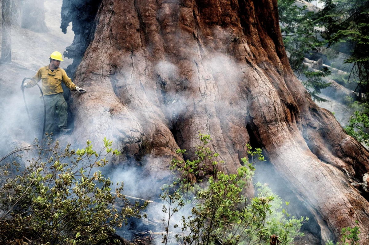
Unique Coalition Unites to Restore California's Giant Sequoias
Unique Coalition Unites to Restore California's Giant Sequoias
Giant Sequoia Land Coalition Brings Together Government Agencies, Tribes and Environmental Groups To Save Iconic Trees
California has lost nearly a fifth of its population of giant sequoias to wildfires over the past few years, according to a 2021 report.
Over the past year, however, the Giant Sequoia Lands Coalition has treated more than 15,000 acres of forest land in and around the groves. By sharing their knowledge and working to better treat forest areas where groves of giant sequoias can be found, the group is working to make these titans more resilient to future massive wildfires.
Tribal Wildfire Resilience Program
Up to $19M Available for Tribal Wildfire Resilience Program
CAL FIRE’s Forest Health Grant program will award competitive grants to Native American tribes located within California. Of the $19 million, up to $15 million is available for wildfire resilience implementation projects with the remainder available for planning projects. These grant funds will assist California Native American tribes in managing ancestral lands, implementing and promoting Traditional Ecological Knowledges in wildfire resilience, and establishing wildfire safety for tribal communities.
The Forest Health grant guidelines address this new opportunity and Forest Health staff hosted a Tribal Wildfire Resilience Roundtable explaining this opportunity. Applications are due February 28, 2023.
California Native American tribes provided guidance during the early consultation on the creation of this new grant program. CAL FIRE and California Natural Resources Agency (CNRA) are collaborating on the review of applications and administering of the funds. CNRA is leading program design and consulting with CAL FIRE regarding program administration including processes, project selection, and tribal consultation. CAL FIRE will administer the program, including running a solicitation, issuing grant agreements, and processing progress reports and invoices.
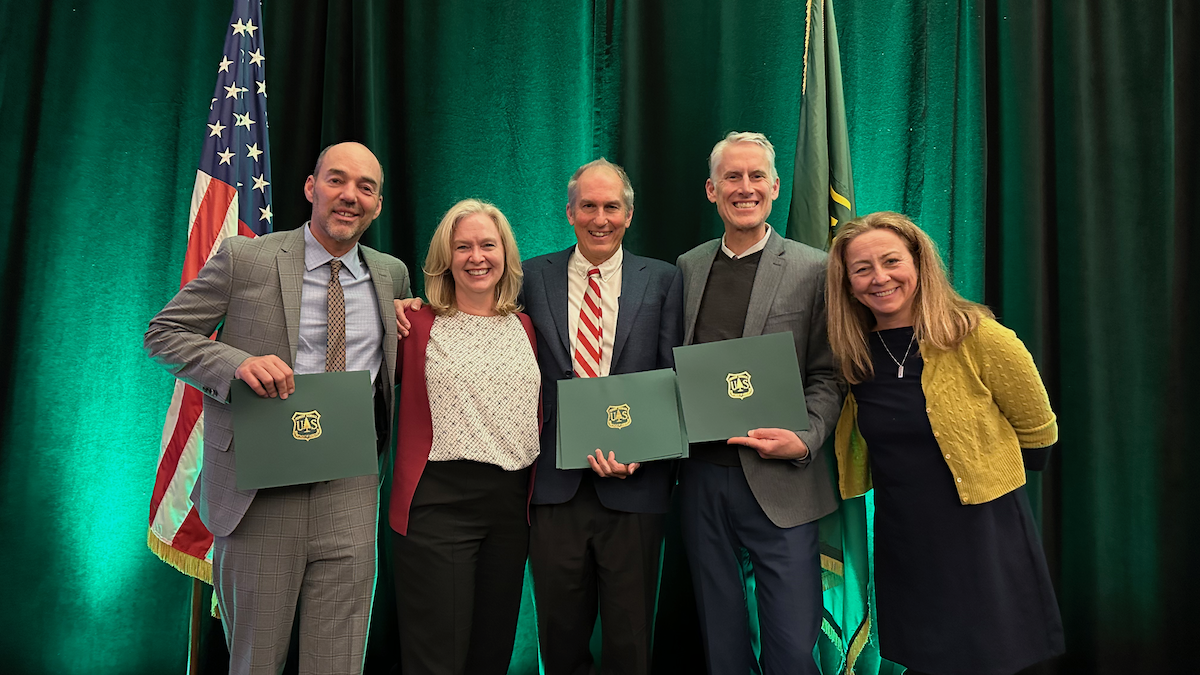
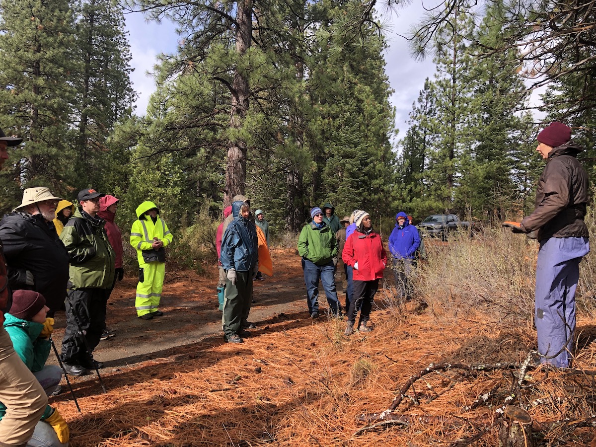
USFS Awards CALREC Vision Partnership of the Year
USFS Awards CALREC Vision Partnership of the Year
December 14, 2022 – At the Regional Foresters Awards Ceremony in Sacramento, CA, the Leadership Team of the Sustainable Recreation/CALREC Vision Key Working Group (SRCRV) was awarded a Regional Forester’s Honor Award for Partnership of the Year from the U.S. Forest Service Pacific Southwest Region. The award recognizes the Leadership Team’s efforts to develop California’s Joint Strategy for Sustainable Outdoor Recreation and Wildfire Resilience for California’s Wildfire & Forest Resilience Task Force. The Joint Strategy satisfies Key Actions 3.13 and 3.14 of the California Wildfire and Forest Resilience Action Plan. The California Wildfire and Forest Resilience Task Force will publish the Joint Strategy in early 2023.
Accepting the award with Jennifer Eberlein (second from left), from left to right are Bill Keane, Climate Equity Solutions, Inc.; John Wentworth, Mammoth Lakes Trails and Public Access Foundation; Austin McInerny, Consensus and Collaboration Program, College of Continuing Education, Sacramento State University; and Nancy Parachini, USFS Deputy Director of Public Services.