Central Coast Regional Meeting

Registration for in-person attendance is now closed.

Central Coast Regional Meeting


Join us in person at The Cocoanut Grove on the Santa Cruz Beach Boardwalk or remotely via Zoom. Hosted by the California State Coastal Conservancy and San Mateo Resource Conservation District, discussions will focus on the unique landscapes and land management issues of California’s Central Coast. The meeting will open with a Resource Fair to showcase local organizations at work in the Central Coast region. Field tours will be offered on May 12. We look forward to connecting, committing to action, and collaborating on real solutions to the daunting challenges facing our landscapes and communities.

MAY 11 & 12
The Cocoanut Grove
Santa Cruz Beach Boardwalk
400 Beach Street
Santa Cruz, CA

Event schedule - May 11

8:30-10:00 a.m. Resource Fair

10 a.m.-12:15 p.m. Morning Session

12:15-1:30 p.m. Lunch

1:30-4:30 p.m. Afternoon Session

4:30-6:00 p.m. Reception

Free parking available in the main parking lot. Keep your ticket for validation.


field tours


FIELD TOURS WILL BE OFFERED ON MAY 12th

San Vicente Redwoods: Demonstrating Compatibility of Forest Resiliency and Public Access

Destination: San Vicente Redwoods, a privately held property demonstrating the compatibility of forest resiliency, conservation, sustainable timber harvest, and public access. This unique property is managed by a collective of four land trusts: Peninsula Open Space Trust, Sempervirens Fund, Save the Redwoods League, and the Land Trust of Santa Cruz County. All of this nearly 9,000-acre site burned in the 2020 CZU Lightning Complex Fire. On this field trip, we’ll see the efficacy of a prescribed burn conducted just months before the 2020 wildfire and we’ll visit a temporary biomass processing site and discuss the opportunities and challenges of processing forest residue onsite. Pending weather and site conditions, we hope to demonstrate the use of air curtain burners, a carbonator, and a pile burn side by side. After the 9 am – 11 am tour, stay for a networking lunch hour (cold drinks and light snacks provided) with attendees of the Together Bay Area Conference Field trip participants are encouraged to also attend the subsequent 12-2 p.m. field trip with Together Bay Area.

Start/End Time: 9am – 11pm (with option to 2pm)

Location:  VIEW MAP > 

Accessibility: Small section that meets outdoor accessibility guidelines, majority of tour along moderate difficulty trails.

Fall Creek Truck Trail Forest Health Project: Ladder Fuels Reduction Promotes Biodiversity and Resilience

Destination: Fall Creek Unit of Henry Cowell State Park, the focus of a 62-acre CAL FIRE Forest Health project. This primarily second-growth redwood and mixed conifer forest was nearly all burned at low to moderate severity during the 2020 CZU Fire and was used heavily by fire personnel during the event. The Forest Health project includes removal of dense ladder fuels and dead trees with the goal of lowering stand density and promoting greater biodiversity and resilience. This project showcases a great partnership between the RCD of Santa Cruz County, California State Parks and CAL FIRE.

Start/End Time: 2pm – 4:30pm

Location: VIEW MAP >  Meet at Trininty Bible parking lot at the bottom of El Solyo Heights Road in Felton (7301 Hwy 9, Felton, CA 95018)

Accessibility: No ADA access or restrooms. Personal protective equipment may be required.

Quarry Park Fuel Reduction/Community Protection: Community Engagement and Protection in the WUI

Destination: Quarry Park, just north of Half Moon Bay, is a focal point of significant community interest regarding management of fuel loads, particularly eucalyptus, in the Wildland Urban Interface. Learn how San Mateo Resource Conservation District and partners, including county parks and local fire agencies, brought fire science and deep listening to community engagement. We will tour a shaded fuel break project on site while discussing how projects are informed by fire modeling and permit strategies, and how biomass management and winter storm response affect their implementation.

Start/End Time: 10am – 12pm

Location:  VIEW MAP > 

Accessibility: Walking tour. Personal protective equipment may be required. Limited parking, please carpool.

Forest Health Work in the Butano Watershed: Envisioning Forest Health as a Process, Not a Project, in the Pescadero-Butano Watershed

Destination: The State’s first completed California Vegetation Treatment Program (CalVTP) project, also the first project approved by the California Coastal Commission to use a Public Works Plan as a novel approach to permitting in the Coastal Zone. We will visit two sites in southern San Mateo County impacted by the August 2020 CZU Lightning Complex Fires: Butano State Park and Girl Scouts of Northern California’s Camp Butano. Over 2,100 acres will be treated to improve the health and resilience of the forest. Discussion will include recovery from fire, prescribed burns and fuels treatments, and permitting for long-term management.

Start/End Time: 10am – 2pm

Location:  VIEW MAP > 

Accessibility: Two vehicle stops with short walking tour from each.

Big Basin State Park Post-Fire Recovery: Reimagining Big Basin

Destination: The headquarters area of Big Basin State Park. The tour will highlight the recovery efforts that have been made to reopen the park following the CZU Lightning Complex incident. We will also be discussing the “Reimagining Big Basin” process that seeks to create a more equitable and resilient park. The tour will include a short walk-through old growth redwood forest that experienced high severity fire and give participants an opportunity to discuss State Park’s development of a forest management strategy for Big Basin and its neighboring parks.

Start/End Time: 9am – 12pm

Location:  VIEW MAP > 

Accessibility: Short walk through old growth redwood on accessible path.

Marin Wildfire Prevention Authority: Efforts of the Only Publicly Funded Wildfire Prevention Authority in the U.S. 

Destination: Showcased projects of the Marin Wildfire Prevention Authority (MWPA), the only publicly funded wildfire prevention authority in the U.S. The tour will highlight local collaborative programs led by MWPA including vegetation management, a countywide chipper program, defensible space evaluations/creation, evacuation planning, and route clearing. We will discuss the MWPA’s use of and reliance and the CalVTP and MWPA’s support of the recently launched Fire Foundry Program, an innovative workforce development program aimed at achieving equity in the fire and civic service and providing pathways to sustainable wage careers. Participants will meet at the MWPA office in San Rafael, the MWPA will provide vans to shuttle participants to each tour site.

Start/End Time: 11am – 3pm

Location:  VIEW MAP > 

MWPA Office: 1600 Los Gamos Drive, Suite 345, San Rafael


Accessibility: Some walking on uneven unpaved paths/trails; parts are fully accessible. Driving tour to sites with short walks at each.

Webster Project – San Luis Obispo County: a CAL FIRE Governor’s Priority Project

Destination: “The Webster Project” – one of CAL FIRE’s 2019 Governor’s priority projects – covering 1,200 acres of chapparal habitat in rural north county San Luis Obispo. The goal of this project was to reduce hazard fuel loading and mimic natural fire using prescribed fire. The tour will highlight the treatment of crushing chamise brush followed with prescribed fire to consume 10-hour dead fuels. Treatments are aimed at creating a diversity of resilient vegetation types while creating a safety zone and anchor point for firefighting efforts in the event of a wildfire.

Start/End Time: 1pm – 3pm

Location:  VIEW MAP > 

Accessibility: Will Meet at CAL FIRE Creston Fire Station, load into van, drive to project site- 15 minutes. Mostly driving tour with small walk out to burn units (100 feet from vehicle), No ADA.

Santa Lucia Conservancy: Balancing the Protection of Life, Property, and Biodiversity with Long-term Ecosystem Resilience

Destination: The Santa Lucia Preserve. The Santa Lucia Conservancy’s vision for fire and fuels management on The Preserve is one that harmoniously balances the protection of life, property, and biodiversity with long-term ecosystem resilience. This strategy includes shaded fuel breaks, prescribed burns, conservation grazing, invasive plant removal, a Preserve-wide fuel management plan, and lot-specific fuel management plans for individual homeowners. Join the Santa Lucia Conservancy and collaborating partners for a driving tour of The Preserve to learn more about how we collaborate with fire agencies, land management organizations, landowners, and our neighbors to implement these fire safety tools.

Start/End Time: 9am – 12:30pm

Location:  VIEW MAP > 

Accessibility: This is a driving tour.

Swanton Pacific Ranch and Big Creek Lumber Sawmill: Witnessing and Learning From the Effects of the 2020 CZU Lightning Complex

Destination: Cal Poly’s Swanton Pacific Ranch. The tour will focus on post fire redwood and Douglas fir forest management and restoration funded by CAL FIRE Forest Health program and guided by the property’s long term Non-Industrial Timber Management Plan. In August 2020, the CZU Lightning Complex Fire impacted Cal Poly’s School Forest, which has long been a hub of student learning, research, and demonstration of sustainable timber management practices. The fire, along with CAL FIRE’s funding support, has presented us with some unique opportunities to demonstrate fuels reduction and restoration and ways to experiment with preparing the forest for the predicted consequences of climate change. We are also experimenting with various methods of biomass removal, replanting, and redwood canopy retention while training a workforce on methods to increase the pace and scale of fuels management and vegetation treatment. Break for lunch, and then reconvene down the road for a tour of the Big Creek Lumber Sawmill. We’ll see the mill in operation and discuss the effects of fire on merchantable timber, as well as the effects of the CZU fire on Big Creek property, and the recovery work they are doing post-fire.

Start/End Time: 10am – 2pm

Location: VIEW MAP > 

Accessibility: Attendees will meet at a central location and carpool to tour location a short drive away.

Glenwood Open Space Preserve: demonstrating multiple benefits of a conservation grazing program

Destination: Glenwood Open Space Preserve. Join the Land Trust of Santa Cruz County for a tour of this beautiful preserve in Scotts Valley, just a few minutes off of Highway 17 on the way out of Santa Cruz. The Glenwood Open Space Preserve is home to a high number of rare and endangered species, including the Ohlone tiger beetle, Opler’s longhorn moth, and the Scotts Valley spineflower. This tour will show off the beautiful spring wildflowers in bloom and highlight how we manage fuels along the wildland-urban interface while preserving the endangered species through conservation grazing, among other methods.

Start/End Time: 1pm – 3pm

Location: VIEW MAP > 


Recommended Accommodations


Courtyard by Marriott Santa Cruz

313 Riverside Avenue
Santa Cruz, CA 95060
(831)419-8700

RESERVE

Hotel Paradox, Autograph Collection

611 Ocean Street
Santa Cruz, CA 95060
(831) 425-5590

RESERVE

Hyatt Place Santa Cruz

407 Broadway
Santa Cruz, CA 95060
(831) 226-2300


RESERVE

Best Western Plus

500 Ocean Street
Santa Cruz, CA 95060
(831) 458-9898

RESERVE

Questions? Please contact:

foresttaskforce@fire.ca.gov


Thank You to our Sponsors


Recap of Sacramento Task Force Meeting

SACRAMENTO TASK FORCE MEETING RECAP


March 30, 2023

The California Wildfire & Forest Resilience Task Force held its quarterly meeting at the California Natural Resources Agency in Sacramento and live on Zoom.
The agenda and video recordings are available below
.

MEETING AGENDA HIGHLIGHTS

  • Looking Back: Members on this panel highlighted major accomplishments from state and federal agencies in 2022, shared preliminary results from California’s Year in Fire analysis, discussed what field monitoring reveals about the effectiveness of fuels treatments, and what recent wildfires reveal about the effectiveness of defensive space and home hardening. Subjects covered include:
    – What have we accomplished?
    – How do we measure the impacts of fires? California’s Year in Fire
    – Are treatments working?
  • Moving Forward: Presentations covered the questions that components of the Regional Resource Kits are meant to address: What are our goals and how do we define them? What is the current condition of our landscapes? How do we most effectively plan and prioritize projects? Where are we currently investing? How do we measure the effectiveness of those investments? The Monitoring and Reporting Work Group unveiled the Interagency Treatment Tracker, and Google.org provided an update on the decision support tool, Planscape. Subjects covered include:
    – Where is management most beneficial?
    – How do we more effectively plan & prioritize projects? Planscape
    – Where are we investing? Interagency Treatment Tracker
    – How do we measure the effectiveness of our investments?
  • Wood Utilization Work Group: The Work Group provided an overview of preliminary proposed actions in future joint strategy for wood utilization. Panelists discussed the importance of private sector investments in a vibrant wood products market that advances the state’s sustainable forest management strategy. Subjects covered include:
    – Overview of Proposed Action
    – Panel Discussion with Industry Representatives

View Full Agenda

Welcome & Opening Remarks


• Wade Crowfoot, CNRA

• Jennifer Eberlien, USFS

• Task Force Executive Committee


Director’s Report


• Patrick Wright


Looking Back


Moderator: John Battles, UC Berkeley

• Patrick Wright, Task Force

• Leana Weissberg, UC Berkeley, Center for Law, Energy & the Environment

• Scott Stephens, UC Berkeley

• Yana Valachovic, UC Cooperative Extension


Moving Forward


Moderator: John Battles, UC Berkeley 

• Pat Manley, USFS Pacific SW Research Station

• David Saah, Spatial Informatics Group

• Mickey Kataria, Google.org

• Alan Talhelm, CARB

• Loretta Moreno, CNRA

• Stephanie Coppeto, USFS.


Wood Utilization Work Group Report


Moderator: Steve Frisch, Sierra Business Council

• Elizabeth Betancourt, Dept. of Conservation

• Helena Murray, USFS

• Matt Dias, California Forestry Association

• Julia Levin, Bioenergy Association of California

• Dan Porter, The Nature Conservancy

• Matt Sjoholm, Blue Forest Conservation.


Final Remarks


• Task Force Co-Chairs


Southern California Regional Meeting

Southern California Regional Meeting


The Southern California Regional Meeting will be held in person in Calabasas, with a LiveStream option for remote attendance. Hosted by the Santa Monica Mountains Conservancy (SMMC) and Mountains Recreation and Conservation Authority (MRCA), discussions will focus on Southern California, with updates and panel discussions about real progress being made on the ground, and opportunities to network with partners from around the state. We look forward to connecting, committing to action, and collaborating on real solutions to the daunting challenges facing our landscapes and communities. The meeting will open with a Resource Fair to showcase local organizations at work in Southern California. Field tours will be offered on February 3. See below for tour details and registration.

FEBRUARY 2 & 3
King Gillette Ranch
26800 Mulholland Hwy
Calabasas, CA

Event schedule

8:30-10:00 a.m. Resource Fair

10 a.m.-12:15 p.m. Morning Session

12:15-1:30 p.m. Lunch

1:30-3:15 p.m. Afternoon Session

3:30-4:30 p.m. Small Group Discussions

4:30 p.m. Reception


field tours


FIELD TOURS WILL BE OFFERED ON FEBRUARY 3RD 

Planting a Legacy: FULL

Creating an Ember Screen Along a Historic Wildfire Corridor

Description: Tour the Mountains Recreation and Conservation Authority’s (MRCA) freeway-adjacent-focused vegetation management effort within the historic wildfire corridor along a four-mile section of the 101 freeway where wildfires jump the freeway into the Santa Monica Mountains. The project consists of planting coast live oak ember barriers, a suburban interface with over 1,500 planted mitigation trees with the help of the Los Angeles Conservation Corps and the San Gabriel Valley Conservation Corps. You will also have an opportunity to see progress on the Wallis Annenberg Wildlife Crossing at Liberty Canyon, which will be the largest wildlife crossing in the world. The tour will involve driving to several sites and standing and walking for short periods of time on uneven terrain.

Location: Calabasas

Start/End Time: 9:30am – 12:30pm

Register

Partnerships in the Santa Monica Mountains: FULL

Wildfire Prevention, Response, and Resilience

Description: This event will provide an opportunity to tour the shrublands of the Santa Monica Mountains and learn about the unique wind-driven wildfire behavior that has shaped partnerships among wildfire practitioners and land managers with federal, state, and local agency perspectives. The tour will feature the Mountains Recreation and Conservation Authority (MRCA) Fire Division Headquarters and a key Los Angeles County Fire Department wildfire response facility which features a sustainable habitat-focused defensible space project. The tour will include discussion among contiguous land managers including National Park Service, California Department of Parks and Recreation, Santa Monica Mountains Conservancy, and the MRCA who maintain a Cooperative Management Agreement of the Santa Monica Mountains National Recreation Area. The tour will involve driving to several sites and standing on uneven terrain.

Location: Calabasas

Start/End Time: 9:00am – 1:00pm

Register

Community Hardening and Resilience in the Santa Monica Mountains

Description: This tour consists of visiting a home hardening demonstration structure that gives homeowners the opportunity to see best management practices for hardening their structures against wildfires particularly in wind-driven wildfires where embers can progress miles ahead of an active fire and create new ignitions – the project is in partnership with Los Angeles County Fire Department and the Resource Conservation District of Santa Monica Mountains. You will have an opportunity to learn more about the tools and programs being developed to educate and engage with communities and meet with a local community in Oak Park that has organized to create a local Fire Safe Council. The tour will involve driving to several sites and standing on uneven terrain.

Location: Agoura Hills (10 minutes from Calabasas)

Start/End Time: 9:00am – 12:00pm

Register

Reducing Wildfire Risks on our Landscapes and in Communities:

Ventura County Invasive Fuels Management and Home Hardening Projects

Description: This tour will discuss the different wildfire efforts in Ventura County, both on the landscape and within communities, to address wildfire risk. The tour consists of visiting the Arroyo Conejo Invasive Plant Management Project and meeting with a local community that has recently organized to create a Fire Safe Council to discuss how they are working with local organizations to engage with their community to advance home hardening practices. The tour will include COSCA, Ventura Regional Fire Safe Council, the Ventura County Resource Conservation District, Oak Park Fire Safe Council, and Ventura County Prescribed Burn Association. The tour will involve driving to several sites and standing on uneven terrain.

Location:  Oak Park (20 minutes from Calabasas)

Start/End Time: 9:00am – 12:00pm

Register

Northeast Los Angeles Canyons and Hilltops:

Community Wildfire Resilience through Restoration, Local Engagement, and Workforce Development

Description: Wildfire resilience efforts in Los Angeles are complex and most resources focus on the large mountain ranges that surround the developed valleys and basins, such as the Angeles National Forest and the Santa Monica Mountains; however, there is another vulnerable landscape type: urban islands of open space. These smaller open space areas typically include undeveloped canyons and hilltops and are often owned by local agencies, non-profits, private parties, or a combination of these. These open space islands are surrounded by some of the most densely populated communities in California and are highly utilized as spaces of refuge and recreation for residents of Los Angeles. Although they differ in size from the large State and Federal landholdings in the mountains, these smaller islands of open space are also vulnerable to wildfires. The potential impact of a wildfire in any of these islands would be devastating to the surrounding communities, which lack the resources of more affluent areas. On this tour, we will discuss various wildfire efforts occurring in Northeast Los Angeles led by local non-profits, including organizations like North East Trees, who are working to deplete an invasive seed bank of flammable flashy fuels and restoring native habitat, and Community Nature Connection, who is establishing a nursery to supply local restoration projects. They will discuss their unique projects and community engagement efforts. An important component of these efforts is training to create a sustainable green workforce who can steward future wildfire resilience projects to combat climate change and progressively more destructive fires. On this tour, we will also hear from organizations working on wildfire efforts in similar landscapes across the metro area, such as a new Tribal Conservation Corps for Los Angeles and Outward Bound Adventures, an organization dedicated to outdoor education for BIPOC youth for over 60 years. This tour will be an opportunity to hear the perspective of several local organizations as they share their unique wildfire perspectives, goals, and priorities, engage with local communities, and increase conservation employment opportunities.

Location: Northeast Los Angeles (1 hour from Calabasas)

Start/End Time: 9:00am – 12:00pm

Register

Eastern Angeles National Forest Tour:

Description: This tour will begin in Wrightwood to discuss the recent Sheep Fire’s progression and impacts to the community including the role of climate change and weather and their impacts to communities and resources including desert transition vegetative communities such as Joshua Trees. The tour will discuss fire history of the area, the role that fuel treatments played in the Blue Cut Fire and Sheep Fire, and restoration potential. Next, the tour will take a look at Big Pines Highway, ongoing fuels treatment implementation, and a three-way partnership with the Forest Service, National Forest Foundation, and the Rivers and Mountains Conservancy. The tour will conclude at Big Rock Creek road which demonstrates the impacts of the Bobcat Fire. Here we will discuss the bigcone Douglas-fir endemic in Southern California as well as restoration in the face of climate change. Please note that this tour will take place in the eastern Angeles National Forest; it is recommended that participants traveling for the event fly out of Ontario Airport after the tour. Guests may also elect to spend the previous night in the Ontario area to assist with travel time to the tour in the morning. The tour will involve driving to several sites and standing on uneven terrain. Participants are advised to bring their own lunch, wear warm clothes, and wear sunscreen.

Location: Wrightwood (2.5 hours from Calabasas)

Start/End Time: 9:00am – 2:30pm

Register

Angeles National Forest:

Mt. Wilson and Chilao Tour

Description: This tour will visit two sites on the Angeles National Forest that have been threatened by large wildfires, including Mt. Wilson and the Chilao area. The southern California Mediterranean climate has always been subject to large wildfires due to the flammable shrub vegetation and Santa Ana wind patterns. Values at risk and other tree form vegetation types are equally threatened and at risk from climate change, past fire suppression, and high frequency of human caused ignitions. On this tour we will visit Mt. Wilson which hosts numerous stakeholders such as the communications site which serve the Los Angeles basin for emergency, utility, and media services. The tour includes a visit to the Mt. Wilson Observatory which maintains operational telescopes while preserving its legacy of historic contributions to astronomy. Mt. Wilson and the stakeholders’ interests have survived the Station and Bobcat Fires and a lesser known Wilson Fire. We will look at the site’s proximity to Los Angeles and the urban interface and fuel treatments that were initiated 10 years ago. There will be a representative from the Mt. Wilson Observatory to discuss stakeholder interests and actions within the framework of living with wildfire. The second leg of the tour will explore Chilao – a popular area for recreation within one of the few areas of the national forest that is a forested east side pine stand. The Chilao area has also been subject to both the Station and Bobcat Fires and represents a remote forest health stand, highly susceptible to wildfire due to adjacency to flammable chaparral. We will look at different fuel and vegetation treatments including mechanical and prescribed fire. Participants are advised to bring their own lunch. The tour will involve standing on unpaved surfaces.

Location: Angeles National Forest (2 hours from Calabasas)

Start/End Time: 9:30am – 2:00pm

Register

Angeles National Forest – Green Valley Tour:

Forest Health in the Face of an Invasive Pest

Description: This tour of Green Valley will highlight the challenges posed by the goldspotted oak borer (GSOB) which was discovered in Green Valley in 2015, 162 miles from the known initial introduction point in San Diego County. We will discuss how public agencies are coordinating with private landowners, bordering National Forest land, as they remove or treat trees affected by GSOB. Participants are advised to bring their own lunch and wear warm clothes. The tour will involve walking on unpaved surfaces.

Location: Green Valley (2 hours from Calabasas)

Start/End Time: 9:30am – 2:30pm

Register

We are encouraging all meeting
attendees to pre-purchase lunch.
Same day purchases will be limited.

PRE-PURCHASE LUNCH

hotel information

** Discounted rates available while room blocks last, thru January 15th **


Best Western Plus Thousand Oaks Inn
75 W Thousand Oaks Boulevard,
Thousand Oaks, CA 91360

RESERVE

The Anza
23627 Calabasas Road,
Calabasas, CA, 91302

RESERVE

La Quinta
by Wyndham Thousand Oaks

1320 Newbury Rd.
Thousand Oaks, CA 91320

To receive the Task Force
discounted rate,
please call the hotel at
805-499-5910
and use code CG2223


RESERVE

Cambria Hotel Calabasas
26400 Rondell Street
Calabasas, CA 91302

RESERVE

Questions? Please contact planning@mrca.ca.gov


Thank You to our Sponsors


prescribed fire burn

Task Force Issues Strategic Plan For Prescribed Burns

prescribed fire burn

Task Force Issues Strategic Plan For Prescribed Burns


Comprehensive strategy lays path for state, federal, and tribal partners to promote use of “beneficial fire” on up to 400,000 acres annually by 2025 to help make forests more resilient.

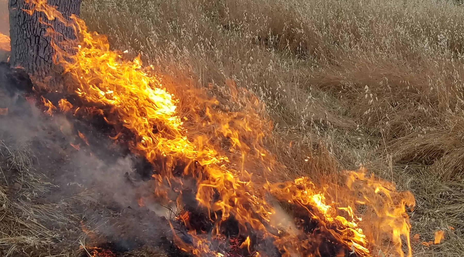
March 30, 2022 – California Wildfire and Forest Resilience Task Force issued a Strategic Plan for Expanding the Use of Beneficial Fire to expand the use of prescribed fire and cultural burning to build forest and community resilience statewide – efforts critical to forest management and wildfire mitigation. By expanding the use of beneficial fire, the state can utilize smart burning tactics on brush and other fuels to help both prevent the start of fires and mitigate the spread of wildfires.Based on a collaborative effort of the state’s leading fire experts and managers, the Strategic Plan sets a target of expanding beneficial fire to 400,000 acres annually by 2025, a shared goal between state, federal, tribal, and local entities – part of an overall goal to treat 1 million acres annually in California by 2025. The state invested $1.5 billion in wildfire resilience in 2021 alone, including significant support for prescribed fire and cultural burning.“As climate change continues to exacerbate wildfire conditions, we’re bringing federal, state, tribal, and local partners together to more effectively address the scale of this crisis,” said Governor Gavin Newsom. “California is putting in the work to help protect our communities from the devastating impacts of wildfires, build for the long-term, and safeguard our treasured state for generations to come.” The Governor earlier this week participated in fuels management work along Highway 50 ahead of peak wildfire season, click here for b-roll of the Governor joining CAL FIRE and Conservation Corps crews.“We know that returning good fire to the ground is one of our best tools in the fight against catastrophic wildfire and climate change,” said Task Force Co-Chair and California Secretary for Natural Resources Wade Crowfoot. “This Strategic Plan includes the key steps we need to take over the next few years to build capacity, return to a culture of beneficial fire, and invest in our future.”“This plan is vital to improve the health and resilience of the state’s forests, reduce wildfire risk of vulnerable communities, and increase stewardship by Native American fire practitioners,” added Task Force Co-Chair and U.S. Forest Service Regional Forester Jennifer Eberlien.The key elements of the Strategic Plan include:

  • Launching an online prescribed fire permitting system to streamline the review and approval of prescribed fire projects;
  • Establishing the state’s new Prescribed Fire Claims Fund to reduce liability for private burners;
  • Beginning a statewide program to enable tribes and cultural fire practitioners to revitalize cultural burning practices;
  • A prescribed fire training center to grow, train, and diversify the state’s prescribed fire workforce;
  • An interagency beneficial fire tracking system;
  • Pilot projects to undertake larger landscape-scale burns; and
  • A comprehensive review of the state’s smoke management programs to facilitate prescribed fire while protecting public health.

The announcement delivers on several of the key commitments made in the Wildfire and Forest Resilience Action Plan issued in January 2021. The Action Plan is also backed by the Governor’s $1.5 billion investment in forest health and wildfire resilience, and a proposed $1.2 billion additional investment for fiscal years 2022-23 and 2023-24. Lenya Quinn-Davidson, Area Fire Advisor, UC Cooperative Extension: “The plan gives me hope because it represents the vision and priorities of the people who know prescribed fire best—the community leaders, cultural burners, and agency practitioners who have been leading and championing this work for years. California is ready for a bolder, more collaborative approach to prescribed fire, and this plan gives us a great place to start.”Don Hankins, Professor, CSU Chico and Cultural Fire Practitioner: “California’s Strategic Plan for Expanding the Use of Beneficial Fire takes an unprecedented step for the state to address shortcomings of current fire policy and use. Most significant is the recognition of the role of Native American tribes, organizations and practitioners to revitalize traditional fire stewardship.”Craig Thomas, Director, The Fire Restoration Group: “California’s Strategic Plan for Expanding the Use of Beneficial Fire demonstrates the collaborative commitment to expand the use of restorative fire to limit damaging wildfires, stabilize forest carbon, better protect communities, and restore and maintain resiliency and biodiversity in the California landscape.  This past year of collaborative work with State and Federal agencies, scientists, and multiple non-governmental partners has addressed and supported the proper role of restorative fire in California.”

Visit: Prescribed Fire Action Area Page

CONTACTS


Download the Task Force
Strategic Plan

Download

Len Nielson,
CAL FIRE
Len.Nielson@fire.ca.gov

EMAIL

Lance Noxon,
U.S. Forest Service
William.Noxon@usda.gov

EMAIL