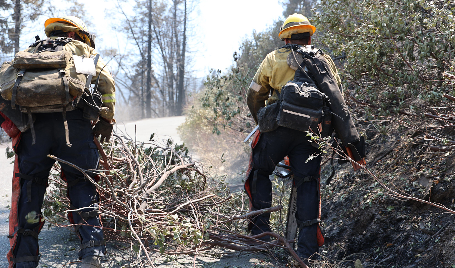
See Progress on Protecting People and Communities from Wildfire
From day one, Governor Gavin Newsom declared community protection and wildfire resilience a top priority of his administration. California and its partners continue to deliver nation-leading results. Since taking office, the Governor has committed more resources and investments than ever before to significantly boost wildfire response capabilities while tackling the root causes of the wildfire crisis head-on.
Here are the top 5 things to know about California’s progress on protecting communities and landscapes from wildfire:
1. Historic Investments Making Big Impacts Statewide
- Invested $6 billion: Collectively, Task Force partners have increased wildfire resilience investments to more than $6 billion, with state investments surging to more than $4 billion since 2021.
- Doubled CAL FIRE resources: To support more effective wildfire response, CAL FIRE nearly doubled its fire protection staff since 2019 from 5,829 to 11,436 positions, and nearly doubled its fire protection budget from $2 billion to $3.8 billion.
- Added 2,400 firefighters: The Governor’s proposed investments will add 2,400 new firefighters to CAL FIRE’s firefighting force over the next five years.
- Boosted Cal OES: Since 2019, the budget of the California Office of Emergency Services (Cal OES), a key agency in responding to and rebuilding after fires, increased from $1.8 billion to $4.5 billion.
2. Moving Faster without Compromising Environmental Protections
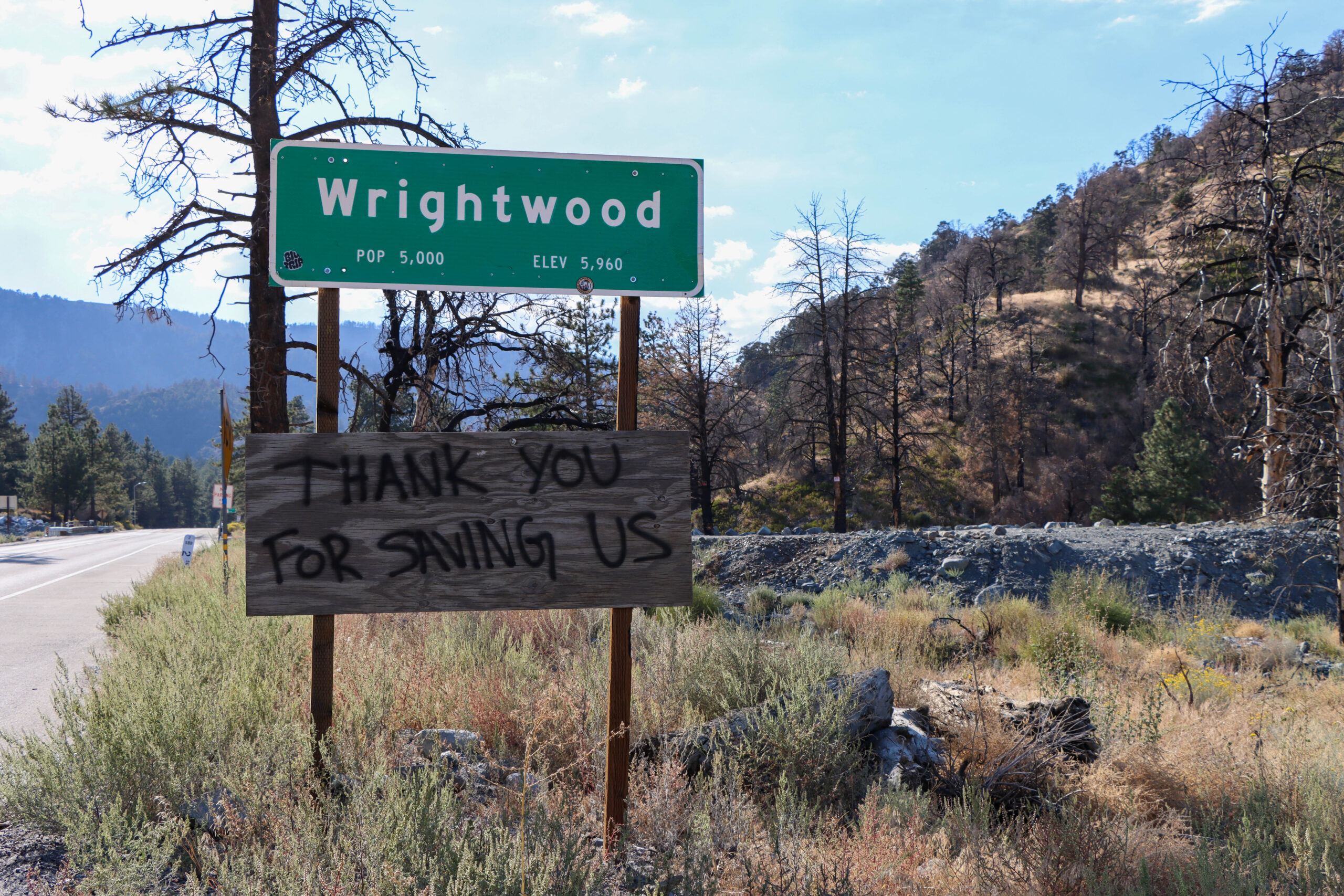
- Fast-tracking wildfire projects: Thanks to the Governor’s March 2025 emergency proclamation on wildfire, California has fast-tracked 300 projects in 300 days through a streamlined permitting system, with projects now being approved in as little as 30 days, saving a year or more of review and red tape for more complicated projects.
- Moving at record pace to support wildfire recovery: Immediately following the devastating Los Angeles firestorms, the Governor issued an executive order to suspend CEQA and Coastal Act permitting requirements to enable homeowners and businesses to rebuild without undue delay.
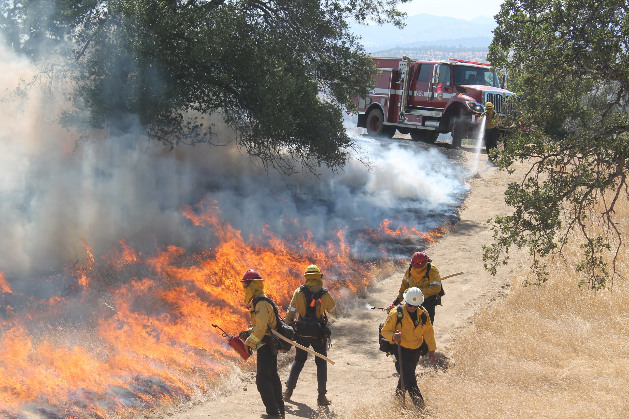
- Accelerating the use of good fire: In October 2025, the Governor signed an executive order to reduce red tape and expand tools to safely deploy beneficial fire projects. In the same month, the U.S. EPA issued policy guidance directing regional offices to work with local, state, tribal, and federal partners to remove barriers for prescribed fire.
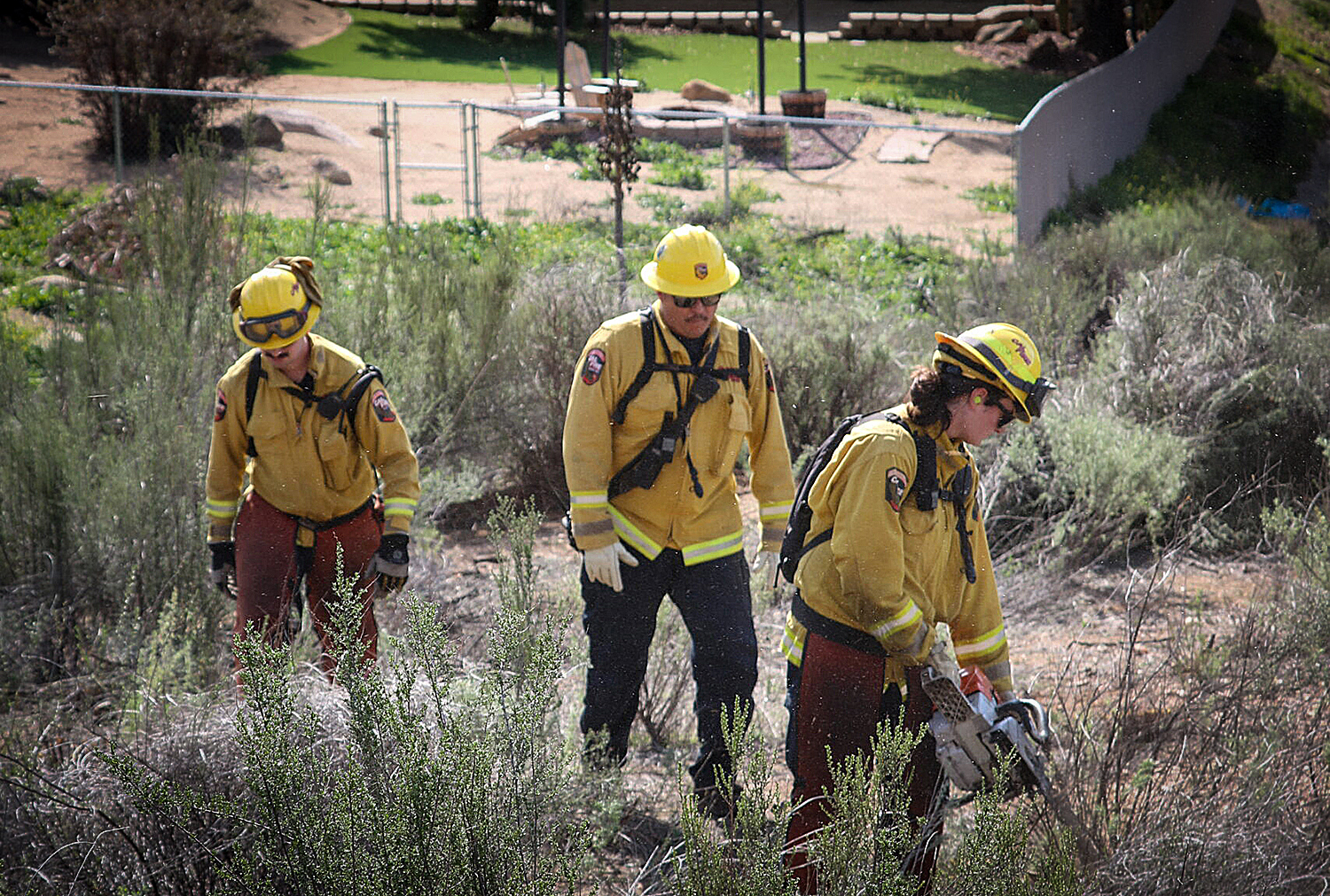
3. Scaling Up Protection for Communities Facing Increasing Wildfire Risks
- Funding wildfire prevention at record-levels: Since 2019, CAL FIRE has awarded more than $570 million for more than 560 wildfire prevention projects across the state. Since 2023, the U.S. Forest Service has awarded more than $150 million across California to plan for and mitigate wildfire risk through community wildfire defense grants.
- Protecting structures and creating defensible space: CAL FIRE conducts defensible space inspections on more than 250,000 homes each year. In February 2025, Governor Newsom signed an executive order to further improve community hardening and wildfire mitigation, including accelerating Zone Zero regulations.
- Communities working together with nation-leading results: California leads the nation with more than 1,500 local Firewise USA communities.
4. On the Ground in California's Wildlands: Unprecedented Results in Record Time
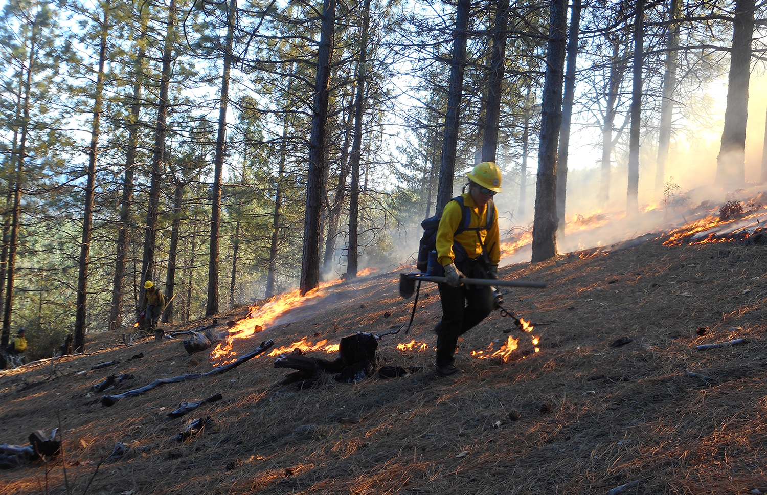
- Launched more than 2,000 projects: California’s historic investments continue to pay off. State agencies have conducted over 2,000 landscape health and fire prevention projects.
- Treated more than 3.7 million acres: Collectively, Task Force partners treated over 3.7 million activity acres with state, federal, and local partners between 2021 and 2024, including over 1 million activity acres of treatments across 733,000 footprint acres in 2024.
- Nearly doubled prescribed fire: Prescribed fire treatments nearly doubled since 2021, with interagency partners now treating roughly 200,000 acres annually.
- Supported tribal stewardship: In September 2024, Governor Newsom signed SB 310, which supports tribal sovereignty by enabling California Native American tribes to conduct cultural burns on ancestral territories. In March 2025, the Karuk Tribe and the California Natural Resources Agency entered into a landmark cultural burning agreement as part of SB 310.
- Created emergency teams: State and federal partners have established 15 Emergency Forest Restoration Teams (EFRTs) across the state to rapidly restore private forestlands after fires.
- Awarded $620 million to forest health: Since 2021, CAL FIRE has committed more than $620 million in support of 120 wildfire and forest resilience projects through its Forest Health Grant Program.
- Built local capacity: The Department of Conservation’s Regional Forest and Fire Capacity (RFFC) program has awarded more than $140 million to communities across the state to create fire-adapted communities and landscapes.
5. Leveraging Technology to Increase Transparency and Improve Wildfire Prevention and Response
- Innovative tools for tracking progress: In 2023, the Task Force launched an Interagency Treatment Dashboard to display completed federal, state, local, and private vegetation management projects across the state. The Dashboard, provides transparency, tracks progress, facilitates planning, and informs firefighting efforts.
- Documenting effectiveness: CAL FIRE’s Fuels Treatment Effectiveness Dashboard spotlights and documents how recent wildfire resilience projects are protecting communities and landscapes when wildfire strikes.
- First-ever statewide LiDAR maps: In December 2025, California released the state’s first-ever statewide LiDAR maps, providing data on forest and vegetation conditions, enabling tribes, researchers, land managers, and community partners to incorporate the free data products into their own tools, models, and planning processes to inform wildfire resilience projects.
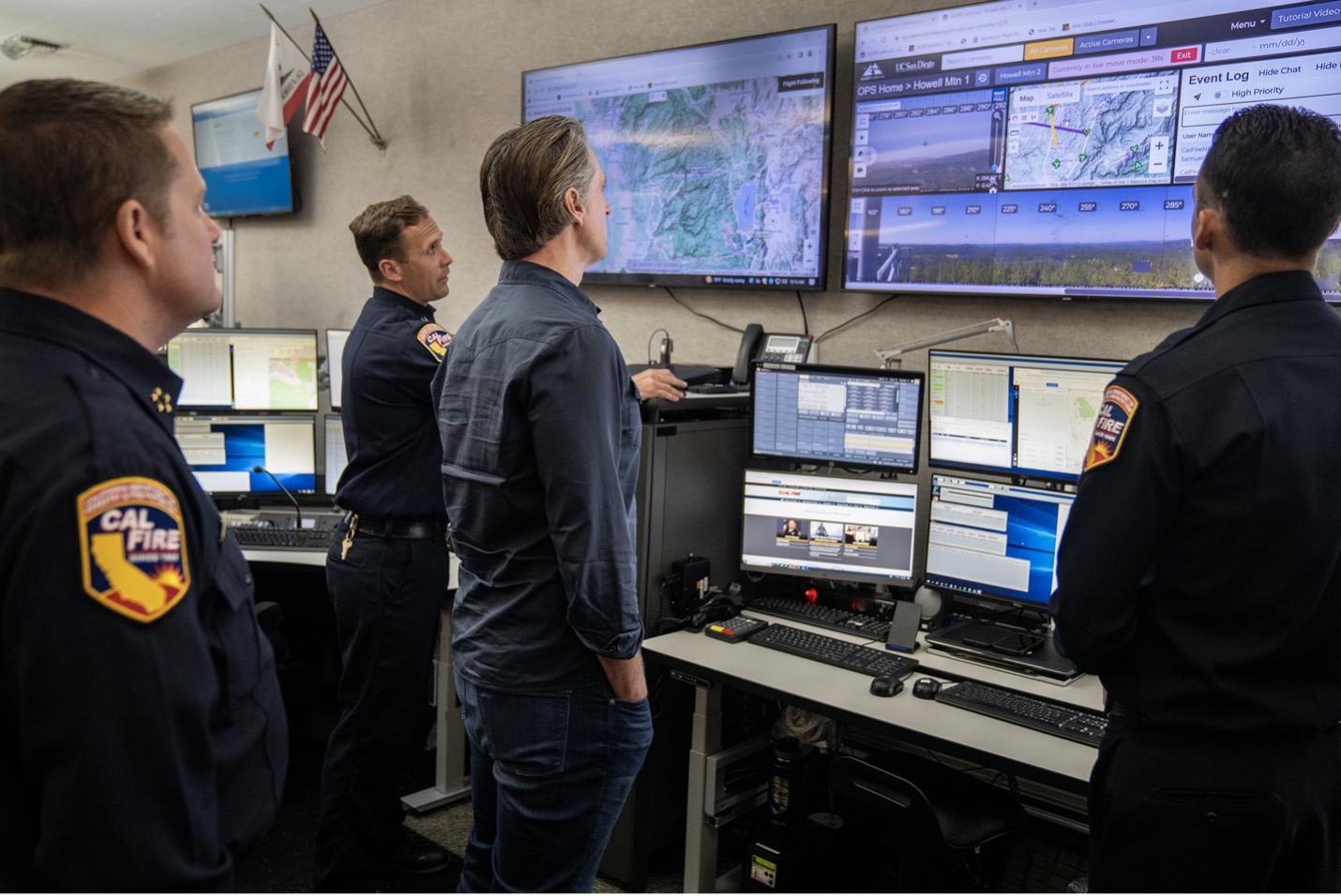
- Utilizing cutting-edge technology for fire response: CAL FIRE and Cal OES have also invested heavily in drones, satellite technology for advanced mapping, and AI-powered tools to spot fires quicker, and a Fire Integrated Real-Time Intelligence System (FIRIS) to provide real-time mapping of wildfires. Additionally, CAL FIRE partnered with UC San Diego to support the development of ALERTCalifornia which utilizes AI to identify and monitor wildfires. ALERTCalifornia was named one of TIME’s Best Inventions of 2023.
USDA California Climate Hub Provides Forestry Resource Repository for Land Managers
New Website Provides Forestry Resource Repository for Land Managers
January 8, 2025 – The USDA California Climate Hub released a new webpage that compiles datasets and decision-support tools to help land managers and natural resource professionals with assessing the conditions of a landscape for project planning. The list is not exhaustive of all resources but focuses on data and tools available to the public, with an emphasis on resources available within the state of California. The repository also contains a series of factsheets, produced by the USDA California Climate Hub, that offer a succinct overview of the California Wildfire and Forest Resilience Task Force’s Regional Resource Kits and its constituent products.
Survey Open to Collect Input from Landowners on Prescribed Burning
Survey Open to Collect Input from Landowners on Prescribed Burning
In collaboration with the University of California Cooperative Extension, Pennsylvania State University is conducting a survey to better understand private landowner perspectives and potential intentions to use planned burning in California. The objectives of this project are to:
•Evaluate private forest landowners’ attitudes towards prescribed fire in California.
•Identify barriers and opportunities for prescribed fire adoption in the state.
•Develop tailored support strategies for California landowners.
•Assess the influence of policy and environmental factors on prescribed fire use in California.
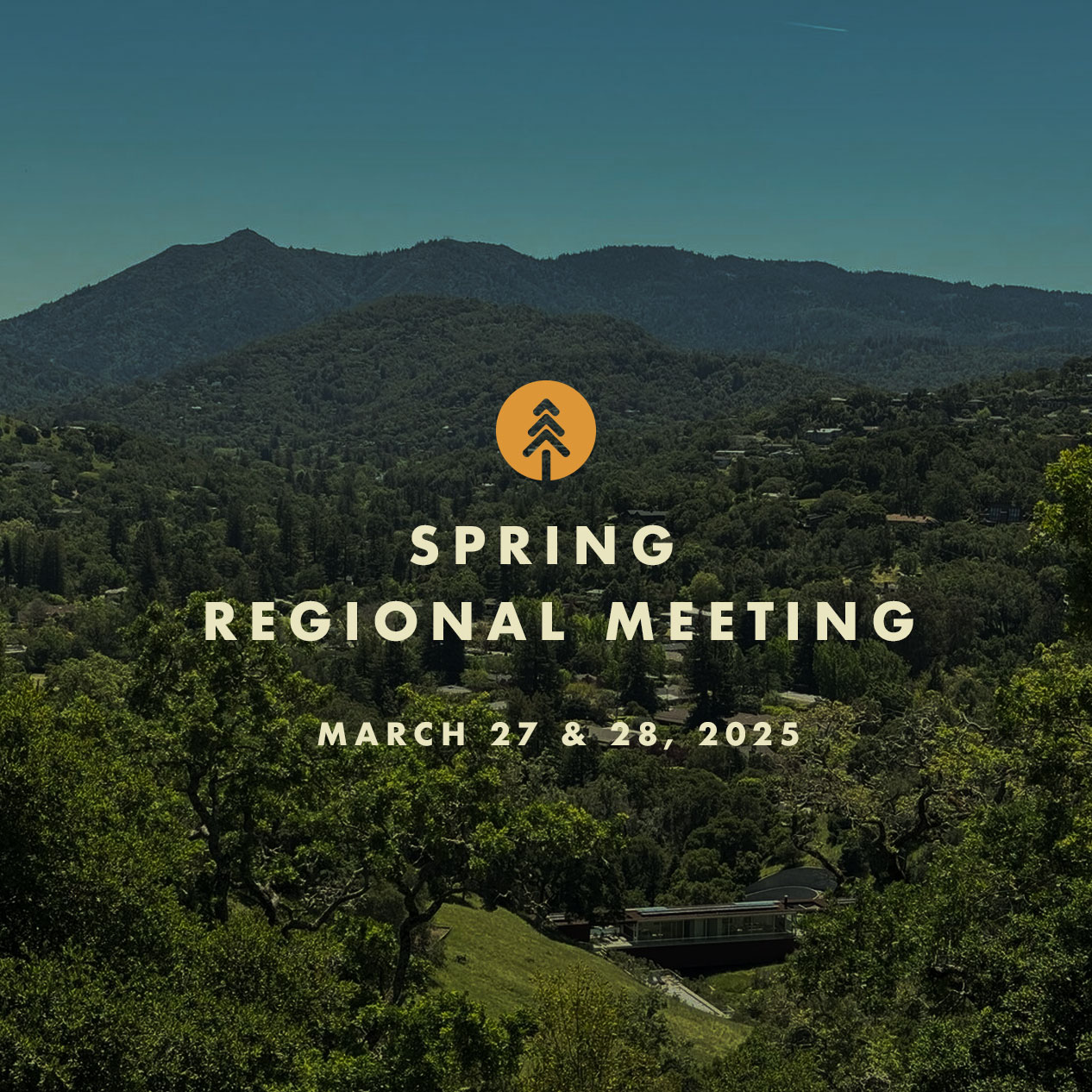
The Next Task Force Meeting is March 27 in San Rafael

Spring Regional Meeting – Marin County, CA
The Marin Wildfire Prevention Authority and Fire Safe Marin are hosting the California Wildfire and Forest Resilience Task Force Regional Meeting March 27 at the Embassy Suites in San Rafael, California. A remote attendance option will be available via Zoom.
The meeting on March 27 will focus on critical issues related to community wildfire risk reduction and landscape management in Marin County. We will kick off the day with refreshments and a resource fair.
On March 28, Task Force partners will host field tours offering immersive opportunities to better understand the critical landscape health and wildfire resilience work being done in Marin County and the greater Bay Area.
New for this meeting! The Climate and Wildfire Institute and Marin Wildfire Prevention Authority are hosting special Keynote Speaker Event the evening of March 26 at the Embassy Suites.
EVENT SCHEDULE
March 26
Keynote Speaker Night – Wildfires and Climate Change in California
Separate registration is required!
Marin Wildfire Prevention Authority and Climate and Wildfire Institute present Dr. Daniel Swain, renowned climate scientist from the University of California, Los Angeles who will present his research on climate and wildfire with a special emphasis on what we can learn from the recent Los Angeles fires.
Reception: 4:30 p.m – 6 p.m.
Keynote: 6 p.m – 7p.m.
March 27
Spring Regional Meeting
– Resource Fair – 8:30 a.m. to 10:00 a.m.
– Morning Session – 10:00 a.m. to 12:15 p.m.
– Lunch – 12:30 a.m. to 1:30 p.m.
– Afternoon Session – 1:30 p.m. to 4:30 p.m.
– Reception at Embassy Suites – 4:30 p.m. to 6:30 p.m. (Meeting registration is required.)
March 28
field tours
China Camp State Park: Prescribed Burning & Workforce Development
30+ Years of Collaboration To Promote More Resilient Human and Natural Communities at China Camp State Park
Visit China Camp State Park and hear about how a unique 30-year collaboration between State Parks, local fire agencies, and the FIRE Foundry has helped protect the Park’s hardwood forests and the adjacent homes in the WUI of San Rafael.
Pack a lunch and take a walk with sweeping views of San Francisco and San Pablo bays while learning about recent fuels reduction and prescribed fire treatments and the role of the FIRE Foundry in accomplishing the work. The FIRE Foundry is a workforce development and education program created in 2022 to support underserved and under-represented individuals in navigating a career in the fire service.
Start/End Time: 9:30 a.m. to approximately 1 p.m.
Meet: Embassy Suites San Rafael
Transport: Car caravan & vans available
Notes: Bring lunch. Prepare to hike on dirt roads and uneven terrain for 1.5 miles with up to 300 feet elevation gain.
Mountain Bike Tour of Marin County’s Camp Tamarancho
Public/Private Partnership to Promote Wildfire Prevention, Public Safety, and Sustainable Recreation
Bring your mountain bike (or rent one) and tour 412-acre Camp Tamarancho with amazing views of the North Bay stretching from Mt. Tamalpais to Mt. Diablo.
Learn about the multi-faceted fire preparedness work completed by Marin County to protect the communities of Fairfax & Woodacre while promoting safe and sustainable public recreation on the property.
Start/End Time: 9:00 a.m. to 2 p.m.
Meet: Splitrock Tap & Wheel – Fairfax
Transport: Mountain or e-mountain bike + full safety gear (rentals available)
Notes: Minimum intermediate cycling ability preferred for riding on fire roads and some technical single track.
– Bike rentals are available in Fairfax at Sunshine Bicycle Center and Splitrock Tap & Wheel.
Tomales Bay Forest Health and Wildfire Resilience Project
A Precedent-Setting Partnership & Tribal Collaboration Project
Pack a lunch and join California State Parks and the Golden Gate National Parks Conservancy for a tour of Tomales Bay State Park. Learn how the One Tam collaborative partnered with the Federated Indians of Graton Rancheria to develop an RFFC-funded Regional Priority Plan for Marin County, and how California State Parks leveraged the Marin Regional Forest Health Strategy to include Tribal participation in the Coastal Development Permit and CalVTP process.
Start/End Time: 9:30 a.m. to 12:30 p.m.
Meet: Vista Point Picnic Area – Inverness
Transport: 50-minute drive from San Rafael – Carpooling Encouraged – Parking Passes Provided
Notes: Prepare to hike on dirt roads and uneven terrain for 2.5 miles with up to 400 feet elevation gain.
Forest and Watershed Resilience on Mt. Tamalpais
Reflections on 5-years of Management to Increase Forest Resilience on Mt. Tamalpais Watershed to Protect the County’s Water Supply
On a beautiful hike through Mt. Tamalpais Watershed’s mixed-conifer forests and oak woodlands, review forest health and fuels reduction treatments, view and learn about recent prescribed burning sites, and discuss management designed to address impacts from weeds, fire exclusion, and pathogen impacts. The hike ends with a bring-your-own picnic lunch atop Mt. Tam’s West Peak with panoramic views of the San Francisco Bay Area.
Start/End Time: 9:30 a.m. to 12:30 p.m.
Meet: Quarry Parking Lot – E. Ridgecrest Blvd at Lagunitas Rock Springs Road
Transport: 40-minute drive from San Rafael – Carpooling Encouraged – Parking Passes Provided
Notes: Prepare to hike on dirt roads and uneven terrain for 2.5 miles with up to 500-feet elevation gain.
Forest and Fire Ecology: The Old Growth Coast Redwoods of Muir Woods National Monument
National Park Service Efforts to Bring Beneficial Fire Back to Marin’s Iconic Old Growth Redwood Forests
Join National Park Service natural resource and interpretive staff on a hike through the majestic old-growth coast redwoods of Muir Woods National Monument. Planning is underway to bring prescribed fire back to Muir Woods for the first time in decades, and the One Tam collaborative behind the Marin Regional Forest Health Strategy / Regional Priority Plan is helping to make it happen.
Learn about the significance and inner workings of this unique and remnant habitat while strolling the Main Trail with its bridges and boardwalks along Redwood Creek and through the remarkable Cathedral Grove.
Start/End Time: 9:00 a.m. to 1:30 p.m.
Meet: Embassy Suites San Rafael
Transport: MWPA to coordinate vans
Notes: Café on site or bring lunch. Prepare to hike on smooth terrain and gentle grade for 2 miles.
Greater Novato Shaded Fuel Break Tour
Creating an Expanded Defensible Space Buffer Around the Novato Community
Learn how Novato Fire District, Marin County Parks, and Marin Wildfire are using the CalVTP process, a CAL FIRE Wildfire Prevention grant, and two tax revenues to fund a 60-mile expanded defensible space project around the entire community of Novato. This tour will feature field presentations at three locations that focus on the CalVTP process, collaborative treatments, and prescribed burning.
Start/End Time: 9:00 a.m. to 1:30 p.m.
Meet: South Hamilton Park – Novato
Transport: Self-Driving – 3 Stops, Starting 15 minutes from San Rafael – Carpooling Encouraged
Notes: Bring lunch. Prepare to hike on smooth terrain and gentle grade for 2 miles.

Questions? Please contact foresttaskforce@fire.ca.gov
Thank You to our Hosts
Thank You to our Sponsors