
USFS Study Shows How Fuel Treatments Improve Wildfire Outcomes
USFS Pacific Southwest Research Station (PSW) Study Shows How Fuel Treatments Improve Wildfire Outcomes
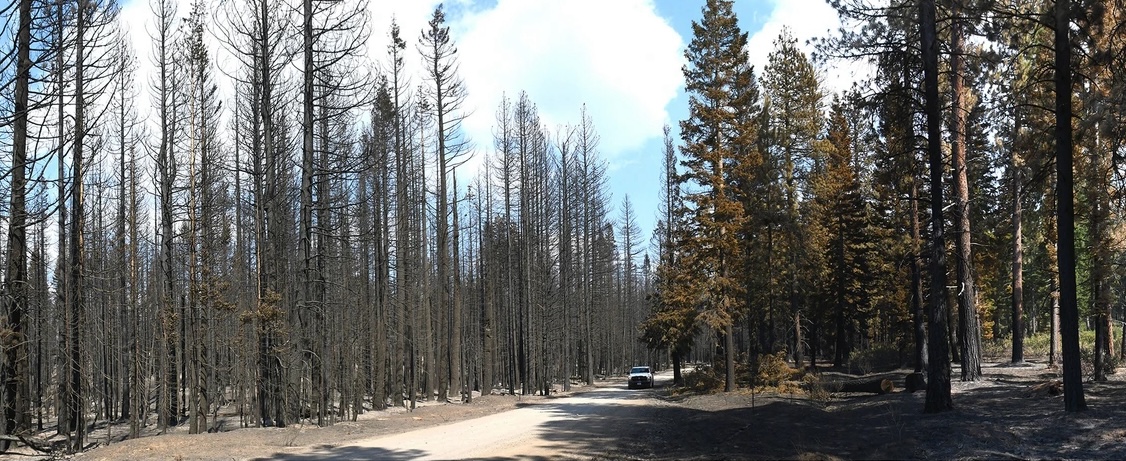
PSW researchers recently published findings that provide strong evidence for the use of fuel treatments to mitigate fire behavior and resulting fire severity even under extreme fire weather conditions. When the 2021 Antelope Fire tore through the Goosenest Adaptive Management Area (long-term research plots set up in northeastern California in the late 1990s), it seemed that 20 years worth of research had been lost. However, shortly after the fire a 2,300-acre study was conducted that demonstrates how reducing canopy bulk density via mechanical thinning treatments can help to limit crown fire behavior for 20 years or more. The findings make a compelling case for doing both tree thinning and prescribed burning to protect forests in the future.
USFS Invests $179M to Confront Wildfire Crisis
USDA Forest Service Invests Nearly $179 Million for Priority Landscapes in California to Confront Wildfire Crisis
On February 20, the USDA Forest Service announced it will invest nearly $179 million into priority landscapes across California as part of a $500 million national investment to expand work on the Wildfire Crisis Strategy to reduce risk to communities, critical infrastructure, and natural resources from the nation’s ongoing wildfire and climate crisis. This builds on the $2.8 billion already invested by Governor Newsom and California’s Legislature to take proactive actions to reduce catastrophic wildfire risks, protect communities, and restore the health of our landscapes.
“These and other federal investments are vital to match the Governor’s $2.8 billion investment over the last several years. They will also strengthen our partnership with the Forest Service, California’s largest landowner, in taking an ‘all-lands’ approach to improve the health of our forests and the safety of our communities,” said California Wildfire and Forest Resilience Task Force Director, Patrick Wright.
Funding has been designated for the following projects:
| Regional Landscapes | FY24 Allocation |
| Stanislaus | $57,663,352 |
| North Yuba | $16,489,560 |
| Sierra and Elko Fronts (includes CA & NV) | $27,692,340 |
| Klamath River Basin (includes CA & OR) | $36,831,090 |
| Plumas Community Protection | $3,522,500 |
| Southern California | $1,915,000 |
| Trinity | $34,749,886 |
| Total Allocation FY24: | $178,863,728 |
An additional $100 million will be allocated across 24 qualifying states under a new Forest Service program — the Collaborative Wildfire Risk Reduction Program which will expand work in high-risk wildfire areas outside the 21 priority landscapes. The Collaborative Wildfire Risk Reduction Program will use hazardous fuels funds from the Inflation Reduction Act to treat areas in other high-risk wildfire areas where national forests and grasslands meet homes and communities.
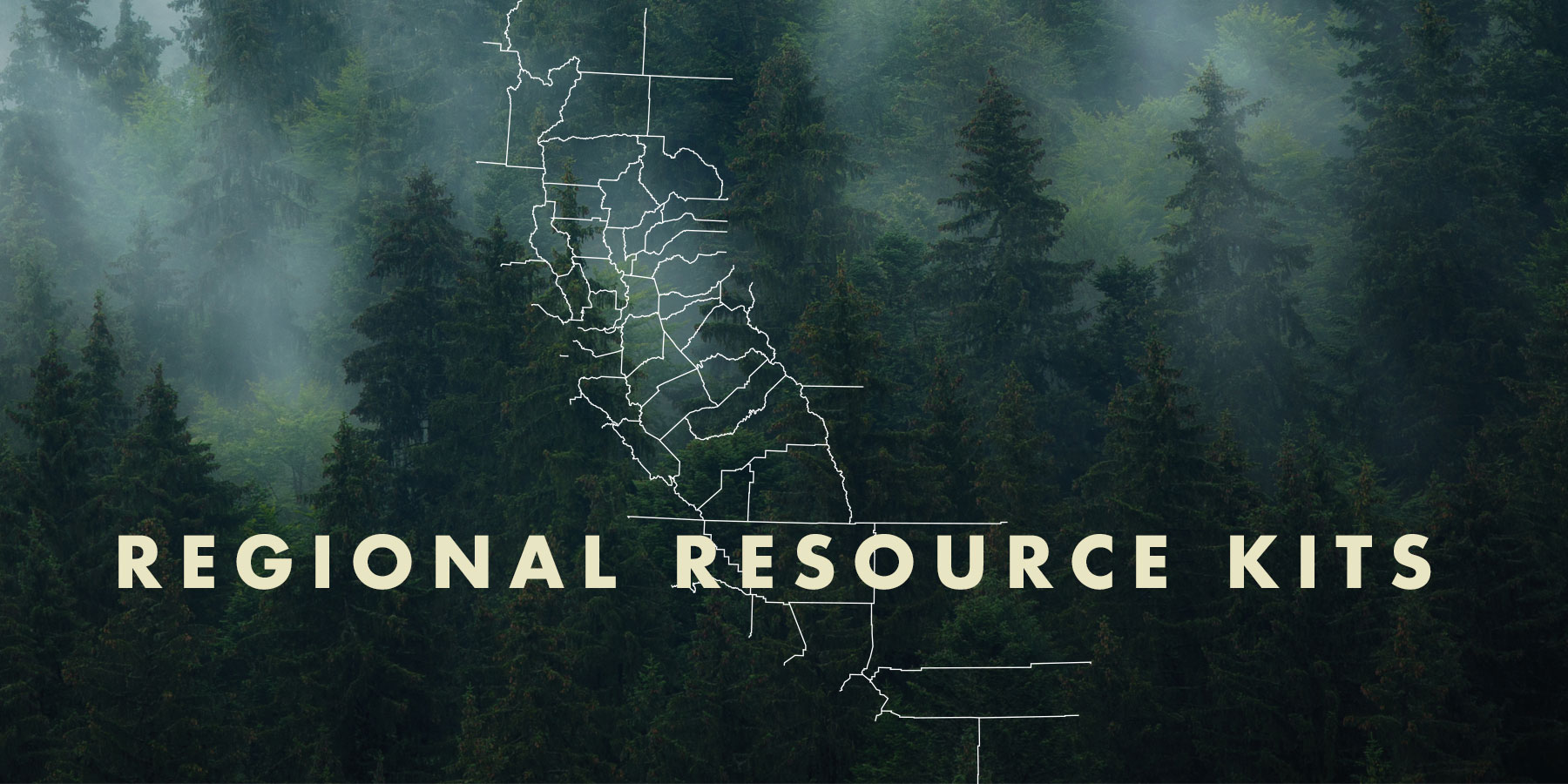
Statewide Set of Regional Resource Kits Completed with Release of Northern CA Region
Task Force Offers Statewide Set of Regional Resource Kits with Release of Northern CA Region
On October 5, 2023, the Task Force released its fourth and final Regional Resource Kit and Regional Profile for Northern California. This adds to the kits and profiles already available for the Sierra Nevada, Southern California, and Central California Task Force designated regions. Kits provide sets of tools and data created to accelerate the work by regional partners and collaboratives to reduce wildfire hazard and improve the conditions of forested and shrub landscapes. Regional Profiles add socio-ecological context for each region, highlight examples of current condition assessments from the associated kit, and present findings from interviews and surveys about stakeholder priorities and concerns for community and ecosystem resilience.
Wildfire Mitigation and Management Commission Releases Final Report
Wildfire Mitigation and Management Commission Releases Final Report
On September 27, the federal Wildland Fire Mitigation and Management Commission, co-chaired by the U.S. Departments of Agriculture and Interior and the Federal Emergency Management Agency, released a final report submitted to Congress that reflects a comprehensive review of the federal wildfire system. The report makes 148 recommendations covering seven key themes:
- Urgent new approaches to address the wildfire crisis
- Supporting collaboration to improve partner involvement
- Shifting from reactive to proactive in planning for, mitigating and recovering from fire
- Enabling beneficial fire to reduce the risk of catastrophic wildfire
- Supporting and expanding the workforce to hire and retain the wildland firefighting staff needed to address the crisis
- Modernizing tools for informed decision-making to better leverage available technology and information
- Investing in resilience through increased spending now to reduce costs in the long run
Regional Resource Kits and Profiles Are Now Available
Regional Resource Kits and Profiles Are Now Available
The Task Force’s Science Advisory Panel has completed Regional Resource Kits and Regional Profiles for both the Sierra Nevada and Southern California regions. These invaluable tools are now available here on the Task Force website.
Regional Resource Kits offer critical tools and data to guide regional partners and collaboratives in their efforts to reduce wildfire hazard and improve the conditions of forested and shrub landscapes.
Likewise, Regional Profiles bring together the best available scientific information and a wide range of input from stakeholders throughout the region.
The Science Team will now focus on collecting data and tools for the Central Coast in preparation for the May 2023 Task Force meeting.

Administration Announces Plans for Reforestation, Climate Adaptation
Biden-Harris Administration Announces Plans for Reforestation, Climate Adaptation, including New Resources from Bipartisan Infrastructure Law
On July 2022, the U.S. Department of Agriculture and U.S. Forest Service announced a nationwide strategy that will address a reforestation backlog of four million acres on national forests and plant more than one billion trees over the next decade. According to USFS Chief Randy Moore, the reforestation strategy will serve as a framework to understand reforestation needs, develop shared priorities with partners, expand reforestation and nursery capacity, and ensure the trees planted grow to support healthy, resilient forests. In addition to the reforestation strategy, Secretary Vilsack announced 13 new USDA agency climate adaptation plans, which outline how each USDA agency will incorporate climate change into their operations and decisions to support communities, agriculture and forests nationwide.
RESOURCES