
CAL FIRE Releases Vegetation Burn Severity Online Viewer
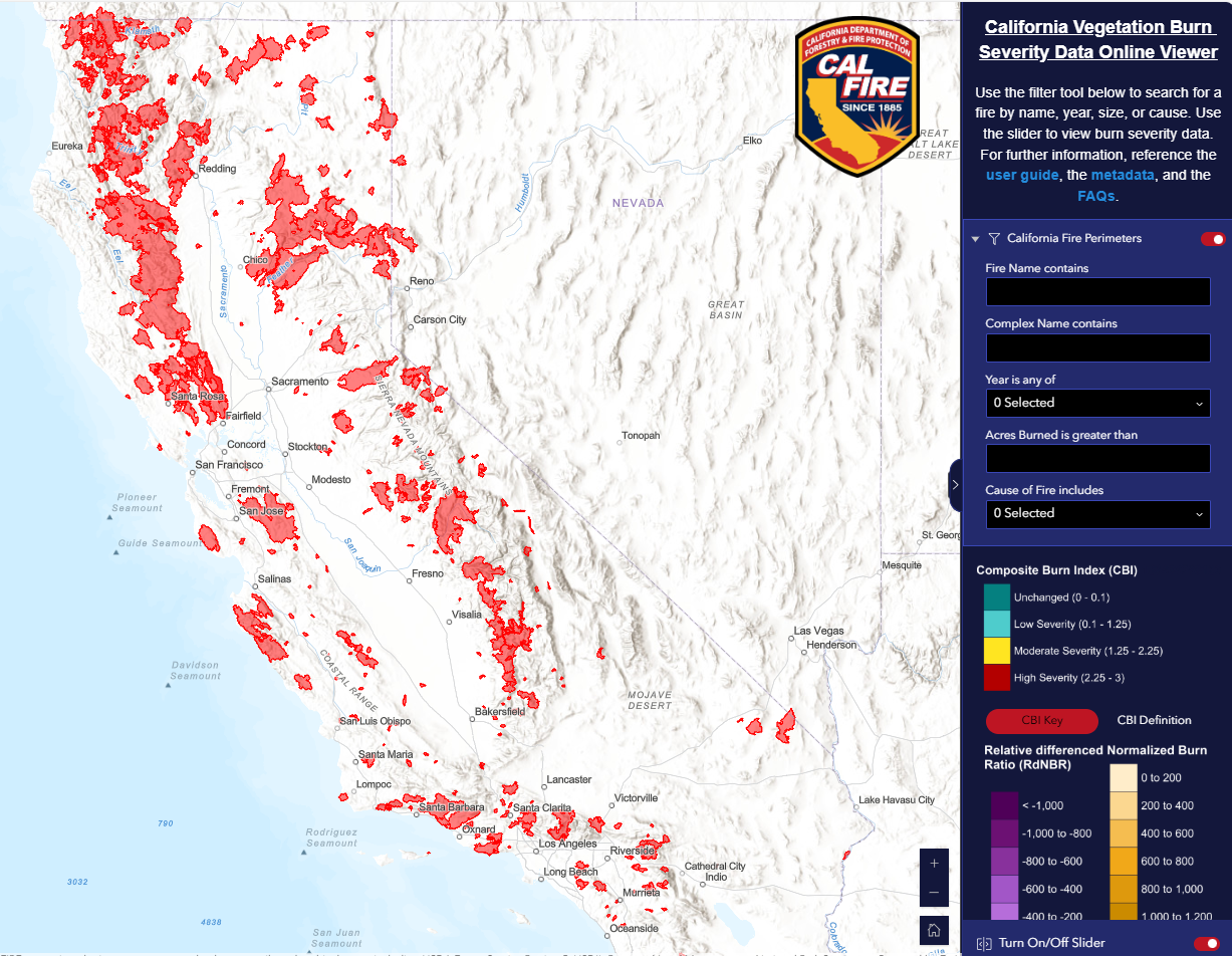
July 15, 2025 – CAL FIRE’s Fire and Resource Assessment Program (FRAP) released the California Vegetation Burn Severity Online Viewer, a public geospatial tool that displays burn severity data for wildfires across all land ownerships that burned at least 1,000 acres in California from 2015 to 2023. In accordance with Senate Bill 1101, FRAP developed this viewer to enhance public understanding of post-fire conditions and ecological impacts. It offers insight into the severity of impacts to vegetation across both forested and non-forested landscapes. The viewer will support post-fire recovery planning, inform habitat management and conservation efforts, enhance safety through insights for fire suppression planning, and improve preparedness by helping prescribed fire practitioners plan treatments based on past burn severity and fuel changes. Users can view fire perimeters, severity maps, and proportional area statistics for each fire. The viewer will be updated annually to include new fires under 1,000 acres.