Registration for In-Person Attendance is Closed.Register for Field Tours by March 13.
Sierra Nevada Regional Meeting – Jamestown, CA
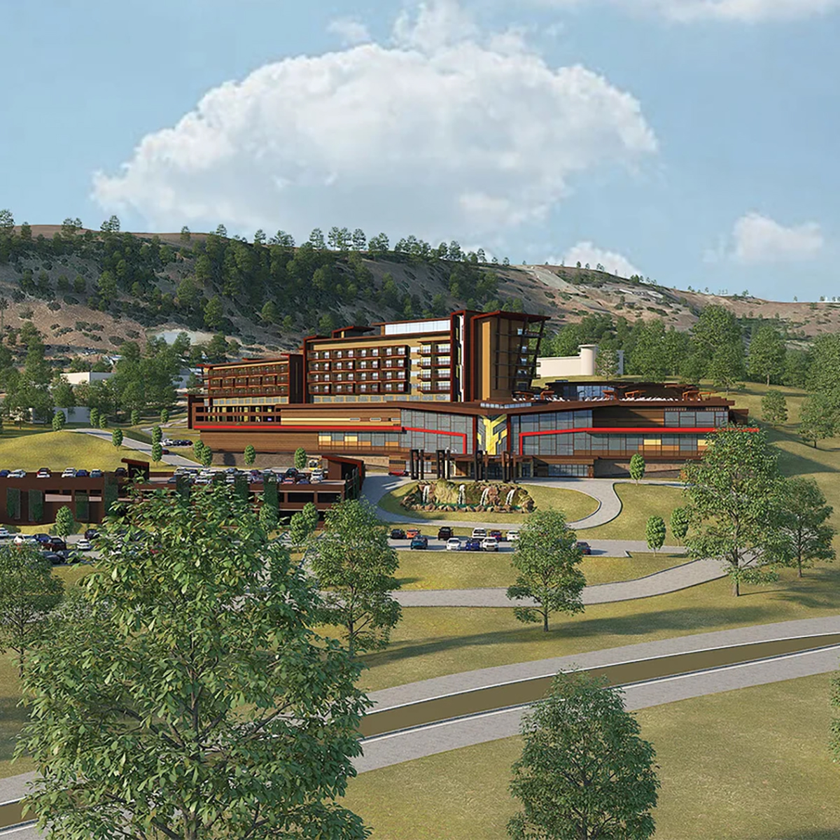
Mountain Counties Water Resources Association and Sierra Nevada Conservancy are hosting the California Wildfire and Forest Resilience Task Force Regional Meeting March 19 at the Chicken Ranch Casino Resort in Tuolumne County. A remote attendance option will be available via Zoom.
The meeting on March 19 will highlight issues of regional importance in the Central Sierra. We will kick off the day with refreshments and a resource fair. On March 20, Task Force partners will host field tours offering immersive opportunities to better understand the critical landscape health and wildfire resilience work being done in the region.
New Wildfire Task Force Merch Available
Purchase HERE, for pick up at the March 19 regional meeting.(no mail delivery option.)
EVENT SCHEDULE
MARCH 19 MEETING SCHEDULE
Resource Fair
8:30 – 10:00 a.m.
Welcome, Land Acknowledgement, Opening Remarks
10:00 a.m. – 10:30 a.m.
Director’s Report
10:30 a.m – 11:00 a.m.
Morning Session: Achieving Resilience
11:00 a.m. – 12:15 PM
Lunch
12:15 p.m. – 1:30 p.m.
Afternoon Session 1: Sustaining Resilience
1:30 p.m. – 2:45 p.m.
Afternoon Session 2: Financing Resilience
3:00 p.m. – 4:15 p.m.
Closing Remarks
4:15 p.m. – 4:30 p.m.
Reception
4:30 p.m. – 6:30 p.m.
hotel information
Chicken Ranch Casino Resort
9100 People of the Mountain Rd.
Jamestown, CA 95327
209-984-9066
RESERVE YOUR ROOM
field tours
ALL FIELD TOURS ARE FRIDAY MARCH 20
Tuolumne Bioenergy and Heartwood Biomass
Expanding Wood Products and Biomass Utilization in Tuolumne County
Destination: Join this tour of two of Tuolumne County’s newest wood-products facilities, Tuolumne Bioenergy and Heartwood Biomass. Both facilities boast state-of the-art technologies in the processing of forest biomass into multiple marketable products and were financed, in part, through grants from CAL FIRE and through the National Disaster Resilience Competition Grant.
Starting Point: Chicken Ranch Casino
Start/End: 9:00 AM – 1:00 PM
Accessibility: Tour will consist of walking around industrial facilities, potentially on uneven ground at times.
Additional Notes: Carpools encouraged. Bring your own water/snacks/lunch. Restrooms will be available.
Arnold Avery Healthy Forest Restoration Project
Prioritizing Community Wildfire Safety and Recreation Management
Destination: Bring your mountain bike or gravel bike for a fun ride on the Arnold Rim Trails to learn about the intersection between community wildfire safety and recreation management. Learn how active fuels reduction and prescribed burning projects in the wildland–urban interface adjacent to the community of Arnold have allowed for priotritization of outdoor recreation, forest health and wildfire safety.
Hear from the Arnold Rim Trail Association and the U.S. Forest Service about how they are advancing the shared goals of healthy forests, safe communities and fun recreational trails. This is a no-drop ride which means all are welcome as long as you have intermediate biking skills. We will have a sweeper for the group and will stop often to allow the group to catch up and help with any issues along the way. There are a couple small stream crossings to navigate. There are more trails in the area if you want to ride more. Our planned route is approximately 10 miles with 1,000’ of climbing. There will be a couple small stream crossings where your feet may get wet. We will cancel if snow or heavy rain affects the trails.
Start/End: 9:00 AM – 1:00 PM
Starting Point: See map pin
Accessibility: Mountain biking on gravel and native surface trails. Trails may be steep in some areas.
Additional Notes: Bring water/snacks/lunch. No restroom facilities along trail path. Leave Chicken Ranch Casino no later than 8am.
Social and Ecological Resilience Across the Landscape (SERAL) Project
A Collaborative Approach to Wildfire Protection and Forest Resiliency
Destination: View and discuss an all hands, all lands approach to community protection and forest resilience in the context of the SERAL Project and adjacent fuel treatment efforts. Stops will include examples of fuelbreaks and other fuel treatments to protect critical infrastructure, forest thinning and planned Rx burning treatments.
Starting Point: Twain Harte Market parking lot
Start/End: 09:30 AM -1:30 PM
Accessibility: Driving on maintained paved, gravel and dirt roads. Minimal walking just off of road side.
Additional Notes: Carpools encouraged; bring water/snacks/lunch; no restroom facilities after leaving meeting location.
Calaveras Big Trees State Park Beneficial Fire and Fuels Reduction
Collaborating to Reduce Wildfire Risk in a Giant Sequoia Forest
Destination: Hear from Calaveras Big Trees State Park Fire Management staff alongside local CAL FIRE Tuolumne-Calaveras Unit staff to learn about a brief park history, recent Wildfire and Forest Resilience Program funded fire and fuels work, and a Q&A session with local Park and CAL FIRE staff. This will be followed by a guided hike through giant sequoias to view recent prescribed burns along the 1.5 mile long ADA accessible North Grove Trail. This schedule may be slightly altered to accommodate inclement weather.
Starting Point: Jack Knight Hall, Calaveras Big Trees State Park
Start/End: 10:30 AM – 12:30 PM
Accessibility: 1.5 mile hike on ADA trail
Additional Notes: Carpools encouraged. Bring water and snacks. Restrooms will be available.
Rim Fire Reforestation and Restoration
Restoring Iconic Landscapes After Large-scale Wildfire
Destination: Join the Stanislaus National Forest and partners on a tour of the 2013 Rim Fire. Attendees will view the various restoration and reforestation strategies decided on by the Stanislaus National Forest and the Yosemite Stanislaus Solutions Forest Collaborative.
Starting Point: Groveland Ranger Station
Start/End:10:00 AM – 1:00 PM
Accessibility: Attendees must be prepared to walk short distances across uneven or steep terrain. Bring appropriate footwear and clothing for cold weather.
Additional Notes: Carpools encouraged. Bring your own water/snacks/lunch. Restrooms will be available at Ranger Station.
Yosemite National Park Fuel Treatments
Working Across Jurisdictions for Landscape-scale Fuel Reduction and Forest Management
Destination: Tour Yosemite Valley and giant sequoia forests to discuss landscape-scale fuel reduction and forest management implemented through mechanical and manual fuel treatments, prescribed fire, and Tribally-led fire and fuels work. Stops will examine how these approaches interact with wildfire and support the park’s goal of restoring good fire to the landscape to increase resilience. The tour will highlight how Tribal and Resource Conservation District partnerships are necessary to carrying out this work at scale across jurisdictions.
Starting Point: Chicken Ranch Casino
Start/End: 9:00 AM – 2:00 PM
Accessiblity: Attendees must be prepared to walk short distances across uneven or steep terrain. Bring appropriate footwear and clothing for cold weather.
Additional Notes: This is a one-way tour and will end on Highway 41 by Wawona. Only attendees traveling southward to return home should plan on joining this tour. Bring your own water/snacks/lunch. Restrooms will be available throughout tour.
Mokelumne Amador Calaveras Forest Health & Resilience Project
Planing for Large Landscape Fuels Reduction
Destination: Join the Upper Mokelumne River Watershed Authority (UMRWA) and the U.S. Forest Service for a tour of the Mokelumne Amador Calaveras Forest Health & Resilience Project (MAC Project) along the Highway 88 corridor in Eldorado National Forest. This tour will showcase ongoing and future fuels reduction and forest health treatments as part of this large-landscape green forest initiative. Participants will learn about treatment effectiveness, Tribal and other partner engagement, and lessons learned. The tour will begin at the Chicken Ranch Casino Resort. It will then proceed north to Jackson, CA, for a brief overview presentation on the project at the Amador County facility, and then participants will be led to several locations along Highway 88 on the Amador Ranger District to see recently treated areas and hear about future forest health treatments.
Starting Point: Chicken Ranch Casino
Start/End: 9:00 AM – 2:00 PM
Accessibility: Attendees must be prepared to walk short distances across uneven or steep terrain. Bring appropriate footwear and clothing for cold weather.
Additional Notes: Carpools highly encouraged. Participants will be able to leave vehicles in Jackson. Bring your own water/snacks/lunch and wear weather-appropriate clothing and footwear. Restrooms will be available early in tour.
THIS TOUR HAS BEEN CANCELED
Southwest Interface Team Wildfire Prevention
Defending Watersheds and Communities from Wildfire in Tuolumne and Mariposa Counties
Destination: Tour of Southwest Interface Team (SWIFT) area to learn how strategic fuelbreaks and fire prevention projects are helping to defend the watersheds, communities, and residents from wildfire in a 132,000 acre area in Southern Tuolumne and Northern Mariposa Counties. The collaboration, formed in 1999, is composed of local, county, state, and federal agencies, as well as non-profits and associations, working cooperatively to reduce the threat of wildfire. The tour will include projects focused on fuels reduction in an effort to achieve fire resilient landscapes.
Starting Point: Moccasin Schoolhouse, 1 Lakeshore Drive Moccasin, CA. (37.812040716786385, -120.30163409956883). From Moccasin Switchback Road take right at Hetch Hetchy Learning Center.
Start/End: 9:00 AM – 2:00PM
Accessibility: Attendees must be prepared to walk short distances across uneven or steep terrain. Bring appropriate footwear and clothing for cold weather.
Additional Notes: Bring your own water/snacks/lunch. Transportation provided for up to 20 attendees.
From Partnership to Scale: Financing Forest Resilience
Helping California Forest Landowners Thrive
Destination: Join the American Forest Foundation, utility partners, and local experts on this multi-stop field tour for discussions on fuels reduction projects highlighting CalFire Block grants, collaboration with electric utilities, and setting the stage for an innovative funding model to fund work on a larger scale.
Starting Point: Chicken Ranch Casino
Start/End: 9:00 AM – 2:00 PM
Accessibility: Attendees must be prepared to walk short distances across uneven or steep terrain. Bring appropriate footwear and clothing for cold weather.
Additional Notes: Carpools encouraged. Bring your own water/snacks/lunch.
Ponderosa Hills/Mira Monte Pilot Project
Implementing the California Wildfire Mitigation Program in Tuolumne County
Destination: Join California Wildfire Mitigation Project (CWMP) representatives and staff from Tuolumne County Office of Emergency Services touring the Ponderosa Hills/Mira Monte Pilot project created as part of the State of California’s effort to strengthen community-wide resilience against wildfires. The tour will look at the project area, relationship to local fuels reduction projects and discuss important measures that focus on cost-effective structure hardening and retrofitting to create fire-resistant homes as well as defensible space and vegetation management activities.
Starting Point: Chicken Ranch Casino
Start/End: 9:00 AM – 12:30 PM
Accessibility: Minor amounts of walking.
Additional Notes: Transportation will be provided from Chicken Ranch Casino. Bring your own water/snacks/lunch. Wear clothing appropriate for cold weather.

Thank You to our Sponsors