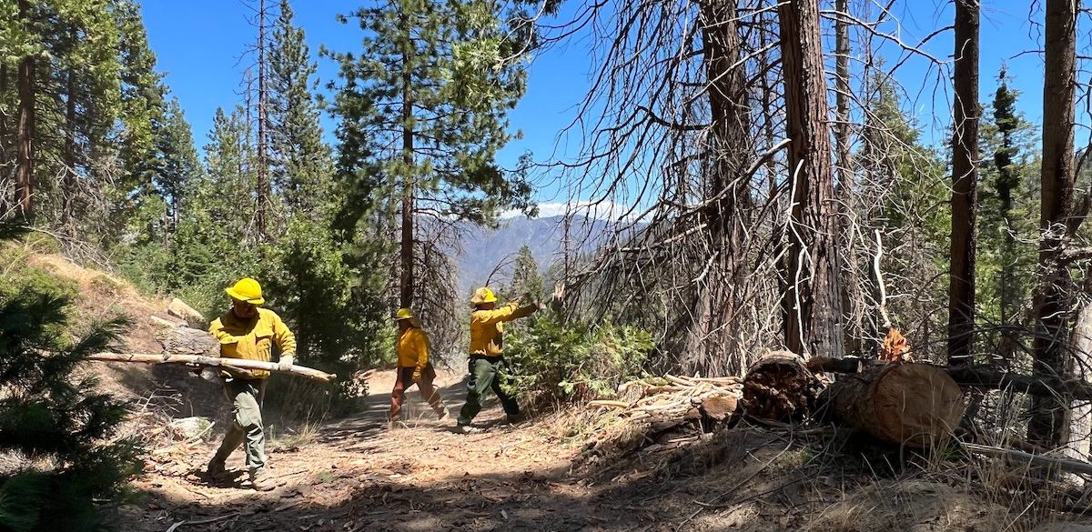


First Set of Projects Fast-tracked as Part of Governor’s Emergency Proclamation on Wildfire

CNRA and CalEPA Identify First Set of Fast-tracked Projects as Part of Governor’s Emergency Proclamation on Wildfire


New Streamlined Process:
Governor Newsom issued an Emergency Proclamation (Proclamation) on March 1, 2025, to confront the severe ongoing risk of catastrophic wildfires that threatens public safety across California. The Proclamation authorizes the Secretaries of the California Natural Resources Agency (CNRA) and the California Environmental Protection Agency (CalEPA) to determine which projects are eligible for suspension of certain State of California statutory and regulatory requirements to expedite critical fuels reduction projects, while at the same time protecting public resources and the environment. The Task Force has established a website that includes eligibility criteria, FAQs, and a link to the application to request a determination of eligibility for suspension of relevant State of California statutory and regulatory requirements. The Secretaries also hosted a virtual briefing on the Proclamation and the process.

First Set of Approved Projects:
Just one week after applications opened, CNRA and CalEPA identified a 450-acre collaborative wildfire resilience project in Humboldt County as the first project to be determined eligible for streamlining. Three projects totaling 882 acres have been approved to date, spanning from the northern California coast to Sierra Nevada Mountains and all the way down to San Diego. Each of these projects involve tribes and other partners, natural resource managers and fire districts.  Here is an overview of the first set of approved projects.

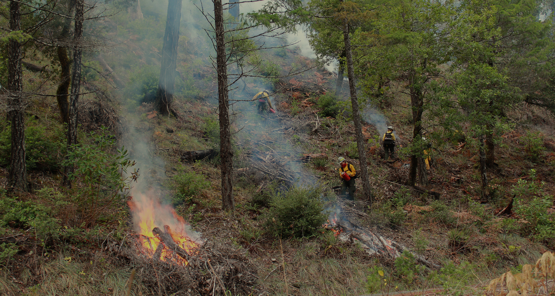
  • The Prosper Ridge Community Wildfire Resilience Project in Humboldt County is the first approved project under the Governor’s emergency proclamation on wildfire. This collaborative state, federal, and tribal project will treat nearly 450 acres with a combination of mechanical thinning, manual treatments, and prescribed fire.
  • The Sycuan Wildfire Resiliency Project covers over 240 acres in San Diego County and aims to protect the Sycuan Reservation from wildfire by reducing fire hazard, ensuring defensible space, and providing safe egress with the use of 300 grazing goats.
  • Vedanta Hazardous Fuels Reduction Project will reduce wildfire risk, improve forest health and enhance landscape resilience within the WUI, reducing risk of crown fires spans across 190 acres near Lake Tahoe.

These projects are focused on removing flammable dead or dying trees, creating strategic fuel breaks, creating safe egress along roadways, manual and mechanical removal of ladder fuels and beneficial fire use. Approved project location maps and documentation will be made available on the Task Force website. 


Wildfire Project Streamlining Requests

Fast-Tracking Critical Fuels Reduction Projects:

Requests to Suspend State Statutes and Regulations

New Project streamlining requests under the Governor Newsom’s Emergency Proclamation on wildfire are no longer being accepted. Under this proclamation nearly 500 critical wildfire projects across more than 120,000 acres have been fast-tracked with projects approved in as little as 30 days – reducing review timelines by a year or more for many projects. This page includes information on approved projects and resources to support ongoing planning efforts for projects submitted prior to the May 1, 2026 deadline.


Eligibility:

A project is eligible to operate under the suspension of state laws if it meets all four of the following requirements:

1. The primary objective of the project is at least one of these activities:

    • Removal of hazardous, dead, and/or dying trees
    • Removal of vegetation for the creation of strategic fuel breaks as identified by approved fire prevention plans, including without limitation, CAL FIRE Unit Fire Plans or Community Wildfire Preparedness Plans
    • Removal of vegetation for community defensible space
    • Removal of vegetation along roadways, high-ways, and freeways for the creation of safer ingress and egress routes for the public and responders and/or to reduce roadside ignitions
    • Removal of vegetation using cultural traditional ecological knowledge for cultural burning and/or prescribed fire treatments for fuels reduction
    • Maintenance of previously established fuel breaks or fuels modification projects

2. The request for suspension is submitted by May 1, 2026.

3. Work will be performed or supervised by qualified responsible parties, such as Registered Professional Foresters, Certified Rangeland Managers, qualified vegetation management contractors, qualified incident commanders, certified arborists, certified burn bosses and authorized cultural burners.

4. Work will follow Best Management Practices (BMPs) and measures identified in the Statewide Fuels Reduction Environmental Protection Plan (EPP). 

As identified above, projects that receive suspension must focus on critical fuels reduction to combat catastrophic fires and promote community safety and resiliency. This includes, but is not limited to, projects identified in CAL FIRE Unit Fire Plans, Community Wildfire Preparedness Plans, and Utility Wildfire Mitigation Plans provided they meet the objectives above.


Statewide Fuels Reduction Environmental Protection Plan (EPP):

View the Current EPP

View the redlined changes from the May 2025 version


Project Support Resources:

Find Assistance for Project Design & Application

Approved Project Information:

View Project Details & Locations

FAQ's

Given the severe threat of catastrophic wildfire risk, the Newsom Administration is moving to expedite fuel reduction projects that protect public safety and communities. Consistent with Governor Newsom’s March 1, 2025 State of Emergency Proclamation (Proclamation) the Secretaries of the California Natural Resources Agency (CNRA) and the California Environmental Protection Agency (CalEPA) are authorized to determine which projects are eligible for suspension of certain state laws and regulations to expedite critical fuels reduction projects, while at the same time protecting public health and the environment. 

A project is eligible to operate under the suspension of state laws if it meets all four of the following requirements:

1. The primary objective of the project is at least one of these activities:

    • Removal of hazardous, dead, and/or dying trees
    • Removal of vegetation for the creation of strategic fuel breaks as identified by approved fire prevention plans, including without limitation, CAL FIRE Unit Fire Plans or Community Wildfire Preparedness Plans
    • Removal of vegetation for community defensible space
    • Removal of vegetation along roadways, high-ways, and freeways for the creation of safer ingress and egress routes for the public and responders and/or to reduce roadside ignitions
    • Removal of vegetation using cultural traditional ecological knowledge for cultural burning and/or prescribed fire treatments for fuels reduction
    • Maintenance of previously established fuel breaks or fuels modification projects

2. The request for suspension is submitted by May 1, 2026.

3. Work will be performed or supervised by qualified responsible parties, such as Registered Professional Foresters, Certified Rangeland Managers, qualified vegetation management contractors, qualified incident commanders, certified arborists, certified burn bosses and authorized cultural burners.

4. Work will follow Best Management Practices (BMPs) and measures identified in the Statewide Fuels Reduction Environmental Protection Plan (EPP)

As identified above, projects that receive suspension must focus on critical fuels reduction to combat catastrophic fires and promote community safety and resiliency. This includes, but is not limited to, projects identified in CAL FIRE Unit Fire Plans, Community Wildfire Preparedness Plans, and Utility Wildfire Mitigation Plans provided they meet the objectives above.

Eligible entities include, but are not limited to, public agencies, Tribes, Resource Conservation Districts, non-governmental organizations, Fire Safe Councils, utilities and professional land managers.

The following state statutes and regulations that fall within the jurisdiction of the California Environmental Protection Agency and the California Natural Resources Agency are eligible for suspension under the State of Emergency proclamation:

      1. California Environmental Quality Act (Public Resources Code [PRC] Section 21000 et seq.)
      2. California Coastal Act (PRC Section 30000 et seq.)
      3. California Endangered Species Act (Fish and Game Code [FGC] Sections 2050-2115.5); Prohibition of the take of any species of wildlife designated as endangered, threatened, or candidates for listing.
      4. Lake or Streambed Alteration Agreement, notification of significant alteration to stream channel, bank or bed (FGC Section 1600 et seq.)
      5. Native Plant Protection Act (FGC Section 1900 et seq.)
      6. Western Joshua Tree Conservation Act (FGC Section 1927 et seq.)
      7. California Fully Protected Birds (FGC Section 3511)
      8. California Migratory Bird Protection Act (FGC Section 3513)
      9. California Fully Protected Mammals (FGC Section 4700)
      10. California Fully Protected Reptiles and Amphibians (FGC Section 5050)
      11. California Fully Protected Fish (FGC Section 5515)
      12. FGC Sections 5650 and 5652; Deposition of deleterious material into waters of the state.
      13. FGC Section 5901; Fish passage.
      14. FGC Section 5937; Sufficient water for fish.
      15. FGC Section 5948; Obstruction of streams. 
      16. FGC Section 2000; Taking is unlawful except as provided
      17. FGC Sections 3503 and 3503.5; Protection for bird nests and eggs and birds of prey
      18. FGC Section § 86, where “Take” shall be avoided. Take is defined as to hunt, pursue, catch, capture, or kill, or attempt to hunt, pursue, catch, capture, or kill.
      19. 14 CCR Section 13001 et seq.; California Coastal Commission Administrative Regulations
      20. California Water Code (CWC) Section 13160 and all regulations pursuant to that section; Water quality certification for discharges to navigable waters
      21. CWC Section 13260 and all regulations pursuant to that section; report of waste discharge requirement for discharges of waste or proposed discharges of waste to waters of the state
      22. 17 CCR Sections 80100-80330; Smoke Management Guidelines for Agricultural and Prescribed Burning
      23. PRC Sections 5024 and 5024.5; State agency consultation

Suspensions apply only to these identified state statutes and regulatory requirements. Applicable local and federal laws and regulations remain in place.

A project proponent completes the online application, which can be found at this website landing page. Completing this application provides the Secretaries and their state agencies all needed information to determine if suspension can be granted. Project proponents will receive notification within 30 calendar days if their application has been approved. 

The request for suspension, made through the online application, must be submitted by May 1, 2026. On-the-ground work must begin no later than October 15, 2026. Typically, projects must be completed within two years of initiating work on-the-ground. However, extensions may be allowed for up to five years from the commencement of on-the-ground work for fuels reduction projects that have been awarded funding from the following state grant programs:

Projects that receive extensions must submit progress reports that are required under their grant agreements to the suspension review teams at CNRA and CalEPA. Additionally, state agencies within CNRA (e.g. CAL FIRE, State Parks, CDFW, State Lands Commission, State Conservancies) are eligible to apply for extensions of up to five years from the commencement of on-the-ground work for projects that they lead and directly implement.

No. Once approved, suspensions remain in effect for the duration of project work.

Projects must meet the eligibility criteria identified above. When applicants submit suspension requests, they attest that project work will comply with BMPs and measures identified in the Statewide Fuels Reduction Environmental Protection Plan. Secretarial Determinations are conditioned on compliance with the EPP. Agency staff will have the opportunity to inspect project sites to assess EPP compliance and make recommendations for resource protection. 

For-profit commercial timber operations that do not have as a primary objective one of the six listed above and cited in the State of Emergency proclamation.

Large landscape projects of over 3,000 acres are not eligible for suspension and are advised to pursue permitting through the California Vegetation Treatment Program (CalVTP) process.  

The Statewide Fuels Reduction Environmental Protection Plan (EPP) can be found here. It identifies the Best Management Practices and measures which must be followed by projects that receive suspensions. The EPP streamlines and simplifies the substantive requirements that would otherwise govern fuels reduction projects through the normal regulatory process. The EPP covers practices such as:

  • Access to the project site for inspection 
  • Identifying and protecting sensitive resources 
    • Tribal cultural resources
    • Coastal zone sensitive habitat
    • Riparian and water quality
    • Biological resources such as habitat, fish and wildfire
  • Measures to control sediment and erosion 
  • Procedures when conducting prescribed fire and grazing

No. To ensure a consistent approach for implementation, the Secretaries will condition their determinations on compliance with the Statewide Fuels Reduction EPP; alternative plans developed by others are not being accepted. 

The Governor’s Proclamation issued on March 1, 2025 called on the California Board of Forestry to refine and expand the California Vegetation Treatment Program. The Board of Forestry has taken steps to begin the process of updating the CalVTP, including soliciting input from practitioners on how to improve the process. Information on the update process can be found here.

Please note that the information below is intended as a resource to help applicants navigate their project planning and implementation needs. However, the State provides no assurances that the entities listed below are available for project requests. Please be advised that receiving assistance is not a guarantee that your project will be approved for a State of Emergency Proclamation suspension.


California Department of Conservation Regional Fire and Forest Capacity (RFFC) Program Contact List:

Map of Grantees 

North Coast Resource Partnership
Rose Robertsrroberts@northcoastresourcepartnership.org 

North Sacramento Valley Coalition
Greg Conantgreg@glenncountyrcd.org 

Tahoe Conservancy
Christine Aralia – Christine.Aralia@tahoe.ca.gov 

Santa Monica Mountains Conservancy
Sarah Kevorkian – sarah.kevorkian@mrca.ca.gov 

Rivers and Mountains Conservancy
Blair Crossman – bcrossman@rmc.ca.gov 

Inland Empire RCD
Susie Kirschner – skirschner@iercd.org 

Inland Empire Community Foundation
David Hernandez – dhernandez@iegives.org 

RCD of Greater San Diego
Stan Hill – stan.hill@rcdsandiego.org 

State Coastal Conservancy
Lilly Allen – lilly.allen@scc.ca.gov  

Irvine Ranch Conservancy
Madi Killebrew – mkillebrew@irconservancy.org


  1. Travelway – An existing route with width, surfacing, and grade that would allow for travel by a standard licensed passenger vehicle (e.g., light pick-up truck) without risk of damage or loss of control under normal weather conditions.
  2. Heavy equipment – Self-propelled wheeled or tracked mobile forestry or construction machinery capable of overland travel.
  3. Mechanical treatment – The use of heavy equipment, independent of its location, to reduce or rearrange vegetation forest fuel continuity; or the use of heavy equipment to perform road or trail surface maintenance. Clarifications:
    • Chipping performed from an existing travelway with a stationary chipper that is fed exclusively by hand is classified as manual treatment.
    • Use of heavy equipment staged on travelways to lift workers using hand-held tools or hand-held power tools is classified as manual treatment.
    • Transit-only movement of heavy equipment along a travelway is not mechanical treatment and does not by itself trigger the Environmental Protection Plan provisions for heavy equipment.
  4. Manual treatment – The reduction or rearrangement of vegetation using hand-held tools, hand-held power tools, and manual handling. Includes chipping from an existing travelway where a stationary chipper is fed exclusively by hand; and use of heavy equipment staged on travelways to lift workers.
  5. Lightweight Mechanized Ground-Based Equipment – This class of equipment does not constitute Heavy Equipment and is not restricted by the Mechanical Treatment requirements, with the exception that they shall not be used within designate stream protection zones when saturated soil conditions exist. They include equipment such as ATVs, Side-by-Sides, standard production pickup trucks, small remote-controlled mowers, etc.


USDA California Climate Hub Provides Forestry Resource Repository for Land Managers

New Website Provides Forestry Resource Repository for Land Managers


January 8, 2025 – The USDA California Climate Hub released a new webpage that compiles datasets and decision-support tools to help land managers and natural resource professionals with assessing the conditions of a landscape for project planning. The list is not exhaustive of all resources but focuses on data and tools available to the public, with an emphasis on resources available within the state of California. The repository also contains a series of factsheets, produced by the USDA California Climate Hub, that offer a succinct overview of the California Wildfire and Forest Resilience Task Force’s Regional Resource Kits and its constituent products.


button test


More detailed information will be provided after registration

ALL FIELD TOURS ARE FRIDAY, OCTOBER 2

Mail Ridge Wildfire Resilience Project – Humboldt Redwood Company

A 10-year, landscape-scale effort to protect communities and restore forest health along a vital 54-mile ridgeline

Tour the Humboldt Redwood Company (HRC) portion of the Mail Ridge Wildfire Resilience Project, a multi-phased fuel reduction effort along the crest of Mail Ridge, a 54-mile strategic ridgeline in southern Humboldt and northern Mendocino counties. The tour will showcase nearly 200 acres of mechanical and manual treatments and prescribed fire on private industrial timberlands southeast of the confluence of the main stem and South Fork Eel River, with views of the surrounding landscape. The Humboldt County Resource Conservation District is the lead agency and grant administrator, in partnership with Briceland VFD, cultural practitioners, private ranch owners, HRC and California State Parks; funders include CAL FIRE Forest Health, North Coast Resource Partnership and the State Coastal Conservancy.

Starting Point: Avenue of the Giants Staging Area (40.356007, -123.923252)

Start/End:
9:00 AM – 1:00 PM

Accessibility:
Two suburbans and two crew cab trucks provided. Short walks across moderate terrain.

Additional Notes:
Meet at the Avenue of the Giants Staging Area for an overview of the larger project before traveling to the site in HRC-provided vehicles. Limited cell coverage. Boots or other comfortable hiking shoes recommended. Windbreaker recommended. Pack a lunch.

Mail Ridge Wildfire Resilience Project – Private Lands

Protecting private lands and conserving shared landscapes

Tour the private lands portion of the Mail Ridge Wildfire Resilience Project along the ridge dividing the main stem and South Fork Eel Rivers. The tour will showcase mechanical and manual treatments and prescribed fire across thousands of acres of grasslands, oak woodlands and timber stands, while highlighting the area’s cultural history and expansive views. The Humboldt County Resource Conservation District is the lead agency and grant administrator, in partnership with Briceland VFD, cultural practitioners, private ranch owners, Humboldt Redwood Company and California State Parks; funders include CAL FIRE Forest Health, North Coast Resource Partnership and the State Coastal Conservancy.

Start/End: 9:00 AM – 1:00 PM

Starting Point: Avenue of the Giants Staging Area (40.356007, -123.923252)

Accessibility: Steep terrain, 4-5 miles hiking.

Additional Notes: Self driving, 4WD not necessary. Limited cell coverage. No restrooms. Wear hiking shoes and layers of clothing. Bring water and lunch.

Arcata Community Forest Mountain Bike Field Tour

Prioritizing forestry, community wildfire safety, and recreation management

Bring your mountain bike for a tour of the Arcata Community Forest focused on forest management, community wildfire safety and recreation. See how active timber harvest, fuels reduction and road-to-trail conversions in the wildland–urban interface support forest health, wildfire safety and outdoor recreation, and hear from Arcata Community Forest staff and community members about these efforts. The approximately 9-mile route includes 1,500 feet of climbing and is a no-drop ride for participants with intermediate biking skills; a sweeper will accompany the group, with frequent stops to regroup and address issues.

Tour Guides:
Jeff Hoag, Assistant Chief CALFIRE – AEU – MC
Michael McDowell, Forest Tech, Arcata Community Forest
Michael Anzalone, Executive Director, California Mountain Biking Coalition

Location:
Starting Point: Twain Harte Market parking lot
600 F St, Arcata, CA 95521

Start/End: 09:00 AM -1:00 PM

Accessibility: Mountain biking on gravel and native surface trails. Trails may be steep in some areas. Route Map

Additional Notes: Park in the Uniontown Shopping Center. Bring water/snacks/lunch. No restroom facilities along trail path.

Mattole Forest Health and Beneficial Fire Projects

Forest health and community protection through collaborative stewardship and beneficial fire

Join the Mattole Restoration Council and project partners for a tour of recently completed forest health projects in rural Humboldt, focusing on instream biomass utilization, prescribed fire and workforce development. The tour will begin at the Mattole Restoration Council’s newly acquired Mattole Resilience Education and Research Center in Petrolia with an overview of watershed projects, followed by a site visit showcasing thinning, prescribed fire and instream biomass utilization and restoration projects completed with the Mattole Salmon Group, Humboldt County Resource Conservation District, Humboldt Redwood Company and local volunteer fire departments.

Starting Point: 29295 Mattole Road, Petrolia, CA 95558

Start/End: 9:30 AM – 1:30 PM

Accessibility: Limited walking on uneven surfaces.

Additional Notes: Self driving. MRC has some UTV’s and other vehicles if needed. AWD or 4WD required. Restrooms and water fill up available in Petrolia before starting field tour. Wear long pants and good hiking shoes. Extremely limited cell phone coverage on the drive, wifi available in Petrolia. Participants are encouraged to fuel up before leaving Bear River Community Center.

Mattole River Headwaters Restoration and Forest Health: Vanauken Creek Tour

Securing the Mattole headwaters through innovative watershed restoration, proactive forestry, and collaborative partnership

Join Sanctuary Forest’s Executive Director, April Newlander; Water Program Director, Walker Wise; and Registered Professional Forester, Tim Metz, for a tour of the Vanauken Creek watershed in the headwaters of the Mattole River. The tour will explore the property’s conservation history and collaborative stewardship while showcasing streamflow augmentation ponds, instream salmon habitat improvements, landscape-scale forest thinning, and shaded fuel break and prescribed fire preparation for a future public-access community forest.

Starting Point: Sanctuary Forest, 315 Shelter Cove Road #3, Whitethorn, CA 95589

Start/End:10:00 AM – 5:00 PM

Accessibility: Attendees should be prepared to walk short distances over uneven and steep terrain.

Additional Notes: Carpools are highly encouraged; participants may leave vehicles at the Sanctuary Forest office or project site. Please bring your own water, snacks, and lunch, and wear weather-appropriate clothing and sturdy footwear. Restrooms will be available at the meeting point at the Sanctuary Forest office. There is no cell phone service or restroom at the project tour site.

Trinity River Forest Resilience and Cultural Fire

Restoring forests through community partnerships and cultural fire

Visit two sites showcasing cultural fire preparation, forest resilience and community partnerships in Trinity County. The tour begins at the Trinity River Natives Cultural Center, where the Nor Rel Muk Wintu Nation partnered with the Watershed Research and Training Center’s Youth Conservation Corps to thin around the center in preparation for cultural fire, then continues to Junction City Park to see forest resilience work by the Trinity County Resource Conservation District, partner agencies and volunteers. Hear from the RCD, volunteer fire department and North Fork Grange about partnerships with CAL FIRE and Trinity County that made the work possible.

Starting Point: Big Flat River Access Parking (Big Bar, CA)

Journey to: Trinity River Natives’ Cultural Center (28501 CA-299, Big Bar, CA 96010)

Journey to: Junction City Park (Junction City, CA 96048)

Start/End: 1:00 PM – 3:00 PM

Accessiblity: Tour will include walking around uneven ground at times.

Additional Notes: Self driving. Carpools encouraged. Bring your own water/snacks/lunch. Restrooms will be available at the Junction City Park and Big Flat River Access. 

Clear Lake North Shore Restoration Project

From wildfire recovery to landscape resilience

Tour post-fire restoration efforts following the 2018 Mendocino Complex Fire, which burned much of the Mendocino National Forest in Lake County and was the state’s largest wildfire at the time. Clear Lake Environmental Research Center, the U.S. Forest Service and other partners have since worked across a 40,000-acre NEPA-approved project area along the north shore of Clear Lake, the largest wildland–urban interface on the Mendocino National Forest. The project has received multiple CAL FIRE grants for roadside hazard tree abatement, reforestation, management of “green islands” and chaparral fuel reduction. The tour will cover post-fire restoration, hazard tree abatement, the NEPA planning process, federal Shared Stewardship Agreements, reforestation and cross-boundary work on federal and non-federal lands.

Starting Point: Intersection of State Hwy 20 and Bartlett Springs Road; 39°06’46.2″N 122°49’09.8″W (or 4900 Bartlett Springs Road, Nice, CA 95464)

Start/End: 12:00 PM – 3:00 PM

Accessibility: Some walking on dirt roads, uneven surfaces; most of the tour can be seen without going too far from the vehicle. High clearance vehicle is recommended, carpooling on the tour is encouraged.

Additional Notes: Bring plenty of water and snacks. No restrooms availble on the tour, plan ahead accordingly.

Cross-Boundary Wildfire Resilience Collaboration in the Lower Trinity River Region

WUI restoration after the Knob Fire and Six Rivers Lightening Complex

Join Humboldt County Resource Conservation District, the Watershed Research and Training Center, and Trinity County Resource Conservation District, partners, and local tribal members on this multi-stop field tour within and adjacent to the 2021 Knob Fire and 2022 Six Rivers Lightning Complex. Stops will showcase post-fire restoration and roadside fuels reduction in rural communities surrounded by public lands, while highlighting the challenges of planning and implementing projects across county lines and the importance of tribal, agency and private partnerships in advancing forest health and wildfire resilience.

Starting Point: Bigfoot Museum, 38949 CA-299, Willow Creek, CA 95573

Start/End: 10:00 PM – 1:00 PM

Accessibility: Attendees must be prepared to walk short distances across uneven or steep terrain. Driving will occur on maintained paved, gravel, and dirt roads.

Additional Notes: Wear closed-toe shoes and layers for potential changes in weather conditions. No restroom facilities are available after leaving the meeting location. Cell coverage will be limited. Bring lunch or purchase before/after the tour at local establishments such as Salyer Store or Osprey Cafe.

Cultural Land Stewardship on Ancestral Wailaki Homelands

Restoring traditional land stewardship through tribal-led forestry and fire treatments

Tour recent forestry and fire treatments on ancestral Wailaki homelands near the Humboldt-Mendocino county line. Over the past decade, tribal practitioners, with support from the Redwood Forest Foundation, California State Parks and other partners, have worked to return traditional land stewardship practices to the area through projects and workshops. The tour will highlight recent forestry and fire treatments, lessons from the ongoing effort and plans for a long-term cultural management zone.

Starting Point: TBD

Start/End:  10:00 AM – 1:00 PM

Accessibility: Mild walking terrain.

Additional Notes: Very limited cell coverage. Restrooms available.

Creating a Fire Resilient Watershed in Usal Redwood Forest

Active forest health, cultural fuels management, and salmon watershed recovery across 250 acres of the South Fork Eel River

Join Redwood Forest Foundation staff for a tour of an active forest health project in priority salmonid watersheds of the South Fork Eel, one of two components of the CAL FIRE-funded Northern Mendocino County Forest Health Collaborative, Phase II. The tour will showcase shaded fuel breaks and planned prescribed fire units along two major ridges treated by five saw crews, including Indigenous-led crews incorporating cultural objectives, before visiting the 250-acre Gulch 7 subbasin of the Coho stronghold Anderson Creek to explore the “8 Rs” approach to watershed recovery. Participants will see and discuss our planning of fire resiliency treatments on ridges, along roads, in refugia units, riparian zones, a reforestation unit and a walking trail system throughout the basin.

Starting Point: Highway One WRP gate, mile marker 100.2

Start/End: 10:00 AM – 3:00 PM

Accessibility: This tour is in a remote, rugged area with steep terrain.

Additional Notes: Self-driving (car pool). Tour will be on both rocked and dirt roads. Four wheel drive is not needed. No facilities available and very limited cell coverage. We will stop occasionally as we drive along our mainline roads to see shaded fuel break work and then park and walk approximately one mile total along a trail system in the Gulch 7 sub-basin. Bring water, lunch, layers and good hiking shoes. Mosquitoes have been plentiful this year.

Community-led Forest Health Projects in the South Fork Eel Headwaters

Scaling forest health, hydrology, and beneficial fire through emerging forest resilience science and practice

Explore community-led forest health and wildfire resilience projects developed by Northern Mendocino Community. The tour will showcase beneficial fire, onsite biochar production and hydrologic restoration; preview the next generation of work in the basin; and visit the Eel River Critical Zone Observatory’s hillslope forest hydrology monitoring system. The tour will conclude at a site where forest and wildfire strategies intersect with meadow hydrology and fisheries restoration, with discussion of strategic fire zones, post-fire management, hydrologic implications of forest health efforts, native grass restoration, cross-boundary planning and scaling beneficial fire across boundaries.

Starting Point: Tan Oak Park, 58974 US-101, Laytonville, CA 95454

Start/End: 9:00 AM – 4:00 PM

Accessibility: The tour of the Critical Zone Observatory will include walking on moderately steep trails. Other sites are adjacent to low gradient gravel roads.

Additional Notes: Self driving with car pooling. Bathrooms will be available at the departure point before 10:00 AM and at 1:00 PM. Cell reception is excellent in the middle and end of the trip. Morning coffee and snacks will be provided. Lunch will be provided. Bring water, dress in weather appropriate layers as it could get warm. Bring hats and sunscreen. We will not leave Tanoak park until 10 am. 


Task Force Launches New Work Group on Healthy Watersheds

Task Force Launches New Work Group on Healthy Watersheds


August 6, 2024 – The Task Force launched its newest work group which focuses on a critical aspect of the CA Wildfire & Forest Resilience Action Plan – the intersection between watershed health and landscape resilience to wildfire. 

It’s well known that wildfires adversely impact watersheds. But it’s important to also recognize that healthy watersheds play a key role in mitigating catastrophic wildfires. The Watershed Work Group promotes fire resilience and watershed health programs that share these important priorities. 

Visit the Healthy Watersheds Work Group webpage to learn more about the Work Group partnering organizations and to access a list of programs, plans, and strategies focused on California’s water supply and security. 


Forest Service Conducts Fuel Reduction Work in Lake Tahoe Basin

Forest Service Conducts Fuel Reduction Work in Lake Tahoe Basin


The USDA Forest Service Lake Tahoe Basin Management Unit continues cut-to-length mechanical fuels reduction (forest thinning) operations on approximately 275 acres around the Lake Tahoe Basin. This fuels reduction work is part of the NV Energy Resilience Corridors Project that aims to reduce the risk of severe wildfire and create healthier and more resilient forests.

RESOURCES


Read the News


Reclamation Continues Wildfire Prevention in Auburn Project Lands with Fuels Reduction Project

Reclamation Continues Wildfire Prevention in Auburn Project Lands with Fuels Reduction Project


The Auburn area Five-Year Fuels Reduction Project work is on schedule and the Bureau of Reclamation’s contractor, Wildfire Services Group, Inc., has completed several segments of shaded fuel break construction and maintenance work on Auburn Project Lands within the Auburn State Recreation Area in Placer and El Dorado counties.
RESOURCES


Read the News


Meadow Restoration

USFS Uses Machine Learning to Promote Meadow Restoration

Meadow Restoration

USFS Uses Machine Learning to Promote Meadow Restoration


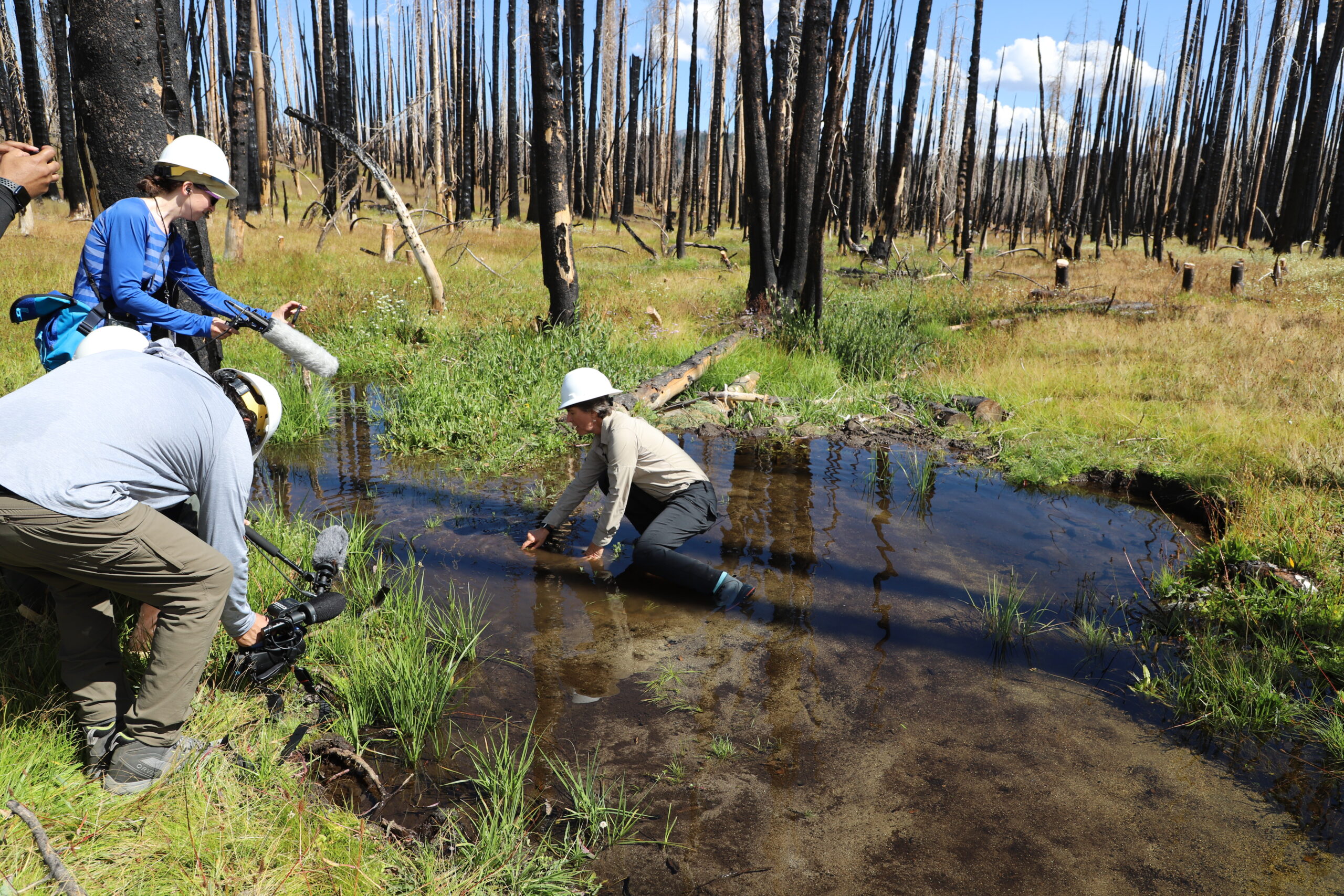
Pacific Southwest Research Station U.S. Forest Service ecologists have developed new machine learning algorithms to identify potential locations of lost meadows where forests now encroach. Meadows in California’s Sierra Nevada mountains historically covered nearly three times the area they do today. New maps of lost meadows provide a large-scale perspective to help us think differently about the historical importance of meadows and the positive impact their restoration could have on streamflow and wildfire management.
USFS Press Release

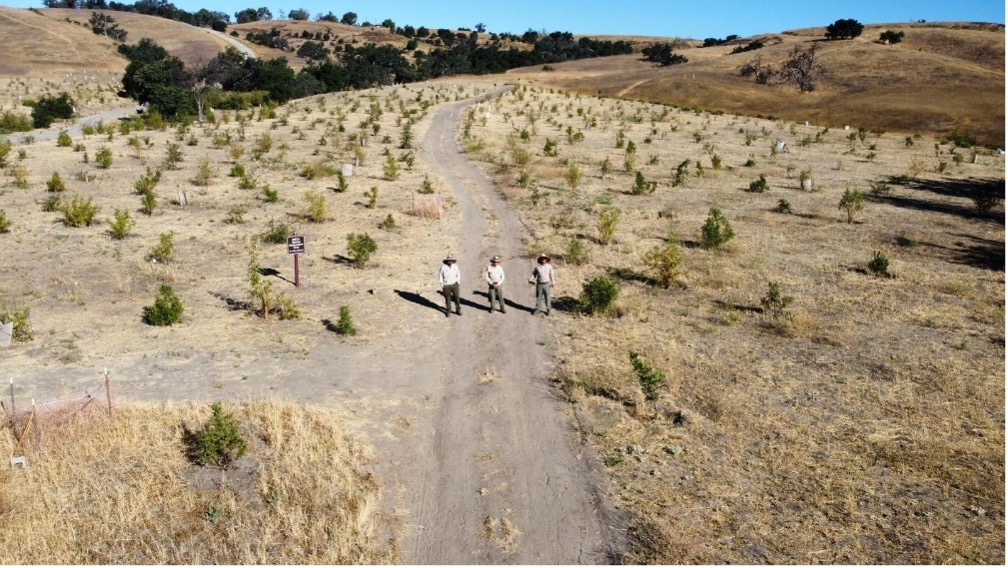
Three People Standing on a Fire Road with Newly Planted Trees Around them

Project Implementation in High-Risk Regions – Santa Monica Mountains

Project Implementation in High-Risk Regions – Santa Monica Mountains


Department: Santa Monica Mountains Conservancy


Program Description: The Santa Monica Mountains Conservancy prioritized wildfire resilience projects that proactively reduce the risk of wildfire, strengthen wildfire resilience, increase carbon sequestration, rally against the effects of climate change, and dedicate more resources to local community infrastructure.

Program Impact: In 2022, the Conservancy coordinated with partner agencies, non-profit organizations, local tribes, and other stakeholders to kickstart projects that performed one or more of the following types of wildfire resilience activities.

Wildfire resilience activities included:

  • Removing dry, hazardous, or non-native vegetation that poses ignition risk and habitat restoration
  • Increasing the efficacy of wildfire response through emergency operations equipment and workforce development
  • Ignition monitoring program
  • Fire hardening at-risk structures

Conservancy wildfire resilience efforts, initiated in 2021 and sustained throughout 2022, addressed major wildfire hazards in the Santa Monica Recreation Area. State funding supported projects that mitigate hazards posed by fuel-vegetation, human actions, and at-risk structures. Investment in workforce development and capacity building in climate, fire resilience, and habitat restoration further enhanced wildfire prevention and emergency response operations. Ongoing project efforts will continue to reduce wildfire risk throughout the 2023 fire season and following years.
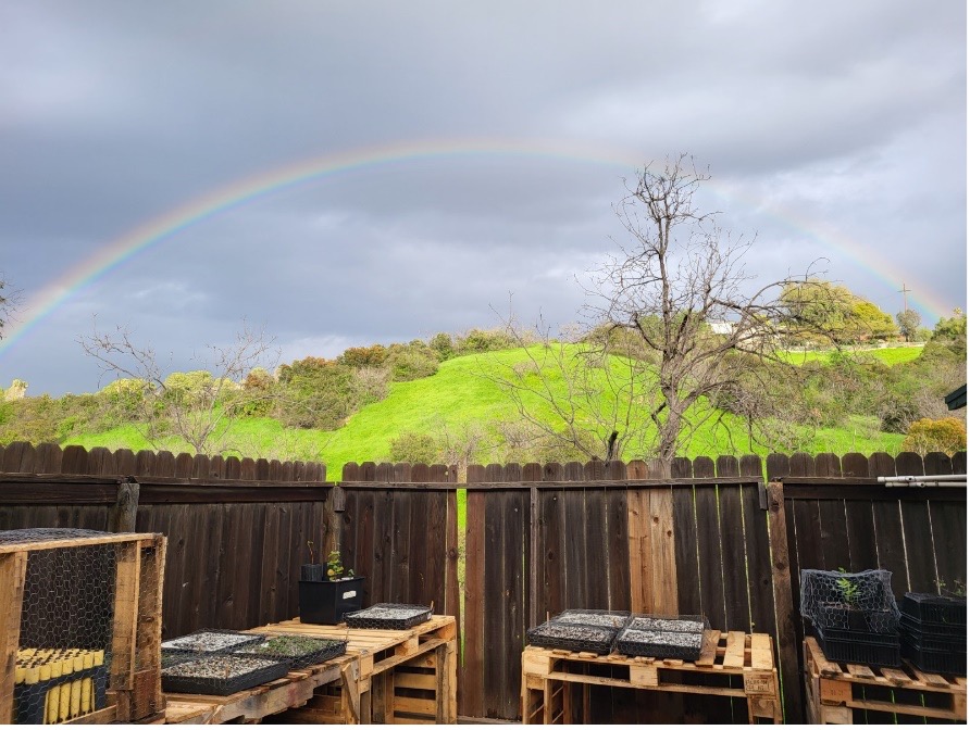
Backyard with a view of a green hill and rainbow

Native plants at Elyria Canyon Nursery to be installed at habitat restoration sites
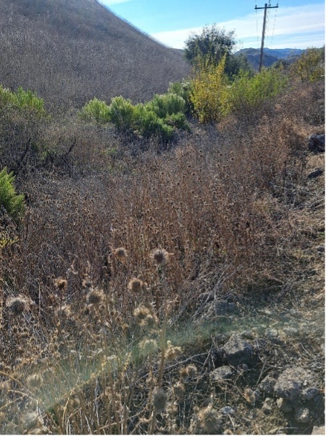
Brush Side of the Road

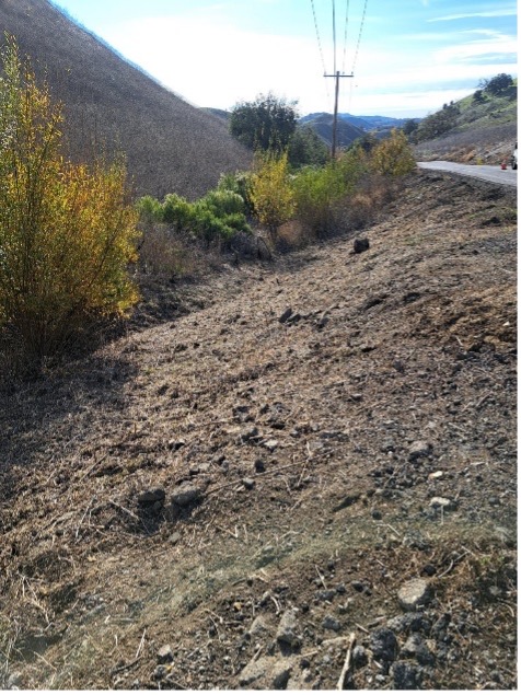
Before and after photos of completed fuel reduction treatments (mowing) to reduce flammable, flashy fuels in strategic locations of the Santa Monica Mountains.

Resilience in Action: Fuel reduction along the ignition-prone highway 101 corridor continued in 2022, and as of January 2023, approximately 2,000 fire-resistant oaks have been planted at five key sites. In the coming years, fire-resistant oak habitat will replace the existent grassy fuel vegetation and serve as a natural fire buffer around the freeway. Funding for workforce development supported an expanded crew of seasonal firefighters in the Fire Division of the Mountains Recreation and Conservation Authority who received basic and advanced fire training classes, drills, and fuel vegetation removal.

Three People Standing on a Fire Road with Newly Planted Trees Around them

Roadside vegetation management and oak habitat planting project to reduce ignition risk posed by nearby US Highway 101
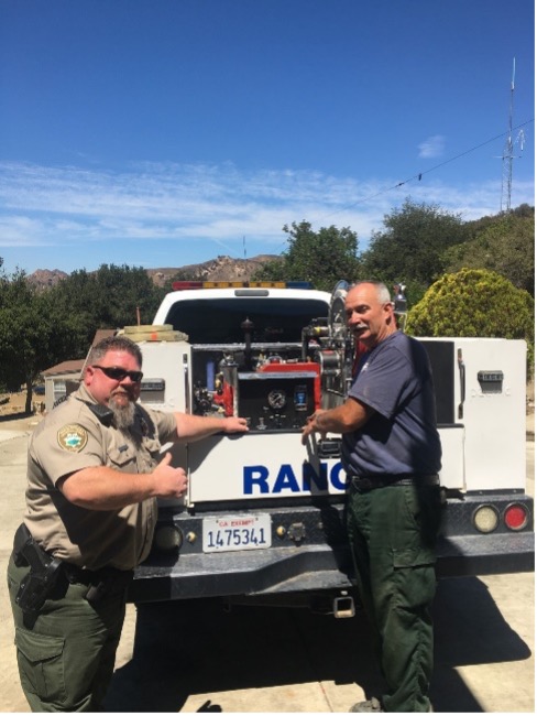
Back of a Rangers truck with Ranger and other

New portable water pumps installed on daily patrol vehicles in conjunction with water tanks and fire hoses allow rangers to respond to fires on patrol

Back

RESOURCES


USFS Awards CALREC Vision Partnership of the Year

USFS Awards CALREC Vision Partnership of the Year


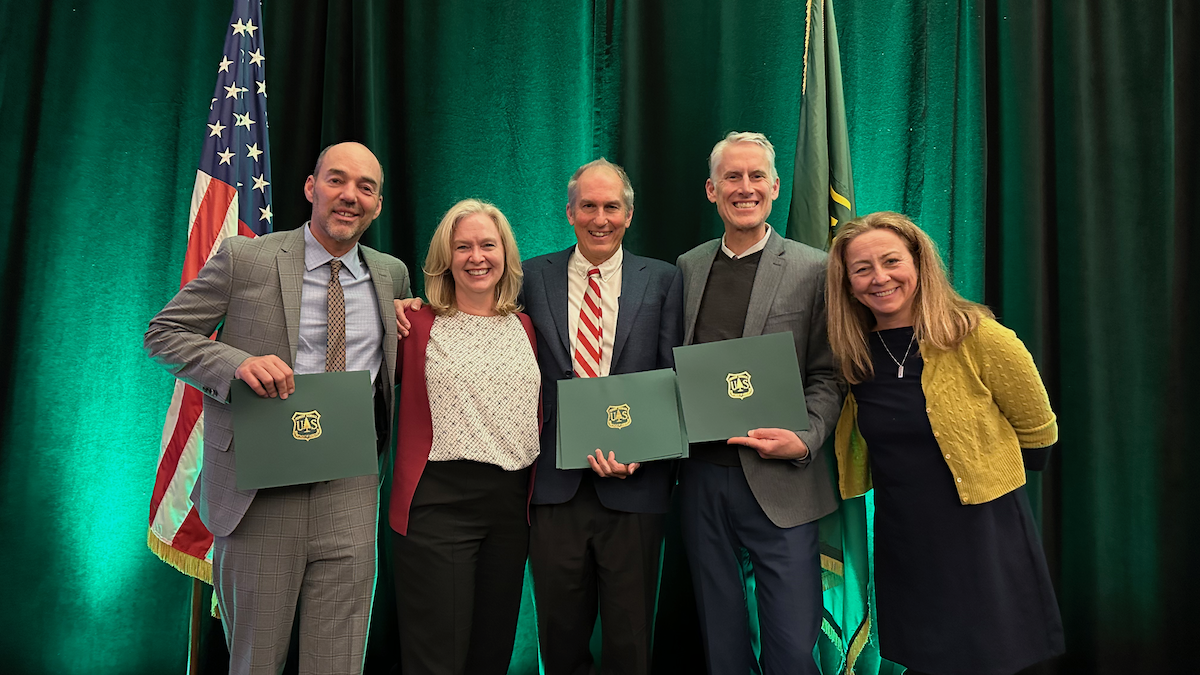
December 14, 2022 – At the Regional Foresters Awards Ceremony in Sacramento, CA, the Leadership Team of the Sustainable Recreation/CALREC Vision Key Working Group (SRCRV) was awarded a Regional Forester’s Honor Award for Partnership of the Year from the U.S. Forest Service Pacific Southwest Region. The award recognizes the Leadership Team’s efforts to develop California’s Joint Strategy for Sustainable Outdoor Recreation and Wildfire Resilience for California’s Wildfire & Forest Resilience Task Force. The Joint Strategy satisfies Key Actions 3.13 and 3.14 of the California Wildfire and Forest Resilience Action Plan. The California Wildfire and Forest Resilience Task Force will publish the Joint Strategy in early 2023.

Accepting the award with Jennifer Eberlein (second from left), from left to right are Bill Keane, Climate Equity Solutions, Inc.; John Wentworth, Mammoth Lakes Trails and Public Access Foundation; Austin McInerny, Consensus and Collaboration Program, College of Continuing Education, Sacramento State University; and Nancy Parachini, USFS Deputy Director of Public Services.
Read the Press Release

RESOURCES


CAL REC VISION

California Wildfire & Forest Resilience uses Accessibility Checker to monitor our website's accessibility.

Privacy Preference Center