What is Planscape?
Planscape is a new wildfire resilience decision support tool for planning designed to bring the best available state and federal data and science together in a user-friendly, accessible format.
Planscape helps regional planners prioritize landscape treatments to mitigate fire risk, maximize ecological benefits and help California’s landscapes adapt to climate change.
Specifically, Planscape:
-
- Shows the conditions of the landscape across the four main regions of California (Sierra Nevada, Southern California, Northern California, Central Coast)
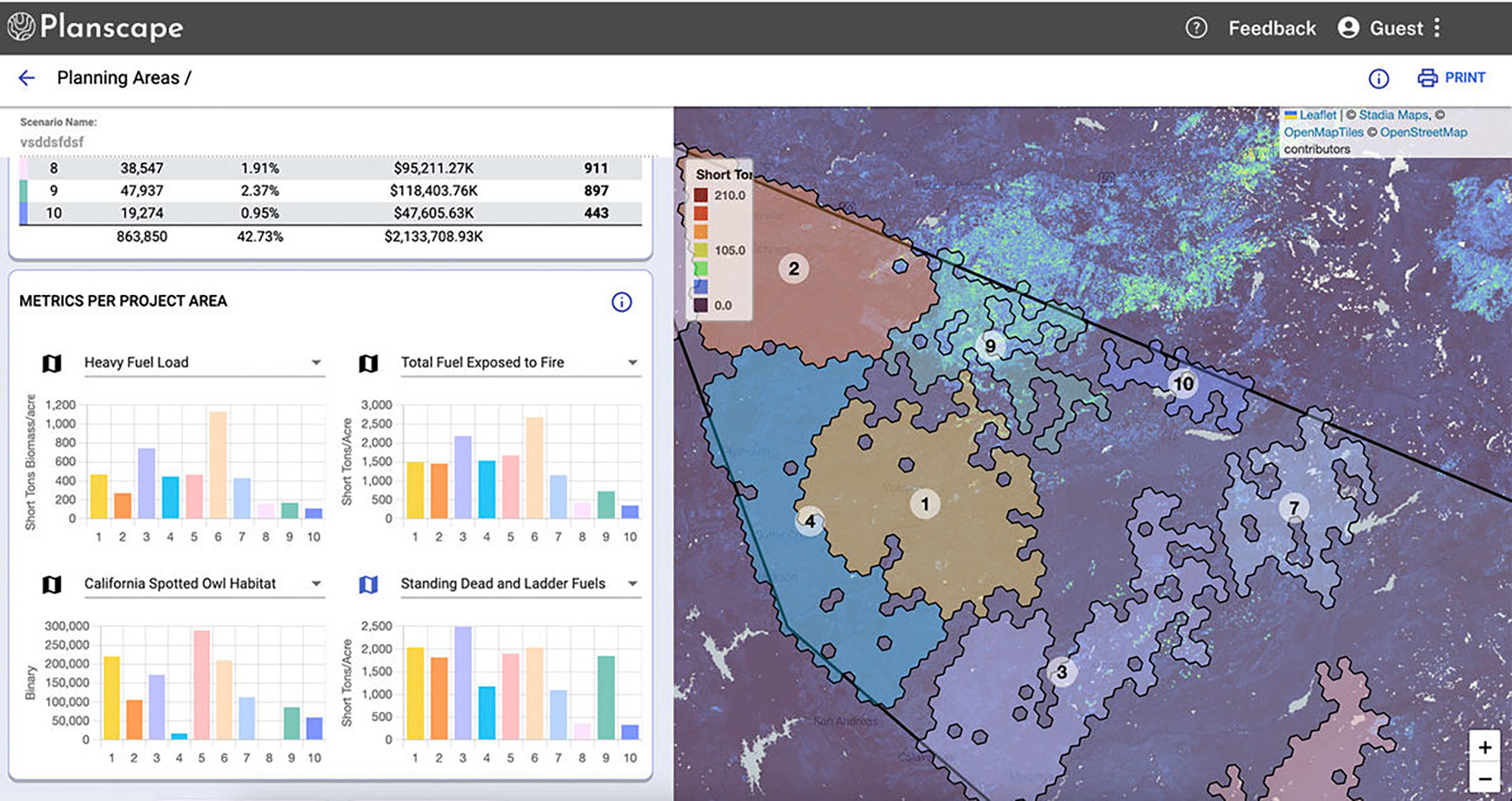
- Visualizes treatment areas and how they affect the conditions on the landscape
- Helps plan new treatment areas, allowing users to maximize benefits and compare tradeoffs taking into account both current and future conditions
Planscape is free for anyone to use.
“Californians are threatened by worsening wildfires driven by an overheated, unstable climate. Planscape will leverage science and data to help deliver wildfire resilience projects that protect our communities and natural places.”
Wade Crowfoot.
California Secretary for Natural Resources.
Why use Planscape?
- To strategically plan resilience treatments in forested and chaparral landscapes across California.
- To leverage the full potential of the Pillars of Resilience, which provide a robust framework to assess and communicate the benefits and impacts of potential projects.
- To increase collaboration by allowing users to select proposed actions based on their own preferences and then share and contrast results with the proposed actions of others.
Planscape is available for beta users who want to check out the early functionality and share feedback to help improve the tool.
Who creates and maintains Planscape?
Planscape is a collaboration of the California Natural Resources Agency, the USDA Forest Service, the California Wildfire & Forest Resilience Task Force, University of California and others, with support from Google.org and Spatial Informatics Group (SIG)
