
Governor’s January Budget Invests $457 Million in Wildfire and Forest Resilience
Governor’s January Budget Invests $457 Million in Wildfire and Forest Resilience
January 9, 2026 – The Governor’s proposed 2026–27 January Budget allocates $457 million to advance wildfire and forest resilience statewide, including $142 million from the Greenhouse Gas Reduction Fund (GGRF) and $315 million from Climate Bond funding. Due to auction proceeds from the November 2025 Cap-and-Invest auction coming in lower than anticipated, the proposal adjusts the GGRF continuous appropriation to $142 million, with funding prioritized to sustain key capacity, including grant administration staffing, 10 dedicated fuels crews for prescribed fire and fuel reduction, and continued grant support for healthy forests and fire prevention projects. Climate Bond investments will be distributed across CAL FIRE, the Department of Conservation, California State Parks, the California Conservation Corps, and state conservancies, supporting on-the-ground projects that reduce wildfire risk and strengthen community and landscape resilience.
USFS Study Shows How Fuel Treatments Improve Wildfire Outcomes
USFS Pacific Southwest Research Station (PSW) Study Shows How Fuel Treatments Improve Wildfire Outcomes
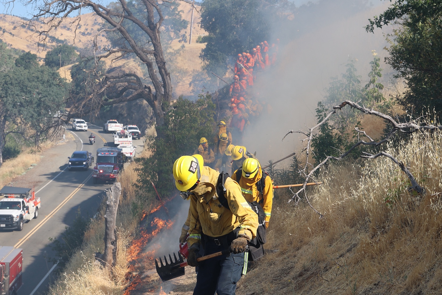
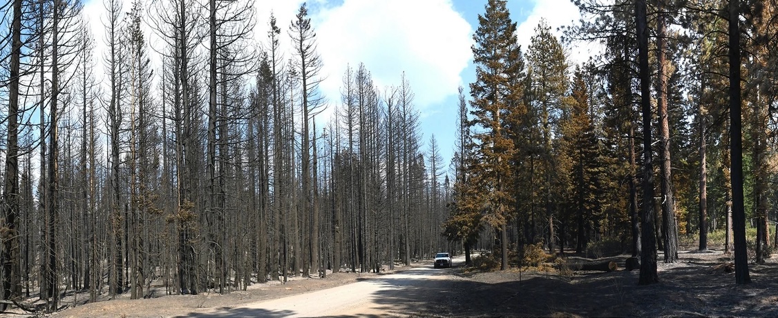
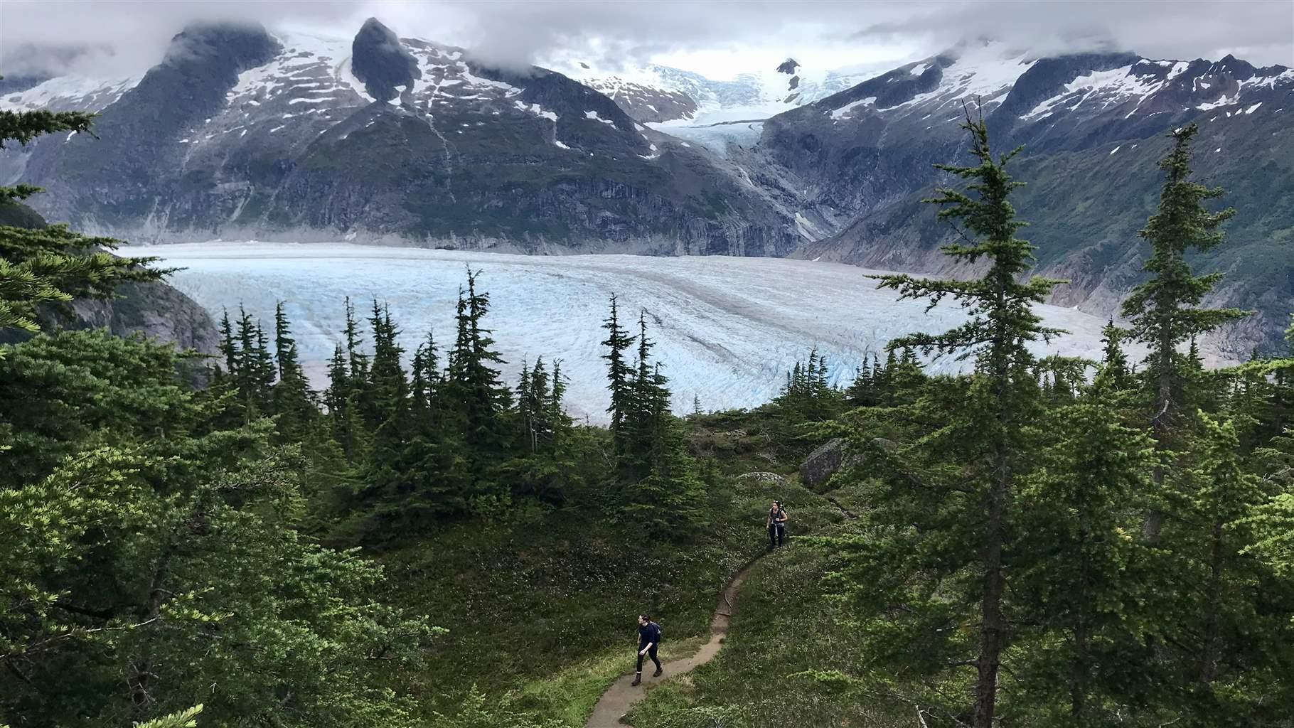
PSW researchers recently published findings that provide strong evidence for the use of fuel treatments to mitigate fire behavior and resulting fire severity even under extreme fire weather conditions. When the 2021 Antelope Fire tore through the Goosenest Adaptive Management Area (long-term research plots set up in northeastern California in the late 1990s), it seemed that 20 years worth of research had been lost. However, shortly after the fire a 2,300-acre study was conducted that demonstrates how reducing canopy bulk density via mechanical thinning treatments can help to limit crown fire behavior for 20 years or more. The findings make a compelling case for doing both tree thinning and prescribed burning to protect forests in the future.
Tahoe Conservancy Grant Supports Joint USFS-Washoe Tribe Project at Meeks Meadow
Tahoe Conservancy Awards $600,000 Grant to Support Joint USFS-Washoe Tribe Project at Máyala Wáta (Meeks Meadow)
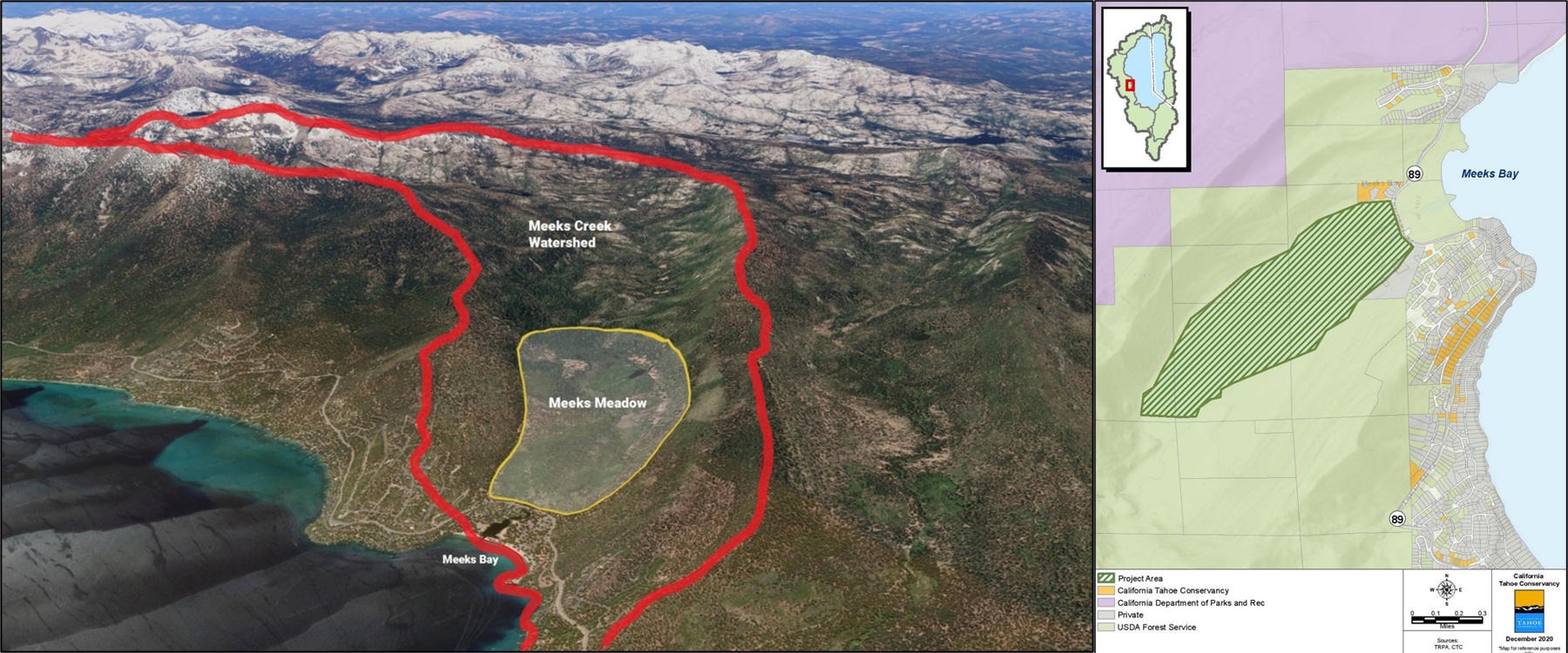
The California Tahoe Conservancy has awarded a $600,000 grant to the USDA Forest Service Lake Tahoe Basin Management Unit (LTBMU) for forestry operations as part of its joint project with the Washoe Tribe of Nevada and California to restore Máyala Wáta (Meeks Meadow). The absence of low-intensity fire has allowed lodgepole pines to encroach on the meadow, drying the soils and reducing the availability of culturally significant plants. The LTBMU will use these funds, matched by $1 million in federal funds, to remove encroaching conifers from 213 acres of the meadow and thin 70 acres of the surrounding upland forest. This federal, state, and tribal partnership is an excellent example of how Task Force partners can work together to achieve multiple benefits, from improving wildlife habitat to promoting culturally significant plants.
USFS Invests $179M to Confront Wildfire Crisis
USDA Forest Service Invests Nearly $179 Million for Priority Landscapes in California to Confront Wildfire Crisis
On February 20, the USDA Forest Service announced it will invest nearly $179 million into priority landscapes across California as part of a $500 million national investment to expand work on the Wildfire Crisis Strategy to reduce risk to communities, critical infrastructure, and natural resources from the nation’s ongoing wildfire and climate crisis. This builds on the $2.8 billion already invested by Governor Newsom and California’s Legislature to take proactive actions to reduce catastrophic wildfire risks, protect communities, and restore the health of our landscapes.
“These and other federal investments are vital to match the Governor’s $2.8 billion investment over the last several years. They will also strengthen our partnership with the Forest Service, California’s largest landowner, in taking an ‘all-lands’ approach to improve the health of our forests and the safety of our communities,” said California Wildfire and Forest Resilience Task Force Director, Patrick Wright.
Funding has been designated for the following projects:
| Regional Landscapes | FY24 Allocation |
| Stanislaus | $57,663,352 |
| North Yuba | $16,489,560 |
| Sierra and Elko Fronts (includes CA & NV) | $27,692,340 |
| Klamath River Basin (includes CA & OR) | $36,831,090 |
| Plumas Community Protection | $3,522,500 |
| Southern California | $1,915,000 |
| Trinity | $34,749,886 |
| Total Allocation FY24: | $178,863,728 |
An additional $100 million will be allocated across 24 qualifying states under a new Forest Service program — the Collaborative Wildfire Risk Reduction Program which will expand work in high-risk wildfire areas outside the 21 priority landscapes. The Collaborative Wildfire Risk Reduction Program will use hazardous fuels funds from the Inflation Reduction Act to treat areas in other high-risk wildfire areas where national forests and grasslands meet homes and communities.
Sierra Nevada Conservancy Shares Draft Strategic Plan for Public Comment
Sierra Nevada Conservancy Shares Draft Strategic Plan for Public Comment
Over the past year, the Sierra Nevada Conservancy (SNC) has been taking stock of the past five years and gathering input from their Board, partners, and the public in order to craft a Strategic Plan for 2024-2029 that will help the SNC best serve the Sierra-Cascade and all of California. Comments on the Draft Strategic Plan can be emailed or delivered in person at SNC’s March 7 Governing Board meeting in Sacramento. Public comment closes Friday, March 8 at 5 PM. After review of public comment, the SNC anticipates that the Board will consider adoption of a 2024-2029 Strategic Plan at its June 2024 meeting.
2023 Year in Review
Thank you for being interested and involved in wildfire and landscape resilience efforts in California. Here’s a brief review of 2023 and a preview of what's ahead in 2024. The Task Force Team wishes you and your families a safe, happy and healthy 2024.
2023 highlights
Regional Resource Kits Finalized
Regional Profiles and Regional Resource Kits are now available for all four regions of California. The kits bring together the scientific data needed to help regional entities plan, prioritize and monitor projects.
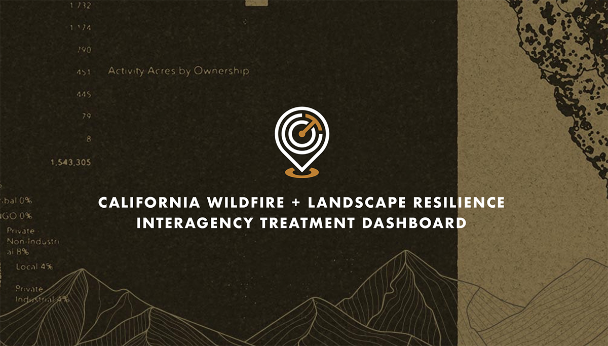
Treatment Dashboard Launched
The Wildfire & Landscape Resilience Interagency Treatment Dashboard is a highly interactive online tool that displays the location and size of wildfire and landscape resilience treatments throughout the state, helping to guide practitioners on where to plan new projects.
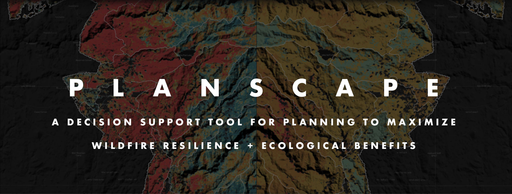
Planscape Beta Available
With a full launch expected in 2024, Planscape can be accessed now to test the early functionality and share feedback. This unique wildfire resilience decision support tool helps regional planners prioritize landscape treatments to mitigate fire risk, maximize ecological benefits, and help landscapes adapt to climate change.
Joint Strategies Completed for Beneficial Fire and Sustainable Outdoor Recreation
Task Force Work Groups completed and launched their Joint Strategies as required in California’s Wildfire & Forest Resilience Action Plan. Click below to see them, and look forward to Reforestation Pipeline, Resilient State Lands and Private Landowner strategies to be published in early 2024.
Regional Meetings in Southern, Central and Northern California
There’s no better way to align resources than bringing people together to focus on regionally specific issues. Three regional meetings were held in 2023, and three more in Sacramento. Hundreds of people came away from the meetings having learned new information, and having made new connections, and inspired to make positive change.
spread the word in 2024
Promote the Task Force in Your Communications
The Task Force is an important source of vital information on the combined efforts of those involved in landscape resilience and wildfire prevention in California. Please follow and share Task Force communications when you can.
Join us at our Upcoming Meetings
April 4-5: Southern CA Region
June 20: Sacramento
September 26-27: Sierra Region
December 13: Sacramento
RESOURCES
ABOUT THE TASK FORCE
The California Wildfire & Forest Resilience Task Force was created by the Office of Governor Gavin Newsom to directly confront the near perfect storm of climatic and human-caused conditions that have brought the threat of devastating wildfire and its far-reaching effects to the doorstep of nearly everyone in our state, and beyond.
The Task Force is a collaborative effort to align the activities of federal, state, local, public, private, and tribal organizations to support programs and projects tailored to the priorities and risks of each region and bring the best available science to forest management and community protection efforts.
The critical work of the Task Force effects all Californians, and Task Force meetings offer an ideal opportunity for members of the press to hear directly from those involved in the comprehensive, coordinated efforts to reduce the risk of catastrophic wildfires and create safe communities while ensuring healthier, more sustainable natural environments.
USFS Advances Commitment to Protect Old-Growth Forests
USFS Advances Commitment to Protect Old-Growth Forests
On December 19, 2023, the USFS published a Notice of Intent to prepare an environmental impact statement for a National Old Growth Amendment in the Federal Register. This would amend all 128 forest land management plans across the country to conserve and restore old-growth forests across the National Forest System to maintain and improve amounts and distributions of old-growth to improve resilience and climate-adaptability of our forests.

North Yuba Landscape Resilience Project
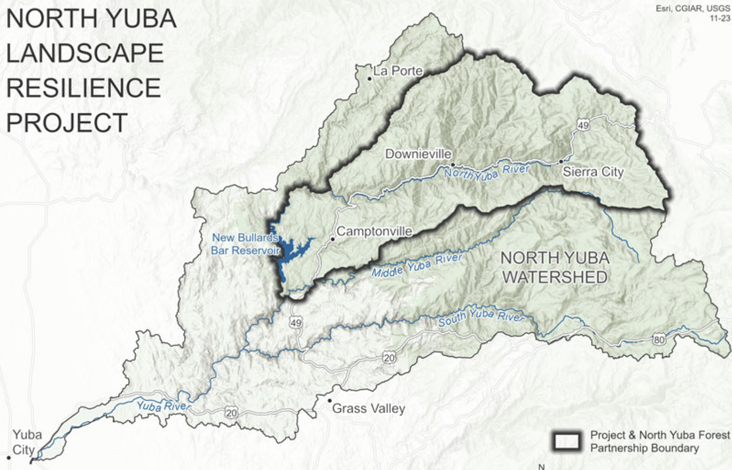
North Yuba Landscape Resilience Project an Example of Collaborative Funding
A 2020 Sierra Nevada Conservancy grant in support of planning efforts by the North Yuba Forest Partnership leveraged a $160 million USFS investment which will allow much-needed work to be completed across 275,000 acres of federal land within the North Yuba River watershed. While federal projects are ramping up, others have already started thanks to private funding from a forest resilience bond created by Blue Forest Conservation.
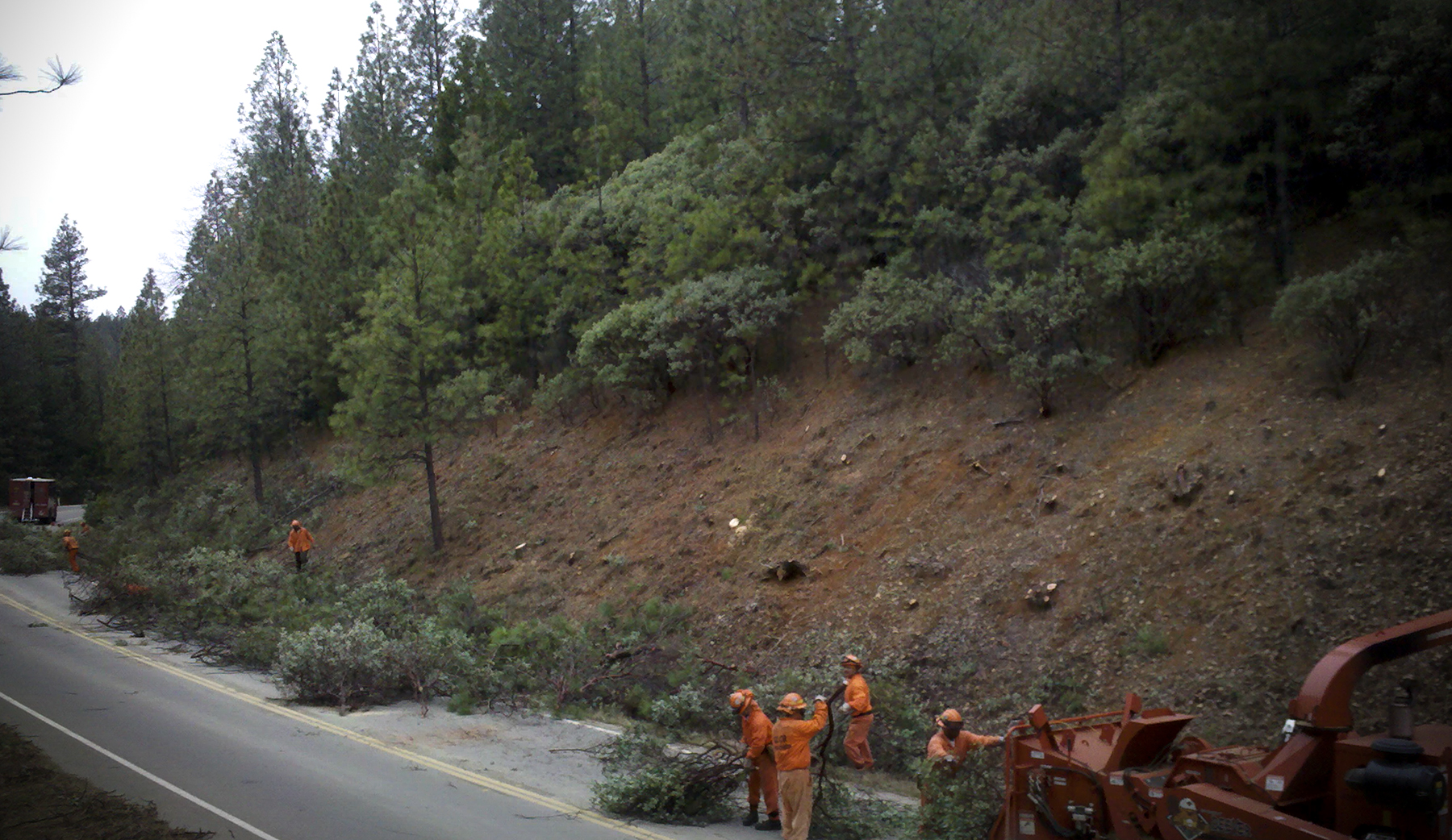
CAL FIRE Funding Grants Available for 2024
CAL FIRE Funding Grants Available
- Wildfire Prevention: CAL FIRE’s Wildfire Prevention Grant Program will award up to $117 million to local projects that address the risk of wildfire and reduce wildfire potential to communities. Applications are due January 10, 2024.
- Forest Health: CAL FIRE’s Forest Health Program will fund up to $120 million forest fuels reduction, prescribed fire, pest management and reforestation projects and $50 million post-fire reforestation and regeneration projects. View the virtual workshop. Applications are due January 15, 2024.
- Forest Health Research: CAL FIRE’s Forest Health Research Grant Program will award $4.5 million for scientific research projects that address wildfire and forest health issues critical to the State of California. Concept proposals are due January 24, 2024.
- Business and Workforce Development: CAL FIRE Wood Products and Bioenergy expects to open a solicitation for a new round of funding on January 15, 2024.
NFWF and USFS Announce $50M for Landscape-scale Grants
NFWF and USFS Announce $50M for Landscape-scale Grants
The National Fish and Wildlife Foundation (NFWF), in partnership with USFS-Region 5, has $50M available for landscape-scale grants — targeting landscapes encompassing up to 250,000 acres — to address comprehensive efforts to restore forest ecosystems. The priorities outlined in the California Headwaters RFP include ecological restoration and protection at a landscape scale using a comprehensive approach that takes into account the interdependencies between water and fire. NFWF is hosting a webinar on December 12 at 1:00 PM PST. Pre-proposals are due on January 18, 2024.