
Central Coast Regional Profile
Water Security
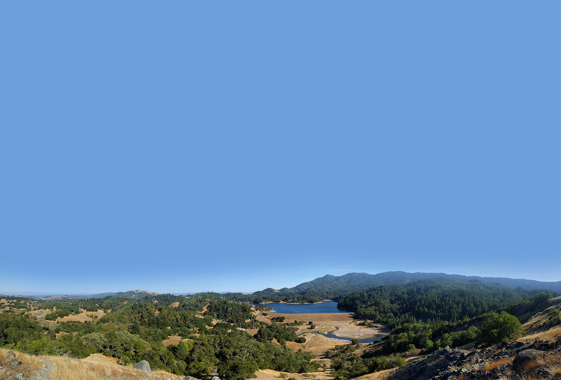
photo credit: David Baron
Overview
In addition to the ecological impacts that wildfire can have on aquatic habitat [see ‘Biodiversity Conservation’], wildfire also threatens water security. Some of these impacts can persist long after the fire is extinguished and evacuated residents have returned home.
When fire burns vegetation cover and exposes bare soil, the landscape becomes more prone to runoff and erosion which transports ash, debris, and sediments into streams. This can affect community water supplies and also impact downstream ecosystems [see ‘Biodiversity Conservation’]. Some of the pollutants that are eroded or leached can be especially harmful to human health and aquatic organisms, including mercury, lead, and other metals that are released when structures and other artificial materials burn. Moderate and high severity wildfires can alter soil properties and make the soil less permeable to water for up to 2-4 years after being burned. This further increases runoff as well as the risk of flooding.
In some cases, wildfire removes the vegetation cover that stabilized steep slopes, which can increase the risk of debris flows—fast-moving landslides that generally occur after intense rain or rapid snowmelt. Risk of debris flows remains elevated for several years following fire, and areas with steep topography, including areas where the 2020 CZU Lightning Complex fire burned the Santa Cruz Mountains, may be especially susceptible. Extreme precipitation events, such as the atmospheric rivers that occurred in winter 2022-2023, are projected to intensify under climate change, making it more likely that damaging debris flows will impact this region in the future.
Fire can directly damage critical infrastructure, such as water treatment plants, facilities and reservoirs. When plumbing infrastructure burns or becomes depressurized, water distribution systems can become contaminated with dangerous volatile organic compounds, such as benzene. The August 2020 CZU Lightning Complex fire burned several miles of above-ground plastic distribution pipes, along with creek diversions, storage tanks, and other infrastructure. Afterward benzene and other volatile organic compounds were detected in parts of the water distribution system. Repairing infrastructure and ensuring safe water quality took weeks–and in some cases, months–to get drinking water back to impacted areas.
Central Coast water agencies and other organizations are taking proactive measures to mitigate wildfire risk and increase the resilience of community water resources. For example, the Marin Municipal Water District (Marin Water), which serves 190,000 customers and sources most of its water from local reservoirs, is managing vegetation throughout the watershed to reduce fuels in strategic locations and facilitate emergency response and suppression activities. Marin Water coordinates with the Marin County Fire Department to conduct prescribed burning to reduce the likelihood of future high severity fire and to promote ecological health. Marin Water is also a member of One Tam, a partnership of four public agencies and the nonprofit Golden Gate National Parks Conservancy that is collaborating to steward the Mt Tamalpais watershed. One Tam is an example of how water security can be pursued in tandem with other goals, such as forest health and public access to recreation, through landscape-level partnerships.
Stakeholder Perspectives
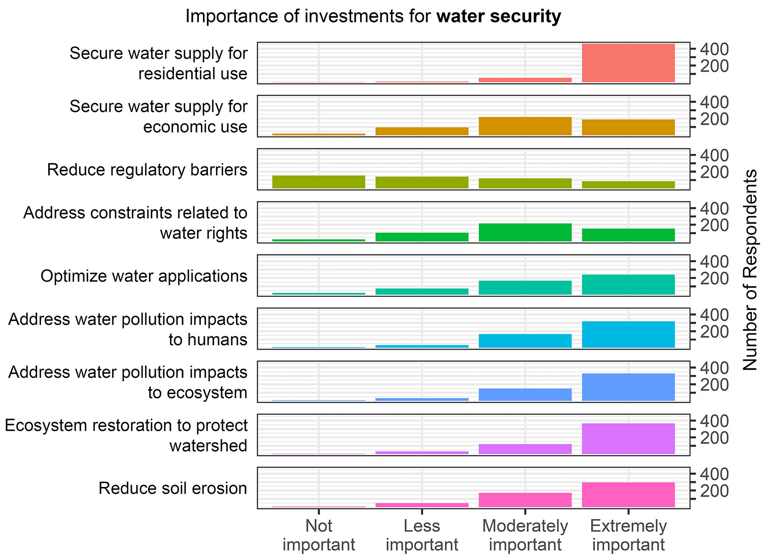
Securing water supply for residential use was rated as the top priority for investing in regional water security. Ecosystem restoration to protected watersheds, and addressing water pollution impacts to both humans and ecosystems were also rated as highly important. Public survey respondents considered reducing regulatory barriers to be lower priority than other areas of investment.
Interview findings: Regional wildfire resilience projects are coordinating with other watershed management projects to promote water security. One interviewee described how following the 2020 CZU Lightning Complex fire, there was a big effort to address potential runoff and water quality impacts from burned properties to community water and fish-bearing streams.
Resource Conditions
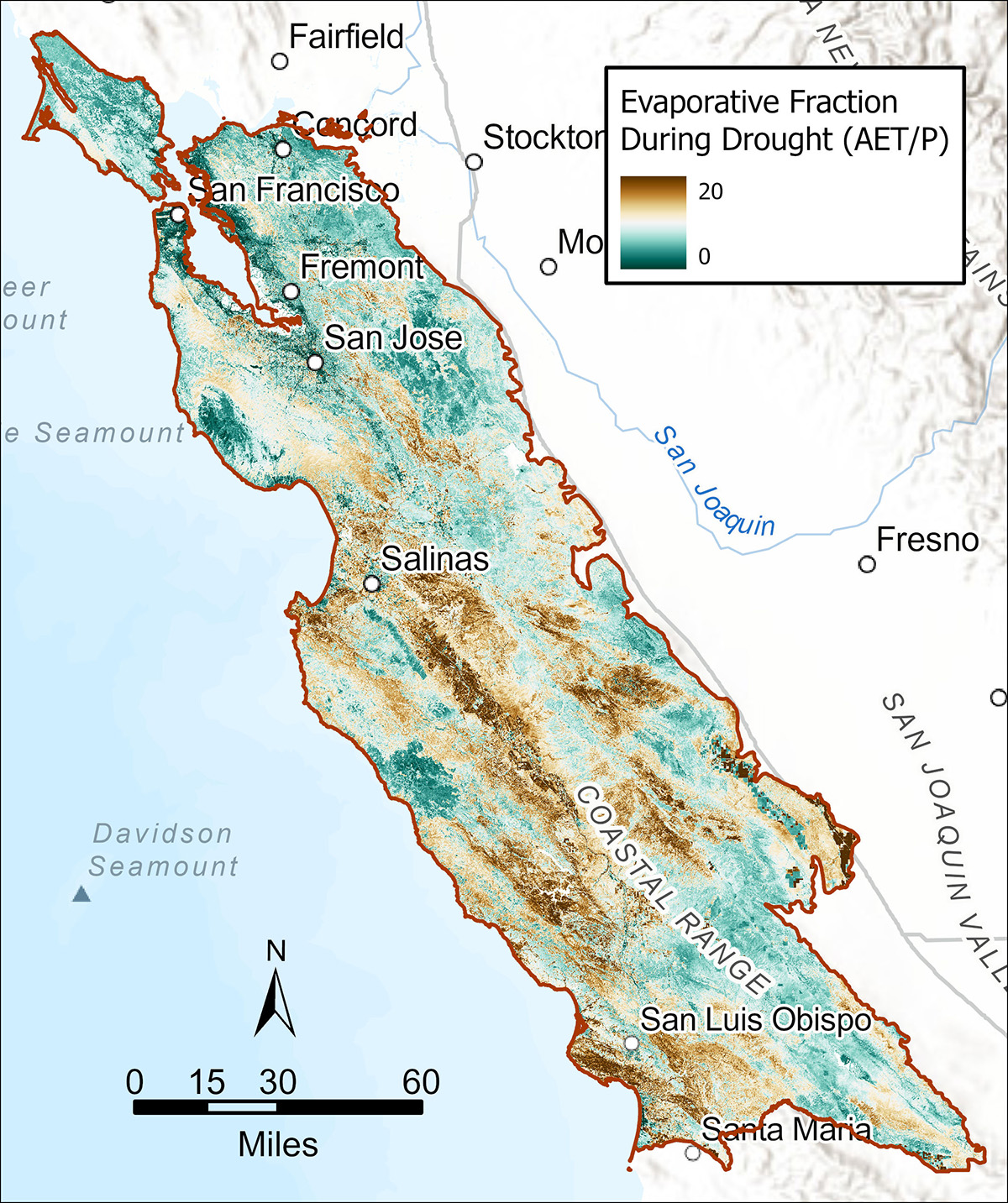
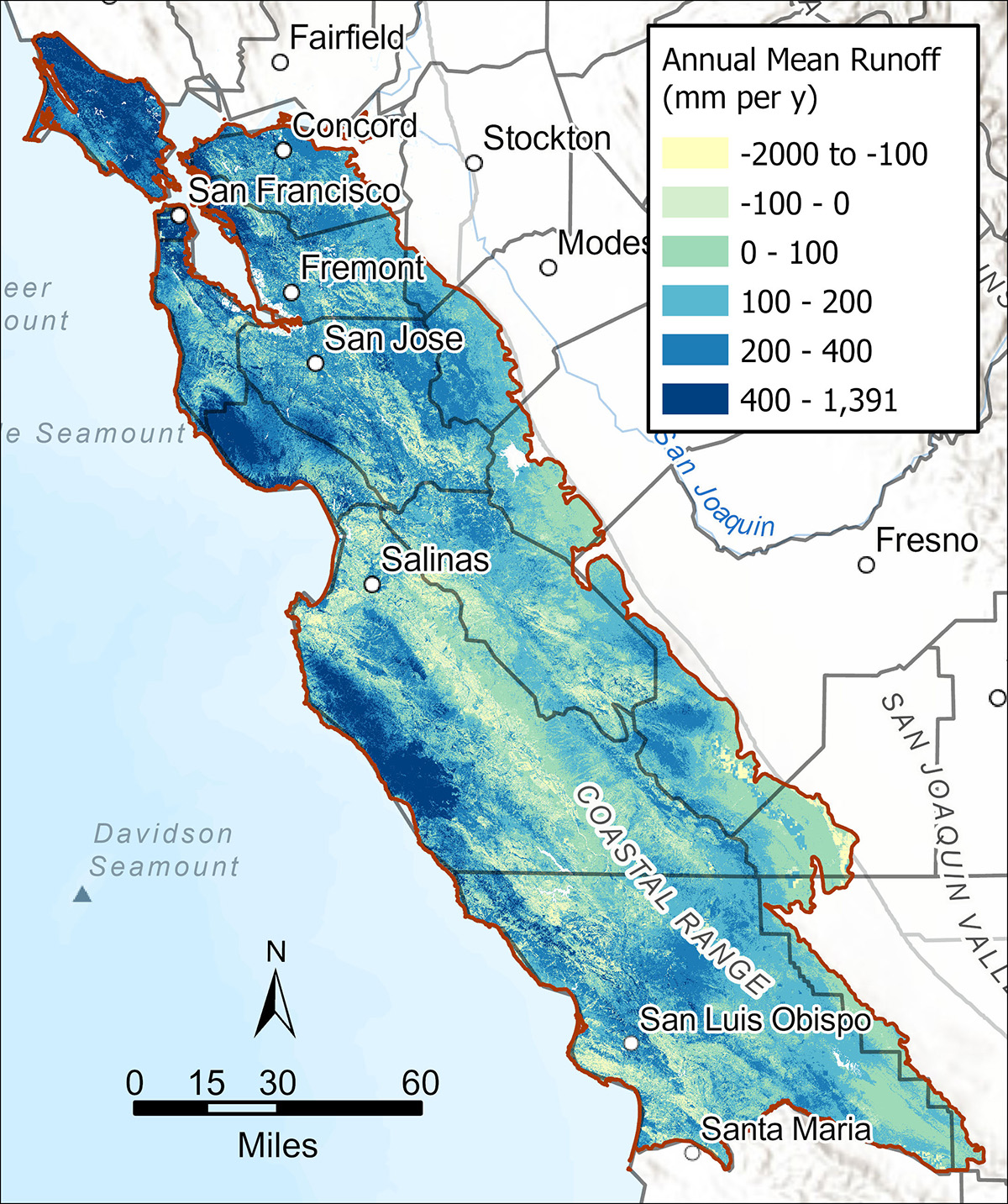
Water security can be assessed in terms of actual evapotranspiration/precipitation (AET Fraction) (top) and annual mean runoff (bottom). Actual evapotranspiration is the combined amount of water that evaporates from the land surface in addition to the water that is lost as vapor from plants. AET Fraction represents the percentage of water needed by plants that is met by precipitation during a severe 4-year drought. Values > 1 indicate moisture stress driven by shortfalls in precipitation relative to plant needs. Annual mean runoff is the surplus water discharged from a location in the form of surface or groundwater flows. This metric is important for water security because it estimates the amount of surplus water for downstream use. Vegetation management and disturbances like wildfire can affect runoff. For example, forest treatments that thin trees in moisture-stressed areas may increase runoff and provide more water availability downstream.