First Set of Projects Fast-tracked as Part of Governor’s Emergency Proclamation on Wildfire
CNRA and CalEPA Identify First Set of Fast-tracked Projects as Part of Governor’s Emergency Proclamation on Wildfire
New Streamlined Process:
Governor Newsom issued an Emergency Proclamation (Proclamation) on March 1, 2025, to confront the severe ongoing risk of catastrophic wildfires that threatens public safety across California. The Proclamation authorizes the Secretaries of the California Natural Resources Agency (CNRA) and the California Environmental Protection Agency (CalEPA) to determine which projects are eligible for suspension of certain State of California statutory and regulatory requirements to expedite critical fuels reduction projects, while at the same time protecting public resources and the environment. The Task Force has established a website that includes eligibility criteria, FAQs, and a link to the application to request a determination of eligibility for suspension of relevant State of California statutory and regulatory requirements. The Secretaries also hosted a virtual briefing on the Proclamation and the process.
First Set of Approved Projects:
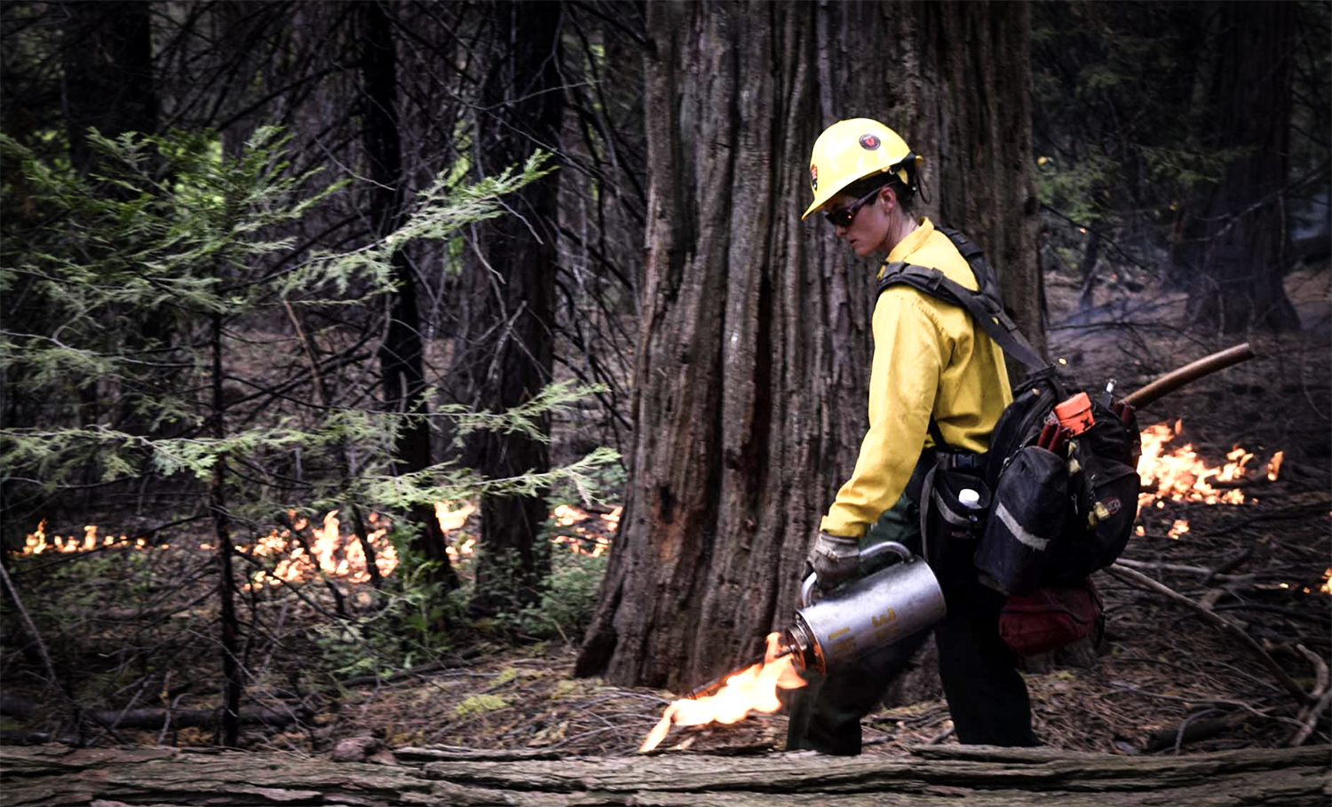
Just one week after applications opened, CNRA and CalEPA identified a 450-acre collaborative wildfire resilience project in Humboldt County as the first project to be determined eligible for streamlining. Three projects totaling 882 acres have been approved to date, spanning from the northern California coast to Sierra Nevada Mountains and all the way down to San Diego. Each of these projects involve tribes and other partners, natural resource managers and fire districts. Here is an overview of the first set of approved projects.
- The Prosper Ridge Community Wildfire Resilience Project in Humboldt County is the first approved project under the Governor’s emergency proclamation on wildfire. This collaborative state, federal, and tribal project will treat nearly 450 acres with a combination of mechanical thinning, manual treatments, and prescribed fire.
- The Sycuan Wildfire Resiliency Project covers over 240 acres in San Diego County and aims to protect the Sycuan Reservation from wildfire by reducing fire hazard, ensuring defensible space, and providing safe egress with the use of 300 grazing goats.
- Vedanta Hazardous Fuels Reduction Project will reduce wildfire risk, improve forest health and enhance landscape resilience within the WUI, reducing risk of crown fires spans across 190 acres near Lake Tahoe.
These projects are focused on removing flammable dead or dying trees, creating strategic fuel breaks, creating safe egress along roadways, manual and mechanical removal of ladder fuels and beneficial fire use. Approved project location maps and documentation will be made available on the Task Force website.
Rancheria Celebrates Achievement as the State’s 1,000th Firewise Community
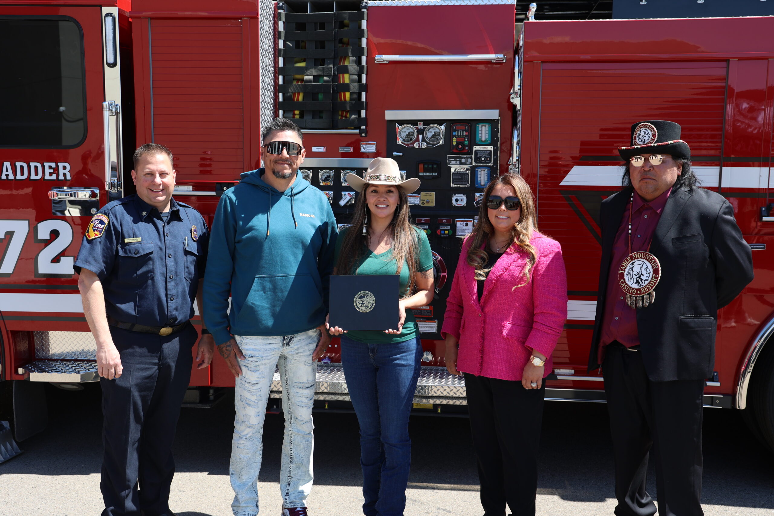
Table Mountain Rancheria Celebrates Achievement as the State’s 1,000th Firewise Community During Wildfire Preparedness Week
Table Mountain Rancheria, located in Fresno County, has been announced as the 1,000th Firewise USA® community in the state during this year’s Wildfire Preparedness Week celebration. This recognition by the National Fire Protection Association® (NFPA®) highlights the commitment the community has taken to ensure that wildfire risk is reduced and that residents are prepared. Governor Newsom declared May 4-10 as “Wildfire Preparedness Week” with the theme, “Building a Fire-Ready Future: Strengthening Our Defenses, Together,” to emphasize the importance of both collaborative efforts and individual responsibility in reducing and managing wildfire risk. CAL FIRE’s readyforwildfire.org website hosts an array of preparedness resources.
Senator Padilla and Western Senators Introduce Fix Our Forests Act to Reduce Wildfire Risk
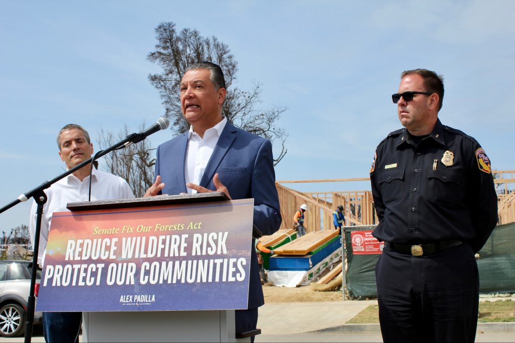
Senator Padilla and Western Senators Introduce Bipartisan Fix Our Forests Act to Reduce Wildfire Risk
April 11, 2025 – U.S. Senator Alex Padilla (D-Calif.), co-chair of the bipartisan Senate Wildfire Caucus and Senators John Curtis (R-Utah), John Hickenlooper (D-Colo.), and Tim Sheehy (R-Mont.) introduced the Fix Our Forests Act. This bipartisan legislation aims to combat catastrophic wildfires, restore forest ecosystems, and make federal forest management more efficient and responsive. The bill reflects months of bipartisan negotiations to find consensus on how to best accelerate and improve forest management practices, streamline environmental reviews, and strengthen partnerships between federal agencies, states, tribes, and private stakeholders. Key provisions specific to California include:
-
- Establishing a Wildfire Intelligence Center to serve as a national hub for wildfire intelligence, prediction, coordination, and response. This joint office would be comprised of the Departments of Agriculture, the Interior, and Commerce that is modeled after the National Weather Service. The center would modernize and unify wildfire management by leveraging real-time data, science, and interagency collaboration to better prepare for wildfires, assist with decision-support during a crisis, inform recovery, and streamline federal wildfire response.
-
- Establishing an interagency program to coordinate federal wildfire risk reduction efforts across 10 federal agencies through research, development of fire-resistant construction standards, hazard mitigation, and public-private partnerships. The program would provide a uniform application for multiple wildfire-related grants, streamline technical assistance, and mandate coordination with non-federal stakeholders.
-
- Increasing the use of prescribed fire on both federal and non-federal lands by prioritizing large, cross-boundary projects near wildland-urban interfaces, Tribal lands, high-risk fire zones, or critical habitats. It also strengthens the prescribed fire workforce by streamlining supervisory certification requirements and enhancing interoperability between federal and non-federal practitioners.
-
- Allowing electric utilities with permits or easements on National Forest System or BLM land to cut and remove vegetation near power lines without requiring a separate timber sale (if done in compliance with applicable plans and environmental laws). If the vegetation is sold, proceeds must be returned to the federal government.
-
- Streamlining land management projects by authorizing emergency authorities to increase the pace and scale of wildfire risk reduction projects on federal land. It includes appropriate guardrails to avoid abuse of these authorities and prohibits using emergency authorities for projects not aimed primarily at reducing wildfire risk or protecting communities. This would Increase the acreage limit of streamlined projects for wildfire resilience projects, fuel breaks, and insect and disease projects from 3,000 acres to 10,000 acres.
President Trump Orders Immediate Expansion of American Timber Production
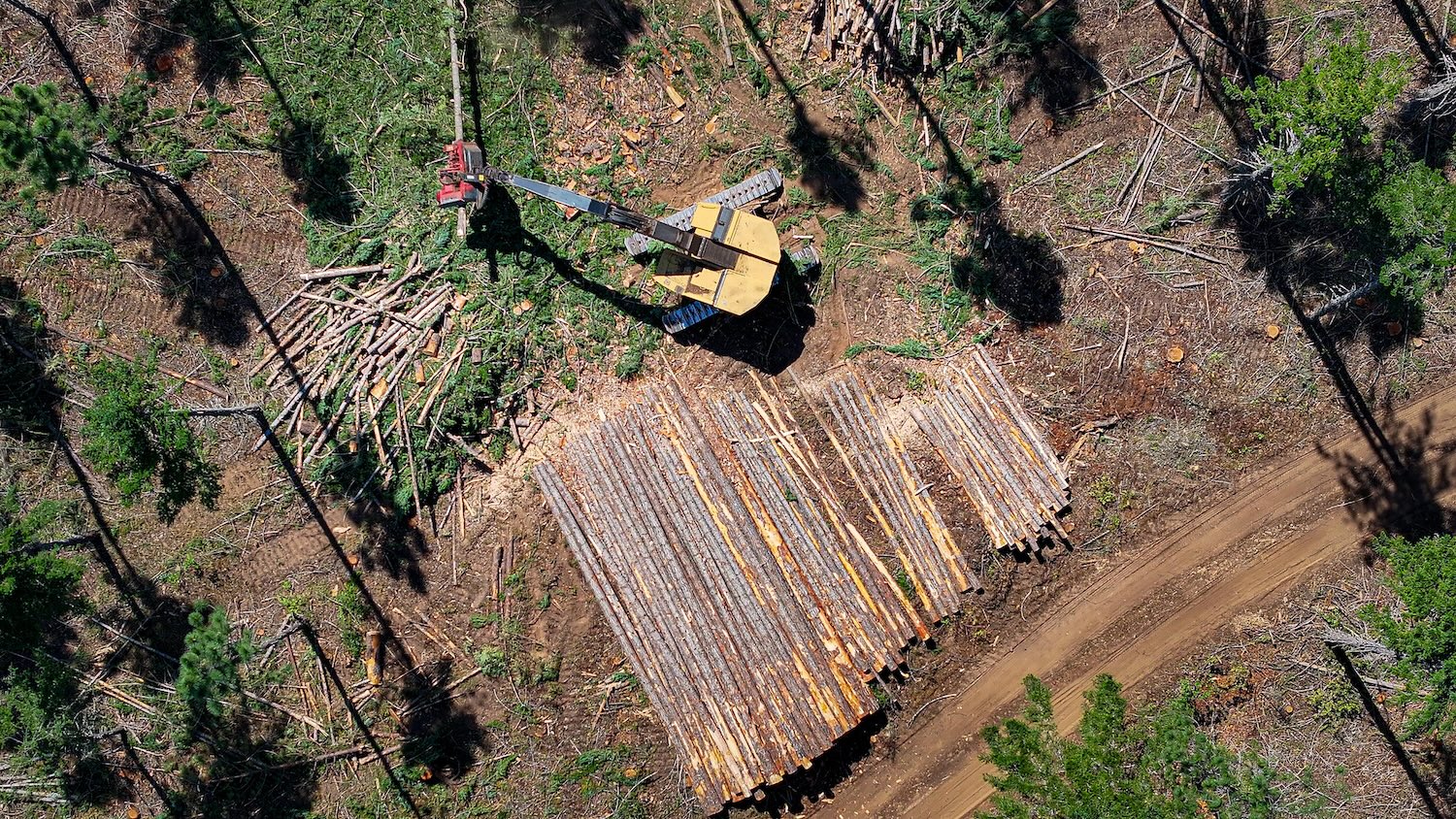
President Trump Orders Immediate Expansion of American Timber Production
March 1, 2025 – President Trump signed an executive order which aims to boost domestic timber production. The order directs the Secretary of the Interior and the Secretary of Agriculture to:
- Within 30 days, issue new or updated guidance regarding tools to increase timber production, reduce time to deliver timber, and decrease timber supply uncertainty;
- Within 60 days, complete a strategy on USFS and BLM forest management projects to increase speed of approving forestry projects under section 7 of the Endangered Species Act (ESA);
- Within 90 days, set a target for the annual amount of timber per year to be offered for sale over the next 4 years;
- Within 120 days, complete the Whitebark Pine Rangewide Programmatic Consultation under section 7 of the ESA;
- Within 180 days, consider adopting categorical exclusions administratively established by other agencies to comply with the National Environmental Policy Act for timber production, forest management, and wildfire risk reduction treatments; and
- Within 280 days, consider establishing a new categorical exclusion for timber thinning and re-establish a categorical exclusion for timber salvage activities.
The order also directs all relevant agencies to eliminate all undue delays within their respective permitting processes related to timber production and use ESA regulations on consultations in emergencies to facilitate timber production. Lastly, the order directs the federal members of the Endangered Species Committee to submit a report that identifies obstacles to domestic timber production related to the ESA.
Additionally, on March 12, 2025, the U.S. EPA announced 31 actions aimed toward environmental deregulation, including reconsideration of exceptional events rulemaking to work with states to prioritize the allowance of prescribed fires within State and Tribal Implementation Plans.
Interagency Treatment Dashboard Shows Progress Toward Resilience

FOR IMMEDIATE RELEASE
October 10, 2024
California Unveils First-of-Their-Kind Dashboards Mapping Out Fire-Prevention Work to Protect Communities
New tools created by CAL FIRE and Wildfire and Forest Resilience Task Force simplify data, boost transparency, and help inform wildfire planning and response – adding to the suite of tools the state has created
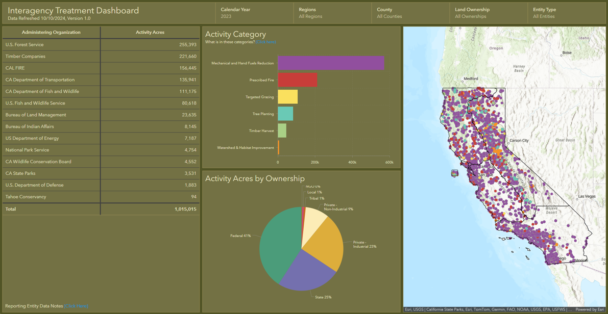
(South Lake Tahoe, CA) – The Governor’s Wildfire and Forest Resilience Task Force and the California Department of Forestry and Fire Protection (CAL FIRE) unveiled several new tools today to help California track and communicate the state’s significant progress in improving wildfire and landscape resilience.
Key takeaways from the Task Force’s Sierra Nevada Regional Meeting in South Lake Tahoe include:
• Interagency Treatment Dashboard updated to show 2021, 2022 and 2023 data.
• Over one million acres of treatments were conducted on about 700,000 footprint acres in 2023.
• Prescribed fire treatments more than doubled between 2021 and 2023.
• CAL FIRE Fuel Treatment Effectiveness Dashboard is showing the impact of treatments impacted by recent wildfires.
“Thousands of wildfire resilience projects have been completed across California to protect our communities and landscapes from catastrophic wildfire in recent years, and more are underway,” said Wade Crowfoot, Secretary of the California Natural Resources Agency and co-chair of the Task Force. “Thanks to historic investments from our state and federal leaders, dozens of local agencies and hundreds of organizations are delivering these projects. Now for the first time, we have a dashboard that tracks all these diverse projects in one place and on one map. This enables us to measure our overall progress toward building wildfire resilience across the state and provides regional leaders valuable information to plan future projects.”
Interagency Treatment Dashboard
The updated version of the Interagency Treatment Dashboard shows wildfire resilience work (or “treatments”) for three calendar years (2021, 2022 and 2023). The data, which was sourced from federal, state, local, tribal, and private entities, is now available in a single hub that allows Californians to easily see where treatments (such as prescribed fire, mechanical thinning, and tree planting) have been completed. This information is used to inform firefighting efforts, ensure transparency to the public, and track progress toward statewide goals.
The Task Force released a Beta version of the Dashboard last year with 2022 data. This updated version now includes data for 2021, revised data for 2022, and new data for 2023.
Over 1 million acres worth of treatment work on 700,000 acres of land
The Dashboard shows significant progress on multiple fronts to bolster wildfire resilience in California. In 2023, more than one million acres of treatments were conducted on about 700,000 acres, with many acres receiving multiple treatments such as thinning, prescribed fire, or other practices to improve forest health and community resilience. The Task Force is tracking both “activity acres” – which reflect the level of effort conducted through various state, federal, and private programs – and “footprint acres” – which show the total geographic area treated in a calendar year.
The 2023 data shows a significant increase in acres treated since 2021. The increase is largely due to a significant expansion of prescribed fire treatments, which more than doubled since 2021. These efforts have put the state on a solid path toward meeting its joint commitment with the U.S. Forest Service to complete treatments on more than a million acres by the end of 2025.
The Task Force is committed to increasing the pace and scale of statewide actions to address California’s wildfire crisis. The Dashboard is part of a larger strategy to connect the various statewide entities committed to this monumental task.
Fuel Treatment Effectiveness Dashboard
CAL FIRE also launched a Fuel Treatment Effectiveness Dashboard, which shows how wildfire prevention projects are helping protect communities and landscapes when wildfire strikes. “Utilizing technology, we can now track in real time when wildfires hit areas where fuel treatments have been conducted. We can then go into an area and see how those treatments affected fire behavior, evacuation routes, firefighting efforts and more,” said CAL FIRE Chief/Director Joe Tyler. “This new dashboard is a tool for the public to see how fuels treatments had a positive impact on the firefight and how this work is making a difference.”
“No other state in the country is tackling wildfire resilience at this scale or with this level of innovation,” added U.S. Forest Service Deputy Regional Forester Kara Chadwick, who co-chaired today’s meeting. “From groundbreaking prescribed fire projects to comprehensive data tracking systems, we’re setting the standard for what it means to protect our landscapes and communities.”
The meeting is supplemented by field tours on October 8 and 11, to showcase wildfire resilience projects in the Tahoe Basin. Tour highlights include recovery efforts following the 2021 Caldor Fire, long-term prescribed burn projects in Sugar Pine Point State Park, meadow restoration at Máyala Wát undertaken by the Washoe Tribe of Nevada and California, and the first new industrial-scale sawmill built in Sierra Nevada in several decades.
“Today’s meeting is a major milestone in our efforts to better document and share our collective progress,” said Task Force Director Patrick Wright. “We will continue to build on our collective momentum to make California more resilient to wildfire.”
The next Task Force meeting will take place in Sacramento on December 13 and will provide a synthesis of the latest scientific findings that are informing California’s approach to address wildfire risks in a changing climate. These findings will be incorporated into the Task Force’s 2025 Action Plan Update.
Sky Biblin, Communications Coordinator
Governor’s Wildfire and Forest Resilience Task Force
916-502-6527
Federal Climate Financial Report Demonstrates Need for Proactive Action on Wildfire Resilience
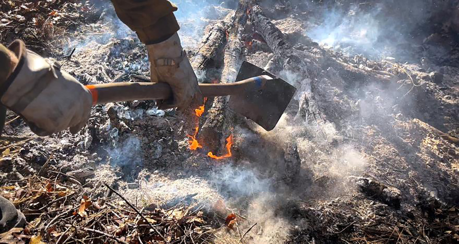
Federal Climate Financial Report Demonstrates Need for Proactive Action on Wildfire Resilience
Over the last decade, suppression has cost the USFS and the Department of the Interior an average of more than $3 billion per year. The Climate Financial Risk report provides estimates for 10 future climate scenarios and a wide range of projections for fire extent and fire suppression spending. A central estimate across the 10 future climate scenarios shows that lands in the National Forest System would experience a near doubling of the area burned by mid-century (2041-2059) and a 42% increase in costs by 2050, to $3.9 billion. Anticipated increased costs of fire suppression due to climate change brings additional urgency to the need for proactive wildfire risk reduction treatments and efforts to protect and prepare communities ahead of wildfires.
120,000 Acres Added to California National Monuments
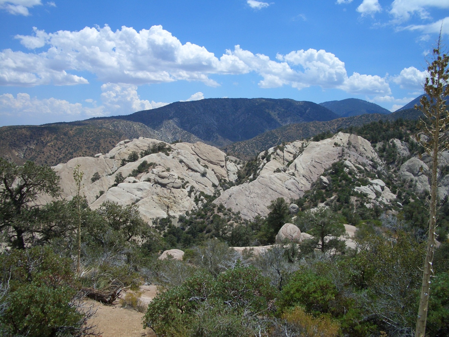
120,000 Acres Added to California National Monuments
May 2, 2024: On May 2, President Biden signed proclamations expanding the San Gabriel Mountains and Berryessa Snow Mountain National Monuments. Together, these actions will protect nearly 120,000 acres of lands in California of scientific, cultural, ecological, and historical importance. This will expand federal wildfire management programs and response to these newly added lands.
105,919 acres of U.S. Forest Service lands will be added to San Gabriel Mountains National Monument. The proclamation directs the U.S. Forest Service to manage the area according to the same terms, conditions, and management as the original national monument designation and calls for development of a management plan for the expansion area that incorporates Indigenous Knowledge and community input.
13,696 acres will be added to Berryessa Snow Mountain National Monument. The proclamation directs the Bureau of Land Management to manage the area according to the same terms, conditions, and management as the original national monument designation and directs the Secretary of the Interior to explore co-stewardship of the area with Tribal Nations.
New Online Treatment Dashboard to Track Wildfire Resilience Projects
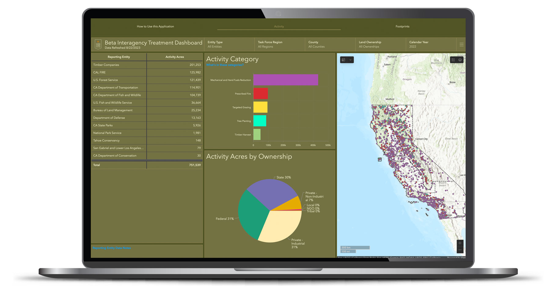
New Online Treatment Dashboard to Track Wildfire Resilience Projects
On August 29, the Governor’s Wildfire and Forest Resilience Task Force launched the beta version of a first-of-its-kind Interagency Treatment Dashboard beta that displays the size and location of state and federal forest and landscape resilience projects in California.
The dashboard offers a one-stop-shop to access data, provide transparency, and align the efforts of more than a dozen agencies to build resilient landscapes and communities in California. It reports treatment activities such as prescribed fire, targeted grazing, uneven-aged timber harvest, mechanical and hand fuels reduction, and tree planting. Users can sort treatments by region, county, land ownership and more.
The beta version of the dashboard will continue to be refined to include additional data, including projects by local and tribal entities, along with revisions based on public feedback. An official launch is expected in spring 2024 with more complete data on projects implemented in 2022.
California Launches Online Tool to Track Wildfire Resilience Projects

FOR IMMEDIATE RELEASE
August 29, 2023
California Launches Online Tool to Track Wildfire Resilience Projects
New beta statewide tracking system brings local, state, and federal wildfire resiliency projects into one place to reflect significant progress.
(Sacramento, CA) – Today, the Governor’s Wildfire and Forest Resilience Task Force (Task Force) launched the beta version of a first-of-its-kind Interagency Treatment Dashboard that displays the size and location of state and federal forest and landscape resilience projects in California.
The dashboard offers a one-stop-shop to access data, provide transparency, and align the efforts of more than a dozen agencies to build resilient landscapes and communities in California. It reports treatment activities such as prescribed fire, targeted grazing, uneven-aged timber harvest, mechanical and hand fuels reduction, and tree planting. Users can sort treatments by region, county, land ownership and more.
“Thanks to historic funding from our Legislature and Governor Newsom, over 1,000 wildfire resilience projects are in motion across the state to protect communities and our diverse landscapes from catastrophic wildfire,” said California Secretary for Natural Resources Wade Crowfoot, co-chair of the Task Force. “Now we can track our progress like never before through this public Interagency Dashboard. It identifies where projects are happening, what kind of work is happening in a given location, and how much overall resilience work is being done. It’s one more step forward in building a comprehensive, durable approach to increasing our wildfire resilience in years to come.”
“This dashboard delivers a new tool for collaboration among agencies and communities,” said U.S. Forest Service Regional Forester Jennifer Eberlien, who co-chairs the Task Force with Secretary Crowfoot. “Having access to treatment information in this format will allow us to coordinate landscape scale activities aimed at restoring and enhancing ecosystem resilience.”
The dashboard compiles data from a broad range of organizations and government departments—many of which have different reporting requirements guiding how they capture information. While individual reporting tools and data will sometimes differ from this statewide snapshot, the dashboard brings these different reporting approaches together as a single and streamlined reporting tool. Key differences are addressed in the dashboard website FAQs .
“It takes everyone to create a more wildfire resilient California and this dashboard reflects the strides being made to get us there,” said CAL FIRE Director and Fire Chief Joe Tyler. “This dashboard shows how far we’ve come, the significant efforts underway, and our firm commitment to future work. As our many partners share data and outcomes to a central place, the mission of protecting communities and natural resources will remain the common thread driving our work. This new tool will also provide first responders a snapshot of where treatment has occurred to help inform fire suppression efforts.”
The dashboard is an important step to increase the pace and scale of statewide actions addressing California’s wildfire crisis and is a key deliverable of the Governor’s Wildfire and Forest Resilience Action Plan , issued by the Task Force in January 2021.
The beta version of the dashboard will continue to be refined to include additional data, including projects by local and tribal entities, along with revisions based on public feedback. An official launch is expected in spring 2024 with more complete data on projects implemented in 2022.
Contact Information:
Sky Biblin, Communications Coordinator
Governor’s Wildfire and Forest Resilience Task Force
916-502-6527
Albert Lundeen, Director of Media Relations
California Natural Resources Agency
albert.lundeen@resources.ca.gov
916-606-3990
D’Artanyan Ratley, Public Affairs Specialist
USDA Forest Service
CAL FIRE and BLM Join Forces to Work Across Jurisdictions on Forest and Fuels Management Projects

CAL FIRE and BLM Join Forces to Work Across Jurisdictions on Forest and Fuels Management Projects
Through a nationwide initiative known as the Good Neighbor Authority, CAL FIRE and the BLM have entered a statewide agreement and contract worth approximately $4.5 million, made available to CAL FIRE as part of the agreement. The primary objective of this contract is to mitigate the potential devastation caused by wildfires specifically on BLM lands. By joining forces, the agencies can pair similar goals of separate projects on adjacent or nearby lands and further reduce the risks associated with wildfires while improving overall ecosystem health.

