


Monitoring, Reporting & Assessment

Monitoring, Reporting, & Assessment
on the Resilience of California’s Landscapes
INNOVATE AND MEASURE PROGRESS
The State of California and the U.S. Forest Service (USFS), along with other partners, collaborate closely through the California Wildfire and Forest Resilience Task Force to track vegetation management actions on the ground, monitor ecosystem responses, and assess progress of wildfire and climate resilience efforts in California’s landscapes. The California Natural Resources Agency (CNRA), CAL FIRE, and the USFS have established monitoring and assessment programs developed to specifically focus on:
● Location and status of vegetation management projects
● Status and trends in ecosystem conditions
● Effectiveness and ecological performance of management activities
These programs are intended to adaptively manage landscapes by leveraging data to inform future investments in landscape health and wildfire resilience. Highlighted here are State and federal-led efforts to track management, monitor trends, and assess ecological conditions across historically fire-adapted terrestrial ecosystems within California.
Featured below are several complementary monitoring efforts being undertaken by these agencies, covering California’s historically fire-adapted ecosystems (forests, shrublands, and grasslands). Together, these programs leverage data and perform assessments to better understand the impact and progress of multi-billion-dollar wildfire resilience programs and other land management occurring across California, providing a more holistic view of change within these ecosystems, and informing future investments in landscape resilience. The highlighted programs focus on different aspects and scales, looking at California’s ecosystems in different ways, from evaluating the impact of individual projects, to understanding how California is changing as a whole as a result of climate change and land management.
TRACKING OUR PROGRESS
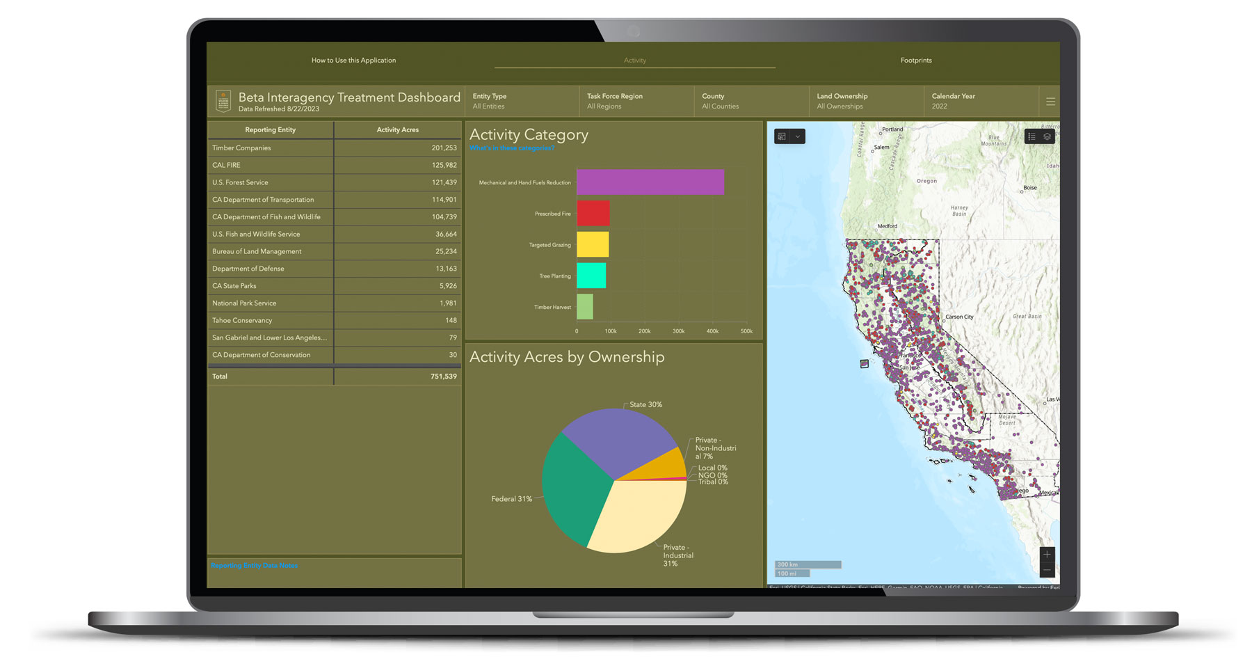
The Task Force established the new Wildfire and Landscape Resilience Interagency Tracking System and Dashboard which, for the first time, provides a single repository for recently completed projects across California from over a dozen federal and State agencies to track progress towards targets to reduce catastrophic wildfire and promote healthy landscapes. These data are essential to meet the needs of wildfire incident response crews, inform strategic planning, provide public transparency, and enable monitoring and impact assessments.
Monitoring & Assessment Programs
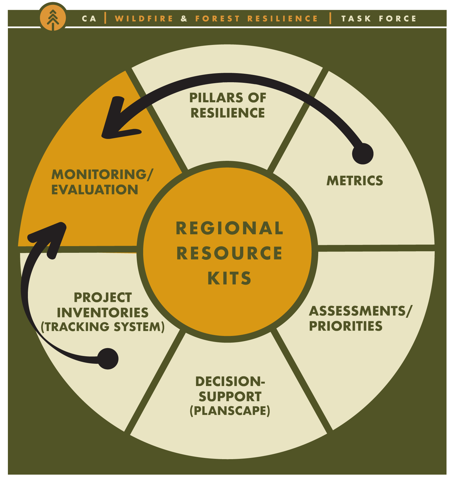
Leveraging field-based and remotely sensed monitoring data, agencies are tracking ecosystem condition change at the project to statewide-levels to determine how natural resources and public safety are affected by land management action, providing scientific and policy insights to inform adaptive management. These monitoring programs leverage the Task Force’s Regional Resource Kits metrics and data from the Interagency Tracking System and Dashboard.
LANDSCAPE-LEVEL MONITORING AND ASSESSMENT PROGRAMS
These monitoring and assessment programs focus on wildfire resilience and are conducted at a landscape-scale.
The Forest and Rangeland Assessment (Assessment) is a report authored by CAL FIRE’s Fire and Resource Assessment Program (FRAP) on a five-year cycle that synthesizes datasets to determine and monitor current trends affecting California’s forests and rangelands. The next Assessment is under development and planned for release by the end of 2024.
Focus:
Assessments focus on forest health, large-scale patterns of timber harvesting, and rangeland issues such as managing the grazing of commercial livestock, threats from development, and impacts of droughts and economic shifts. It also highlights trends in wildfires and climate change. The 2024 Assessment will highlight the major changes taking place in California over recent years, including unprecedented scale wildfires, and record droughts that are impacting millions of acres of forests and rangelands. Past editions of the Assessment have used spatial analyses to define priority regions and landscapes to understand core assets at risk (e.g., in 2010); more recent ones have employed the framework of the international Montreal Process Criteria and Indicators, comprised of 7 overarching Criteria with a set of 50 indicators customized for monitoring the health and status of our wildlands (2003, 2017).
Assessments inform the State Legislature on important status and trends affecting the wildlands of California. The Legislature and the State Board of Forestry use this information to craft new policies to improve management of our natural lands, and to better meet public needs.
Mandate:
Forest and Rangeland Assessment Reports are produced by CAL FIRE in accordance with California Public Resource Code § 4789, beginning in 1979. Assessment results are used by the State Board of Forestry and Fire Protection to develop and update a forest policy statement for California.
Who to Contact:
To learn more, contact Chris Keithley, Assistant Deputy Director of Fire and Resource Assessment, CAL FIRE: chris.keithley@fire.ca.gov.
Broader-Scale Monitoring Strategies help answer monitoring questions across a broad geographic area that includes multiple national forests.
Mandates
The 2012 Planning Rule (36 CFR 219.12) requires a Broader-Scale Monitoring Strategy and individual national forest plan monitoring programs. The U.S. Forest Service (USFS) evaluates and provides the results of a Broader-Scale Monitoring Strategy at least every five years.
Deliverables
The USFS Pacific Southwest Region released their Broader-Scale Monitoring Strategy in June 2020. This strategy asks 10 monitoring questions related to social, economic and ecological status and trends for National Forest System lands in California, along with small portions of Oregon and Nevada managed by the region.
The first results of the strategy were released on the Broader-Scale Monitoring Strategy Interactive website in April 2024. The website offers a wealth of information with icons to explore each monitoring question and a State of the Region summary with key results. Interactive dashboards and maps allow users to explore trends for specific geographic areas, dates and other topics of interest.
Strategy results use the best available scientific information. Sources primarily include publicly available federal and State field-based and remote sensing data. Trends for each of the 10 questions were interpreted by USFS subject matter experts, state agency partners, and scientific partners with academic and nonprofit institutions. Examples of publicly available data sources include American Community Survey (census data), California Surface Water Ambient Monitoring Program, CAL FIRE’s Fire and Resource Assessment Program, and TerraClimate. As well as USFS data including Health Protection Aerial Detection Surveys, National Visitor Use Monitoring Program, Natural Resource Manager databases, and Rapid Assessment of Vegetation Condition after Wildfire.
USFS managers use results from the Broader-Scale Monitoring Strategy and national forest plan monitoring to gauge relevant changes in the ecological, economic and social conditions on USFS lands and explore how management is interacting changes to identify ways to adapt.

Sustainability
The Broader-Scale Monitoring Strategy results and interpretation will be updated on the Forest Service interactive website at least every five years. Look for close-to-annual updates for questions with data refreshed more frequently.
The Broader-Scale Monitoring Strategy is a long-term, living document for the life of the individual national forest plans. As new science becomes available, or new uncertainties are discovered, the USFS will update the Broader-Scale Monitoring Strategy.
Who to Contact
To learn more, contact Stephanie Coppeto, Regional Monitoring Planner, USFS Pacific Southwest Region: stephanie.coppeto@usda.gov.
The WERK project will generate novel, updatable, high resolution, wall-to-wall datasets for California’s fire-adapted ecosystems. Additionally, it will synthesize datasets from other sources to track land cover change and management actions and contextualize statewide ecological condition, disturbance, and recovery. These new data will then be integrated into the project’s follow-on effectiveness assessments to better determine how vegetation management is interacting with wildfire and other ecosystem changes, providing the State and federal agencies spatially explicit, updatable data to continually evaluate how their programs and projects are affecting entire landscapes in the context of environmental variability and extreme events.
Mandates:
The State of California is required to assess ecological performance, impact, and effectiveness of its various programs charged with management and oversight of fire-The State of California is required to assess ecological performance, impact, and effectiveness of its various programs charged with management and oversight of fire-prone landscapes. Among the programs that require these assessments are the Timber Regulation and Forest Restoration Program (AB 1492 [2012]) and various State programs implementing vegetation management for wildfire risk reduction (AB 203 [2022]). Under AB 1757 (2022), the State is required to track progress and measure outcomes of nature-based solutions targets set in April 2024, including several related to fire-prone landscapes.
Resources, Funding, Deliverables:
With significant funding from the State Legislature, the California Natural Resources Agency (CNRA) has invested in making remote sensing data and analytics With significant funding from the State Legislature, the California Natural Resources Agency (CNRA) has invested in making remote sensing data and analytics publicly available for use in ecosystem health and wildfire management, along with related public safety and science applications across the state’s fire-prone landscapes. These investments will revolutionize how California utilizes science to track and mitigate the negative impacts of catastrophic wildfire and other events.
The California Air Resources Board (CARB) and CNRA are working jointly with NASA Ames Research Center to utilize their supercomputing capabilities to develop cutting-edge remote sensing-based vegetation mapping products, tailored to California ecosystems. Using high-resolution data, this project will establish a thorough and up-to-date understanding of spatial and temporal ecosystem changes across California. The WERK project will create new metrics to monitor the state’s ecosystems and evaluate the impact management actions are having.
The primary data products and analyses include:
Change Detection & Attribution | Maps and related assessments of where wildfires, forest and fire management, restoration, and other disturbance (e.g., drought or insect induced mortality events) have occurred throughout California
Land Cover Classification & Mapping | High-resolution land cover classification maps to improve understanding of vegetation in California
Individual Tree Monitoring | Tree canopy delineation maps using high-resolution imagery
Built Structure Mapping | Polygon representation of structures (e.g., habitable dwellings, accessory structures, and industrial/commercial buildings)
Leveraging these data as well as data from Regional Resource Kits, the WERK project will integrate data on reported and remotely sensed management activity and ecosystem changes (water quality and supply, biodiversity, biomass, etc.) to develop comprehensive, updatable, and accurate accounting and contextualization of statewide ecological condition, disturbance, and recovery. This will include new wildfire severity metrics, improved biomass quantification, improved tree die-off detection and quantification, and impact and effectiveness assessments. Data will be aggregated within and across geographies (e.g., HUC 12, counties, ecoregions, etc.), and analyses will be performed to link drivers of change to disturbance events and outcomes, as well as broader ecosystem condition change. For example, these analyses will enable the State to better gauge how management (fuel reduction treatments, commercial timber harvest, etc.) is interacting with wildfire and other ecosystem changes. These assessments will allow the State and federal agencies to evaluate how their programs have affected entire landscapes – not just within project boundaries.
While data refresh frequency will vary depending on the specific product, it is expected many products will be updated annually.
Sustainability:
These data and assessments will be maintained by CARB’s Nature-Based Strategies to transform the WERK project into an enduring monitoring program and provide new means for monitoring and assessing the progress of California’s wildfire and broader landscape resilience programs. These data will become available starting in early 2026 and will strengthen the State’s ability to monitor progress and outcomes of the State’s significant ramp up of landscape management actions.
Who to Contact:
To learn more, contact Loretta Moreno, Program Manager of the Timber Regulation and Forest Restoration Program, CNRA: Loretta.Moreno@resources.ca.gov.
Project-Level Monitoring Programs
These programs focus on wildfire resilience for which data is collected at the level of individual projects
intended to inform statewide programs.
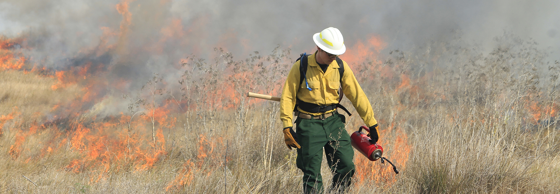
The California Prescribed Fire Monitoring Program (CPFMP) is a partnership between CAL FIRE and UC Berkeley to develop and implement a long-term monitoring program for prescribed fire in California. With an expected increase in the amount and complexity of prescribed fire in California ecosystems, it is imperative that implementation be accompanied by monitoring.
Focus:
The CPFMP was created following California’s Forest Carbon Plan (2018) and produces data to quantify the capacity of prescribed fire to mitigate carbon losses from wildfire, improve best management practices, minimize potential negative impacts, prioritize investments, and achieve statewide prescribed fire objectives.
Mandate:
The CPFMP supports the requirement for the State of California to evaluate the ecological and fire behavior impacts from vegetation management activities, including prescribed fire (AB 203 [2022]). The CPFMP also supports Senate Bill 1260 (2018) as well as the California Air Resources Board’s (CARB) mandate to enhance air quality and smoke monitoring.
Resources, Funding, Deliverables:
The CPFMP is funded through the California Climate Investments program (Greenhouse Gas Reduction Fund) and managed by CAL FIRE’s Fire and Resource Assessment Program. CPFMP measures a multitude of fire effects, including surface fuel consumption, impacts to forest structure, and botanical response. This work services all landownerships in California and provides a scientific foundation to help mitigate public health impacts and ensure management objectives are met as the State advances its goals to increase the pace and scale of beneficial fire.CPFMP protocols are now also used by partners at California State Parks and Save the Redwoods League, among others.
The primary data products and analyses include:
- Monitoring prescribed fire treatment effectiveness, measured as reductions of fuel loading/continuity, and other stated management burn objectives.
- Monitoring prescribed fire treatment effects, measured as changes in aboveground carbon, tree mortality and damage, soil surface conditions, and understory plant species.
- Monitoring selected sites for multiple years following treatment.
- Supporting prescribed fire air quality monitoring in coordination with CARB and local Air districts.
- Delivering stakeholder reports summarizing fire effects to all cooperating stakeholders.
- Where possible, connecting monitoring to specific research questions, across, or specific to, vegetation types.
- Areas previously prescribe burned (maintenance burning)
- Post-wildfire restoration (prescribed fire following wildfire)
- Fire effects by burn season
- Production of peer-reviewed scientific literature
Sustainability:
These are publicly available data and are maintained by CAL FIRE’s Fire and Resource Assessment Program. The program is designed to sustain growth over time in response to the growing demand for data related to the implementation of prescribed fire. This includes new university partners and increased student involvement, additional stakeholders, and updated research questions.
Who to Contact:
To learn more, contact Joe Restaino, Prescribed Fire Specialist, CAL FIRE: joe.restaino@fire.ca.gov
The California Forest Health Monitoring Program (FHMP) is designed to measure progress of the Forest Health Grant Program towards its goals and to provide data to evaluate the impacts of forest health treatments across California.
Sampling and Data:
The Forest Health Grant Program funds large-scale and regionally driven efforts to help ensure forest persistence and increase forest resilience and stable carbon storage. Treatments are generally categorized into five core areas: forest fuels reduction, prescribed fire, pest management, biomass utilization, and reforestation. The FHMP uses field–based plots in treated and untreated areas to measure ecosystem elements that reflect progress towards the program’s goals:
- Forest persistence – reforestation efforts put trees back on the landscape after fire. The FHMP will help to understand mortality of planted seedlings over time and resulting sapling densities in planted areas.
- Forest resilience –Forest Health treatments strive to make forests more resilient to drought, pests, and fire via ecological thinning that reduces competition within the stand. FHMP monitoring plots will detect the magnitude of changes in canopy and understory fuels due to treatment to uncover differences in the outcomes of future disturbance in treated areas.
- Long-term and stable carbon storage – though treatments may remove carbon-containing biomass, they stabilize the carbon stocks that remain. On-the-ground plots quantify the increase in the proportion of larger trees and allow for calculation of carbon stability metrics such as the probability that a tree will be consumed in a wildfire.
- Protected communities – the FHMP recognizes the interdependence of healthy forests and protected communities. Future data collection will focus on the impact of Forest Health treatments in firefighting operations.
Mandate:
Forest Heath Grants are administered by CAL FIRE and utilize Cap-and-Trade dollars as part of the California Climate Investments (CCI) program. All CCI funded programs have mandated reporting and the California Air Resources Board requires that monitoring of Forest Health projects occur for a minimum of 10% of projects for at least 10 years. Sampling for FHMP will begin in spring 2025 and protocols are currently under development.
Who to Contact:
To learn more, contact Emily Brodie, Forest Monitoring Scientist, CAL FIRE: emily.brodie@fire.ca.gov.
CAL FIRE’s Fuel Treatment Effectiveness Reporting (FTER) program is intended to evaluate the impacts vegetation management treatments have on fire behavior and highlight how fuel reduction activities not only assist in suppression efforts, but how they protect life, property, and the natural resources of California. FTER relies on an automated process to overlay new wildfire incidents with projects in CalMAPPER to identify where fuel treatment projects are impacted by wildfire. Identified projects are surveyed and verified by CAL FIRE unit personnel, reports are generated and posted to CAL FIRE’s website, and the information displayed on an interactive data dashboard.
Focus:
The FTER program assesses the effect a fuel reduction treatment has on fire behavior, ingress or egress, and fire suppression. Positive fuel treatment impacts are assessed based on whether the project: assisted with fire containment and ingress/egress, reduced property damage, or change fire behavior. Change in fire behavior is determined based on whether the project halted rate of spread, slowed rate of spread, or reduced the fire intensity. Projects are also assessed on their contribution to control of fire based on whether primary or secondary containment lines were utilized and whether the project provided ingress/egress for fire suppression personnel.
Mandate:
Public Resource Code 4137 states on or before December 31, 2022, the Department of Forestry and Fire Protection shall develop a standardized protocol for monitoring implementation and evaluating the positive and negative ecological and fire behavior impacts from vegetation management projects undertaken by the state, consistent with the requirements of Chapter 387 of the Statutes of 2021.
Who to Contact:
To learn more, contact: prefireplanning@fire.ca.gov

Interagency Treatment Dashboard Shows Progress Toward Resilience
FOR IMMEDIATE RELEASE
October 10, 2024
California Unveils First-of-Their-Kind Dashboards Mapping Out Fire-Prevention Work to Protect Communities
New tools created by CAL FIRE and Wildfire and Forest Resilience Task Force simplify data, boost transparency, and help inform wildfire planning and response – adding to the suite of tools the state has created
(South Lake Tahoe, CA) – The Governor’s Wildfire and Forest Resilience Task Force and the California Department of Forestry and Fire Protection (CAL FIRE) unveiled several new tools today to help California track and communicate the state’s significant progress in improving wildfire and landscape resilience.
Key takeaways from the Task Force’s Sierra Nevada Regional Meeting in South Lake Tahoe include:
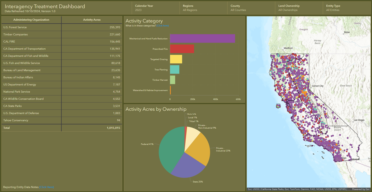
• Interagency Treatment Dashboard updated to show 2021, 2022 and 2023 data.
• Over one million acres of treatments were conducted on about 700,000 footprint acres in 2023.
• Prescribed fire treatments more than doubled between 2021 and 2023.
• CAL FIRE Fuel Treatment Effectiveness Dashboard is showing the impact of treatments impacted by recent wildfires.
“Thousands of wildfire resilience projects have been completed across California to protect our communities and landscapes from catastrophic wildfire in recent years, and more are underway,” said Wade Crowfoot, Secretary of the California Natural Resources Agency and co-chair of the Task Force. “Thanks to historic investments from our state and federal leaders, dozens of local agencies and hundreds of organizations are delivering these projects. Now for the first time, we have a dashboard that tracks all these diverse projects in one place and on one map. This enables us to measure our overall progress toward building wildfire resilience across the state and provides regional leaders valuable information to plan future projects.”
Interagency Treatment Dashboard
The updated version of the Interagency Treatment Dashboard shows wildfire resilience work (or “treatments”) for three calendar years (2021, 2022 and 2023). The data, which was sourced from federal, state, local, tribal, and private entities, is now available in a single hub that allows Californians to easily see where treatments (such as prescribed fire, mechanical thinning, and tree planting) have been completed. This information is used to inform firefighting efforts, ensure transparency to the public, and track progress toward statewide goals.
The Task Force released a Beta version of the Dashboard last year with 2022 data. This updated version now includes data for 2021, revised data for 2022, and new data for 2023.
Over 1 million acres worth of treatment work on 700,000 acres of land
The Dashboard shows significant progress on multiple fronts to bolster wildfire resilience in California. In 2023, more than one million acres of treatments were conducted on about 700,000 acres, with many acres receiving multiple treatments such as thinning, prescribed fire, or other practices to improve forest health and community resilience. The Task Force is tracking both “activity acres” – which reflect the level of effort conducted through various state, federal, and private programs – and “footprint acres” – which show the total geographic area treated in a calendar year.
The 2023 data shows a significant increase in acres treated since 2021. The increase is largely due to a significant expansion of prescribed fire treatments, which more than doubled since 2021. These efforts have put the state on a solid path toward meeting its joint commitment with the U.S. Forest Service to complete treatments on more than a million acres by the end of 2025.
The Task Force is committed to increasing the pace and scale of statewide actions to address California’s wildfire crisis. The Dashboard is part of a larger strategy to connect the various statewide entities committed to this monumental task.
Fuel Treatment Effectiveness Dashboard
CAL FIRE also launched a Fuel Treatment Effectiveness Dashboard, which shows how wildfire prevention projects are helping protect communities and landscapes when wildfire strikes. “Utilizing technology, we can now track in real time when wildfires hit areas where fuel treatments have been conducted. We can then go into an area and see how those treatments affected fire behavior, evacuation routes, firefighting efforts and more,” said CAL FIRE Chief/Director Joe Tyler. “This new dashboard is a tool for the public to see how fuels treatments had a positive impact on the firefight and how this work is making a difference.”
“No other state in the country is tackling wildfire resilience at this scale or with this level of innovation,” added U.S. Forest Service Deputy Regional Forester Kara Chadwick, who co-chaired today’s meeting. “From groundbreaking prescribed fire projects to comprehensive data tracking systems, we’re setting the standard for what it means to protect our landscapes and communities.”
The meeting is supplemented by field tours on October 8 and 11, to showcase wildfire resilience projects in the Tahoe Basin. Tour highlights include recovery efforts following the 2021 Caldor Fire, long-term prescribed burn projects in Sugar Pine Point State Park, meadow restoration at Máyala Wát undertaken by the Washoe Tribe of Nevada and California, and the first new industrial-scale sawmill built in Sierra Nevada in several decades.
“Today’s meeting is a major milestone in our efforts to better document and share our collective progress,” said Task Force Director Patrick Wright. “We will continue to build on our collective momentum to make California more resilient to wildfire.”
The next Task Force meeting will take place in Sacramento on December 13 and will provide a synthesis of the latest scientific findings that are informing California’s approach to address wildfire risks in a changing climate. These findings will be incorporated into the Task Force’s 2025 Action Plan Update.
Sky Biblin, Communications Coordinator
Governor’s Wildfire and Forest Resilience Task Force
916-502-6527
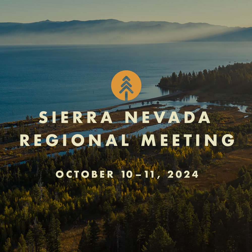
Sierra Nevada Regional Meeting Event 2024
Welcome ToThe Sierra Nevada
Regional Meeting
Event schedule
8:30 – 10:00 a.m. Resource Fair
10 a.m. – 12:15 p.m. Morning Session
12:15 – 1:30 p.m. Lunch
1:30 – 3:15 p.m. Afternoon Session
3:30 – 4:30 p.m. Small Group Discussion
4:30 – 6:00 p.m. Reception
Questions? Please contact foresttaskforce@fire.ca.gov
Thank You to our Hosts
Thank You to our Sponsors



Sierra Nevada Regional Meeting
Sierra Nevada Regional Meeting
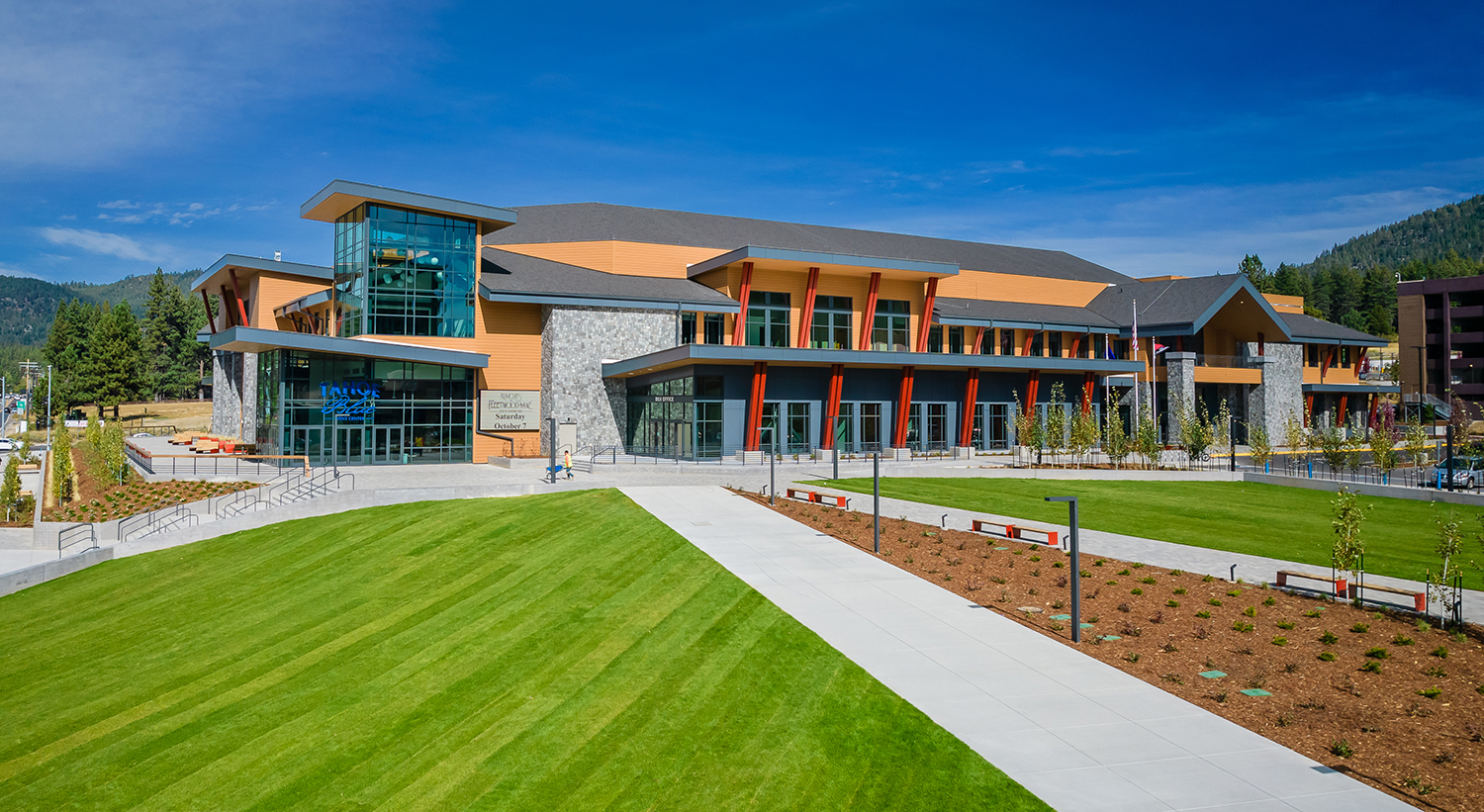
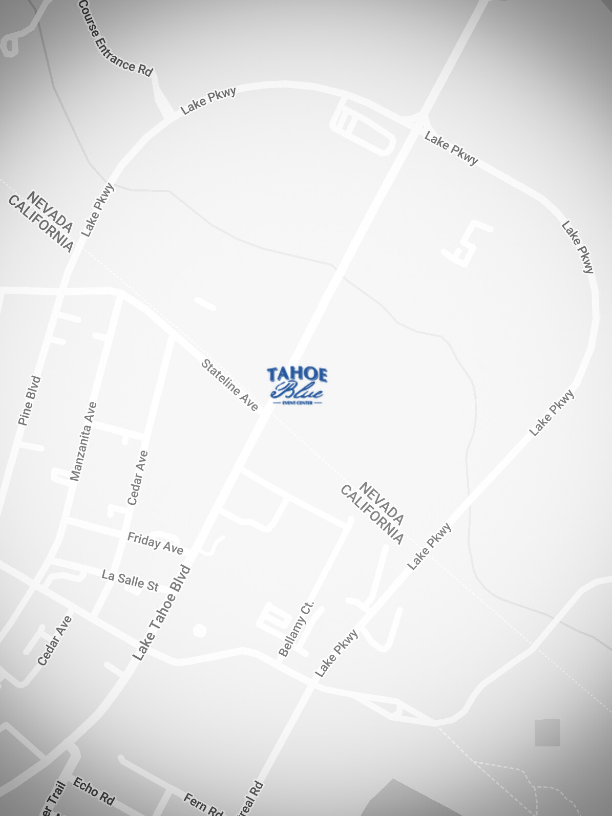
Register early to reserve your seat at the next meeting of the California Wildfire and Forest Resilience Task Force, October 10 at the Tahoe Blue Event Center in South Lake Tahoe, hosted by the California Tahoe Conservancy and the Tahoe Fund.
The Task Force and CAL FIRE will unveil several new tools that will revolutionize how California tracks and communicates progress toward improving wildfire and landscape resilience at its seventh regional meeting on October 10th in South Lake Tahoe:
Interagency Treatment Dashboard: One year after its beta release with 2022 data, CAL FIRE will present three years (2021-2023) of treatment data from a more complete range of federal, state, local, tribal, and private entities through its expanded and improved Interagency Treatment Dashboard.
Draft Metrics: Task Force Science Advisory Panel staff will present a subset of initial proposed metrics to document the outcomes of recent projects on wildfire hazard, watershed health, and wildlife habitat.
Fuel Treatment Effectiveness Dashboard: CAL FIRE will demonstrate its prototype dashboard to document the benefits of fuels treatments in reducing the impacts of recent fires, including the Park Fire in Butte and Tehama County.
CAL FIRE Director Joe Tyler will also provide a report on the current fire season, and three panels of federal, state, tribal, and regional leaders will discuss their efforts to create vibrant forest ecosystems and thriving communities through landscape-scale wildfire resilience projects.
On October 9 and 11, Task Force Partners will host field tours offering immersive opportunities to better understand the critical landscape health and wildfire resilience work being done in the Sierra Nevada region.
The $28 registration fee for the October 10 meeting offsets the cost of breakfast, refreshments, and lunch. If this fee poses a hardship, contact ForestTaskForce@fire.ca.gov.
Registration closes October 3. No registrations will be allowed after this date.
EVENT SCHEDULE
OCTOBER 10 TENTATIVE MEETING SCHEDULE
Resource Fair
8:30 – 10:00 a.m.
Morning Session
10:00 a.m. – 12:15 p.m.
Lunch
12:30 – 2 p.m.
Afternoon Session
2 p.m. – 4:30 p.m.
Reception at the Tahoe Blue Event Center
(Meeting registration is required.)
4:30 p.m. – 6:30 p.m.
hotel information
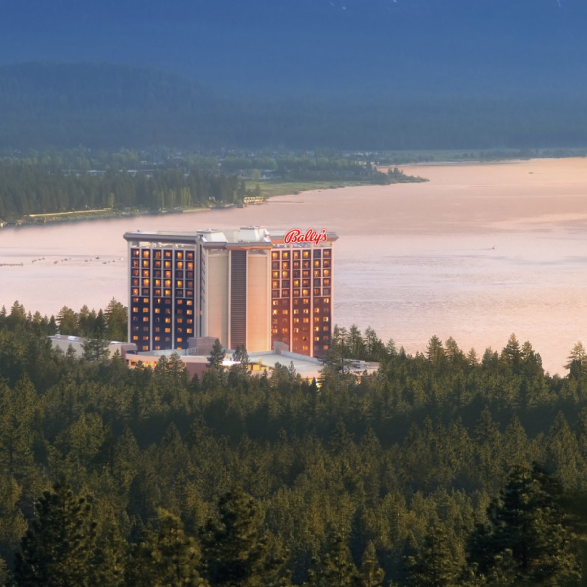
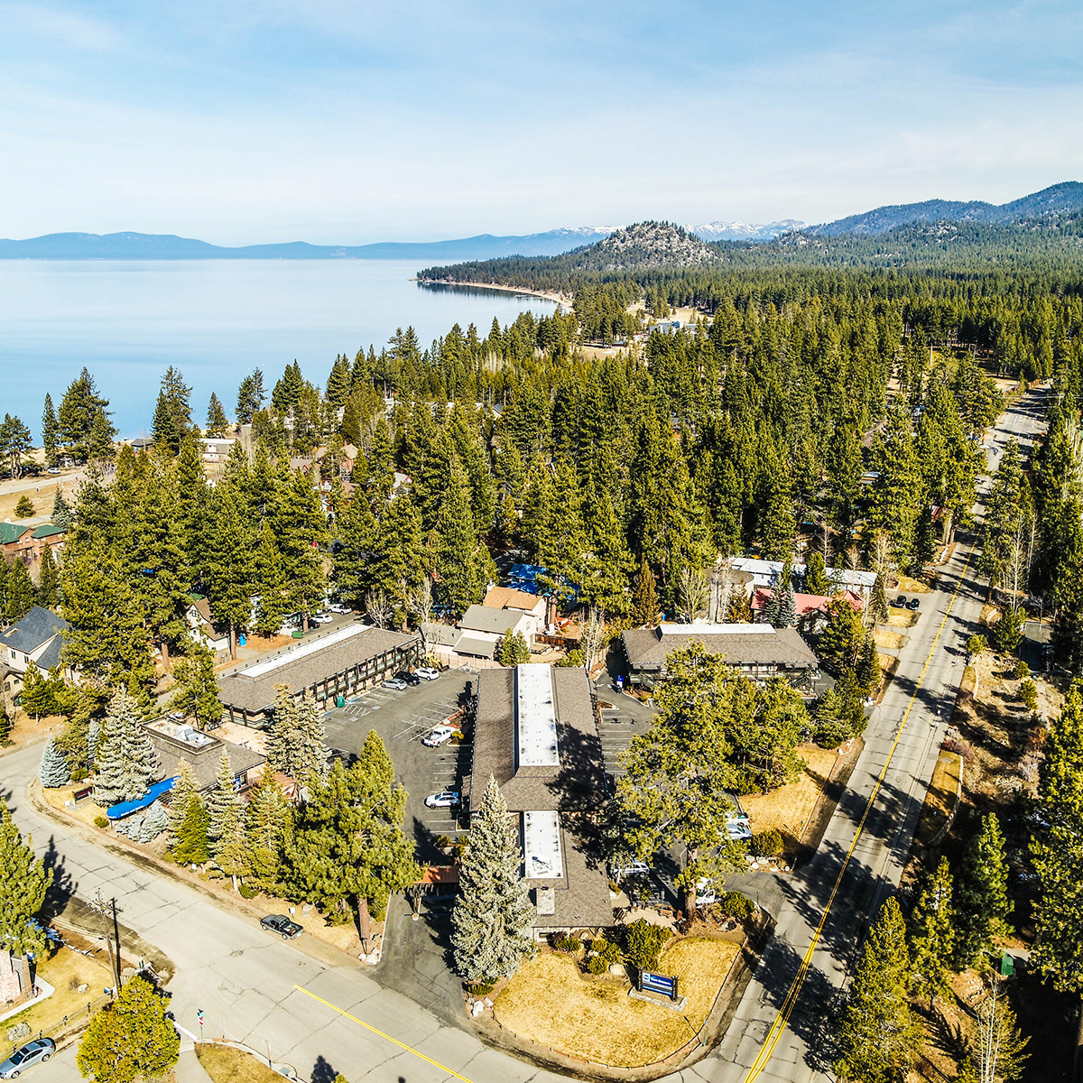
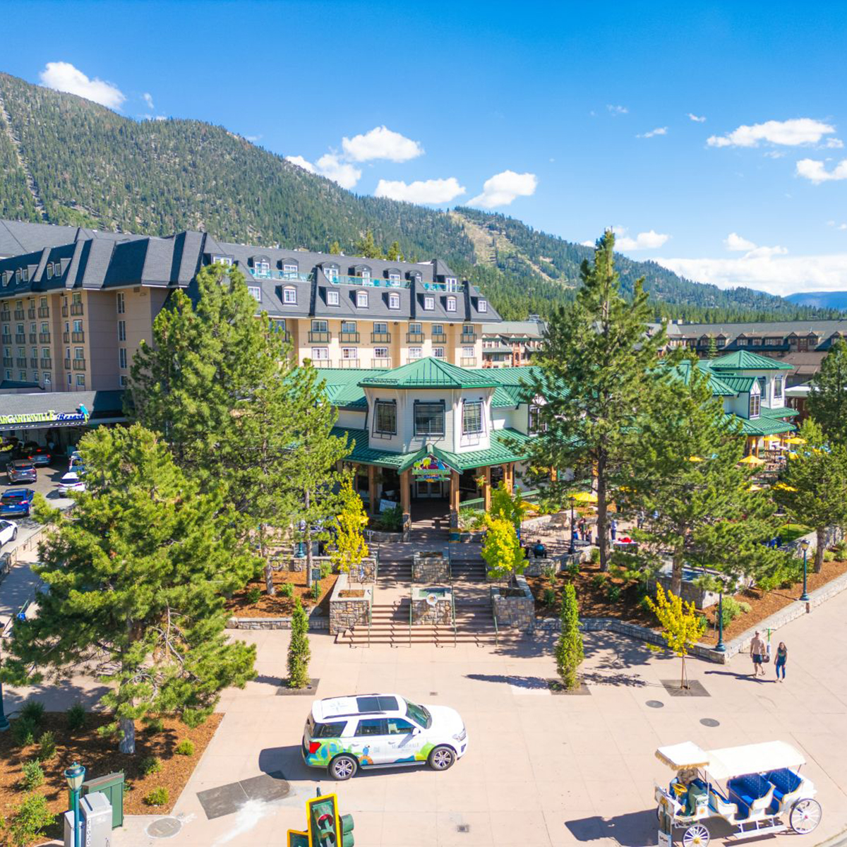
field tours
FIELD TOURS WILL BE OFFERED ON OCT 9 & 11
All tours will be accessed by bus. Parking/meet up locations TBD.
Lunch will not be served.
Tahoe Forest Products Mill
See the first new industrial-scale sawmill built in Sierra Nevada in several decades.
Destination: Tahoe Forest Products worked in partnership with the Washoe Development Corporation an affiliate of the Washoe Tribe of Nevada & California to construct the first new industrial-scale sawmill in the Sierra Nevada in several decades. The mill provides employment opportunities for local citizens and tribal members while supporting forest health and wildfire restoration efforts throughout the Central Sierra. Visit the mill and learn about both the innovative partnerships and engineering that made this long-envisioned opportunity a reality.
Three Tours: start times will be 12:30, 1:00 and 1:30 pm.
Tour lasts approximately 2.5 hours.
Caldor Fire Preparation, Response, and Recovery
Learn what happened before, during, and after one of 2021’s largest wildfires.
Destination: This tour will showcase projects and treatments implemented prior to the 2021 Caldor Fire, successes and lessons learned during initial response to the fire, as well as the significant efforts that have helped the impacted ecosystems recover and accelerated access to recreational opportunities in this post-fire landscape. Tour stops will include Echo Summit, Christmas Valley, Pioneer Trail, and Fountain Place.
Start/End Time: 9am – 1pm
West Shore Prescribed Fire and Indigenous Stewardship
See impacts of long-term prescribed burn projects and multi-benefit ecosystem restoration.
Destination: This tour will visit the renowned Sugar Pine Point State Park to view the effects of a decades-long prescribed fire program. The tour will then explore Máyala Wáta at Meeks Meadow to learn how the Washoe Tribe is partnering with diverse groups to restore ecosystems and habitat by addressing the detrimental impacts of historical cattle grazing, logging, and fire suppression.
Start/End Time: 9am – 1pm
East Shore Shared-Use Trail and Recreation Management
Recreate on a scenic shoreline trail and learn about managing forests in high-visitation areas.
Experience by foot one of Tahoe’s most scenic and historic shoreline trails. Participants will have the opportunity to walk all or part of this spectacular 3-mile pave path while gaining insights on the challenges and solutions for managing forests in high-visitation areas.
TIME: 9am – 1pm
Questions? Please contact foresttaskforce@fire.ca.gov
Thank You to our Hosts
Thank You to our Sponsors


Southern California Regional Meeting
Southern California Regional Meeting
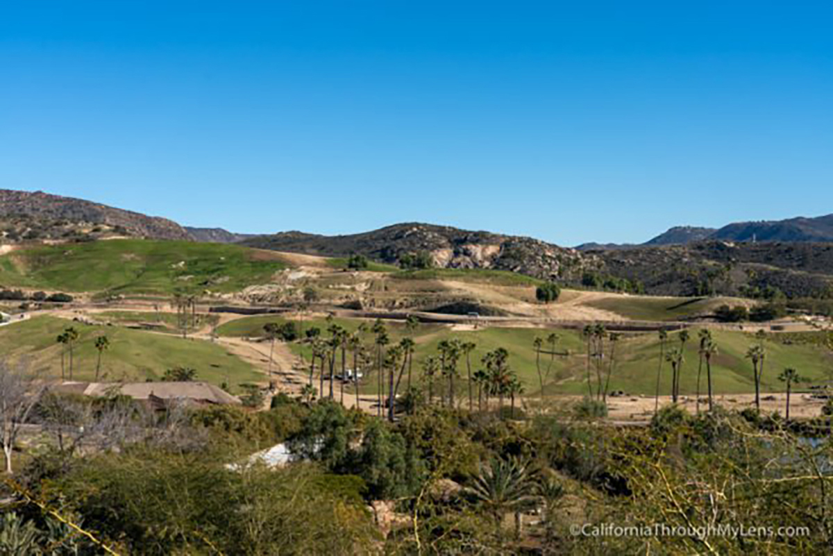
REGISTER early to reserve your seat at the next meeting of the California Wildfire and Forest Resilience Task Force, April 4 at the San Diego Zoo Safari Park in Escondido, CA.
Hosted by the RCD of Greater San Diego County and the San Diego Zoo Wildlife Alliance, the agenda and activities on April 4 will focus on landscapes and land management issues unique to Southern California. Agenda topics will include cultural burning, utilities & infrastructure, and regional planning & optimization.
On April 5, Task Force Partners will host a variety of field tours offering immersive opportunities to better understand the critical landscape health and wildfire resilience work being done in the Greater San Diego region.
REGISTRATION IS REQUIRED. Last day to register is March 27.
April 4 & 5, 2024
San Diego Zoo
Safari Park
Escondido, CA
EVENT SCHEDULE
APRIL 4: MEETING SCHEDULE
Resource Fair
8:30 – 10:00 a.m.
Morning Session
10:00 a.m. – 12:30 p.m.
Lunch
12:45 – 2 p.m.
Afternoon Session
2 p.m. – 4:30 p.m.
Free time to enjoy the Safari Park
4:30 p.m. – 7 p.m.
field tours
FIELD TOURS WILL BE OFFERED ON April 5th
Saving San Diego’s Last Mixed Conifer Forest
Destination: Join the Palomar Collaborative, a group of five federal, state, tribal, and private property owners and managers to learn how the Collaborative is utilizing CAL FIRE Forest Health funds to save San Diego’s last mixed conifer forest through a combination of mechanical thinning, pile burning, and mastication.
Tour Host: RCD of Greater San Diego County
Location: Palomar Observatory
Start/End Time: 10:00 AM – 1:00 PM
Accessibility: Some walking on dirt roads, uneven surfaces
Notes: Carpool encouraged, bring snacks/lunch, layered clothing
Applying Traditional Ecological Knowledge to Forest Health
Destination: This dyanamic tour will feature field presentations on site history, a cultural burn site and a Lumbercycle demonstration. There will also be a discussion on Traditional Ecological Knowledge, funding and collaboration, burning on trust land, and the impact of goldspotted oak borer tree mortality in the area.
Tour Host: La Jolla Band of Luiseno Indians
Location: VIEW
Start/End Time: 9:00 AM – 1:00 PM
Accessibility: Driving on dirt road (prius accessible), minimal seating available, tour will be given on mostly flat, dirt terrain
Notes: Field clothing, hat, sunscreen, bug spray, recommended. If available bring mask, eye protection, preferred hearing protection, PPE will be provided as needed for lumbercycle demo. Carpool recommended. Bring snacks.
Fire History and Frequent Fires in the Cedar Creek Falls Trail Region
Destination: Join CAL FIRE and USFS in the San Diego Country Estates / Cedar Creek Falls Trail to learn what they are doing to defend a WUI community and surrounding ecosystem from frequent fire.
Tour Host: CAL FIRE/USFS
Location: Inaja Trailhead
Start/End Time: 8:00 AM – 1:00 PM
Accessibility: 1 mile roundtrip hike on uneven terrain
Notes: Carpools encouraged. Please bring lunch, water, hat, and sunscreen. No bathrooms along trail. Limited shade / cover. Please wear appropriate footwear for hiking.
Powerlines, Roadsides, and Flashy Fuels
Destination: First, learn about the fire hardening and undergrounding work that has already been completed by San Diego Gas & Electric, along with their future risk reduction plans. Then, visit an ignition reduction demonstration site on a fuelbreak on the Cleveland National Forest (NF) designed by UC Santa Barbara and funded by the San Diego River Conservancy. You’ll see the results of herbicide use to control invasive flashy fuels followed by seeding of less ignitable native plants. Finish with a firsthand look at a BurnBot in action, the first use in Southern California and a critical test of its capability to eliminate the invasive seedbank in addition to the above-ground fuels. This collaboration was funded by the National Forest Foundation as part of the Southern California Ignition Reduction Program (SCIRP) conservation finance effort. It will also lay black line for broadcast burning of a unit on the Cleveland NF. Along the way, learn how SCIRP involves collaboration among many partners, especially CalTrans, from the Mexican border to Monterey.
Tour Host: USFS
Location: VIEW
Start/End Time: 9:00 AM – 12:30 PM
Accessibility: short walks on uneven terrain
Notes: Carpools encouraged. Closed toed shoes required. Option to bring your own lunch and eat onsite.
Postfire Restoration at Cuyamaca State Park and Prescribed Fire on Mt. Laguna
Destination: Join the California State Parks and the US Forest Service to examine first hand what CA State Parks are doing to reforest Cuyamaca Rancho SP following wildfire, and join a discussion on management approaches and the Montane Strategy at Mt Laguna. This field trip visits the location where the 2003 Cedar Fire converted 10,000 acres of montane forest to shrubland. We will highlight State Parks’ major postfire reforestation effort and the Cleveland National Forest’s forest health program for reintroducing maintenance fire into the Laguna Mountains. Stops will include locations on both Cuyamaca State Park (Hwy 79) and the Cleveland National Forest (Sunrise Hwy).
Tour Host: CA State Parks/USFS
Location: Cuyamaca State Park, Paso Picacho
Start/End Time: 8:30 AM – 1:30 PM
Accessibility: Sites will be on or adjacent to roadways, and hiking will be very limited.
Notes: Carpools encouraged. Lunch is not provided and the tour will not end before 1:30; please bring a lunch, snacks, and water. Sturdy shoes, hat and a warm layer are recommended.
Wildfire Grazing: Rancho Jamul Reserve
Description: Join conservation experts in the Rancho Jamul Ecological Reserve to learn how local ranchers, land managers, and the environmental community are utilizing a prescribed grazing plan managing livestock on a commercial cattle ranch with a goal of improving wildfire resilience, and promoting soil health and carbon storage, while achieving many other aligned environmental co-benefits.
Tour Host: CDFW
Location: VIEW
Start/End Time: 9:30 AM – 12:30 PM
Accessibility: Walking approx 1 mile on relatively flat terrain.
Notes: Carpools encouraged. Closed toed shoes required. Option to bring your own lunch and eat onsite. Binoculars encouraged.
Impacts from the Witch Creek Fire to the Bernardo Fire to Now
Destination: Join this out-and-back hike along the “River of Fire” and learn how San Dieguito River Valley Conservancy is managing invasive species and fire risk in a Southern California riparian ecosystem that has been impacted by previous wildfires.
Tour Host: San Dieguito River Valley Conservancy
Location: VIEW
Start/End Time: 9:00 AM to 2:00 PM
Accessibility: Recommended for experienced hikers – 2.8 miles out and back (5.6 miles total).
Notes: Carpools encouraged. Please bring lunch, water, hat and sunscreen. No bathrooms along trail. Limited shade / cover. Please wear appropriate footwear for hiking.
Unique Approaches to Resource Management and Emergency Response on the International Border
Destination: Spend the day exploring the Otay Mountain Wilderness Area which sits directly on the busy International Border, with stops that include the International Fuel Break. There will be discussions about partnerships with Mexico, unique species to the area, and border response challenges. The tour will offer views of the border wall, Tijuana, downtown San Diego, and the Pacific Ocean. Participants will learn about unique approaches being applied for resource management and emergency response in a border area.
Tour Host: CAL FIRE
Location: VIEW
Start/End Time: 9:30 AM to 1:30 PM
Accessibility: Optional short hike to viewpoint. Short walks on flat terrain.
Notes: We will meet at County Fire Station 38 (850 Alta Road, San Diego, CA 92154). We will be utilizing 2 CAL FIRE vans for attendee transportation. While there is no security threat, participants will see migrants on the roadway up to the tour stops. No lunch provided. Restaurant options available.
Guided Tour of Resource Management and Wildfire Mitigation Programs at the Safari Park
Destination: Venture into the Safari Park’s expansive wildlife habitats on the back of a covered, open-air safari truck, with an expert guide to get an up-close view of a variety of wildlife with a special opportunity to learn about the BioReserve. Visit San Diego Zoo Wildlife Alliance’s new Heli-Hydrant Dip Tank, and gain an understanding of SDZWA’s multi-faceted wildfire mitigation program that supports wildlife on grounds, including in our large, multi-species habitats.
Location: San Diego Zoo Safari Park Parking Lot. Meet at the Log Ring.
Start/End Time: 10 AM – 12 PM
Accessibility: Ability to climb steps into truck
Notes: Closed toe shoes required. Casual attire (layers recommended).
CAL FIRE’s Urban and Community Forestry Program in Action
Destination: A unique opportunity to go behind the scenes and see an example of the partnership between CAL FIRE and private industry. Participate in a tour of the Taylor Guitars Factory led by founder Bob Taylor. The tour will focus on the process of building Taylor Guitars and Taylor’s Urban Wood Initiative. Tour will end with a Q & A session, an opportunity to play a selection of guitars, and a visit to the gift shop.
Location: VIEW
Start/End Time: 1:00 PM – 3:30 PM
Accessibility: Parking available at factory. Tour will consist of indoor walking. Government issued ID (e.g. driver’s license) is required to participate in tour.
Notes: Lunch will not be provided. Wear comfortable walking shoes.
hotel information
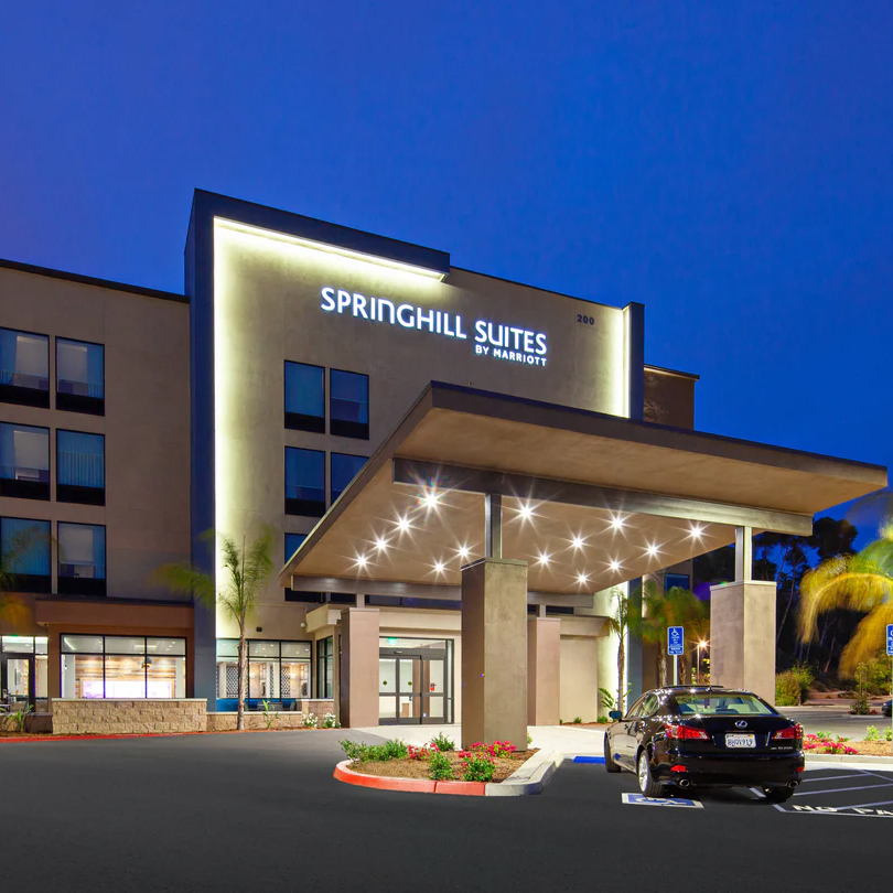
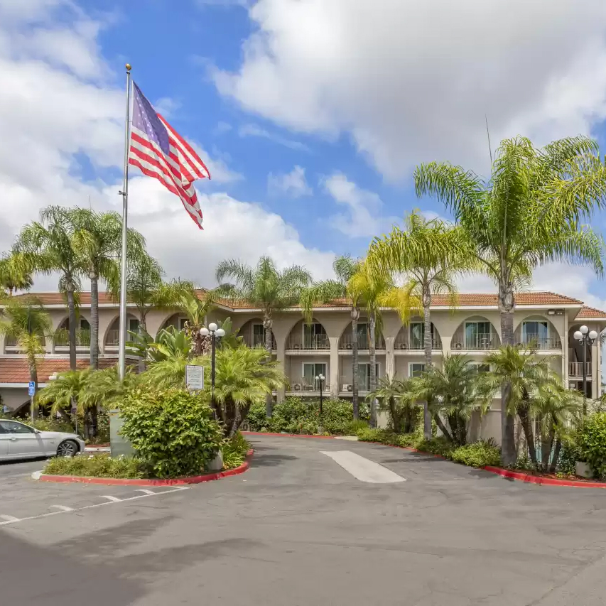
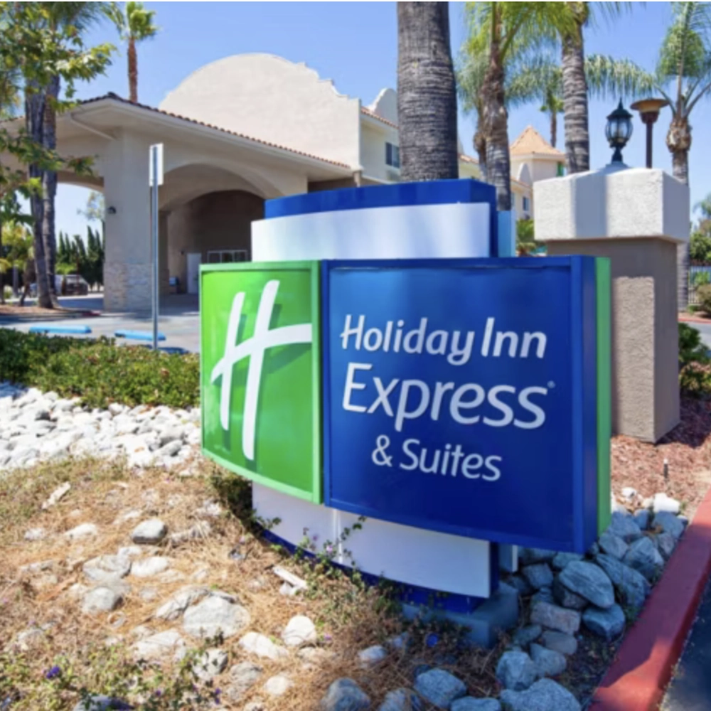

Questions? Please contact foresttaskforce@fire.ca.gov
Thank You to our Hosts
Thank You to our Sponsors



The Climate Science Alliance is offering a limited number of travel stipends for Tribal partners. Contact Althea Walker, Director of Community Resilience, at awalker@climatesciencealliance.org.
USFS Study Shows How Fuel Treatments Improve Wildfire Outcomes
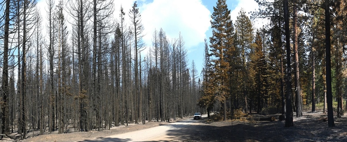
USFS Pacific Southwest Research Station (PSW) Study Shows How Fuel Treatments Improve Wildfire Outcomes
PSW researchers recently published findings that provide strong evidence for the use of fuel treatments to mitigate fire behavior and resulting fire severity even under extreme fire weather conditions. When the 2021 Antelope Fire tore through the Goosenest Adaptive Management Area (long-term research plots set up in northeastern California in the late 1990s), it seemed that 20 years worth of research had been lost. However, shortly after the fire a 2,300-acre study was conducted that demonstrates how reducing canopy bulk density via mechanical thinning treatments can help to limit crown fire behavior for 20 years or more. The findings make a compelling case for doing both tree thinning and prescribed burning to protect forests in the future.
Tahoe Conservancy Grant Supports Joint USFS-Washoe Tribe Project at Meeks Meadow
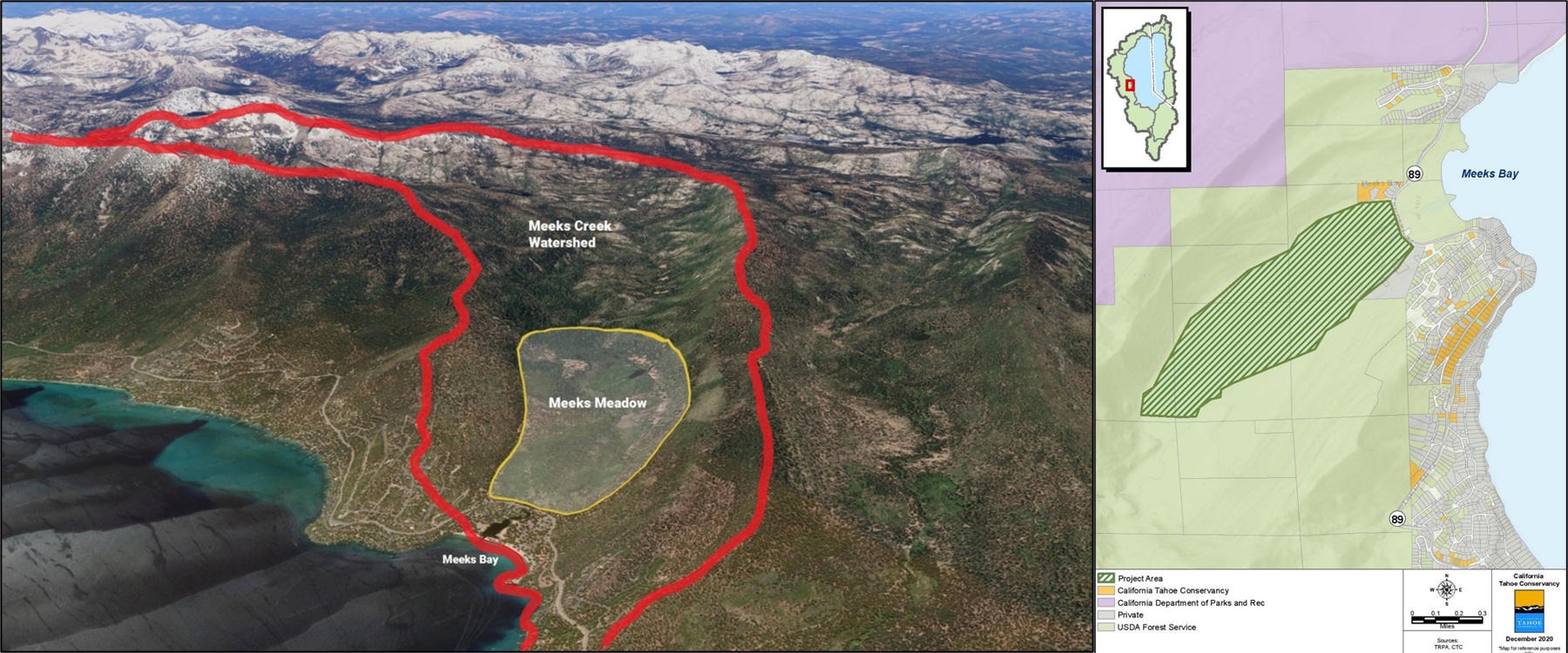
Tahoe Conservancy Awards $600,000 Grant to Support Joint USFS-Washoe Tribe Project at Máyala Wáta (Meeks Meadow)
The California Tahoe Conservancy has awarded a $600,000 grant to the USDA Forest Service Lake Tahoe Basin Management Unit (LTBMU) for forestry operations as part of its joint project with the Washoe Tribe of Nevada and California to restore Máyala Wáta (Meeks Meadow). The absence of low-intensity fire has allowed lodgepole pines to encroach on the meadow, drying the soils and reducing the availability of culturally significant plants. The LTBMU will use these funds, matched by $1 million in federal funds, to remove encroaching conifers from 213 acres of the meadow and thin 70 acres of the surrounding upland forest. This federal, state, and tribal partnership is an excellent example of how Task Force partners can work together to achieve multiple benefits, from improving wildlife habitat to promoting culturally significant plants.
CA Climate Hub Receives USFS Region 5 Partnership of the Year Award
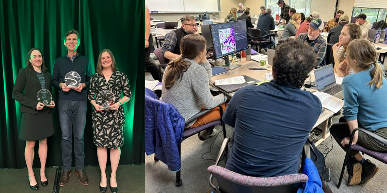
California Climate Hub Receives USFS Region 5 Partnership of the Year Award
The USDA Forest Service Region 5 awarded the California Climate Hub the 2023 Honor Award for Partnership of the Year for their efforts to develop and deliver climate literacy and web-based climate tools trainings. The trainings familiarized participants with relevant information on climate and climate models and provided hands-on experience using two web-based climate data tools: Cal-Adapt and Climate Toolbox. Additionally, the California Climate Hub has designed and delivered a series of workshops focused on the applications of the California Wildfire and Forest Resilience Task Force’s Regional Resource Kits. The most recent workshop gathered forest managers from local, state, and federal agencies at Shasta-Trinity National Forest in Redding.
Fire Adapted Communities
FIRE ADAPTED COMMUNITIES
Working at the intersectionof people, fire & place
The challenges involved in adapting communities to be more fire resilient are remarkably vast and diverse. It’s also inherently local, as no two areas in the state have the exact same set of needs, values, risks, and capacities.
By aligning resources, tools and organizations, the California Wildfire & Forest Resilience Task Force is uniquely structured to address the scope and complexity of resourcing and supporting communities to achieve a more resilient future.
The Vision Statement from the Fire Adapted Communities Work Group is a testament to that approach.
“Our vision for fire-adapted communities will require working across sectors and scales in new ways by engaging people and institutions to build community capacity and partnerships, leveraging investments, and prioritizing and scaling actions for maximum impact. We will accelerate and improve the effectiveness of fire prevention, planning, mitigation, response, evacuation, and recovery. We will embrace holistic and equitable approaches that empower our communities and build sustained wildfire resilience at all scales, while respecting the diverse places and landscapes across our state.”
California’s communities will become more resilient to wildfires by redefining our relationship with fire, protecting and sustaining our people and the places we live, and working towards a fire-adapted future.
FAC Roadmap and Dashboard Project
The Task Force’s Fire Adapted Communities Work Group, with help from Resources Legacy Fund, CAL FIRE, Ascent and others, initiated the FAC Roadmap and Dashboard Project – a strategic statewide initiative focused on fire-adapted and resilient communities, expanding, and building upon other ongoing California wildfire resilience initiatives.
The FAC Roadmap will serve as the strategic plan and implementation strategy for the community fire adaptations and resilience effort of the Task Force, with specific goals and strategic actions that both inform and serve as a critical source of content for the next update to the Action Plan in 2024.
The FAC Framework and Components
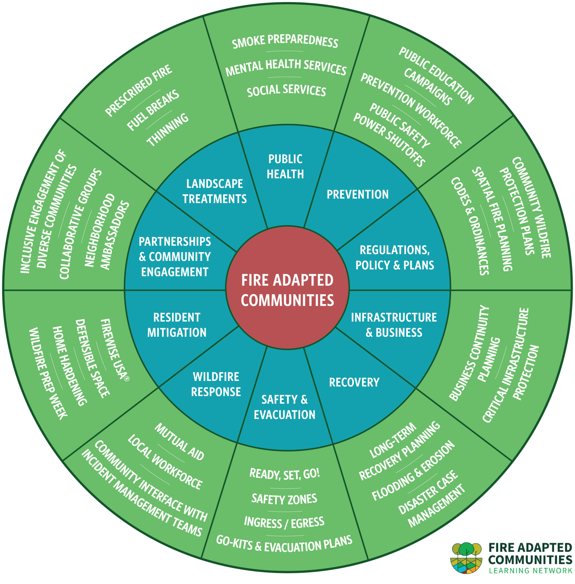
The FAC Wheel serves as the organizational foundation for developing a strategic statewide framework for community-focused fire adaptation and resilience. The blue inner ring displays the main framework components, while the green outer ring displays examples of specific programs or activities communities can engage in. The Wheel describes a set of components that make up community wildfire adaptation, but it should be noted that it is not a check-list or “one-size-fits-all” approach; every community’s journey to living better with fire is unique.
COMPONENTS
Prevention
Most wildfires begin with human-caused ignitions, and efforts are already in place to address and reduce these ignitions. For example, electric utilities play a significant role in ignition prevention, and public awareness campaigns can play major roles in prevention, among other efforts.
Actions:
- Action 2.11: Maintain Fire Prevention Grants.
- Action 2.21: Review Wildfire Mitigation Plans.
- Action 2.22: Coordinate Utility-Related Wildfire Mitigation Initiatives.
- Action 2.23: Expand United States Forest Service (USFS) Master Special Use Permits.
Other Efforts:
· CAL FIRE “One Less Spark” Campaign
· Fire Weather Watches and Red Flag Warnings
· OSFM Fireworks Program
· OSFM Wildfire Prevention Guides
· Public Safety Power Shutoffs
· Reducing Utility-Related Wildfire Risk: Utility Wildfire Mitigation Strategy and Roadmap for the Wildfire Safety Division
Resident Mitigation
Fire hazard mitigation in the residential context includes protecting both individual homes and properties, as well as overall neighborhood- or community-scale implementation, to reduce the risk of fire-related damage or loss caused by embers, radiant heat exposure and combustion, or direct flame contact.
Resident mitigation efforts include defensible space, home hardening, and fire-resistant landscaping and building materials, among others. It is important to note that these concepts are not unique to single-family homes, but also includes multi-family properties, manufactured homes, and other housing types, to ensure protection that spans the entire community.
Additionally, while the FAC framework does not include a “commercial mitigation” component, some concepts addressed under resident mitigation may also apply to infrastructure and businesses.
Actions:
- Action 2.19: Develop WUI Fire Safety Training Manual
- Action 3.8: Launch Catalyst Fund Forest Investments
- Action 3.9: Develop X-Prize for Wood Product Innovation
- Action 3.10: Address Feedstock Barriers through Pilot Projects
- Action 3.11: Develop Statewide Forest and Wood Products Workforce Assessment
- Action 3.12: Maintain and Develop Removal Incentives
Other Efforts:
· California Climate Insurance Working Group
· California Fire Safe Council
· California Wildfire Mitigation Program
· CAL FIRE County Coordinator Grant Program
· CDI “Safer from Wildfires” Initiative and Regulations
· Defensible Space Regulations
· Fire Aside ChipperDay Platform
· IBHS “Wildfire Prepared Home” Program
· Local Home Retrofit and Defensible Space Assistance Programs
· NFPA “Firewise Communities” Firewise USA® Recognition Program
Infrastructure & Business
Wildfires can affect a wide array of assets that are vital to a functioning community, including infrastructure and local businesses. This component of FAC is related to critical facility and infrastructure protection (e.g., hospitals, water infrastructure), along with business continuity, resilience, and the role of private businesses in addressing wildfire risk and supporting wildfire resilience.
Actions:
- Action 2.8: Develop Defensible Space and Home Hardening Curriculum
- Action 2.12: Extend Defensible Space Programs
- Action 2.13: Expand Assistance Programs
- Action 2.14: Increase Defensible Space Inspections
- Action 2.15: Improve Defensible Space Compliance
- Action 2.16: Create a Model Defensible Space Program
- Action 2.17: Expand Home Hardening Programs
- Action 2.18: Develop Home Hardening Guidance
- Action 2.20: Develop Insurance Memorandum of Understanding (MOU)
Other Efforts:
- FEMA Continuity Guidance Circular and Continuity Resource Toolkit
- Local Business Resiliency Initiatives
- NFPA 1600® Standard on Continuity, Emergency, and Crisis Management
- Planning and Investing for a Resilient California: A Guidebook for State Agencies
- PROTECT Program
Community & Regional Planning
Community and regional planning efforts provide an excellent opportunity for localities to reduce wildfire risk within their jurisdictions. Planning, at its foundation, is an articulation of how local or regional governments, residents, and other stakeholders want their communities to look, feel, and function in the future. In WUI areas, or any areas where there are wildfire-related concerns, community and regional planning can set a vision with actionable policies and programs for building resilience to wildfires.
Actions:
- Action 1.18: Develop Prescribed Fire Strategic Action Plan
- Action 1.29: Develop Network of Regional Forest and Community Fire Resilience Plans
- Action 1.36: Complete Timber Harvesting Plan Guidance Documents
- Action 2.4: Update the Fire Hazard Planning Technical Advisory
- Action 2.5: Develop WUI Best Practices Inventory
- Action 2.6: Develop Community Wildfire Protection Plan (CWPP) Best Practices Guide
- Action 2.21: Review Wildfire Mitigation Plans.
- Action 2.26: Assist with General Plans
- Action 4.1: Complete Applied Research Plans
Other Efforts:
- CAL FIRE Land Use Planning Program
- Climate Adaptation Plans
- Community Wildfire Protection Plans
- Fire Hazard Planning Technical Advisory
- General Plans
- Joint Powers Agreements
- Local Hazard Mitigation Plans
- Regional Forest and Fire Capacity Program
- Examples and Best Practices for California Communities
Landscape Treatment
Landscape treatments refer to a suite of measures that strategically manage fuel loads to reduce fire risk. Specifically, these measures can include conducting prescribed burns, developing fuel breaks, thinning roadside vegetation, and generally ensuring that forests, woodlands, or other highly vegetated areas are treated in a way that reduces the risk of wildfire ignition and spread.
Actions:
- Action 2.9: Develop and Maintain 500 Fuels Management Projects
- Action 2.10: Link with Landscape Scale Projects
- Action 2.25: Develop Framework for Safe Road Corridors
- Action 2.27: Expand Highway Treatments
- Action 2.28: Develop Good Neighbor Agreement
Other Efforts:
- CAL FIRE Forest Stewardship Program
- CAL FIRE Prescribed Fire Claims Fund Pilot Program
- CAL FIRE Vegetation Management Program
- CAL FIRE Wildfire Prevention Grants Program
- California Vegetation Treatment Program
- California’s Strategic Plan for Expanding the Use of Beneficial Fire
- Keepers of the Flame
- Roadmap to a Million Acres
Safety & Evacuation
The concepts of safety and evacuation are crucial components of FAC because there will always be some degree of risk—even if measures are taken to reduce risk and build resilience to wildfires, that risk will never be zero. The first and utmost priority when it comes to wildfire, or any hazard, is to protect and sustain human lives, and that could be reflected in pre-fire preparedness, wildfire safety programs and procedures, and robust evacuation planning and execution, among others.
Actions:
- Action 2.24: Identify Subdivision Secondary Emergency Access
- Action 2.25: Develop Framework for Safe Road Corridors
- Action 2.26: Assist with General Plans
- Action 2.27: Expand Highway Treatments
- Action 2.28: Develop Good Neighbor Agreement
- Action 2.29: Expand Messaging Campaign
Other Efforts
- Assembly Bill 747 (Levine, 2019)
- Assembly Bill 1409 (Levine, 2021)
- CAL FIRE Subdivision Review Program
- Medical Baseline Program
- Microgrid Incentive Program
- PG&E Backup Power Transfer Meter Program
- PG&E Portable Battery Program
- “Ready, Set, Go” Campaign
- Senate Bill 99 (Nielsen, 2019)
Public Health
Wildfire can affect people’s physical and mental/emotional health significantly. Perhaps most notably, smoke from wildfires can result in an array of human health impacts (e.g., respiratory issues). However, wildfires can also lead to water supply and soil contamination, along with a severe mental health toll caused by death or injuries to loved ones, property damage or loss, temporary or long-term displacement, and other impacts. A strategic framework for fire-adapted and resilient communities must consider and prioritize public health.
Actions:
- Action 1.39: Update Prescribed Fire Information Reporting System (PFIRS)
- Action 2.30: Launch Smoke Ready California Campaign
- Action 2.31: Release California Smoke Spotter App
- Action 2.32: Enhance Prescribed Fire Reporting
Other Efforts:
- California Smoke Blog
- Protection from Wildfire Smoke Standard
- Wildfire Smoke Clean Air Centers for Vulnerable Populations Incentive Pilot Program
- Wildfire Smoke: Considerations for California’s Public Health Officials
Recovery
The goal of disaster recovery is timely restoration, strengthening and revitalization of infrastructure, housing, and a suitable economy, as well as the health, social, cultural, historical, and environmental fabric of affected communities. In the context of fire, recovery refers to the comprehensive and coordinated process of both short-term actions that typically begin after a wildfire has been contained, as well as longer-term, ongoing actions that serve as steps towards rebuilding communities that have been impacted by wildfire. Wildfire recovery is intrinsically broad, as it touches on many different aspects of society and requires coordination between an array of actors.
Actions:
- Action 1.34: Develop Coordinated State Restoration Strategy
Other Efforts:
- California Community Foundation Wildfire Recovery Fund
- California Disaster Assistance Act
- California Disaster Recovery Framework
- California Wildfire Fund
- Consolidated Debris Removal Program
- EDA Economic Adjustment Assistance Program
- FEMA Public Assistance and Individual Assistance
- Fire Victim Trust
- HUD Community Development Block Grant Programs
- USDA Disaster Assistance Programs
Fire Adapted Communities is really about the intersection of people, fire, and place.
– Michelle Medley-Daniel, Fire Networks Co-Director
Guiding Principles
-
- Recognize that climate change, along with decades of suppression-dominated solutions, is increasing the severity and scale of catastrophic wildfires that threaten the health and safety of our people and lands. We must take decisive and potentially disruptive actions to change our course to realize our vision for a fire adapted future and build sustained resilience in the years and decades to come.
-
- Redefine our understanding of and relationship to fire as a natural and indigenous element in the landscape that must be understood, respected, and managed safely through increased education, partnerships, and cross-sectoral engagement with Indigenous, Tribal, and scientific and advocacy communities.
-
- Use holistic, equitable, and community-centered approaches that empower local action and build resilience at all scales, in partnership with and support from public and private entities.
-
- Engage and build community capacity to reduce risks to public health, safety, and property.
-
- Recognize the connections between healthy and vibrant landscapes and community resilience and broaden community education and support for the use of beneficial fire and other landscape management techniques.
“The Task Force is shining a light on some very complicated issues. We’re creating a vision for what adaptation means, and that needs be locally driven.”
– Yana Valachovic, UC Cooperative Extension
PROGRESS METRICS
Progress On Task Force Fire Adapted Communities Key Actions
The table below shows Key Actions for California’s Wildfire & Forest Resilience Action Plan that are assigned to the Fire Adapted Communities Workgroup. Sort by status to see level of progress completion.
Fuel Reduction Treatment Trackers
“There are lots of valid pathways to living better with fire, and Fire Adapted Communities is about articulating those and helping those communities enact those visions.”
– Michelle Medley-Daniel, Fire Networks Co-Director
TASK FORCE MEETING PRESENTATIONS
On December 15 the Task Force met in Sacramento for its final quarterly meeting of 2023. The primary focus was on Fire Adapted Communities. Below are several presentations that provide comprehensive and current overviews of the state of community adaptation.
California’s Progress on Empowering Community Adaptation: Daniel Berlant from CAL FIRE and CA Fire Safe Council’s Jacy Hyde shared updates on how both statewide programs and local communities are building adaptive capacity and improving wildfire outcomes.
California’s Roadmap for Creating Fire Adapted Communities: Two members of the Task Force’s Fire Adapted Communities Work Group — Steve Hawks from CAL FIRE and Erik de Kok, representing Ascent Environmental — shared updates on the Work Group’s recently completed Baseline Assessment and next steps in developing a statewide roadmap for community fire adaptation.
Regional Leaders’ Perspective on Community Resilience to Fire: In a panel moderated by Molly Mowery of Community Wildfire Planning Center, regional leaders from across the state discussed pressing issues communities are facing to better adapt to fire, and the best ways state and federal institutions can support progress at the community level.
FIRE ADAPTED COMMUNITIES WORK GROUP
On the FAC Work Group page you’ll find additional news and updates along with resources, Work Group leadership and Partners.
2023 Year in Review
Thank you for being interested and involved in wildfire and landscape resilience efforts in California. Here’s a brief review of 2023 and a preview of what's ahead in 2024. The Task Force Team wishes you and your families a safe, happy and healthy 2024.
2023 highlights
Regional Resource Kits Finalized
Regional Profiles and Regional Resource Kits are now available for all four regions of California. The kits bring together the scientific data needed to help regional entities plan, prioritize and monitor projects.
Treatment Dashboard Launched
The Wildfire & Landscape Resilience Interagency Treatment Dashboard is a highly interactive online tool that displays the location and size of wildfire and landscape resilience treatments throughout the state, helping to guide practitioners on where to plan new projects.
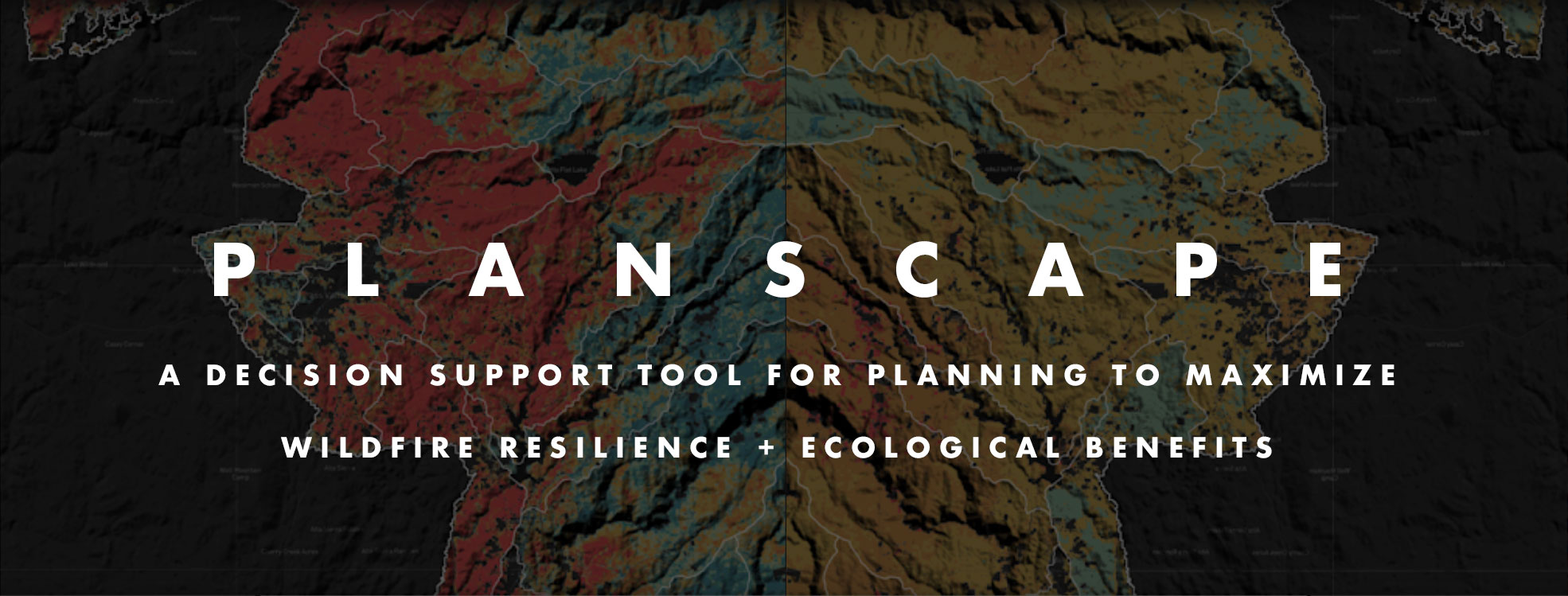
Planscape Beta Available
With a full launch expected in 2024, Planscape can be accessed now to test the early functionality and share feedback. This unique wildfire resilience decision support tool helps regional planners prioritize landscape treatments to mitigate fire risk, maximize ecological benefits, and help landscapes adapt to climate change.
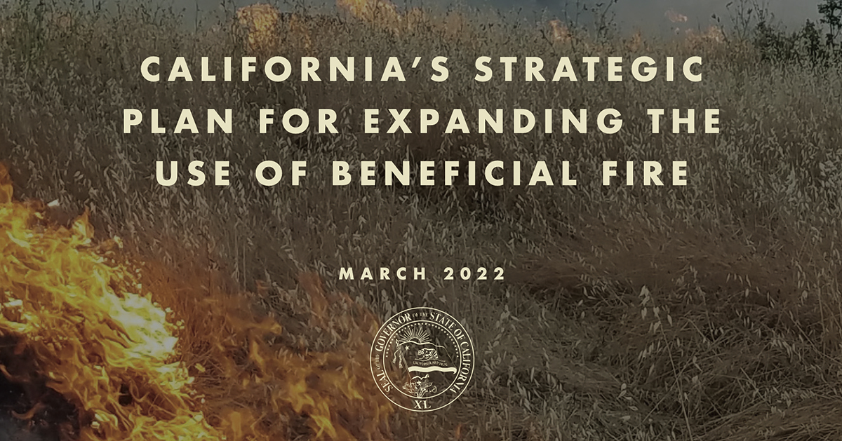
Joint Strategies Completed for Beneficial Fire and Sustainable Outdoor Recreation
Task Force Work Groups completed and launched their Joint Strategies as required in California’s Wildfire & Forest Resilience Action Plan. Click below to see them, and look forward to Reforestation Pipeline, Resilient State Lands and Private Landowner strategies to be published in early 2024.
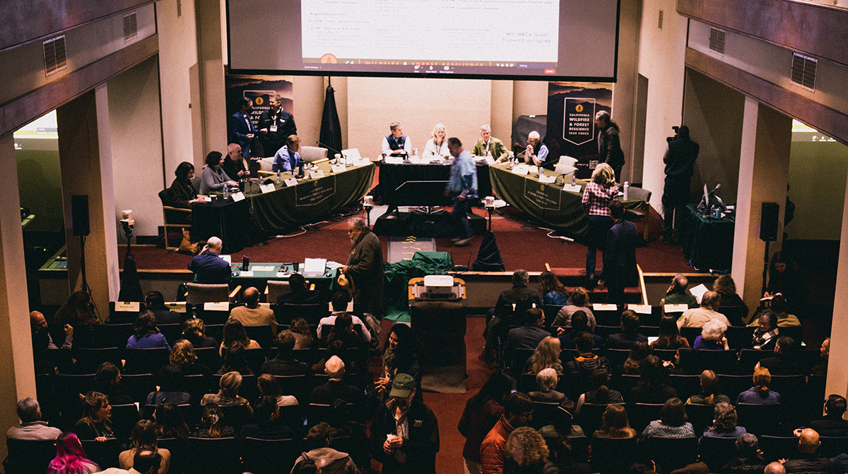
Regional Meetings in Southern, Central and Northern California
There’s no better way to align resources than bringing people together to focus on regionally specific issues. Three regional meetings were held in 2023, and three more in Sacramento. Hundreds of people came away from the meetings having learned new information, and having made new connections, and inspired to make positive change.
spread the word in 2024
Promote the Task Force in Your Communications
The Task Force is an important source of vital information on the combined efforts of those involved in landscape resilience and wildfire prevention in California. Please follow and share Task Force communications when you can.
Join us at our Upcoming Meetings
April 4-5: Southern CA Region
June 20: Sacramento
September 26-27: Sierra Region
December 13: Sacramento
RESOURCES
ABOUT THE TASK FORCE
The California Wildfire & Forest Resilience Task Force was created by the Office of Governor Gavin Newsom to directly confront the near perfect storm of climatic and human-caused conditions that have brought the threat of devastating wildfire and its far-reaching effects to the doorstep of nearly everyone in our state, and beyond.
The Task Force is a collaborative effort to align the activities of federal, state, local, public, private, and tribal organizations to support programs and projects tailored to the priorities and risks of each region and bring the best available science to forest management and community protection efforts.
The critical work of the Task Force effects all Californians, and Task Force meetings offer an ideal opportunity for members of the press to hear directly from those involved in the comprehensive, coordinated efforts to reduce the risk of catastrophic wildfires and create safe communities while ensuring healthier, more sustainable natural environments.