

Climate Catalyst Fund
Climate Catalyst Fund
Department: IBank
Program Description: Businesses in the forestry sector face real challenges raising capital in the private lending market. Creating lower-interest loans removes a major market barrier and expands critical businesses in this sector from micro-mills to masticators to innovative wood and energy products. The Climate Catalyst Fund was established with early action funds in 2020-21 to help jumpstart private sector equipment using wood and woody material removed from forests for wildfire resilience.
Program Impact: Capital was provided in the fall of 2021, along with a crucial legislative change to enable IBank to receive the funds appropriated in 2020-21 and 2021-22. The program was then formally launched in January 2022 and is actively looking at transactions. IBank’s Catalyst Fund team is in advanced lending discussions with six project developers, each one of which is bringing significant private capital to the transaction alongside the state’s investment. Because of the presences of these outside investors, each project negotiation exhibits its own particular complexities – these deals take time, certainly more so than grant allocations do. In addition to Catalyst Fund activity, IBank is working alongside CAL FIRE to support the agency’s financing of projects in the biomass utilization sector, and is leveraging its small business loan guarantee program to encourage community-scale lenders to invest in this sector. IBank continues to support market growth by utilizing other state and federal funding mechanisms where individual transactions allow, and by connecting businesses, NGOs, and public entities in this sector to IBANK’s broader network of financing resources.
Resilience in Action: With the combination of appropriated funding and legislative authorization for IBank to receive and deploy capital, IBank leadership was able to seek and ultimately receive IBank Board approval to launch the program in January 2022. In 2022, , IBank received more than 40 expressions of interest in receiving loans or guarantees from the Climate Catalyst Fund. The IBank staff is currently reviewing expressions of interest, working with entities across the state to support the advancement of projects, and engaging third-party capital partners to further leverage state dollars.
RESOURCES

Urban and Community Forestry
Urban and Community Forestry
Department: CAL FIRE
Program Description: The Urban and Community Forestry Program leads the effort to expand urban forests in California. From mitigating extreme heat, reducing greenhouse gasses, and improving local air, soil, and water quality, to providing an environment better for mental and physical health and wellbeing, trees improve the quality of life in urban environments where 95% of Californians live. Urban forests are crucial for community resilience and the UCF Program helps create more sustainable urban forests by planting trees, improving regional and local policies, building partnerships, expanding the tree care industry workforce, and supporting education and outreach. The program offers grants for several urban forestry related purposes including urban tree canopy expansion, improved urban forest management, education and workforce development, creating healthier and more natural schoolyards, and urban wood and biomass utilization. There is a very strong emphasis on serving disadvantaged communities, as they are nearly always the communities with the lowest canopy cover and fewest urban forest resources.
Program Impact: With the wildfire resilience funding, the Urban and Community Forestry Program awarded 40 new grants (2021-22-grant-awards_web.pdf (ca.gov)), which will plant more than 37,000 trees, reduce greenhouse gases by nearly 173,000 metric tons annually, and provide workforce development by training, educating, and/or assisting in job placement for more than 1,000 individuals in urban forestry programs. An overview of the Urban and Community Forestry Program grants program is available at, Urban and Community Forestry Grant Programs (ca.gov).
Resilience in Action: The Oakland based non-profit, Planting Justice developed partnerships with the City of Oakland, Alameda County, University of California Davis, and the City of Sacramento for an Urban Forestry Education and Workforce Development grant with total project funding of nearly $3 million (grant funding of $1,453,495; matching $1,458,995). The project is focused on training, education, and job placement for formerly incarcerated and at-risk individuals from black, indigenous and people of color populations to work in urban nursery production. The grant allows Planting Justice to hire and train 15 additional staff for established programs and expand its service area from Alameda County to include a satellite facility in the Sacramento region. This project builds on the $28 million Transformative Climate Communities grant in east Oakland which produced a multitude of community benefits as documented in the “Going Deep” video presented at the Catalyst Conference February 2023.
Keta Price presenting “Going Deep” documentary
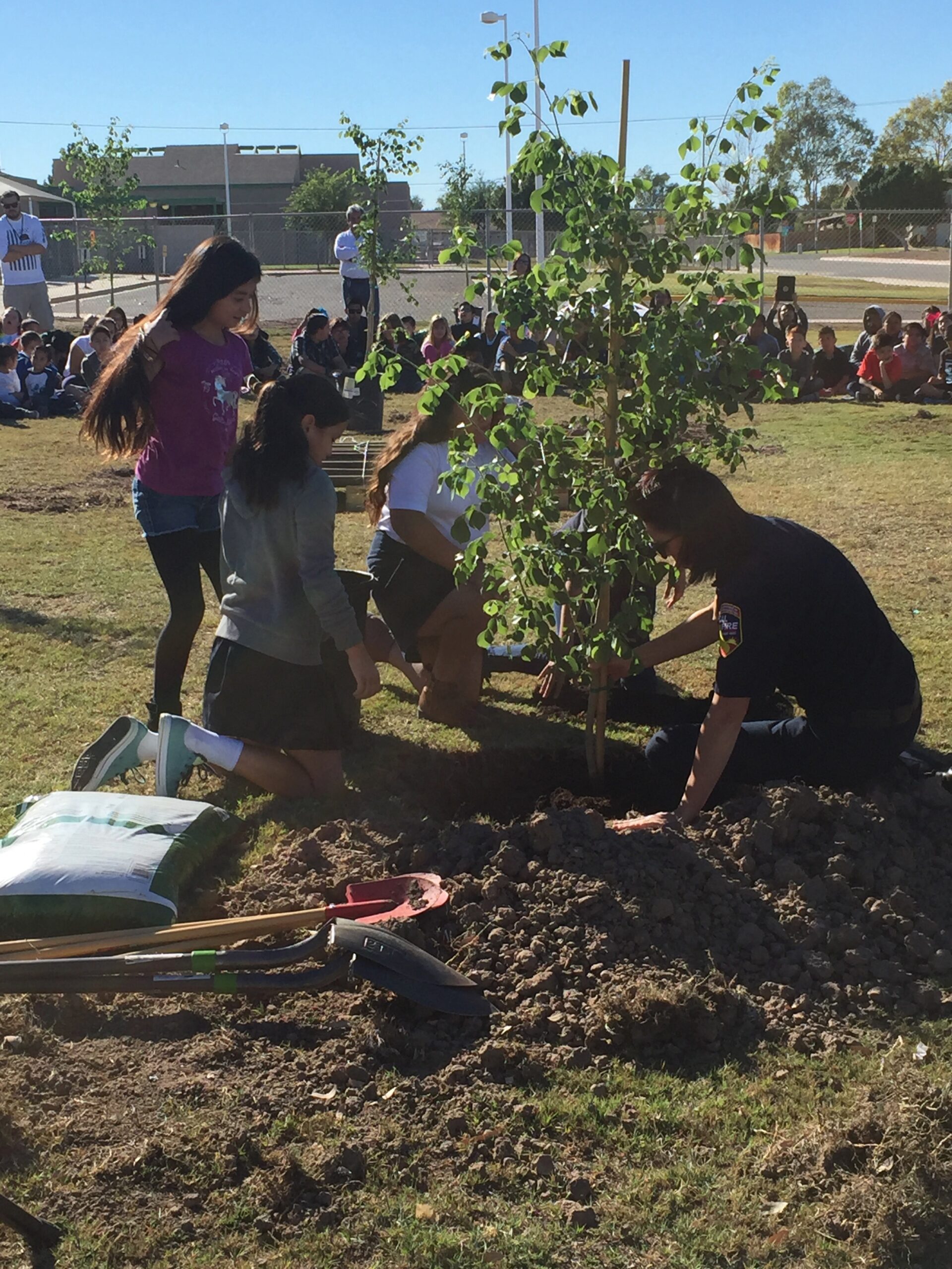
CAL FIRE Urban Forester plants trees with students during a community event.
RESOURCES
Program Social Media:
- Arbor Week Poster Contest Winners
- Arbor Week, Tree City
- Arbor Week, Urban Forests
- Happy Arbor Day, California
- CAL FIRE – CAL FIRE’s Urban and Community Forestry grants … | Facebook
- Pre- and Post-Storm Tree Care Tips with CAL FIRE’s Urban and Community Forestry Program | With major storms hitting California, you may have seen fallen or damaged trees in your neighborhood or on your property. Major storms and high winds can … | By CAL FIRE | Facebook
- CAL FIRE – This future forest is actually a nursery that … | Facebook
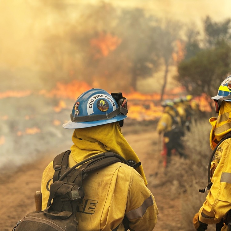
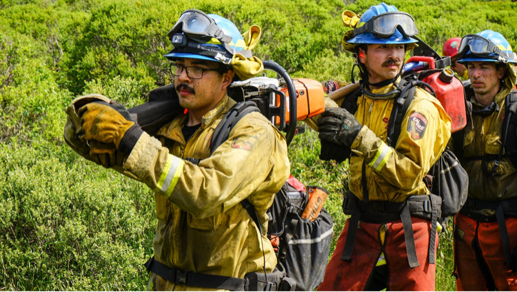
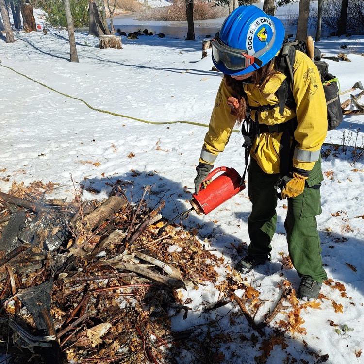
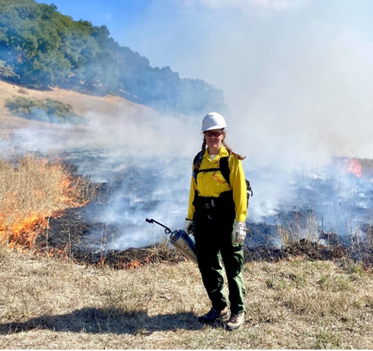
Fire Crews
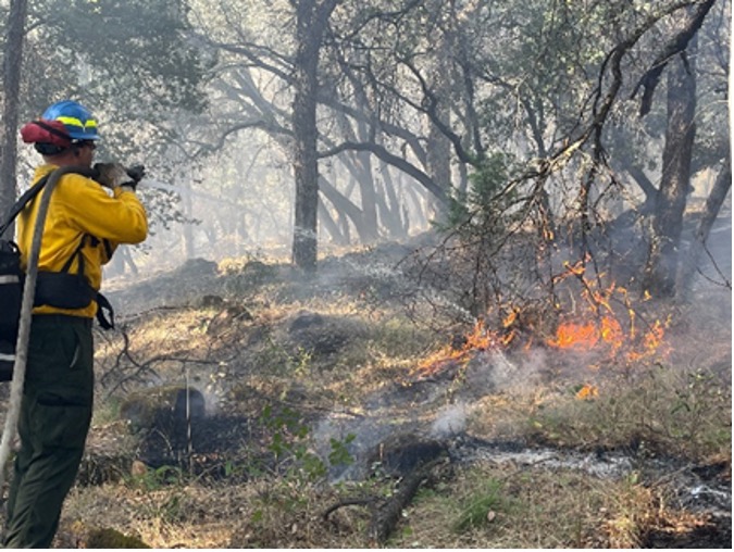
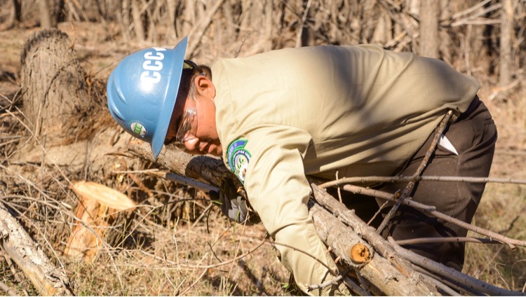
Fire Crews
Department: California Conservation Corps
Program Description: The California Conservation Corps operates more than two dozen wildland firefighting hand crews. These fire hand crews operate at 15 CCC locations across California. The CCC partners with CAL FIRE, U.S. Forest Service, Bureau of Land Management, and National Parks Service to provide hand crews to fight and prevent wildland fires throughout the state.
In 2021, the Legislature and administration approved funding for 8 permanent (“year-round”) and 6 seasonal CCC-CAL FIRE crews. This partnership addresses the state’s need for increased firefighting capacity and workforce development. The effect is two-fold: in the off season, greater fuels work is completed; and during fire season, there are more crews for fire and emergency response. Altogether, these crews work toward decreasing the impact of, if not preventing, catastrophic wildfires.
Program Impact:
In 2021, and per the Fire Resiliency package, the CCC onboarded the following fire crews:
Year-round: Delta (2), Tahoe (2), Los Piños (2)
Seasonal: Fortuna (1), Monterey (Watsonville) (1), Pomona (1), Redding (1), San Diego (1), and Ukiah/Willits (1)
In 2022, and per the Fire Resiliency package, the CCC funded the following fire crews:
Year-round: Los Piños (2*), Ukiah/Willits (2*), Monterey (Watsonville) (1), Pomona (1), San Diego (1), and Fresno (1)
Seasonal: Fortuna (1) and Redding (1)
*The second Ukiah/Willits crew and the two Los Piños crews have been delayed and are expected to be fully implemented in the spring of 2023.
Resilience in Action:
- Between July 1, 2021, and December 31, 2021, the CCC had 46 Corpsmembers transition out of the CCC into jobs related to fire, forestry, or arborist-related careers.
- 2021 – Together, these 12 crews went on 260 dispatches to a total of 166 incidents. They were assigned to these incidents for an aggregated 1,121 days. Corpsmembers from these crews had 191,071 emergency project hours. This does not count hours that were not invoiced (e.g., several single day fires that were extinguished within the regular workday).
- 2022 – Together, the seven crews funded in 2022 went on 85 dispatches to a total of 66 incidents, so far in the current fiscal year. They were assigned to these incidents for an aggregated 253 days. Corpsmembers from these crews have 46,482 emergency project hours.
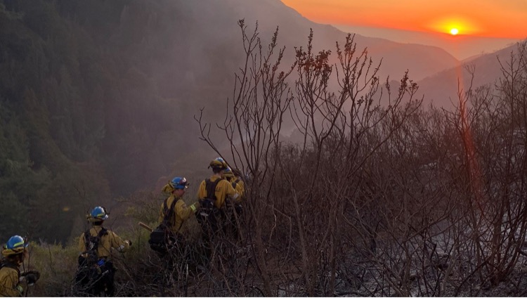
Tahoe crews 1 and 2 work to contain the Colorado Fire in Monterey County as the sun sets on the Pacific in January 2022.
Corpsmembers with San Diego 4 keep a close eye on a controlled burn during training.
Corpsmembers from Monterey Bay 1 fire crew prepare for their next task following a line cut during the annual readiness exercise.
A Corpsmember with Pomona 1 fire crew uses a drip torch during a burn pile project in San Bernardino County.
Workforce Training
Workforce Training
Department: CAL FIRE
Program Description: CAL FIRE offers grant funding through its Workforce Development Grant program to applicants seeking to increase California’s workforce capacity in the fields of logging, fuels treatment, forest sector transportation, forest sector manufacturing, or other forest sector support services. Research and Development ancillary to the workforce development topics discussed may also be funded.
Program Impact: CAL FIRE has 20 grant agreements totaling $38 million with partners who are doing workforce training. These programs are offering training to 1,200+ participants annually in forest-sector fields including prescribed fire, forestry, firefighting, heavy equipment and logging operations, teacher education, and peer-to-peer business learning. Students leave these programs with qualifications that range from college degrees to fellowships, certificates, mentoring, and apprentice work experience. CAL FIRE is currently soliciting additional projects and has received broad interest in furthering workforce development training in forest-sector fields.
Resilience in Action: The Forestry and Fire Recruitment Program (FFRP) is a 510(c)(3) that provides career support to those who have been in, or are returning home from, California’s Conservation Camps (i.e., “Fire Camp”) and are interested in careers in the wildland and/or forestry sector. Their mission is to increase wildfire personnel from non-traditional and underrepresented communities, providing then with the training, skills, resources, and experiences needed to secure gainful, living-wage employment while providing immediate fire prevention services throughout California.
RESOURCES
Workforce Development (Forestry Corps Crews)
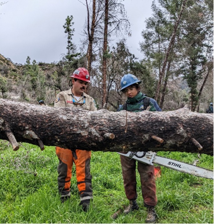
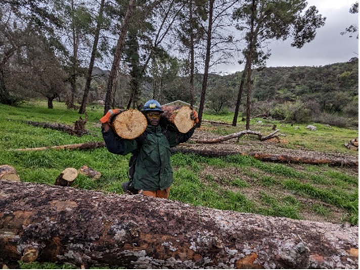
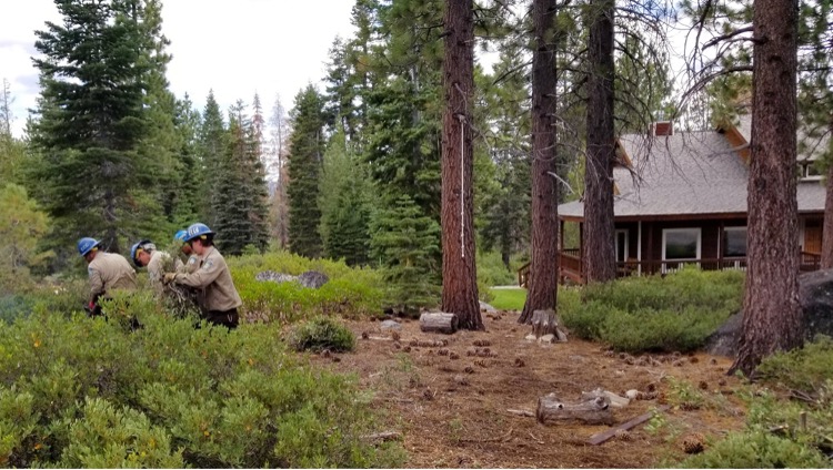
Workforce Development (Forestry Corps Crews)
Department: California Conservation Corps
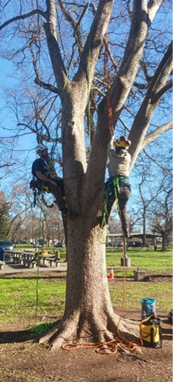
Program Description: The California Conservation Corps Forestry Corps program trains youth in a year-long program in forest resilience. Often recruiting from lower income or vulnerable communities, these young men and women sign up for a year of service and training. These fuel reduction crews assist local departments, cities, counties in completing priority fuel reduction projects to reduce wildfire risk in fire-threatened areas. Often elbow-deep in poison oak and working in long-hot conditions, Forestry Corpsmembers remove hazardous fuels to reduce wildfire risk and re-plants trees to recover after a fire, while gaining valuable work experience in the climate and green industries.
Program Impact: The Pomona Forestry Corps has contributed greatly to the mitigation of wildfire with their fuel reduction and fire recovery projects. Santa Fe Dam’s nature center had an issue with overgrown pepper trees that could serve as ladder fuels, so the Pomona crew significantly reduced the fuel load on two acres of land. William S. Hart Park in Hollywood had a similar issue with oak trees and oleander before the Forestry Corps arrived and brushed another two acres of overgrowth. The Pomona crew assisted Big Basin State Park to reopen after the CZU Lightning Complex Fire by cutting and brushing along 20 miles of trail. Most recently, the crew has been reducing the amount of hazard trees and ladder fuels at Monrovia Canyon Park in the burn scar of the 2020 Bobcat fire. All Forestry Corps members have been trained in using chainsaws and most have completed S-212 training through CALFIRE BDU. There are plans for Forestry Corpsmembers to receive additional training from CALFIRE, including CALFIRE Hazmat First Responder Operational and 1C. Five Corpsmembers have transitioned into the center’s fire crew so far; one Corpsmember received arborist training; and two Corpsmembers have been selected for Hotshot crews in California ahead of this fire season. Pomona Forestry Corps has allowed Corpsmembers to have an impact across the state and prepared them for fruitful careers in fire and forestry.
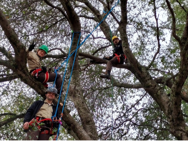
The Chico Forestry crew has been hard at to work in both the classroom and out on projects. Many Corpsmembers have completed a five-week utility arborist training through our building partnership with Butte College; to date, this course has been taught twice. The crew also has been able to receive Basic CALFIRE fire training on two separate occasions. This has enabled the crew to take part in planned prescribed fire incidents on the Big Chico Creek Ecological Reserve (BCCER) and in Chico’s Upper Bidwell Park. The Big Chico Ecological Reserve is our Forestry Crew’s main project partner. We have completed many project hours reducing fire hazard fuels and invasive plant species on the Reserve. The crew is currently conducting two spikes in the Big Basin State Park completing fuels work.
The Greenwood CCC Forestry Corps has treated more than 200 acres and removed more than 317 trees since July 2022 on projects at Greenwood, Tahoe, and Pollock Pines. During the summer, the crew was also assigned to several fires including the McKinney Fire, Mill Fire, Mountain Fire, Barnes Fire, and Mosquito Fire. They have also participated in several trainings including the CALFIRE 1C fire training, chipper safety training, flood training, basic chainsaw training, beginner tree climbing training, and basic and intermediate faller training. Most of the crew will be completing their Forestry Certificate from Lake Tahoe Community College in June 2023.
To further expand the California Natural Resources Agency’s core commitments to embedding equity, environmental justice, and tribal affairs, aGreenwood Forestry Corpsmember served as the first CCC Equity Corpsmember (CCC-ECM) to support the development of a policy white paper on providing inclusive language in our Agency’s operations, practices, and procedures.
Resilience in Action:
Chico Forestry Corps:
The utility line arborist training the Crewmembers received through Butte College is invaluable and opened pathways for employment with tree companies. The Corpsmembers who attended received Certificates of Training in OSHA-10, certified flagger, Electrical Hazard Awareness Program, and aerial rescue.
To further expand the California Natural Resources Agency’s core commitments to embedding equity, environmental justice, and tribal affairs in all that we do, Alex Lima (Greenwood Forestry Corpsmember) served as the first CCC Equity Corpsmember (CCC-ECM) to support the development of a policy white paper on providing inclusive language in our Agency’s operations, practices, and procedures. Alex also supported the Assistant Secretary for Equity and Environmental Justice, the assistant Secretary for Tribal Affairs, and the Office of the Secretary in their efforts to further embed equity across the Agency, including but not limited to, supporting existing roundtables, and the relevant tribal affairs work stemming from the CA Advisory Committee on Geographic Names outside from his main projects, Alex also:
- Provided Language support to Secretary Wade Crowfoot for his 2022 CalFire Silver Medal/ Gold Medal award presentation speeches
- Organized technical changes to CNRA agencies/Equity action plans
- Created initial web map outline for CRNA Equity and Environmental Justice home web page
- Edited short films to support Latino Heritage Month career day and the Secretary Crowfoot Speaker series
Pomona Forestry Corps:
Monrovia Canyon Park before Pomona Forestry Corps set to work.
A corpsmember hauls two rounds, trying to keep up with sawyers cutting trees into moveable sizes.
A Crew Leader explains tension and compression to a Corpsmember.
Chico Forestry Corps:
The utility line arborist training the Crewmembers received through Butte College is invaluable and opened pathways for employment with tree companies. The Corpsmembers who attended received Certificates of Training in OSHA-10, certified flagger, Electrical Hazard Awareness Program, and aerial rescue.
A Corpsmember holding line at a prescribed fire incident.
A Corpsmember performing an aerial rescue during the arborist training.
Tahoe (at Greenwood) Forestry Corps:
Greenwood Forestry Corpsmembers in a tree during beginner arbor training.
The CCC also runs six additional Forestry Corps crews which were not part of the 2021 Wildfire Package. Below are additional examples of projects such crews have completed across the state.
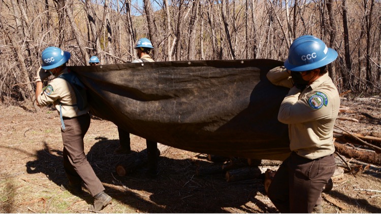
Inland Empire Forestry Corps Corpsmembers haul dead vegetation away in a tarp during project work in San Bernardino County.
Inland Empire Corpsmember Deciderio Gallegos hauls downed tree limbs during a fuel reduction project in San Bernardino County.
Tahoe Forestry Corps Corpsmembers Remove Fire Fuel Near Homes in South Lake Tahoe Near Echo Summit
Land Use Planning and Public Education Outreach
Land Use Planning and Public Education Outreach
Department: University of California Agriculture and Natural Resources (UC ANR)
Program Description: UC ANR’s Fire Resilience Program aims to build community fire adaptation and resilience throughout California to save lives and protect forests, agriculture, food, and other vital resources. The program provides a point of connection for landowners, agencies, local governments, and community members to work together toward fire resilience. By having UC ANR advisors focusing on wildfire, this new team helps to enhance community wildfire planning, daylight best practices on community and state levels, and build community fire adaptation and resiliency throughout California.
The University of California Cooperative Extension (UCCE) has deployed a new team of fire professionals to help California’s communities adapt and become more resilient to wildfires. This team works with California residents, landowners, agencies, local governments, tribes, and other organizations to reduce California’s vulnerability to wildfires.
The advisors are conducting community-based research and outreach, translating research findings into public-facing materials, and conducting outreach to meet the needs of the local community. The program coordinator supports the new advisor and the existing Cooperative Extension advisor network to amplify and organize the teams for effective delivery and program evaluation.
Program Impact: These new fire advisors, the program coordinator, and the existing network of UC ANR advisors and specialists are working to:
- Enhance the use of prescribed fire to reduce fuels, restore ecosystem function, improve forest and rangeland habitats
- Develop best management practices for fuel reduction to improve treatment efficacy and reduce ecosystem impacts
- Incorporate home hardening techniques to build and retrofit homes for wildfire resilience
- Incorporate defensible space standards to reduce near-home fire vulnerabilities
- Engage with local planners to promote wildfire resiliency and best management practices.
Success stories: The current team of advisors is working on many fronts. The three stories below illustrate impacts.
- The team is working locally to build community capacity around prescribed fire by providing workshops and hands-on, live-fire trainings and supporting and formalizing Prescribed Burn Associations (PBAs). Team members work regionally and across the state to support policy development for prescribed fire. The team is also conducting prescribed fire research to provide fact-based evidence for the restoration and management of fire-adapted landscapes.
- Fuel reduction is essential for protecting communities and restoring fire-adapted ecosystems. The Fire Team provides workshops to help landowners learn how to apply science-based management practices, find contractors, permit projects, and secure funding for non-commercial fuel reduction. Additionally, team members are working on testing treatment alternatives and understanding cost comparisons in different ecosystem types.
Permitting fuel reduction projects can be challenging. Yana Valachovic and colleagues published a guide to help landowners and project proponents navigate CEQA. The publication scales from single-property projects to community-scale, multi-jurisdiction forest fuel reduction projects. This publication has been widely utilized by state agencies, community groups, and land management consultants. See Valachovic et al. (2022) Planning and permitting forest fuel-reduction projects on private lands in California. UC ANR Publication 8716. https://anrcatalog.ucanr.edu/pdf/8716.pdf.
- Education is a cornerstone of the team’s efforts. They work with California residents, landowners, agencies, local governments, tribes, and other organizations to reduce California’s vulnerability to wildfires through one-on-one consultations and educational events. During 2022 the team delivered 47 home-hardening talks, had 60 media posts, and reached 25,097 people through these combined activities. Additionally, the team provided 15 training workshops and reached 8,864 people through these virtual and in-person events.
Fire advisor, Luca Carmingini, is testing the effects of irrigation on plant flammability at the UC South Coast Research Extension Center.
Fire advisor, Barbara Satink Wolfson, has been working with community members and the Central Coast Prescribed Burn Association to help increase opportunities for prescribed fire.
Yana Valachovic, Forest advisor, has been working with the Insurance Institute for Business and Home Safety on experiments to better understand how different building products, such as tempered glass windows, perform when exposed to fire from an adjacent building or near landscaping.
RESOURCES
Program Social Media Link:
The following social media handles share stories of UC ANR projects and activities.
https://www.facebook.com/ucanr/
https://www.instagram.com/ucanr/?hl=en

Land Use Planning Program
Land Use Planning Program
Department: CAL FIRE
Program Description: CAL FIRE’s Land Use Planning Program assists local governments (cities and counties) throughout California as they address the risk from wildfire by planning for both existing and new development.
Program staff work with local governments and CAL FIRE Units on topics ranging from Safety Elements of General Plans, development of Community Wildfire Protection Plans (CWPP), State/Local Hazard Mitigation Plans (SHMP/LHMP), Subdivision Review identifying communities at risk and providing recommendations on fire safety via Assembly Bill 2911 (Friedman, 2018), and assist communities to become recognized through the National Fire Protection Association’s Firewise USA program. The CAL FIRE Land Use Planning Program resulted from Senate Bill 1241 (Kehoe, 2012).
The Office of the State Fire Marshal is partnering with the UC extension program and will deploy land use planners within critical cities and counties to support their wildfire preparedness activities and emergency plans.
Program Impact: The Wildfire and Forest Resilience funding augmented staffing to provide local technical assistance in community wildfire mitigation and land use planning. These staff helped increase the number of communities surveyed through the AB-2911 Subdivision Review Program. Additionally, these staff will assist CAL FIRE with the rollout of the new fire hazard severity zone maps to the counties with the SRA and cities with moderate, high, and very high fire hazard severity zones in the LRA.
Resilience in Action: The CAL FIRE Land Use Planning Program works with 56 counties in the SRA and 189 cities within the LRA with development of their Safety Element which includes policies, goals, and objectives that protect the communities from the risk of wildfire. The Safety Element of the General Plan will also link (attach or reference) other planning documents such as CWPPs and LHMPs as needed. Since the inception of the program, more than 150 safety elements have been successfully updated through collaboration with our program. Additionally, California has nearly 650 Firewise USA recognized communities throughout the State. This program has nearly doubled the number of communities in the last couple years leaving CA number one leader in the nation. The Firewise program is a community volunteer-based program that outlines the efforts of the community members to organize and prepare for wildfire.
RESOURCES
Defensible Space Inspectors
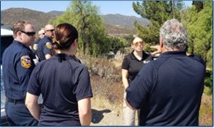
Defensible Space Inspectors
Department: CAL FIRE
Program Description: Defensible space coupled with home hardening is essential to improve a home’s chance of surviving a wildfire. By removing flammable vegetation and material around a home, defensible space provides a safe space for firefighters to defend a home and reduces direct flame and heat on a home during a fire. The CAL FIRE Defensible Space Inspection Program has been in place for more than 60 years.
Inspectors not only enforce California’s defensible space rules, but the inspectors also work with residents to help them understand what specific steps they need to take to create defensible space for their home. Wildfire resilience funding is essential to the program and adds inspectors to CAL FIRE’s base program of nearly 95 Defensible Space Inspectors for 3 months each fiscal year.
Program Impact: In 2022, the legislature tasked the Board of Forestry to enhance and deploy the defensible space laws to include the new ember-resistance zone within the first 5 feet immediately surrounding the home.
Outreach and education to homeowners about these new standards has been crucial to helping homeowners implement the new requirements on their property. With the importance of defensible space inspections and home hardening assessments increasing, this funding allows CAL FIRE to hire each Defensible Space Inspector for a full 9-months, the maximum amount allowed for a temporary help Forestry Aide position. Coupled with other funding, CAL FIRE has added an additional 24 permanent Forestry Technicians and 28 Limited-term Forestry Aide positions to the field.
Resilience in Action: Statistics showed that during the 2022 Oak fire in Mariposa County, homes which were compliant with defensible space standards were 6 times more likely to survive an advancing wildfire. CAL FIRE inspected 83,714 homes for defensible space in 2021 and 194,176 in 2022. This number is a great representation of what additional resources can accomplish. By working the seasonal Defensible Space Inspectors for a full 9-months and adding permanent staff, CAL FIRE more than doubled the properties inspected. This engagement with homeowners gives them the opportunity to learn about the importance of defensible space and home hardening, and how to implement those mitigation strategies for their particular property. It also allows the property owner to ask a fire professional about other wildfire preparedness measures to take. It cannot be underestimated how important it is to have one-on-one in person collaboration between the property owner and the Defensible Space Inspector.
CAL FIRE Defensible Space Inspectors discussing defensible space and home hardening with homeowner.
RESOURCES
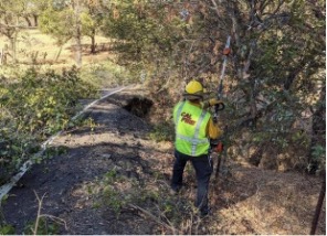
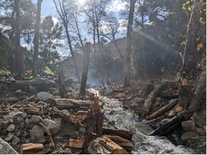
CAL FIRE Unit Fire Prevention Projects
CAL FIRE Unit Fire Prevention Projects
Department: CAL FIRE
Program Description: Building on the success of past fuel reduction work, CAL FIRE continues working on strategically located fuel reduction projects in high wildfire prone communities throughout the State. New projects are started as soon as other projects are complete. CAL FIRE resources are committed to these projects that are vital to slow the spread of fires and provide anchor points for firefighters to implement suppression actions. Using the 2018 Strategic Fire Plan to guide CAL FIRE unit and contract counties, specific fuel reduction projects are formulated into a plan and implemented using the Unit Fire Prevention Projects funding.
Program Impact: These strategic fuel breaks and reduction in hazardous fuels reduce the severity of wildfires, while reducing the fire risk to vulnerable communities. Fuel breaks enable firefighters to approach a fire, take a stand, establish containment lines, and create safer evacuation routes for the public.
Resilience in Action: In 2022 the Santa Barbara County Fire Department completed 1,011 acres of fuel reduction as part of this program. This was accomplished through three projects including 969 acres of broadcast burning on the Spaulding-Midland project, a 30 acres of right-of-way clearance on the Alisal Road Project, and 12 acres of pile burning on the Painted Cave Community Defensible Space Project.
Electra Fire: Pine Acres Fuel Break is a 180-acre fuel break in the 2,544-acre Pine Acres VMP. Located near Jackson on the north rim of the Mokelumne River which divides Amador and Calaveras counties. The fuel break was initially completed in 2003-2004 as a 300-foot wide shaded fuel break and then was developed into a Vegetation Management Plan in 2005. It was maintained and improved again in both 2006 and 2011. It was expanded and maintained again in 2015 and 2019. The primary goal of the project was to create a shaded fuel break intended to support fire suppression and structure defense operations in the event of a wildfire coming out of the Mokelumne River Canyon. On the first four days of the 2015 Butte Fire it did just that. Due to recent maintenance in 2021, it once again was able to be used to stop the fire from progressing into the communities during the 2022 Electra Fire.
Lake Shastina Fuel Break
RESOURCES
Home Hardening Assistance
Home Hardening Assistance
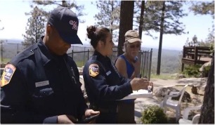
Department: CAL FIRE/OES
Program Description: California is developing the first home hardening assistance program, designed to help low-income high fire risk communities, collectively achieve home hardening and defensible space. The program is currently funded 75 percent through FEMA Hazard Mitigation Grant Program funds and matched 25 percent with state appropriated funds.
Assembly Bill 38, (Wood, 2019) directed the Office of Emergency Services (Cal OES) to enter into a joint powers agreement (JPA) with the Department of Forestry and Fire Protection (CAL FIRE) to develop and administer the California Wildfire Mitigation Program. The program is designed to encourage cost-effective structure hardening and retrofitting and facilitate vegetation management, the creation and maintenance of defensible space, and other fuel modification activities. The legislation directed the JPA to develop criteria and a scoring methodology to prioritize financial assistance to areas and community based on vulnerability to fire, the impact of future climate risk and factors that lead some populations to experience a greater risk to wildfire, adverse health outcomes, or and inhibited ability to respond to a wildfire, including socioeconomic characteristics of the areas or communities that would be protected by financial assistance. Areas eligible for financial assistance under the CWMP include State Responsibility Areas (SRA) located within any Fire Hazard Severity Zone and Local Responsibility Areas (LRA) located within a very high fire hazard severity zone.
Program Impact: The California Wildfire Mitigation Program is currently in the demonstration phase, being piloted in three select areas, Whitmore in Shasta County, Dulzura in San Diego County and Kelseyville-Riviera in Lake County. New pilot communities are also being considered for Tuolumne and El Dorado Counties. The lessons learned working with these pilot communities under the demonstration phase are being used to refine the program and build the program framework before expanding to additional areas within demonstration counties, and ultimately, across the state.
Resilience in Action: The California Wildfire Mitigation Program Joint Powers Authority has been actively updating the program framework based on lessons learned while working with the initial pilot communities. A wildfire home assessment application and training program has been developed and input from the pilot communities has instigated added features and improvements to the application and training program. The pilot communities have been actively conducting environmental review for their project areas. Procurement procedures for contracting for home retrofitting work are actively being developed. The target time frame for retrofitting the first homes in each of the pilot communities is anticipate for later this year.
Interagency staff from CAL FIRE and Cal OES discussing home hardening needs.