
Southern California Regional Meeting Event
Welcome To The Southern CaliforniaRegional Meeting
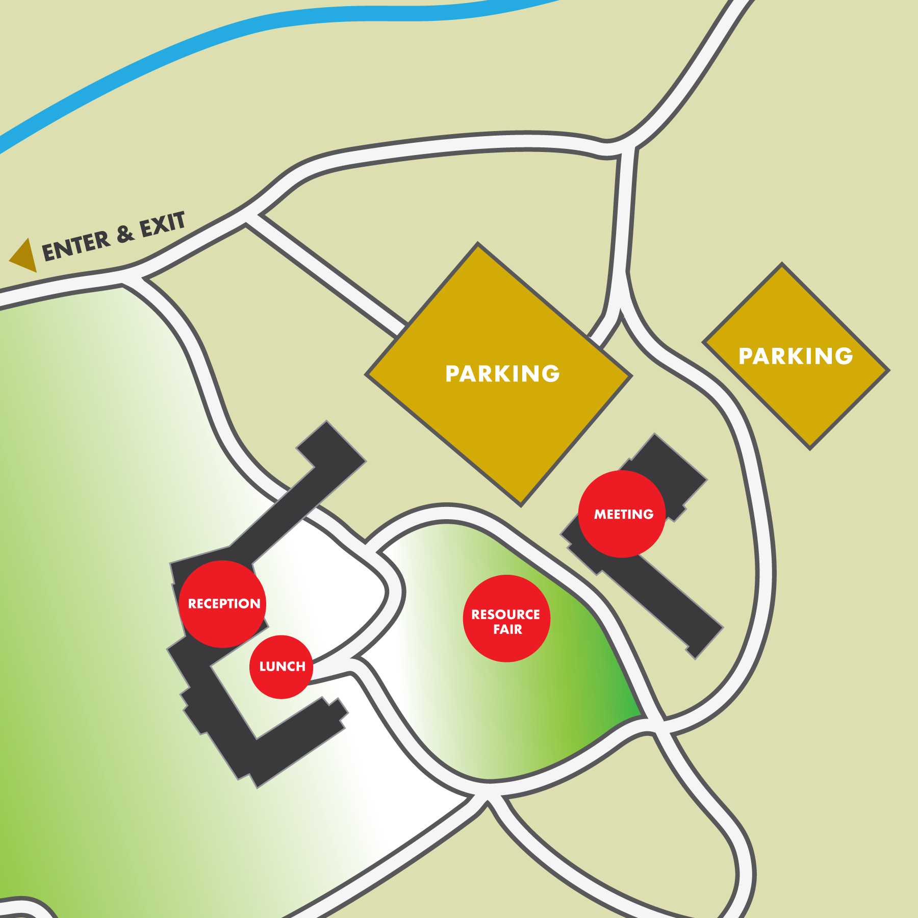
Event schedule
8:30 – 10:00 a.m. Resource Fair
10 a.m. – 12:15 p.m. Morning Session
12:15 – 1:30 p.m. Lunch
1:30 – 3:15 p.m. Afternoon Session
3:30 – 4:30 p.m. Small Group Discussion
4:30 – 6:00 p.m. Reception
agenda
8:30 a.m. Resource Fair & Check-In
10:00 a.m. 1. Welcome & Tribal Blessing
10:10 a.m. 2. Opening Remarks
10:40 a.m. 3. Director’s Report
• Accomplishments & Updates
10:55 a.m. 4. Balancing Priorities In A Complex Landscape
• Fire Regimes & Ecosystem Values
• Cultural Landscape
• WUI & Development
Regional Resource Kits
12:15 p.m. Lunch
1:30 p.m. 5. Key Issues & Priorities
• Ignition Reductions
• Structure and Infrastructure Resilience
• Strategic Fuel Modification & Forest Conservation
• Workforce Development
2:30 p.m. 6. Regional Investment Strategy & Next Steps
3:00 p.m. 7. Closing Remarks
3:15 p.m. Break – Live stream ends
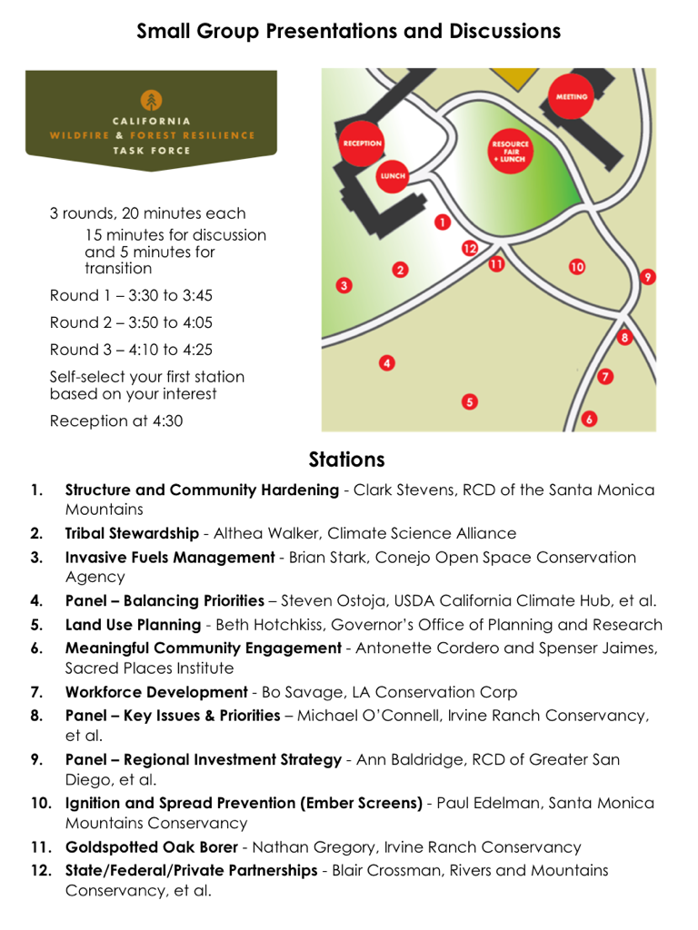
3:30 p.m. 8. Small Group Presentations and Discussions
4:30 p.m. Complimentary Reception

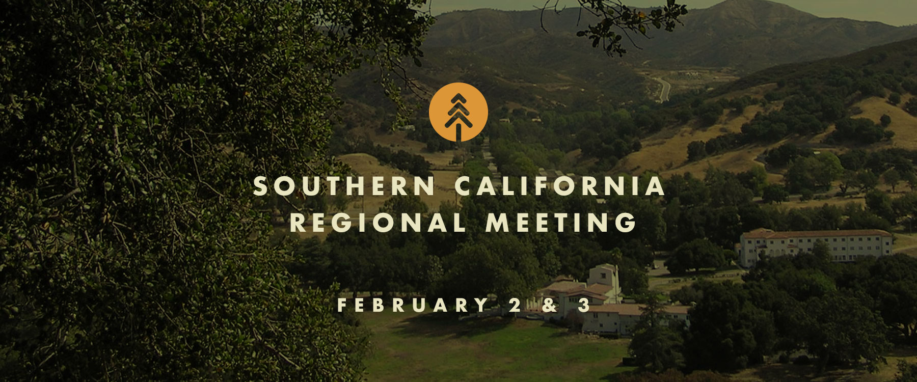
Southern California Regional Meeting
Southern California Regional Meeting
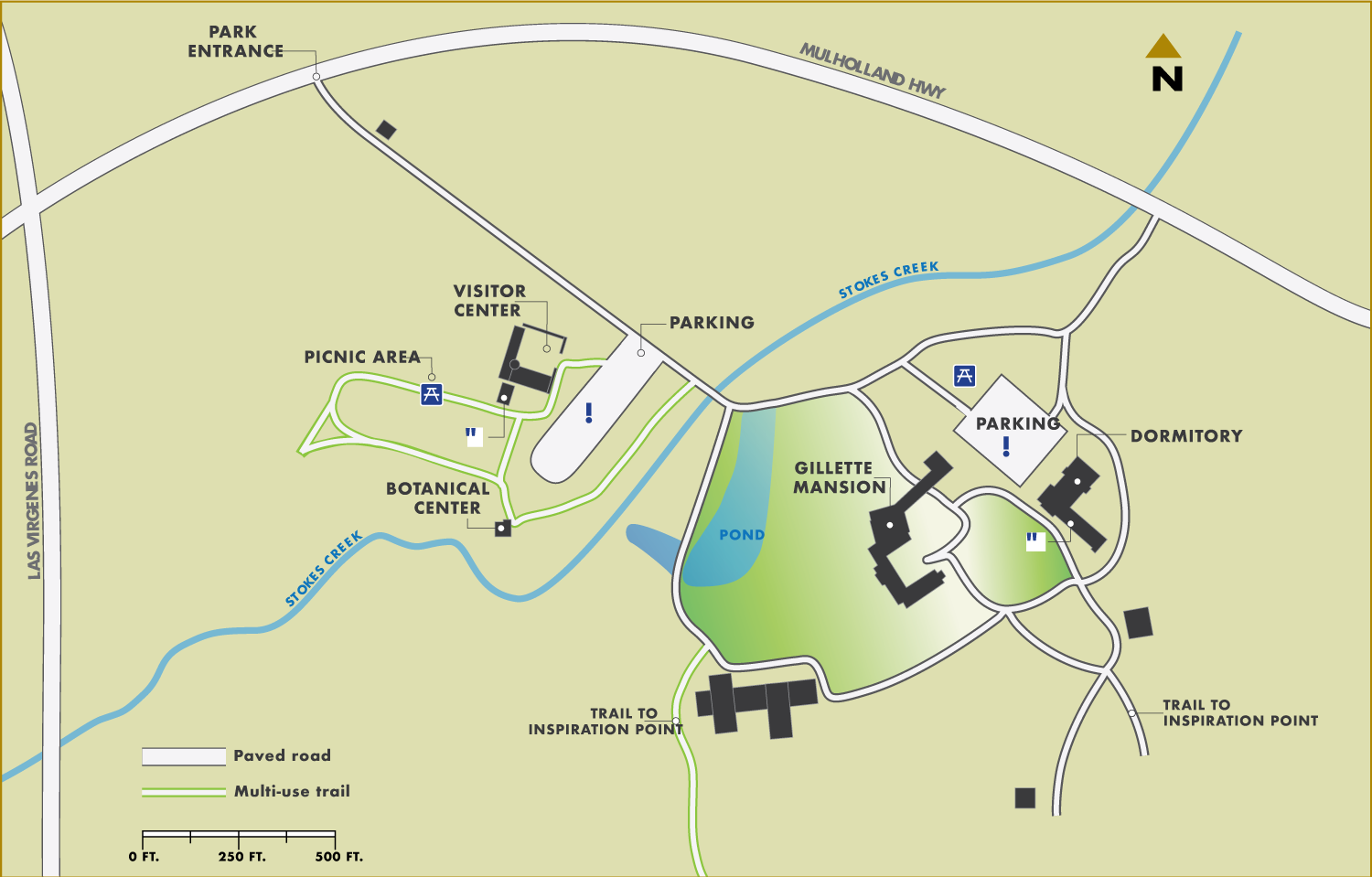
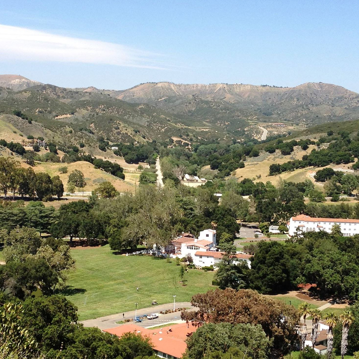
The Southern California Regional Meeting will be held in person in Calabasas, with a LiveStream option for remote attendance. Hosted by the Santa Monica Mountains Conservancy (SMMC) and Mountains Recreation and Conservation Authority (MRCA), discussions will focus on Southern California, with updates and panel discussions about real progress being made on the ground, and opportunities to network with partners from around the state. We look forward to connecting, committing to action, and collaborating on real solutions to the daunting challenges facing our landscapes and communities. The meeting will open with a Resource Fair to showcase local organizations at work in Southern California. Field tours will be offered on February 3. See below for tour details and registration.
FEBRUARY 2 & 3
King Gillette Ranch
26800 Mulholland Hwy
Calabasas, CA
Event schedule
8:30-10:00 a.m. Resource Fair
10 a.m.-12:15 p.m. Morning Session
12:15-1:30 p.m. Lunch
1:30-3:15 p.m. Afternoon Session
3:30-4:30 p.m. Small Group Discussions
4:30 p.m. Reception
field tours
FIELD TOURS WILL BE OFFERED ON FEBRUARY 3RD
Planting a Legacy: FULL
Creating an Ember Screen Along a Historic Wildfire Corridor
Description: Tour the Mountains Recreation and Conservation Authority’s (MRCA) freeway-adjacent-focused vegetation management effort within the historic wildfire corridor along a four-mile section of the 101 freeway where wildfires jump the freeway into the Santa Monica Mountains. The project consists of planting coast live oak ember barriers, a suburban interface with over 1,500 planted mitigation trees with the help of the Los Angeles Conservation Corps and the San Gabriel Valley Conservation Corps. You will also have an opportunity to see progress on the Wallis Annenberg Wildlife Crossing at Liberty Canyon, which will be the largest wildlife crossing in the world. The tour will involve driving to several sites and standing and walking for short periods of time on uneven terrain.
Location: Calabasas
Start/End Time: 9:30am – 12:30pm
Partnerships in the Santa Monica Mountains: FULL
Wildfire Prevention, Response, and Resilience
Description: This event will provide an opportunity to tour the shrublands of the Santa Monica Mountains and learn about the unique wind-driven wildfire behavior that has shaped partnerships among wildfire practitioners and land managers with federal, state, and local agency perspectives. The tour will feature the Mountains Recreation and Conservation Authority (MRCA) Fire Division Headquarters and a key Los Angeles County Fire Department wildfire response facility which features a sustainable habitat-focused defensible space project. The tour will include discussion among contiguous land managers including National Park Service, California Department of Parks and Recreation, Santa Monica Mountains Conservancy, and the MRCA who maintain a Cooperative Management Agreement of the Santa Monica Mountains National Recreation Area. The tour will involve driving to several sites and standing on uneven terrain.
Location: Calabasas
Start/End Time: 9:00am – 1:00pm
Community Hardening and Resilience in the Santa Monica Mountains
Description: This tour consists of visiting a home hardening demonstration structure that gives homeowners the opportunity to see best management practices for hardening their structures against wildfires particularly in wind-driven wildfires where embers can progress miles ahead of an active fire and create new ignitions – the project is in partnership with Los Angeles County Fire Department and the Resource Conservation District of Santa Monica Mountains. You will have an opportunity to learn more about the tools and programs being developed to educate and engage with communities and meet with a local community in Oak Park that has organized to create a local Fire Safe Council. The tour will involve driving to several sites and standing on uneven terrain.
Location: Agoura Hills (10 minutes from Calabasas)
Start/End Time: 9:00am – 12:00pm
Reducing Wildfire Risks on our Landscapes and in Communities:
Ventura County Invasive Fuels Management and Home Hardening Projects
Description: This tour will discuss the different wildfire efforts in Ventura County, both on the landscape and within communities, to address wildfire risk. The tour consists of visiting the Arroyo Conejo Invasive Plant Management Project and meeting with a local community that has recently organized to create a Fire Safe Council to discuss how they are working with local organizations to engage with their community to advance home hardening practices. The tour will include COSCA, Ventura Regional Fire Safe Council, the Ventura County Resource Conservation District, Oak Park Fire Safe Council, and Ventura County Prescribed Burn Association. The tour will involve driving to several sites and standing on uneven terrain.
Location: Oak Park (20 minutes from Calabasas)
Start/End Time: 9:00am – 12:00pm
Northeast Los Angeles Canyons and Hilltops:
Community Wildfire Resilience through Restoration, Local Engagement, and Workforce Development
Description: Wildfire resilience efforts in Los Angeles are complex and most resources focus on the large mountain ranges that surround the developed valleys and basins, such as the Angeles National Forest and the Santa Monica Mountains; however, there is another vulnerable landscape type: urban islands of open space. These smaller open space areas typically include undeveloped canyons and hilltops and are often owned by local agencies, non-profits, private parties, or a combination of these. These open space islands are surrounded by some of the most densely populated communities in California and are highly utilized as spaces of refuge and recreation for residents of Los Angeles. Although they differ in size from the large State and Federal landholdings in the mountains, these smaller islands of open space are also vulnerable to wildfires. The potential impact of a wildfire in any of these islands would be devastating to the surrounding communities, which lack the resources of more affluent areas. On this tour, we will discuss various wildfire efforts occurring in Northeast Los Angeles led by local non-profits, including organizations like North East Trees, who are working to deplete an invasive seed bank of flammable flashy fuels and restoring native habitat, and Community Nature Connection, who is establishing a nursery to supply local restoration projects. They will discuss their unique projects and community engagement efforts. An important component of these efforts is training to create a sustainable green workforce who can steward future wildfire resilience projects to combat climate change and progressively more destructive fires. On this tour, we will also hear from organizations working on wildfire efforts in similar landscapes across the metro area, such as a new Tribal Conservation Corps for Los Angeles and Outward Bound Adventures, an organization dedicated to outdoor education for BIPOC youth for over 60 years. This tour will be an opportunity to hear the perspective of several local organizations as they share their unique wildfire perspectives, goals, and priorities, engage with local communities, and increase conservation employment opportunities.
Location: Northeast Los Angeles (1 hour from Calabasas)
Start/End Time: 9:00am – 12:00pm
Eastern Angeles National Forest Tour:
Description: This tour will begin in Wrightwood to discuss the recent Sheep Fire’s progression and impacts to the community including the role of climate change and weather and their impacts to communities and resources including desert transition vegetative communities such as Joshua Trees. The tour will discuss fire history of the area, the role that fuel treatments played in the Blue Cut Fire and Sheep Fire, and restoration potential. Next, the tour will take a look at Big Pines Highway, ongoing fuels treatment implementation, and a three-way partnership with the Forest Service, National Forest Foundation, and the Rivers and Mountains Conservancy. The tour will conclude at Big Rock Creek road which demonstrates the impacts of the Bobcat Fire. Here we will discuss the bigcone Douglas-fir endemic in Southern California as well as restoration in the face of climate change. Please note that this tour will take place in the eastern Angeles National Forest; it is recommended that participants traveling for the event fly out of Ontario Airport after the tour. Guests may also elect to spend the previous night in the Ontario area to assist with travel time to the tour in the morning. The tour will involve driving to several sites and standing on uneven terrain. Participants are advised to bring their own lunch, wear warm clothes, and wear sunscreen.
Location: Wrightwood (2.5 hours from Calabasas)
Start/End Time: 9:00am – 2:30pm
Angeles National Forest:
Mt. Wilson and Chilao Tour
Description: This tour will visit two sites on the Angeles National Forest that have been threatened by large wildfires, including Mt. Wilson and the Chilao area. The southern California Mediterranean climate has always been subject to large wildfires due to the flammable shrub vegetation and Santa Ana wind patterns. Values at risk and other tree form vegetation types are equally threatened and at risk from climate change, past fire suppression, and high frequency of human caused ignitions. On this tour we will visit Mt. Wilson which hosts numerous stakeholders such as the communications site which serve the Los Angeles basin for emergency, utility, and media services. The tour includes a visit to the Mt. Wilson Observatory which maintains operational telescopes while preserving its legacy of historic contributions to astronomy. Mt. Wilson and the stakeholders’ interests have survived the Station and Bobcat Fires and a lesser known Wilson Fire. We will look at the site’s proximity to Los Angeles and the urban interface and fuel treatments that were initiated 10 years ago. There will be a representative from the Mt. Wilson Observatory to discuss stakeholder interests and actions within the framework of living with wildfire. The second leg of the tour will explore Chilao – a popular area for recreation within one of the few areas of the national forest that is a forested east side pine stand. The Chilao area has also been subject to both the Station and Bobcat Fires and represents a remote forest health stand, highly susceptible to wildfire due to adjacency to flammable chaparral. We will look at different fuel and vegetation treatments including mechanical and prescribed fire. Participants are advised to bring their own lunch. The tour will involve standing on unpaved surfaces.
Location: Angeles National Forest (2 hours from Calabasas)
Start/End Time: 9:30am – 2:00pm
Angeles National Forest – Green Valley Tour:
Forest Health in the Face of an Invasive Pest
Description: This tour of Green Valley will highlight the challenges posed by the goldspotted oak borer (GSOB) which was discovered in Green Valley in 2015, 162 miles from the known initial introduction point in San Diego County. We will discuss how public agencies are coordinating with private landowners, bordering National Forest land, as they remove or treat trees affected by GSOB. Participants are advised to bring their own lunch and wear warm clothes. The tour will involve walking on unpaved surfaces.
Location: Green Valley (2 hours from Calabasas)
Start/End Time: 9:30am – 2:30pm
We are encouraging all meeting
attendees to pre-purchase lunch.
Same day purchases will be limited.
hotel information** Discounted rates available while room blocks last, thru January 15th **

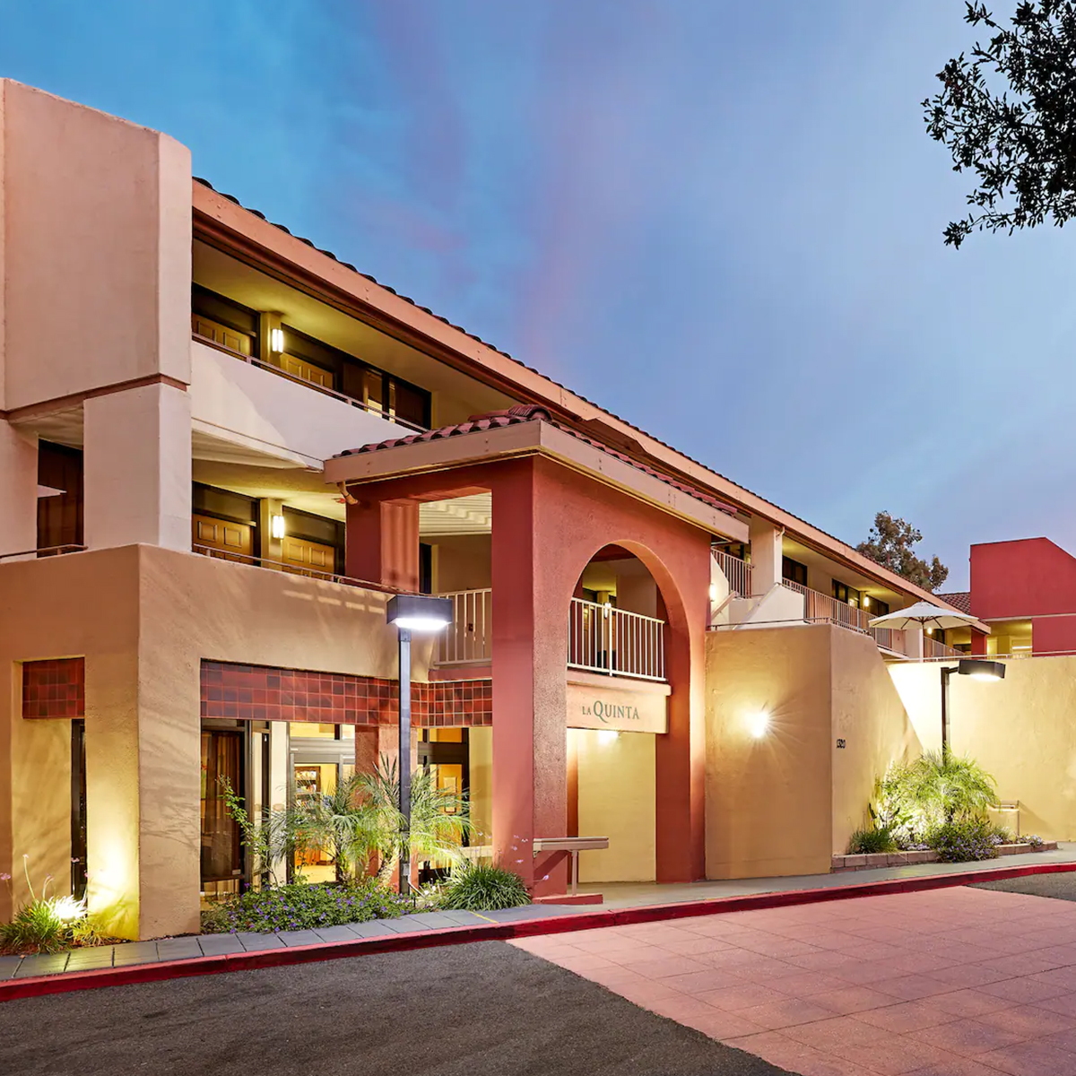
La Quinta
by Wyndham Thousand Oaks
1320 Newbury Rd.
Thousand Oaks, CA 91320
To receive the Task Force
discounted rate,
please call the hotel at
805-499-5910
and use code CG2223

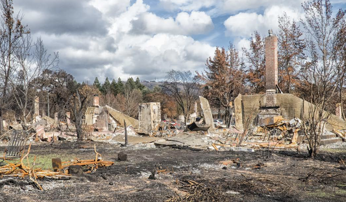
USDA Forest Service Announces Major Investments To Reduce CA Wildfire Risk
USDA Forest Service Announces Major Investments To Reduce CA Wildfire Risk
New funds offer “big shot in the arm” for Task Force efforts.
In an expanded effort to reduce the risk of catastrophic wildfire through the Forest Service’s Wildfire Crisis Strategy, USDA Forest Service announced an investment of more than $490 million to protect communities, critical infrastructure, and forest resources across the western U.S.
Made possible through President Biden’s landmark Bipartisan Infrastructure Law (BIL) and the Inflation Reduction Act (IRA), the funds will directly protect vulnerable landscapes in Arizona, California, Idaho, Nevada, Oregon, Utah and Washington. Combined with initial landscape investments, the additional efforts announced today represent a total USDA investment of $930 million across 45 million acres, mitigating risk to approximately 200 communities.
Here in California, the funds will go towards a wide range of vital projects that fall under the Wildfire and Forest Resilience Task Force Action Plan, with particular focus on historically underserved communities and tribes.
“This funding is a big shot in the arm. Combined with billions in state funding from Governor Newsom and our Legislature, this federal investment will translate into projects that protect our communities and restore the health of our natural landscapes. While catastrophic wildfire remains, threats remain high across the West, we’re making good progress with our federal partners here in California building resilience to wildfire.”
– Wade Crowfoot, California Natural Resources Secretary
The following California landscapes were selected for increased funding:
- Southern California Fireshed Risk Reduction Strategy (4M acres): The immense values at risk in southern California and the collaborative solutions underway for vegetation management represent investment opportunities to avoid staggering social, economic, and ecological costs.
- Trinity Forest Health and Fire Resilient Rural Communities (910K acres): California’s northern forests are naturally adapted to low-intensity fire. The health and well-being of California communities and ecosystems depend on urgent and effective forest and rangeland stewardship to restore resilient and diverse ecosystems. Numerous roads through the area serve as critical ingress/egress routes for local communities.
- Klamath River Basin (OR + CA – 10M acres) The Forest Service manages about 55 percent of the 10-million-acre Klamath Basin. These lands generate 80 percent of the mean annual surface water supply to the Klamath River. The area provides important habitat for fish listed under the Endangered Species Act.
- Plumas Community Protection (285K acres): The Plumas Community Protection Projects Landscape focuses on community zones across the Plumas National Forest with very high, high, or moderate wildfire hazard potential.
- Sierra and Elko Fronts (Nevada, California – 3.4M acres): This Intermountain Region project totals 3.4 million acres and encompasses landscapes in two states. These two projects together demonstrate the comprehensive landscape treatment goal of USDA’s Wildfire Crisis Strategy.
“Restoring natural forest health and diversity with thoughtful, science-based fuels treatments is critical for the future of California communities and natural resources. With our partners, we are dramatically increasing the scope and pace of fuels reduction projects in landscapes across the state.”
– Kara Chadwick, Deputy Regional Forester with the Pacific Southwest Region
This announcement comes on the anniversary of the launch of the Forest Service’s Wildfire Crisis Strategy, which combines an historic investment from congressional funding with years of scientific research and planning into a national effort that will dramatically increase the scale of forest health treatments.
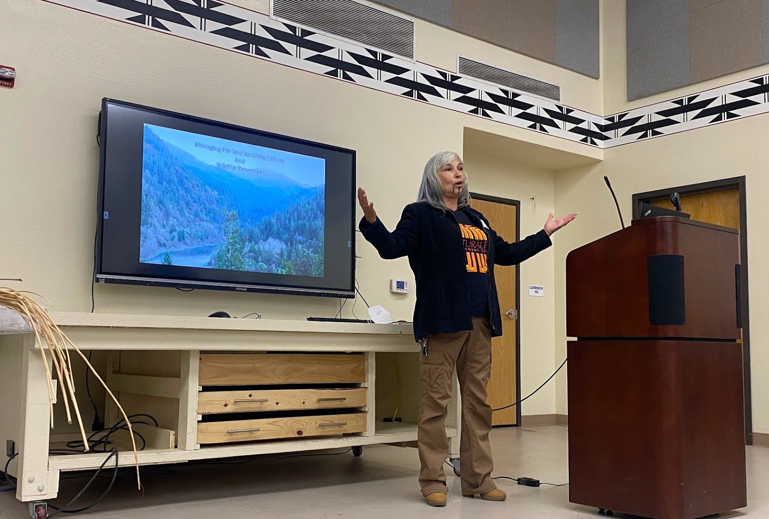
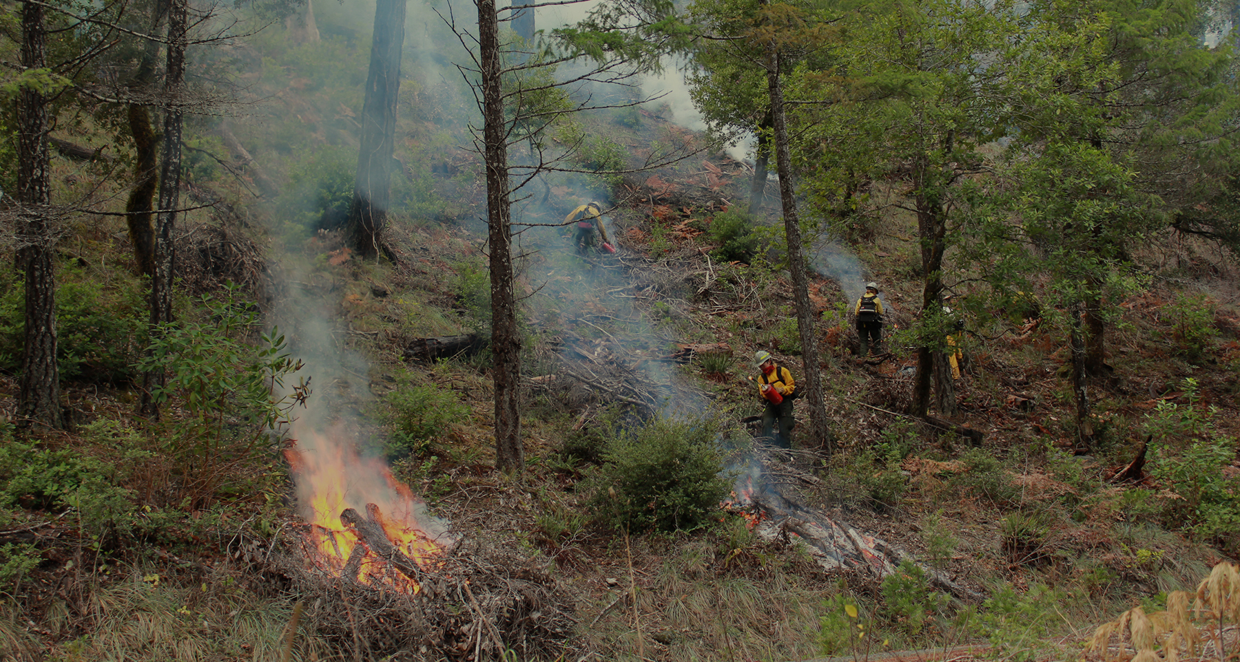
Culturing Burning: Building Leadership, Trust, and Capacity
Culturing Burning: Building Leadership, Trust, and Capacity
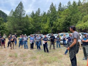
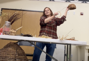
The Karuk Tribe hosted a day long workshop that included presentations from Karuk and Yurok tribal members.
The California Department of Forestry and Fire Protection (CAL FIRE) is actively engaged with tribes to better understand how cultural burning is different from prescribed burning and then applying these lessons learned. By building relationships with tribal practitioners, CAL FIRE staff are gaining new insights into fire management and finding new ways to support tribal fire management practices.
As California continues wildfire and forest resilience efforts throughout the state, many changes are underway to empower governments at all levels and private landowners to treat more acres in the effort to keep California communities safe and better protected.
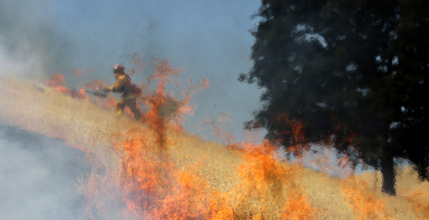
One tool in the toolbox for achieving this: using fire to treat brush and vegetation before wildfires occur. Prescribed fire and cultural burning are fuels reduction tools recognized as cost effective and ecologically beneficial to the landscape. Indigenous peoples in California have a long history of using fire to modify the landscape and cultural burning has been conducted by indigenous tribes for millennia. Reintroducing this tool to the landscape is a mutual goal for the California Department of Forestry and Fire Protection (CAL FIRE), and native tribes.
“By building strong relationships, and through the Tribes’ sharing of knowledge about cultural burning, we can gain a deeper understanding and connectedness to our environment that will help our staff to better support cultural burning,” said Len Nielson, CAL FIRE Staff Chief, Prescribed Fire. “This understanding is needed to have cultural burning occur at an increased pace and scale.”
It also fits within the department’s broader mission. CAL FIRE is responsible for fire protection and stewardship of over 31 million acres of California’s privately-owned wildlands. Assisting landowners and land managers with the support, knowledge, and skills to treat their property safely and effectively with fire is a critical strategy for sustaining the values we cherish for managing our state forests and other wildlands.
In this spirit, a number of activities are happening. CAL FIRE is supporting a burn boss training and certification, providing grants to Prescribed Burn Associations (PBAs), establishing a liability claims fund, creating prescribed fire training centers, and supporting California’s tribal communities to revitalize cultural burning. These are several of the strategies that CAL FIRE is working on to get more beneficial fire on the ground to help improve the health and resiliency of our forests.
“It was a pleasure to host so many great people from across multiple sectors of state government, and to have such a strong presence of CAL FIRE leadership at our event,” commented Bill Tripp, Director of Natural Resources and Environmental Policy for the Karuk Tribe. “It is, after all, the personal relationships and mutual understandings that we can establish based on real world, place-based situations that will help us to truly address the many challenges we face,” said Tripp.
The workshop included presentations from Karuk and Yurok tribal members and a field tour of previously burned areas showing how prescribed fire and cultural burning practices are interrelated for resource protection and revitalization of resources. In attendance were the CAL FIRE leadership team from Sacramento, local and regional foresters, archeologists, and environmental scientists from CAL FIRE and other state agencies. Building relationships and learning about the connections between culture and the landscape from tribal cultural practitioners is a good first step in fostering relationships with Tribal partners and other land managers in California to achieve our wildfire and forest resilience goals.
Photos: Tisina Parker
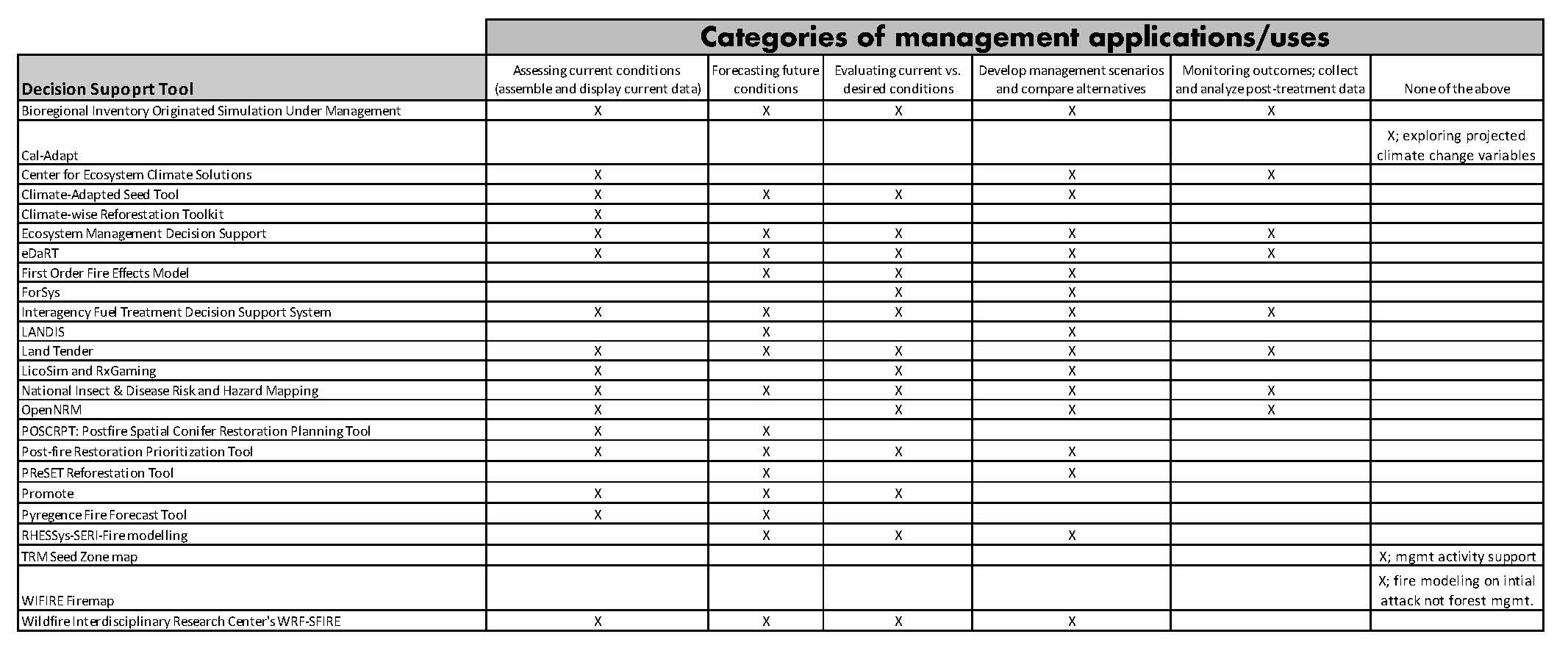
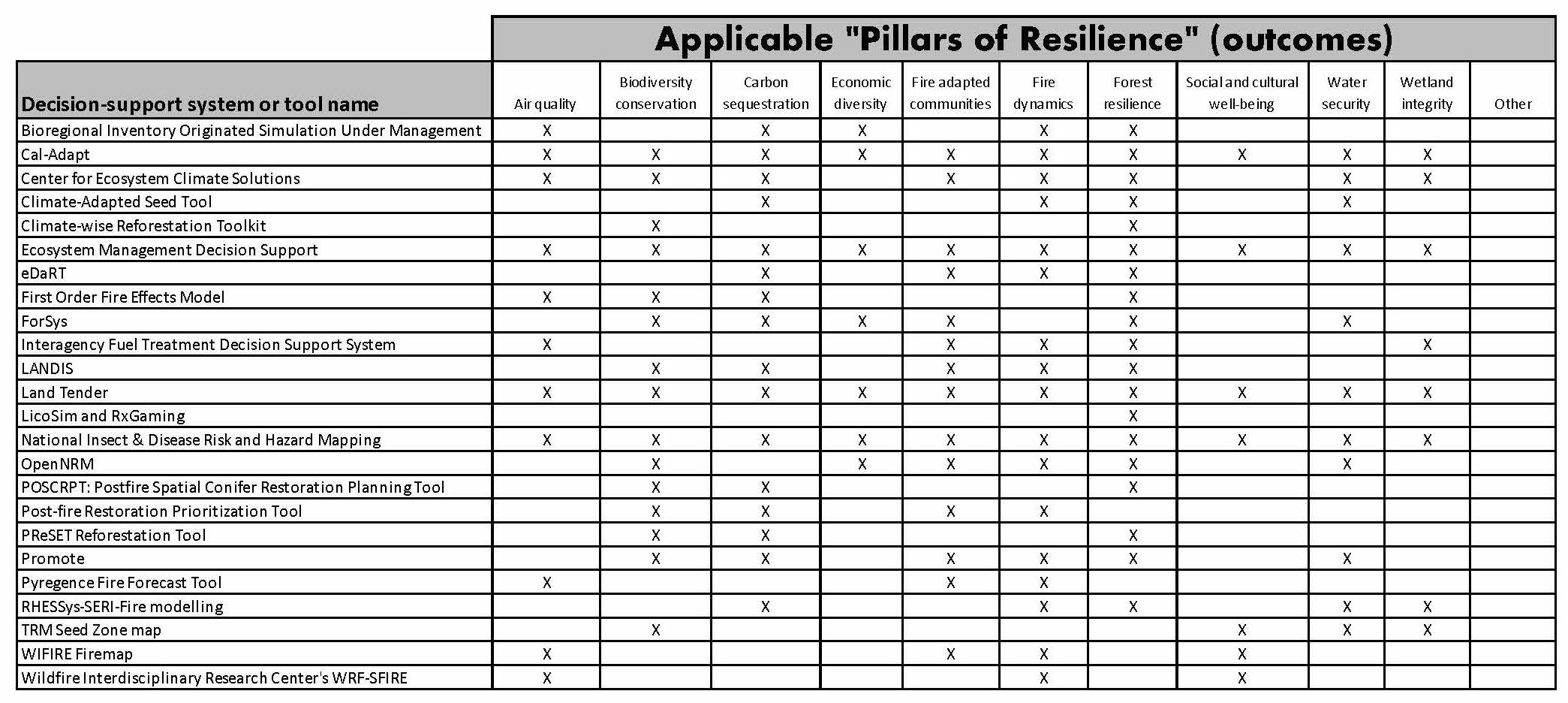
An Overview of Tools to Inform Land Management Decisions
A Guide FOR Land Managers
An Overview Of Tools To Inform Land Management Decisions
24 Decision Support Tools Researched/Analyzed To Help Guide Land Managers
The Science Advisory Panel of the California Wildfire & Forest Resilience Task Force, in collaboration with US Forest Service Region 5 and Pacific Southwest Research Station created this guide to help land managers, both government and private, better understand the tools available to them to help make the critical decisions required to keep their lands healthy and resilient.
Background
The project team curated a list of 24 available tools for land management decision-making in California. Tools included in the list were “application ready” and applied at a regional or larger scale. For each tool, they identified a range of characteristics that could help land managers determine which tool or tools best meet their needs. The characteristics were selected through the project team’s expertise and engagement with tool users and developers.
The following characteristics were
surveyed for each tool:
- Management applications
- Geographic and spatial domain
- Pillars of Resilience
- Metrics used
- Data input and output
- Key strengths and limitations
- Required expertise and training
- Model validation
- Sustainment and maintenance
- Financial cost
- Documented applications
Click on graph to view
RESOURCES
How To Use This Page
Below are two tables representing two key results of the survey conducted by the project team.• Table 1 shows which categories of Management Application apply to each of the tools.• Table 2 identifies which Pillars of Resilience (from the Tahoe Central Sierra Initiative Framework For Resilience) each tool addresses.Land Managers should review these result tables as a first step to determining which tools would be most applicable to their land management decision making needs.
Complete Survey Responses For Each Tool
Write-Up On Additional Findings
Authors
• Jennifer Smith
USDA California Climate Hub
• John Battles
UC Berkeley
• Patricia Manley
US Forest Service Pacific Southwest Research Station
• Steven Ostoja
USDA California Climate Hub
• Carlos Ramirez
US Forest Service Region 5 Information Management – MARS Team
• Peter Stine
Pacific Southwest Research Station
USFS Will Resume its Prescribed Fire Program
USDA Forest Service Chief Randy Moore Announces Actions the USFS Will Take to Resume its Prescribed Fire Program
Update on USFS’ Prescribed Fire Pause. In a statement announced on September 8, USFS Chief Randy Moore has decided – based on a thorough review, findings, and recommendations provided by its National Review Team – to conditionally resume the USFS’s prescribed fire program nationwide. The conditions include a requirement that all USFS units immediately follow all seven tactical recommendations identified in the National Prescribed Fire Program Review. These actions will ensure prescribed fire plans are up to date with the most recent science, that key factors and conditions are closely evaluated the day of a prescribed burn, and that decisionmakers are engaged in those burns in real time to determine whether a prescribed burn should be implemented.
RESOURCES
Wildland Fire Lessons Learned Center
U.S. Forest Service Announcement
UC Cooperative Extension Forest Landowner Workshops
UC Cooperative Extension Forest Landowner Workshops
UC ANR Landowner Workshops:
· Forest Stewardship Workshops: University of California Cooperative Extension-Agriculture and Natural Resources (UCANR) and partners continue to host workshops in various locations throughout the state to help landowners develop management plans for their own property. Upcoming locations include Butte/Yuba and Napa counties.
· Small Forest Landowners’ Field Day: UC ANR, My Sierra Woods and partners are hosting a Small Forest Landowners Field Day on September 18 in Twain Harte. Fuel reduction projects, technical and financial assistance programs for private forest landowners, and the My Sierra Woods programs will be highlighted.
· Post-fire Forest Resilience Workshops: UC ANR is hosting a new post-fire workshop series this fall aimed at assisting private landowners the northern and Central Sierra Nevada affected by the 2021 Dixie, Caldor and Tamarack fires.
RESOURCES
Jackson Demonstration Forest: A Great Recreation Choice
Jackson Demonstration Forest: A Great Recreation Choice
California’s demonstration state forests serve as a living laboratory for how to care for and manage California’s forest lands for multiple benefits—wood products and timber production, recreation, watershed protection, and habitat restoration—given a changing climate and increasingly severe and intense wildfire seasons. The forests provide unique research and demonstration opportunities where environmental scientists, foresters, and other researchers can study the effects of various forest management and restoration techniques that help inform management practices for government, nonprofit and private forestland owners.
Common activities on state forests include experimental timber harvesting techniques that test the Forest Practice Rules, watershed restoration, mushroom collecting, hunting, firewood gathering, cone collecting for seed, a variety of university research projects, horseback riding, camping, mountain biking, and hiking.
Jackson is the largest of CAL FIRE’s ten demonstration state forests. The area has a long history of logging which began in under private ownership 1862 then evolved into sustainable harvesting after the State’s purchase of the property in 1947. Today, more forest growth occurs each year than is harvested. The most common tree on the forest is coast redwood, but visitors will also find Douglas-fir, grand fir, hemlock, bishop pine, tanoak, alder, madrone and bay myrtle.
RESOURCES
Wildland Urban Interface: A Look at Issues and Resolutions
Wildland Urban Interface: A Look at Issues and Resolutions
A report of recommendations for elected officials, policy makers and all levels of government, tribal and response agencies. (June 7, 2022) Report sponsored by FEMA and the U.S. Fire Administration.
RESOURCES
State Can Fight Fire With Prescribed Fire By Funding Jobs In The Field
State Can Fight Fire With Prescribed Fire By Funding Jobs In The Field
“It is now accepted that prescribed fire is needed to conserve and restore biodiversity, prevent catastrophic fires, stabilize carbon and promote public health and safety. To address the pace and scale of prescribed fire that is needed, we must invest in careers in prescribed fire.” Read this guest commentary in CalMatters.org from Tom Gardali, CEO, Audubon Canyon Ranch.