ALERTCalifornia: Using AI to Stay Ahead of Wildfires and Other Disasters
ALERTCalifornia: Using AI to Stay Ahead of Wildfires and Other Disasters
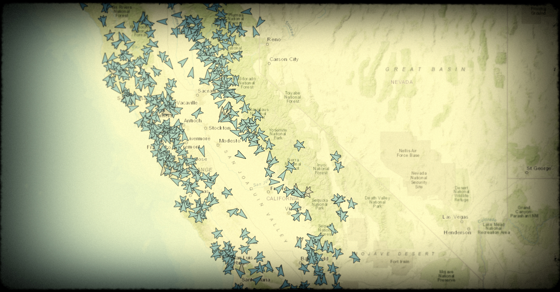
With the shared goal of improving firefighting capabilities and response times, CAL FIRE and UCSD’s ALERTCalifornia has launched an innovative Artificial Intelligence (AI) implementation trial. In keeping with the Task Force’s commitment to cross agency partnership and community protection, this collaborative public safety program aims to provide the tools to prepare for, respond to and recover from wildfires and other natural hazards. ALERTCalifornia has deployed a 24-hour surveillance network of 1,032 high-definition, pan-tilt-zoom cameras for efficient monitoring of active wildfires and other disasters. The pilot program enlists AI to identify abnormalities in the camera feeds and promptly notify emergency command centers.
ALERTCalifornia’s field teams continue to erect new cameras to enhance coverage across the state as California endures more frequent natural disasters. Since the start of 2023, new cameras have been installed in Los Angeles, Santa Barbara and Madera counties.
“The program will spawn invaluable research and mitigation plans that will increase the state’s resiliency towards the new extreme fire risk,” said Neal Driscoll, director of ALERTCalifornia and geoscientist at UC San Diego Scripps Institution of Oceanography.
USFS Issues Old Growth Technical and Reforestation Strategy Reports
USFS Issues Old Growth Technical and Reforestation Strategy Reports
USDA Forest Service and the U.S. Department of the Interior have worked together on two reports required under Executive Order 14072 (4/27/2022) that calls for strengthening the nation’s forests, communities, and local economies.
Mature and Old-Growth Forests: Definition, Identification, and Initial Inventory on Lands Managed by the Forest Service and Bureau of Land Management contains the first national inventory of old-growth and mature forests on these lands.
Reforestation Goals and Assessments, and a Climate-Informed Plan to Increase Federal Seed and Nursery Capacity in which DOI and USDA outline an agency-specific target to reforest over 2.3 million acres nationwide by 2030. The report also includes an opportunity assessment of voluntary reforestation (in acres) through federal programs and partnerships.
CDPH Publishes Air Pollution Health Burden Mapping Dashboard
CDPH Publishes California Wildfire Smoke and Air Pollution Health Burden Mapping Dashboard
California Department of Public Health’s dashboard shows the health burden related to air pollution and wildfire smoke. By mapping excess respiratory or cardiovascular-related emergency room visits, the dashboard allows users to visualize the burden in any zip code, as well as how the burden is distributed among races and ages, and proximity to medical facilities, schools, historical wildfires and Air Quality readings. The dashboard is based on data in the publication, Wildfires and the Changing Landscape of Air Pollution-related Health Burden in California. The dashboard was supported in part by a grant from the CAL FIRE’s Forest Health Research Program, as part of California Climate Investments.
Wildfire & Forest Resilience Treatment Tracking and Mapping
Wildfire & Forest Resilience Treatment Tracking and Mapping
At the March 30 Task Force meeting, the Task Force’s Monitoring, Reporting and Assessment Work Group gave an update on their efforts to build an interagency treatment tracker. The group is assembling federal, state, local, private data on planned, active, and completed projects statewide, including those on forests, grasslands, shrublands, and covering approximately 60 different activities (type of work completed). The goals include tracking progress toward state/federal acreage targets; facilitating regional planning and monitoring; and assessing benefits/costs beyond “acres treated.” The Task Force anticipates having a publicly available treatment tracking map and dashboard by summer 2023.
RESOURCES
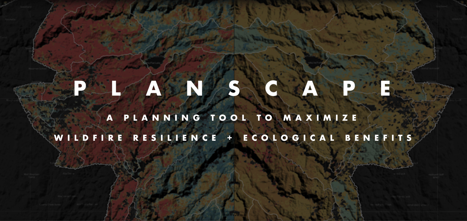
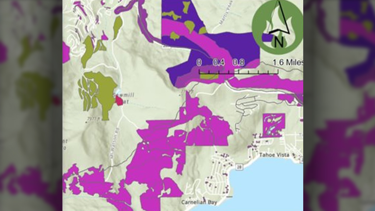
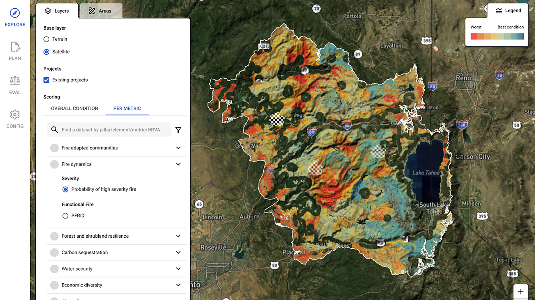
Planscape now lives on the Task Force website
Planscape Now Lives on the Task Force Website
A collaborative effort between CA Natural Resources Agency, USFS, UC Berkeley, Spatial Informatics Group and Google.org, Planscape is a decision support tool that empowers regional planners to prioritize resilience treatments across the landscape and inform the funding process. Planscape partners provided a demonstration of the tool at the March 30 Task Force meeting. This version of the tool is available for beta testing, with the region-specific scenarios released this summer through fall.
RESOURCES
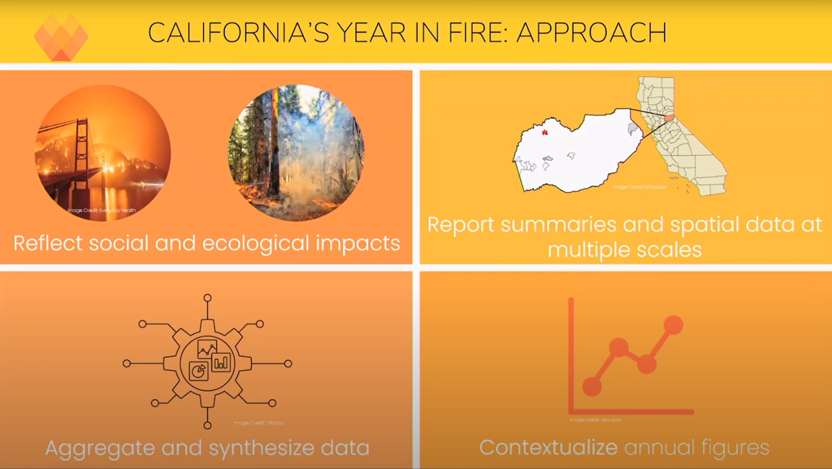
California's Year in Fire
California's Year in Fire
One of the highlights from the March 30 Task Force meeting was a preview of the Annual Wildfire Data Explorer which depicts California’s Year in Fire. A project of the Climate and Wildfire Institute, UC Berkeley’s Center for Law, Energy & the Environment and the Gordon and Betty Moore Foundation, California’s Year in Fire is a framework that works to more comprehensively account for annual wildfire impacts on social and ecological systems. This project will help decision makers better understand how wildfire impacts are trending and identify areas where we need additional investment. Next step in this project is to finalize the documentation for public review, with the results eventually housed on a public-facing website, updated annually. Sign up for updates.
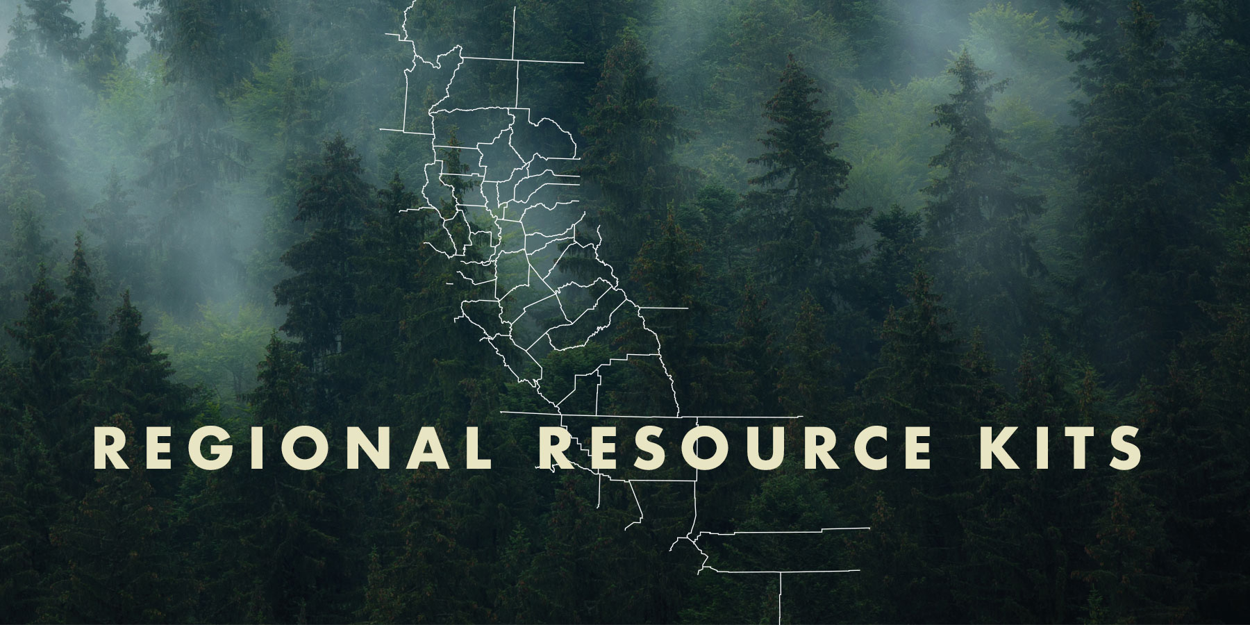
Regional Resource Kits and Profiles Are Now Available
Regional Resource Kits and Profiles Are Now Available
The Task Force’s Science Advisory Panel has completed Regional Resource Kits and Regional Profiles for both the Sierra Nevada and Southern California regions. These invaluable tools are now available here on the Task Force website.
Regional Resource Kits offer critical tools and data to guide regional partners and collaboratives in their efforts to reduce wildfire hazard and improve the conditions of forested and shrub landscapes.
Likewise, Regional Profiles bring together the best available scientific information and a wide range of input from stakeholders throughout the region.
The Science Team will now focus on collecting data and tools for the Central Coast in preparation for the May 2023 Task Force meeting.
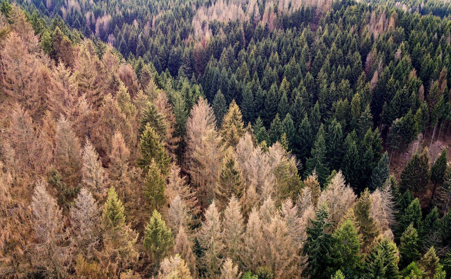
Survey Detects 36 Million Dead Trees in California
Survey Detects 36 Million Dead Trees in California
On February 7, the U.S. Forest Service published the 2022 Aerial Detection Survey report providing an annual estimate of tree mortality. The survey revealed about 36.3 million trees across 2.6 million acres of federal, state and private land died in California in 2022. The central Sierra Nevada Range and areas further north showed the highest mortality rates with true firs being the most impacted.
These data points mark an increased level of mortality compared to 2021 due to the cumulative impacts of extended drought, overstocked forest conditions, insect outbreaks, and disease.
“Forest health is a top priority for the Forest Service,” said Jennifer Eberlien, Regional Forester for the Pacific Southwest Region. “The agency’s 10-year strategy to address the wildfire crisis includes removal of dead and dying trees in the places where it poses the most immediate threats to communities.”
Planscape Update
Planscape Update
At the Task Force’s September meeting, The California Natural Resources Agency and the USDA Forest Service announced plans to build Planscape, with support from Google.org Fellows. Planscape is a new planning tool that brings together the best available science, to maximize landscape resilience and benefits and help regional planners assess, prioritize and plan landscape treatments. Recently, the Planscape Team launched a newsletter and a website to share product development updates and provide a venue for interested parties and future users to contact the team.
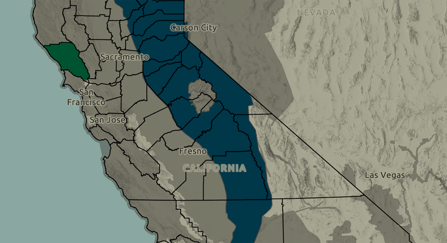
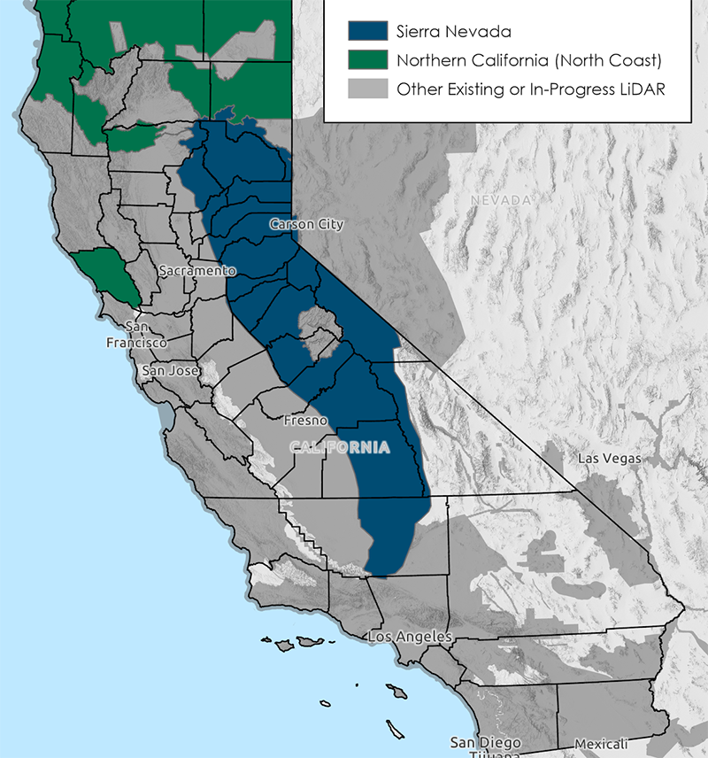
LiDAR Data Collection for Northern California and Sierra Nevada
LiDAR Data Collection for Northern California and Sierra Nevada
The California Natural Resources Agency (CNRA), in partnership with the US Geologic Survey’s 3DEP Program and other entities, have now collected nearly 31.5 million acres of LiDAR (Light Detection and Ranging) covering large swaths of Northern California and the Sierra Nevada. These data fill substantial gaps in LiDAR coverage to improve the state’s ability to manage natural resources and protect public safety, directly enhancing our knowledge of forests and landforms in some of the most rugged and fire prone portions of the state. The $3.9M investment by CNRA is a portion of the funding for LiDAR and other remote sensing data that has been made available from funding allocated by the California Legislature (Budget Bill 21/21) .