Recap of Sacramento Task Force Meeting
SACRAMENTO TASK FORCE MEETING RECAP
March 30, 2023
The California Wildfire & Forest Resilience Task Force held its quarterly meeting at the California Natural Resources Agency in Sacramento and live on Zoom.
The agenda and video recordings are available below.
MEETING AGENDA HIGHLIGHTS
- Looking Back: Members on this panel highlighted major accomplishments from state and federal agencies in 2022, shared preliminary results from California’s Year in Fire analysis, discussed what field monitoring reveals about the effectiveness of fuels treatments, and what recent wildfires reveal about the effectiveness of defensive space and home hardening. Subjects covered include:
– What have we accomplished?
– How do we measure the impacts of fires? California’s Year in Fire
– Are treatments working?
- Moving Forward: Presentations covered the questions that components of the Regional Resource Kits are meant to address: What are our goals and how do we define them? What is the current condition of our landscapes? How do we most effectively plan and prioritize projects? Where are we currently investing? How do we measure the effectiveness of those investments? The Monitoring and Reporting Work Group unveiled the Interagency Treatment Tracker, and Google.org provided an update on the decision support tool, Planscape. Subjects covered include:
– Where is management most beneficial?
– How do we more effectively plan & prioritize projects? Planscape
– Where are we investing? Interagency Treatment Tracker
– How do we measure the effectiveness of our investments?
- Wood Utilization Work Group: The Work Group provided an overview of preliminary proposed actions in future joint strategy for wood utilization. Panelists discussed the importance of private sector investments in a vibrant wood products market that advances the state’s sustainable forest management strategy. Subjects covered include:
– Overview of Proposed Action
– Panel Discussion with Industry Representatives
Welcome & Opening Remarks
• Wade Crowfoot, CNRA
• Jennifer Eberlien, USFS
• Task Force Executive Committee
Director’s Report
Director’s Report
• Patrick Wright
Looking Back
Looking Back
Moderator: John Battles, UC Berkeley
• Patrick Wright, Task Force
• Leana Weissberg, UC Berkeley, Center for Law, Energy & the Environment
• Scott Stephens, UC Berkeley
• Yana Valachovic, UC Cooperative Extension
Moving Forward
Moving Forward
Moderator: John Battles, UC Berkeley
• Pat Manley, USFS Pacific SW Research Station
• David Saah, Spatial Informatics Group
• Mickey Kataria, Google.org
• Alan Talhelm, CARB
• Loretta Moreno, CNRA
• Stephanie Coppeto, USFS.
Wood Utilization Work Group Report
Wood Utilization Work Group Report
Moderator: Steve Frisch, Sierra Business Council
• Elizabeth Betancourt, Dept. of Conservation
• Helena Murray, USFS
• Matt Dias, California Forestry Association
• Julia Levin, Bioenergy Association of California
• Dan Porter, The Nature Conservancy
• Matt Sjoholm, Blue Forest Conservation.
Final Remarks
• Task Force Co-Chairs
Recap of The Southern California Regional Meeting
SOUTHERN CALIFORNIA REGIONAL MEETING RECAP
February 2, 2023
Nearly 350 people gathered at the King Gillette Ranch in Calabasas on February 2 for updates and in-depth panel discussions focused on the unique challenges in balancing the protection of the region’s forests and shrublands with community protection from the increased threat of wildfires. Sponsored and hosted by Santa Monica Mountains Conservancy and Mountains and Recreation Conservation Authority, the meeting brought together a wide range of experts and Task Force agency partners.
If you couldn’t make it in person, or missed the real-time webinar, video recordings are available below.
REGIONAL MEETING AGENDA HIGHLIGHTS
- Balancing Priorities in A Complex Landscape: A panel of experts discussed Southern California’s unique landscapes, ecosystems and fire dynamics. The Task Force Interagency Science Team then introduced the Southern California Regional Resource Kit to support efficient and effective planning and prioritization.
- Key Issues & Priorities: A panel of regional leaders highlighted the prime issues they deal with in managing fire and landscape resilience in Southern California. Topics included minimizing ignition reduction, fuelbreaks and forest conservation, workforce development, and structure and infrastructure resilience.
- Regional Investment Strategy & Next Steps: A highlight of the February 2 meeting was the announcement of a multi-agency, $70 million investment in Southern California to support regional landscape and community protection programs. Regional partners responded to this funding commitment with a pledge to formalize their strategic coordination with the outcome being a process to develop and implement a Southern California-wide pipeline of shovel ready projects.
Tribal Blessing & Opening Remarks
• Rudy Ortega, Santa Monica Mts. Conservancy
• Alan Salazar, Tribal Elder
Opening Remarks
• Wade Crowfoot, CNRA
• Jennifer Eberlien, USFS
• Task Force Executive Committee
Director’s Report
Director’s Report
• Patrick Wright
Balancing Priorities In A Complex Landscape
Balancing Priorities In A Complex Landscape
• Moderator: Steven Ostoja, USDA California Climate Hub
• Nicole Molinari, USFS
• Daniel Berlant, CAL FIRE
• Jon Keeley, USGS
• John Battles, UC Berkeley
A panel of experts discussed Southern California’s unique landscapes, ecosystems and fire dynamics. The Task Force Interagency Science Team introduced new tools for practitioners.
Key Issues & Priorities
Key Issues & Priorities
• Moderator: Michael O’Connell, Irvine Ranch Conservancy
• Scott Tangenberg, USFS
• Susie Kirschner, Inland Empire RCD
• Stan Hill, RCD of Greater San Diego
• Rorie Skei, Santa Monica Mts. Conservancy
- Ignition Reduction
- Structure and Infrastructure Resilience
- Strategic Fuelbreaks and Forest Conservation
- Workforce Development
A panel of Southern California regional leaders highlighted key issues and discussed how they are aligning priorities and meeting shared goals.
Regional Investment Strategy & Next Steps
Regional Investment Strategy & Next Steps
• Moderator: Forest Schafer, Task Force
• Sherry Hazelhurst, USFS
• Matthew Reischman, CAL FIRE
• Keali’i Bright, Dept. of Conservation
• Ann Baldridge, RCD of Greater San Diego
Task Force partners will introduce the Regional Investment Strategy and provide funding updates.
Final Remarks
• Task Force Co-Chairs
Southern California Regional Meeting Event
Welcome To The Southern CaliforniaRegional Meeting
Event schedule
8:30 – 10:00 a.m. Resource Fair
10 a.m. – 12:15 p.m. Morning Session
12:15 – 1:30 p.m. Lunch
1:30 – 3:15 p.m. Afternoon Session
3:30 – 4:30 p.m. Small Group Discussion
4:30 – 6:00 p.m. Reception
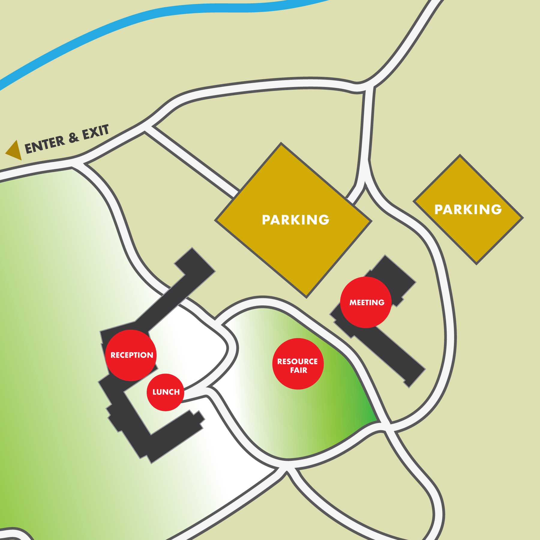
agenda
8:30 a.m. Resource Fair & Check-In
10:00 a.m. 1. Welcome & Tribal Blessing
10:10 a.m. 2. Opening Remarks
10:40 a.m. 3. Director’s Report
• Accomplishments & Updates
10:55 a.m. 4. Balancing Priorities In A Complex Landscape
• Fire Regimes & Ecosystem Values
• Cultural Landscape
• WUI & Development
Regional Resource Kits
12:15 p.m. Lunch
1:30 p.m. 5. Key Issues & Priorities
• Ignition Reductions
• Structure and Infrastructure Resilience
• Strategic Fuel Modification & Forest Conservation
• Workforce Development
2:30 p.m. 6. Regional Investment Strategy & Next Steps
3:00 p.m. 7. Closing Remarks
3:15 p.m. Break – Live stream ends
3:30 p.m. 8. Small Group Presentations and Discussions
4:30 p.m. Complimentary Reception



Southern California Regional Meeting
Southern California Regional Meeting
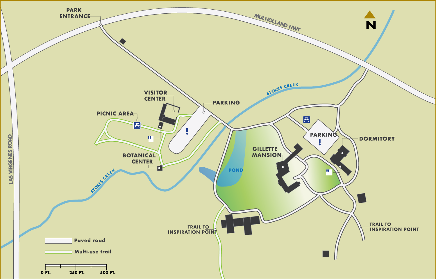
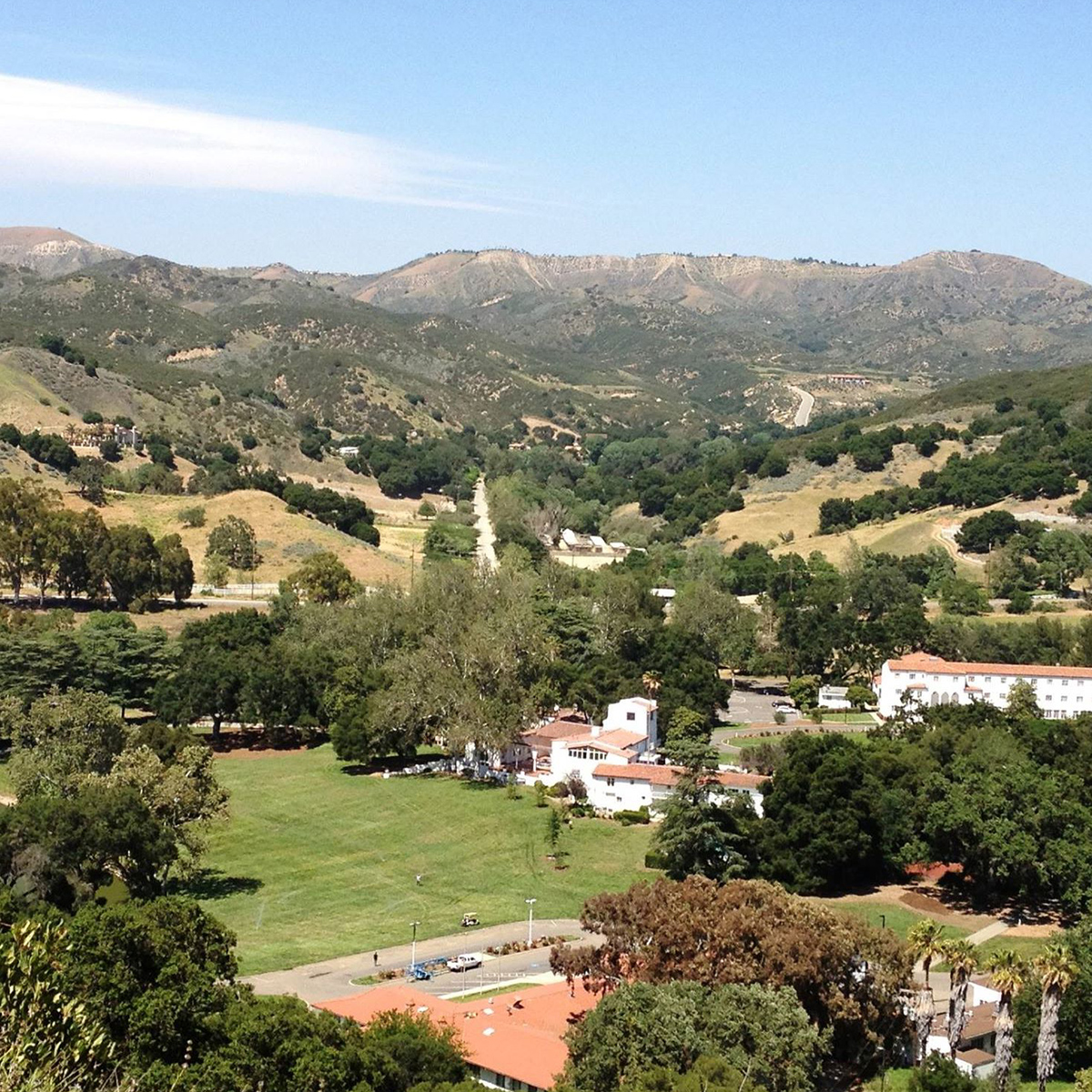
The Southern California Regional Meeting will be held in person in Calabasas, with a LiveStream option for remote attendance. Hosted by the Santa Monica Mountains Conservancy (SMMC) and Mountains Recreation and Conservation Authority (MRCA), discussions will focus on Southern California, with updates and panel discussions about real progress being made on the ground, and opportunities to network with partners from around the state. We look forward to connecting, committing to action, and collaborating on real solutions to the daunting challenges facing our landscapes and communities. The meeting will open with a Resource Fair to showcase local organizations at work in Southern California. Field tours will be offered on February 3. See below for tour details and registration.
FEBRUARY 2 & 3
King Gillette Ranch
26800 Mulholland Hwy
Calabasas, CA
Event schedule
8:30-10:00 a.m. Resource Fair
10 a.m.-12:15 p.m. Morning Session
12:15-1:30 p.m. Lunch
1:30-3:15 p.m. Afternoon Session
3:30-4:30 p.m. Small Group Discussions
4:30 p.m. Reception
field tours
FIELD TOURS WILL BE OFFERED ON FEBRUARY 3RD
Planting a Legacy: FULL
Creating an Ember Screen Along a Historic Wildfire Corridor
Description: Tour the Mountains Recreation and Conservation Authority’s (MRCA) freeway-adjacent-focused vegetation management effort within the historic wildfire corridor along a four-mile section of the 101 freeway where wildfires jump the freeway into the Santa Monica Mountains. The project consists of planting coast live oak ember barriers, a suburban interface with over 1,500 planted mitigation trees with the help of the Los Angeles Conservation Corps and the San Gabriel Valley Conservation Corps. You will also have an opportunity to see progress on the Wallis Annenberg Wildlife Crossing at Liberty Canyon, which will be the largest wildlife crossing in the world. The tour will involve driving to several sites and standing and walking for short periods of time on uneven terrain.
Location: Calabasas
Start/End Time: 9:30am – 12:30pm
Partnerships in the Santa Monica Mountains: FULL
Wildfire Prevention, Response, and Resilience
Description: This event will provide an opportunity to tour the shrublands of the Santa Monica Mountains and learn about the unique wind-driven wildfire behavior that has shaped partnerships among wildfire practitioners and land managers with federal, state, and local agency perspectives. The tour will feature the Mountains Recreation and Conservation Authority (MRCA) Fire Division Headquarters and a key Los Angeles County Fire Department wildfire response facility which features a sustainable habitat-focused defensible space project. The tour will include discussion among contiguous land managers including National Park Service, California Department of Parks and Recreation, Santa Monica Mountains Conservancy, and the MRCA who maintain a Cooperative Management Agreement of the Santa Monica Mountains National Recreation Area. The tour will involve driving to several sites and standing on uneven terrain.
Location: Calabasas
Start/End Time: 9:00am – 1:00pm
Community Hardening and Resilience in the Santa Monica Mountains
Description: This tour consists of visiting a home hardening demonstration structure that gives homeowners the opportunity to see best management practices for hardening their structures against wildfires particularly in wind-driven wildfires where embers can progress miles ahead of an active fire and create new ignitions – the project is in partnership with Los Angeles County Fire Department and the Resource Conservation District of Santa Monica Mountains. You will have an opportunity to learn more about the tools and programs being developed to educate and engage with communities and meet with a local community in Oak Park that has organized to create a local Fire Safe Council. The tour will involve driving to several sites and standing on uneven terrain.
Location: Agoura Hills (10 minutes from Calabasas)
Start/End Time: 9:00am – 12:00pm
Reducing Wildfire Risks on our Landscapes and in Communities:
Ventura County Invasive Fuels Management and Home Hardening Projects
Description: This tour will discuss the different wildfire efforts in Ventura County, both on the landscape and within communities, to address wildfire risk. The tour consists of visiting the Arroyo Conejo Invasive Plant Management Project and meeting with a local community that has recently organized to create a Fire Safe Council to discuss how they are working with local organizations to engage with their community to advance home hardening practices. The tour will include COSCA, Ventura Regional Fire Safe Council, the Ventura County Resource Conservation District, Oak Park Fire Safe Council, and Ventura County Prescribed Burn Association. The tour will involve driving to several sites and standing on uneven terrain.
Location: Oak Park (20 minutes from Calabasas)
Start/End Time: 9:00am – 12:00pm
Northeast Los Angeles Canyons and Hilltops:
Community Wildfire Resilience through Restoration, Local Engagement, and Workforce Development
Description: Wildfire resilience efforts in Los Angeles are complex and most resources focus on the large mountain ranges that surround the developed valleys and basins, such as the Angeles National Forest and the Santa Monica Mountains; however, there is another vulnerable landscape type: urban islands of open space. These smaller open space areas typically include undeveloped canyons and hilltops and are often owned by local agencies, non-profits, private parties, or a combination of these. These open space islands are surrounded by some of the most densely populated communities in California and are highly utilized as spaces of refuge and recreation for residents of Los Angeles. Although they differ in size from the large State and Federal landholdings in the mountains, these smaller islands of open space are also vulnerable to wildfires. The potential impact of a wildfire in any of these islands would be devastating to the surrounding communities, which lack the resources of more affluent areas. On this tour, we will discuss various wildfire efforts occurring in Northeast Los Angeles led by local non-profits, including organizations like North East Trees, who are working to deplete an invasive seed bank of flammable flashy fuels and restoring native habitat, and Community Nature Connection, who is establishing a nursery to supply local restoration projects. They will discuss their unique projects and community engagement efforts. An important component of these efforts is training to create a sustainable green workforce who can steward future wildfire resilience projects to combat climate change and progressively more destructive fires. On this tour, we will also hear from organizations working on wildfire efforts in similar landscapes across the metro area, such as a new Tribal Conservation Corps for Los Angeles and Outward Bound Adventures, an organization dedicated to outdoor education for BIPOC youth for over 60 years. This tour will be an opportunity to hear the perspective of several local organizations as they share their unique wildfire perspectives, goals, and priorities, engage with local communities, and increase conservation employment opportunities.
Location: Northeast Los Angeles (1 hour from Calabasas)
Start/End Time: 9:00am – 12:00pm
Eastern Angeles National Forest Tour:
Description: This tour will begin in Wrightwood to discuss the recent Sheep Fire’s progression and impacts to the community including the role of climate change and weather and their impacts to communities and resources including desert transition vegetative communities such as Joshua Trees. The tour will discuss fire history of the area, the role that fuel treatments played in the Blue Cut Fire and Sheep Fire, and restoration potential. Next, the tour will take a look at Big Pines Highway, ongoing fuels treatment implementation, and a three-way partnership with the Forest Service, National Forest Foundation, and the Rivers and Mountains Conservancy. The tour will conclude at Big Rock Creek road which demonstrates the impacts of the Bobcat Fire. Here we will discuss the bigcone Douglas-fir endemic in Southern California as well as restoration in the face of climate change. Please note that this tour will take place in the eastern Angeles National Forest; it is recommended that participants traveling for the event fly out of Ontario Airport after the tour. Guests may also elect to spend the previous night in the Ontario area to assist with travel time to the tour in the morning. The tour will involve driving to several sites and standing on uneven terrain. Participants are advised to bring their own lunch, wear warm clothes, and wear sunscreen.
Location: Wrightwood (2.5 hours from Calabasas)
Start/End Time: 9:00am – 2:30pm
Angeles National Forest:
Mt. Wilson and Chilao Tour
Description: This tour will visit two sites on the Angeles National Forest that have been threatened by large wildfires, including Mt. Wilson and the Chilao area. The southern California Mediterranean climate has always been subject to large wildfires due to the flammable shrub vegetation and Santa Ana wind patterns. Values at risk and other tree form vegetation types are equally threatened and at risk from climate change, past fire suppression, and high frequency of human caused ignitions. On this tour we will visit Mt. Wilson which hosts numerous stakeholders such as the communications site which serve the Los Angeles basin for emergency, utility, and media services. The tour includes a visit to the Mt. Wilson Observatory which maintains operational telescopes while preserving its legacy of historic contributions to astronomy. Mt. Wilson and the stakeholders’ interests have survived the Station and Bobcat Fires and a lesser known Wilson Fire. We will look at the site’s proximity to Los Angeles and the urban interface and fuel treatments that were initiated 10 years ago. There will be a representative from the Mt. Wilson Observatory to discuss stakeholder interests and actions within the framework of living with wildfire. The second leg of the tour will explore Chilao – a popular area for recreation within one of the few areas of the national forest that is a forested east side pine stand. The Chilao area has also been subject to both the Station and Bobcat Fires and represents a remote forest health stand, highly susceptible to wildfire due to adjacency to flammable chaparral. We will look at different fuel and vegetation treatments including mechanical and prescribed fire. Participants are advised to bring their own lunch. The tour will involve standing on unpaved surfaces.
Location: Angeles National Forest (2 hours from Calabasas)
Start/End Time: 9:30am – 2:00pm
Angeles National Forest – Green Valley Tour:
Forest Health in the Face of an Invasive Pest
Description: This tour of Green Valley will highlight the challenges posed by the goldspotted oak borer (GSOB) which was discovered in Green Valley in 2015, 162 miles from the known initial introduction point in San Diego County. We will discuss how public agencies are coordinating with private landowners, bordering National Forest land, as they remove or treat trees affected by GSOB. Participants are advised to bring their own lunch and wear warm clothes. The tour will involve walking on unpaved surfaces.
Location: Green Valley (2 hours from Calabasas)
Start/End Time: 9:30am – 2:30pm
We are encouraging all meeting
attendees to pre-purchase lunch.
Same day purchases will be limited.
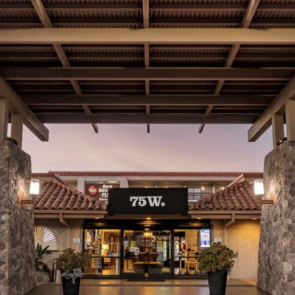
hotel information** Discounted rates available while room blocks last, thru January 15th **
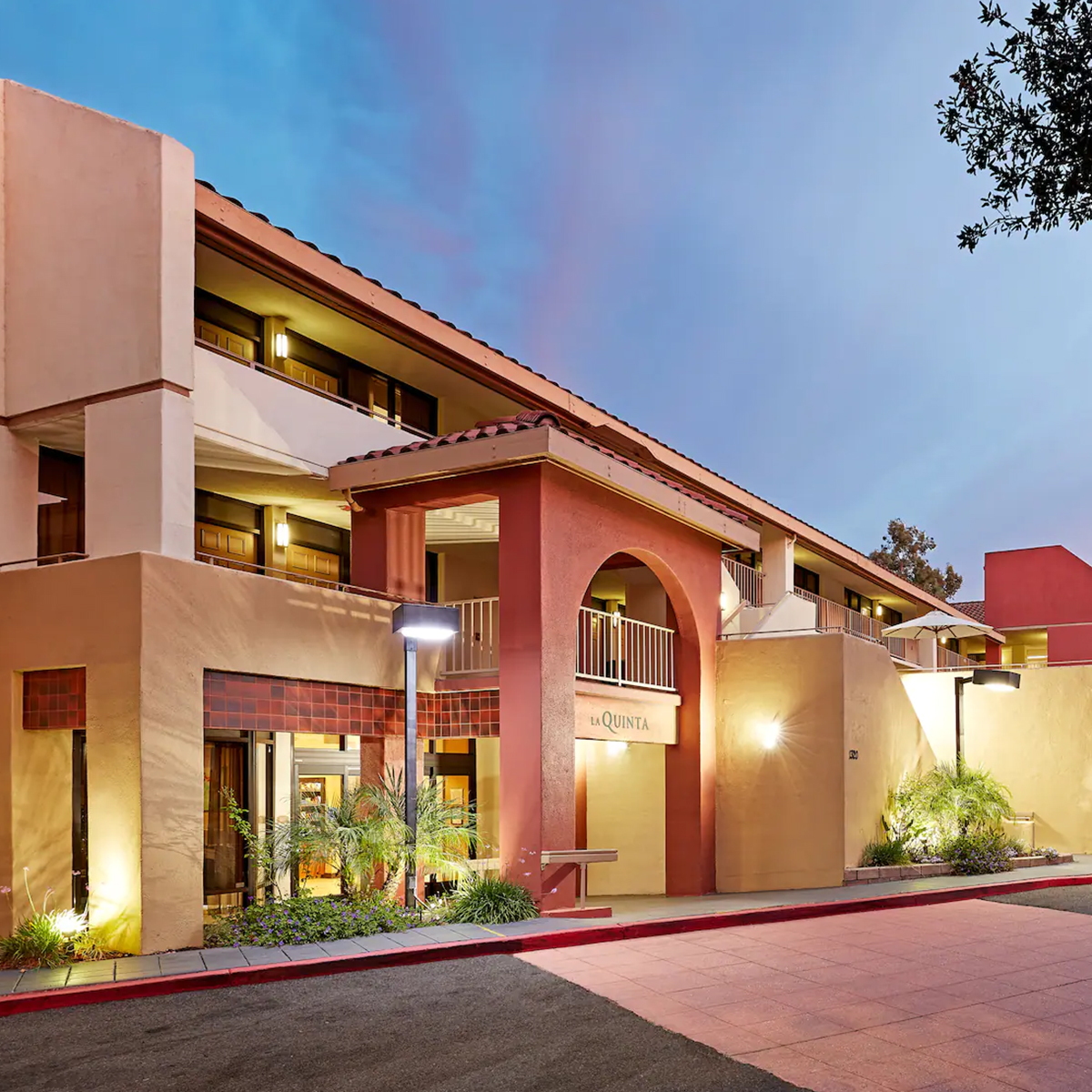
La Quinta
by Wyndham Thousand Oaks
1320 Newbury Rd.
Thousand Oaks, CA 91320
To receive the Task Force
discounted rate,
please call the hotel at
805-499-5910
and use code CG2223
Recap of the Task Force Sierra Nevada Regional Meeting
Recap of the Task Force Sierra Nevada Regional Meeting
Nearly 500 gathered in Grass Valley on September 27 for the regional meeting of the Task Force. The agenda focused on the Sierra Nevada Region and the Task Force’s efforts to develop a Regional Framework, translating statewide strategies to regional decision making and priority setting.The regional meeting of the Governor’s Wildfire & Forest Resilience Task Force brought together a wide range of experts and agency partners for updates and in-depth panel discussions on the State’s progress on wildfire and forest resilience. Presentations were recorded and can be viewed at the link below.
Forest Resilience in the Sierra Nevada: The Task Force’s interagency science team reviewed their efforts to develop a comprehensive set of metrics and a Sierra Regional Resource Kit aimed at helping forest collaboratives measure and map wildfire resilience, biodiversity, carbon storage, watershed health, and other key priorities. Google.org unveiled the Planscape tool, developed to work with the Regional Resource Kits to help resource managers with prioritizing projects and treatments.
• Moderator: John Battles
• UCB Alan Talhelm, CARB
• Tadashi Moody, CAL FIRE-FRAP
• Pat Manley, USFS-PSW
• Michele Turner & Mojia Shen, Google.org
From Data to Decision-Making: Forest Service leaders and their partners shared their efforts in using decision support tools for planning and prioritizing projects with their partners and communities. These landscape level land managers also gave us special insight to the opportunities and challenges specific to their national forests.
• Moderator: Forest Schafer, Tahoe Conservancy
• Eli Ilano, USFS
• Willie Whittlesey, Yuba Water Agency
• Jason Kuiken, USFS
• Patrick Koepele, Tuolumne River Trust
• Jeff Marsolais, USFS
• Angel Hertslet, The Nature Conservancy
Resources For Resilience: Task Force partners USFS and the Sierra Nevada Conservancy described how they are actively working to align funding to high priority landscapes. A description of SNC’s pilot project is below.
• Moderator: Melinda Booth, SYRCL
• Jonathan Kusel, Sierra Institute
• Sherry Hazelhurst, USFS
• Angela Avery, SNC
• Steve Frisch, Sierra Business Council
Recreation Strategy Update: Finally, state, federal, local, and tribal leaders of CALREC Vision outlined their strategic plan to promote equitable, accessible, and climate and fire-resilient outdoor recreation facilities throughout the state.
• Greg Williams, Sierra Buttes Trail Stewardship
• John Wentworth, CALREC Vison
• Jim Bacon, USFS
• Katherine Toy, CNRA
Sierra Nevada Regional Meeting
Please join us for a Meeting of the California Wildfire and Forest Resilience Task Force
The next meeting of the Task Force will be held in person in Grass Valley, with a webinar option for remote attendance. We look forward to connecting, committing to action and collaborating on real solutions to the daunting challenges facing our communities, forests and ecosystems. REGISTRATION REQUIRED.
RESOURCES
September 27th
8:30 AM: Resource Fair & Registration
10:00 AM – 4:30 PM: Task Force Meeting (Agenda to Follow)
12:00 PM: Lunch – Gourmet Lunch Options Available at $16 per Person
4:30 – 5:30 PM: Local Beer & Wine Reception
8:00 PM: FREE Movie Screening by Wild & Scenic Film Festival
September 28th
Field Tours
SIERRA REGIONAL MEETING FIELD TOURSSeptember 28
Registration Required
**Online registration will close at noon on Monday**
On the day after the Task Force Regional Meeting in Grass Valley, join a range of Task Force partners in field tours throughout the area. You’ll get up-close, real-time, boots-on-the-ground details and demonstrations related to the critical work of the California Wildfire & Forest Resilience Task Force. See the schedule below and choose the field tours that interest you most. Then click here to register > Register Now. Online Tour Registration closes Monday at noon. You will still be able to register in person at the meeting on Tuesday for tours with availability.
ALL TOURS MAY BE SUBJECT TO CHANGE OR CANCELLATION DEPENDING ON FIRE CONDITIONS.
Tours start between 8:00 and 10:00 am.
Tour hosts will contact you with specific tour times and any additional information you may need.
tour #1
Tour:
Linking Water Supply Protection with Workforce Development and Community Bioenergy
HOST:
Yuba Water Agency and Camptonville Community Partnership
Description:
This tour will highlight the connections between efforts to protect New Bullards Bar Dam and Reservoir and its watershed, investments in workforce development programs to accomplish that work, and community-driven development of bioenergy facilities.
details:
Location: New Bullards Bar Dam and Reservoir – Emerald Cover Marine, Cottage Creek parking area
Tour Duration: 2 hrs
Distance from Grass Valley: 45 mins
Accessibility Notes: Walking and standing on flat terrain, sometimes in full sun. Participants may bring their own folding chairs. Passenger vehicles ok.
tour #2
Tour:
Upper Watershed Protection with the North Yuba Forest Partnership
HOST:
South Yuba River Citizens League and Tahoe National Forest
Description:
Join a field outing with members of the North Yuba Forest Partnership to current and future forest health treatment sites on the Yuba River Ranger District, highlighting the landscape features, management needs, and treatment approaches of the North Yuba Landscape Resilience Project. Tour stops include Goodyear’s Bar and Downieville.
details:
Location: Downieville
Tour Duration: 4-5 hrs
Distance from Grass Valley: 1 hour
Accessibility Notes: The group will be visiting two sites along the HWY 49 Corridor: Goodyear’s Bar (pulloff area off of 49) and the Downieville USFS Work Station. Sites will be close to the road with minimal walking required. Roads will be paved.
tour #3
Tour:
Protecting the Wildland-Urban Interface and Egress Routes with the Western Nevada Community Defense Project
HOST:
Tahoe National Forest
Description:
Visit the Western Nevada Community Defense project to observe recently completed pile burn units in the wildland-urban interface of Cascade Shores Homes and along a primary escape route for local residents.
details:
Location: Greenhorn Road, Nevada City
Tour Duration: 1 hour
Distance from Grass Valley: 45 mins
Accessibility Notes: Paricipants will be standing in partial sun. Dirt road, all wheel drive recommended.
tour #4
Tour:
Headwaters Meadow Restoration at Van Norden Meadow
HOST:
Tahoe National Forest and South Yuba River Citizens League
Description:
During this tour, participants will learn about meadows, meadow restoration, and view active stream channel restoration, encroaching tree mastication, and bridge construction across the 485-acre Van Norden Meadow at the headwaters of the South Yuba River.
details:
Location: Van Norden Meadow, Soda Springs
Tour Duration: 2 hours
Distance from Grass Valley: 1 hour
Accessibility Notes: 2-3 miles of mostly flat on-trail walking at 7000 ft of elevation. Dirt road accessible to passenger vehicles.
tour #5
Tour:
Working Forest Conservation and Restoration: Improving Forest Health on the Deer Creek Park Forest Reserve Conservation Easement
HOST:
Bear Yuba Land Trust
Description:
This tour will consist of a walk through Bear Yuba Land Trust's 330-acre Deer Creek Park working forest conservation easement to view forest biomass harvesting, and mastication work treated under CFIP and SNC funds. We will discuss equipment, previous forest conditions, and the realities of using prescribed fire in the WUI on private property.
details:
Location: Deer Creek Forest Conservation Easement, Red Dog Road, Nevada City
Tour Duration: 2.5 hours
Distance from Grass Valley: 15 minutes
Accessibility Notes: Some steep slopes and uneven terrain. About 1.5 miles of hiking
tour #6
Tour:
Reducing Wildfire Risk at Scotts Flat to Protect Water Supplies, Hydropower Resources, Communities, and Recreation Assets
HOST:
Nevada Irrigation District
Description:
This tour will demonstrate different treatment methods and strategies that were implemented to reduce wildfire risk adjacent to the Scotts Flat Reservoir Dam and associated campground. Treatment methods included hand-crews with chippers, lop and scatter, and mastication.
details:
Location: Scotts Flat Campground Day Use Area
Tour Duration: 3 hrs
Distance from Grass Valley: 20 mins
Accessibility Notes: Participants will walk on a single track trail on level terrain.
tour #7
Tour:
'Inimim Forest Restoration Project: Experimenting with Different Treatment Types and Linking Recreation Planning and Wildfire Resilience
HOST:
Yuba Watershed Institute
Description:
The tour will visit the 'Inimim Forest Restoration Project, which has treated 550 acres of U.S. Bureau of Land Management lands on the San Juan Ridge since 2018. We will be discussing wildfire resilience and recreation planning, the pros and cons of different treatment methods for different scenarios with Representatives from Nevada County Office of Emergency Services.
details:
Location: North Columbia Schoolhouse Cultural Center, Nevada City
Tour Duration: 3 hrs
Distance from Grass Valley: 30 mins
Accessibility Notes:
tour #8
Tour:
Reforestation in a Burning Landscape: Multi-Age Forestry Fall Field Tour 2022
HOST:
UC Cooperative Extension & private, government, & non-profit partners
Description:
How do we promote multi-age forests after high severity wildfire? Visit eight different wildfires (including re-burns) and post-fire responses across private industrial forests, public lands, and non-industrial private forests. Explore the theory and practice of reforestation and plantation management in a century framed by drought and active fire.
details:
**This is a 2-day field tour. First day will start at 9am in Taylorsville and include a 7-hour loop of the private industrial lands and the Plumas NF. The second day field tour will start at 8:30 am in Quincy and include a 4-hour tour of Emergency Forest Restoration Team (EFoRT) work on non-industrial private forestlands.
Location: To be shared after registration
Tour Duration: Day 1 (9.28): 7 hrs, start time is 9AM
Day 2 (9.29): 4 hours start time is 8:30AM
PLEASE NOTE: This tour is hosted by an affiliated organization with its own registration and cost.
Please register by 9/16. Cost: $40, includes dinner, field trip refreshments, light breakfast.
tour #9
Tour:
Wildfire Risk Reduction on Private Lands - Fire Safe Council and Prescribed Burn Association in Action
HOST:
Ron Gray (Property Owner), Nevada County Fire Safe Council, and Yuba-Bear Burn Cooperative
Description:
Tour a private property where fuel reduction and prescribed fire preparation work has been completed in partnership with the Nevada County Fire Safe Council and the Yuba-Bear Burn Cooperative. The property acts as a buffer between the Yuba River and the 400 residential properties in the Blue Tent community north of Nevada City.
details:
Tour starts at 9 AM.
Location: Edward’s Crossing, Nevada City
Tour Duration: 2 hours
Distance from Grass Valley: 20 mins
Accessibility Notes: Walking on mostly flat trails. Low clearance vehicles ok.
tour #10
Tour:
FOREST⇌FIRE Art Exhibit Tour
HOST:
Llewellyn Studio
Description:
The FOREST⇌FIRE Project invites the people of the Truckee Tahoe region into the captivating story of the Sierra Nevada Forest’s 13,000-year relationship with fire and the surprising and essential role humans play within it, affecting forest, watershed, and our own well-being, from the past into the future. Join the exhibit creators for a narrated tour of the art exhibits.
details:
Location: Truckee Community Recreation Center, Truckee
Tour Duration: 1-2 hours
Distance from Grass Valley: 1 hour, 15 mins
Accessibility Notes: Indoors, ADA accessible
tour #11
Tour:
Forest Restoration and Forest Research at Sagehen Experimental Forest
HOST:
USDA Forest Service Pacific Southwest Research Station, Sagehen Experimental Forest (U.C. Berkeley Field Station)
Description:
Tour the Sagehen Forest Restoration Project, a research-management partnership to implement and study one of the first large-scale, watershed-wide treatments designed to increase forest heterogeneity while reducing the risk of destructive wildfire. PLEASE NOTE: This tour may be subject to change or cancellation depending on fire conditions.
details:
Location: Sagehen Creek Field Station and Experimental Forest, north of Truckee
Tour Duration: 3 hrs
Distance from Grass Valley: 1.5 hours
Accessibility Notes: Mostly driving, some light hiking.
Participating Hotels
Ready, Set, Go Brochure

Ready, Set, Go Brochure
The new CAL FIRE guide illustrates the importance of creating and maintaining defensible space and hardening homes by retrofitting with ignition-resistance or noncombustible materials to protect against the threat of flying embers, direct flame contact and radiant heat exposure. The guide provides information about the preparations and precautions needed to safely evacuate if the threat of fire exists. These new brochures are the consolidation of past materials and part of the new Wildfire Action Plan that incorporates the Ready, Set, Go campaign. Brochures will be delivered to the CAL FIRE units for distribution during public events, fairs, and community meetings.
Welcome To The New Task Force Communications Platform
Welcome To The New Task Force Communications Platform
June 1, 2022 – A new visual identity, a monthly E-newsletter, social media and a beautiful, content-rich new website. It’s all part of a comprehensive communications platform for the Task Force that launched on June 1, 2022.
The Website
It all starts here, with the new website, built to deliver on two primary goals. First, to clearly articulate the purpose of the Task Force. For those unfamiliar or seeking to better understand, the Home Page and About section define the mission, structure, and initiatives of the Task Force.
Second, and no less important, is to show the progress being made by state, federal, local and tribal governments along with a wide range of other Task Force partners. The website is a a single hub for original content from the Task Force along with curated information sourced from partner agencies. It provides easy access to the very latest information that demonstrates tangible, boots on the ground progress on Task Force Goals and Key Action Areas.
You’ll find The Latest section on the Home Page, with an aggregation of the most recent progress and important stories. Below that, and also on the Progress Page, you can sort content by Task Force Goals and Action Areas.
We hope you’ll bookmark and come back to the site often. The news, information, and stories will be updated frequently.
The E-Newsletter
The first week of every month, the Task Force will send out an E-newsletter to all subscribers. Signing up for the E-newsletter is a great way to make sure you’re getting regular updates on the very latest progress. Look for the Sign-Up Form below on this page. When the E-newsletter comes, be sure to forward it on to others who may want to subscribe.
Social Media
The Task Force now has a presence on Facebook, Instagram, LinkedIn, and Twitter. We hope you’ll follow the Task Force social channels and engage with the content, then share Task Force social content on your social media and encourage others to follow. When appropriate, include the hashtag: #wildfiretaskforce.
“It’s all about showing progress,” according to Task Force Director Patrick Wright. “The new site is a one-stop-shop for the latest, boots-on-the-ground accomplishments, and we’re very pleased with how it came together.” Task Force Program Manager Kristen Merrill worked closely with the Communications Work Group and turned to Sonoma County creative communications agency The Idea Cooperative to develop the website, updated visual identity and online marketing materials.
Help Spread The Word
If you or your organization is involved in wildfire prevention, forest health and related fields, there is a role you can play in helping to let more people know about the critical work of the Task Force. The Partner Communications Kit page on the new site has tools and tips on how you can promote the Task Force in your communications. You’ll find instructions and downloadable digital assets for promoting the Task Force to your website audience, social media followers and email subscribers. Click below and start sharing today.

